Category:Old maps of Châlons-en-Champagne
Jump to navigation
Jump to search
Subcategories
This category has the following 3 subcategories, out of 3 total.
Media in category "Old maps of Châlons-en-Champagne"
The following 14 files are in this category, out of 14 total.
-
 Abbayes 00970 Toussaint plan.jpg 4,230 × 2,398; 8.71 MB
-
 B-514546101 Aff 0000CP566 0 00001 p.jpg 2,629 × 2,137; 1.79 MB
-
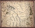
 Canton de chalons F Morieu.jpg 2,845 × 2,480; 390 KB
-
 Cathédral quartier grav N Picart 33692.jpg 1,035 × 885; 217 KB
-
 Cathédrale cloitre église ste Trinité BM Pompidou 33690.jpg 1,420 × 1,980; 387 KB
-
 Gefecht bei Chalon 1814.jpg 1,081 × 1,059; 98 KB
-
 Jard Chalons rempart 14054.JPG 4,240 × 2,832; 8.84 MB
-
 Julien Bryan - Ambulance 646 - Map.jpg 1,558 × 860; 231 KB
-
 Plan chalons domination romaine.jpg 2,822 × 2,184; 1.69 MB
-
 Profil ville chalons jean boisseau TGF82 d'après chastillon.jpg 1,148 × 466; 200 KB
-
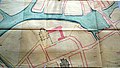
 Quartier notre dame 1008764.jpg 2,392 × 3,146; 1.55 MB
-
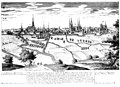 Vue de chalons de loin.jpg 3,426 × 2,480; 1.45 MB
-
 Vue de chalons litho plume Pellée.jpg 3,020 × 2,328; 1.65 MB
-
 Vue de chalons par pansin.jpg 2,576 × 2,480; 791 KB


