Category:Old maps of phantom islands
Salti al navigilo
Salti al serĉilo
| NENIU VIKIDATUMOJ-IDENTIGILO TROVITA! Serĉi Old maps of phantom islands ĉe Vikidatumoj | |
| Alŝuti plurmedion |
Subkategorioj
Ĉi tiu kategorio havas la 8 jenajn subkategoriojn, el 8 entute.
Dosieroj en kategorio “Old maps of phantom islands”
La jenaj 50 dosieroj estas en ĉi tiu kategorio, el 50 entute.
-
 Overview of the phantom islands.jpg 2 796 × 931; 602 KB
-
 'The Sphinx of the Ice Fields' by George Roux 16.jpg 472 × 700; 110 KB
-
 1594 double hemisphere world map by Petrus Plancius detail Japan Colunas.png 980 × 882; 1,93 MB
-
-
 Agathonissi, Eleo, Fermaco - Piacenza Francesco - 1688.jpg 1 004 × 1 500; 771 KB
-
 1744 bellin map Carte des lacs du Canada.jpg 5 827 × 3 642; 7,82 MB
-

-

-
 Phantom Islands in Stielers Handatlas 1891.jpg 746 × 321; 54 KB
-
 Antarctica map.jpg 4 549 × 3 973; 6,18 MB
-
 Bermeja.jpg 2 192 × 1 512; 2,79 MB
-
 Bianco.jpg 424 × 424; 72 KB
-
 Bouvet-Gruppe Karte 1898.jpg 1 500 × 1 679; 445 KB
-
 Bradley Land.jpg 554 × 596; 67 KB
-
 Buss Island.jpg 553 × 839; 251 KB
-
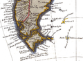
 Elizabeth Island.jpg 773 × 1 021; 312 KB
-
 FMIB 53704 Aufsuchen der Bouvet Gruppe.jpeg 1 728 × 804; 556 KB
-
 Globe terrestre de Jacques Vau de Claye (1583).gif 232 × 228; 47 KB
-
 Groclant in 1572 Typus Orbis Terrarum Ortelius.jpeg 800 × 600; 473 KB
-
 Gulf of Campeche.jpg 891 × 793; 149 KB
-
 Johannes Schöner, globe of 1533, southern hemisphere.jpg 1 000 × 972; 501 KB
-
 LA2-Blitz-0298p.png 762 × 282; 396 KB
-
 Los Jardines ED chart 1886.png 386 × 262; 148 KB
-
-
 Map-533.jpg 437 × 600; 52 KB
-
 Mayda (Americae nova Tabula - Map of North and South America).jpg 766 × 468; 230 KB
-
 Mayda Pizigani.jpg 1 085 × 728; 128 KB
-
 Nicolas Desliens detail of Java la Grande 16th century.jpg 519 × 327; 40 KB
-
 Nimrod Gruppe 1906.jpg 750 × 600; 520 KB
-
 Nimrod.1909 voyage.jpg 696 × 407; 60 KB
-
 NL-HaNA 4.MCAL 2134A.jpg 12 498 × 9 010; 20,29 MB
-
 OSM2023-Ortelius1584.png 1 972 × 844; 2,41 MB
-
 Pareto 1455.jpg 486 × 486; 192 KB
-
 Phantom islands in 1855 Spruner Map of Australia and Polynesia.jpg 408 × 266; 17 KB
-
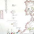
 Phantom islands in Southern Atlantic.jpg 2 716 × 2 011; 933 KB
-
 Pizzigani brothers 1367 map (Atlantic detail).jpg 515 × 497; 23 KB
-
 Pizzigano 1424 map (Antilia islands detail).JPG 331 × 954; 71 KB
-
 Pp94vp.png 660 × 426; 637 KB
-
 Sandy Island on 1908 chart - cropped.jpg 510 × 250; 97 KB
-
 Sandy Island on 1908 chart.jpg 1 500 × 1 116; 229 KB
-
 Seale-1744.png 800 × 587; 656 KB
-
 Stielers Handatlas 1891 76 Cook detail.png 309 × 359; 256 KB
-
 Thule & Orkney & Feroe Carta Marina Olaus Magnus.jpg 1 456 × 900; 601 KB
-
 Thule carta marina Olaus Magnus.jpg 613 × 486; 57 KB
-
 Tile Carta Marina.JPG 861 × 680; 216 KB
-
 Van Keulen-Nieuwe Pascaert van Oost Indien-1680-1735-2 detail Mascareignes.png 1 095 × 781; 164 KB
-
 Verne-sfinga-mapa.jpg 1 464 × 2 144; 426 KB
-
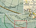
 Wachusett Bank on map of Antarctica.png 1 686 × 1 349; 3,52 MB
-
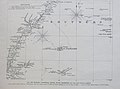
 Wachusett Bank.png 1 280 × 1 023; 1,82 MB
-
 Weimar map (Atlantic islands detail).jpg 744 × 932; 92 KB


_in_Antiquity_-_Geographicus_-_ErythraeanSea-jansson-1658.jpg)


_-_Geographicus_-_DeFonte-1754.jpg)


.gif)


.jpg)


.jpg)


.jpg)
.JPG)