Category:Old maps of Örebro County
Jump to navigation
Jump to search
Subcategories
This category has the following 2 subcategories, out of 2 total.
A
- Old maps of Askersund (5 F)
O
Media in category "Old maps of Örebro County"
The following 12 files are in this category, out of 12 total.
-
 Bagge4.JPG 1,449 × 1,135; 403 KB
-
 Bagge5.JPG 1,496 × 730; 310 KB
-
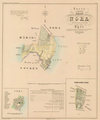
 Ekers landskommun.jpg 2,384 × 3,104; 3.76 MB
-
 Generalkarta Nerike.png 6,400 × 5,694; 60.52 MB
-
 Landskapskarta Mosjön.png 2,134 × 2,706; 3.37 MB
-
 Landskapskarta Närke.png 5,344 × 7,456; 38.65 MB
-
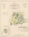 Ljunggren Askersund.png 3,810 × 4,810; 18.63 MB
-
 Ljunggren Lindesberg.png 1,905 × 2,405; 4.89 MB
-
 Ljunggren Nora.png 1,955 × 2,355; 2.9 MB
-
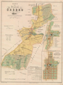 Ljunggren Örebro.png 2,055 × 2,755; 7.33 MB
-
 Wiblingen Lindesberg.png 2,301 × 1,870; 4.64 MB
-
 Wiblingen Örebro.png 1,835 × 2,852; 6.35 MB


