Category:Oliver's Battery
Jump to navigation
Jump to search
village and civil parish in Hampshire, UK  | |||||
| Upload media | |||||
| Instance of | |||||
|---|---|---|---|---|---|
| Location | City of Winchester, Hampshire, South East England, England | ||||
 | |||||
English: Oliver's Battery is a settlement and (as Olivers Battery) a civil parish in Hampshire, England, of some 700 households located just to the south of the City of Winchester. The parish was founded in 1956 on land that was formerly part of Compton parish. The parish does not include the whole of the settlement known informally as Oliver's Battery, with the northern boundary following the A3090 and therefore excluding Oliver's Battery Road North. It is the area where England International footballer Wayne Bridge was raised.
Subcategories
This category has only the following subcategory.
Media in category "Oliver's Battery"
The following 25 files are in this category, out of 25 total.
-

-
 33kV power lines on Compton Down - geograph.org.uk - 449934.jpg 427 × 640; 67 KB
-
 Austen Avenue, Oliver's Battery - geograph.org.uk - 127363.jpg 640 × 416; 82 KB
-

-
 Badger Farm Road, Winchester - geograph.org.uk - 5479972.jpg 2,048 × 1,536; 1.49 MB
-
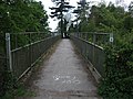 Clarendon Way footbridge across the A3090 - geograph.org.uk - 1888801.jpg 4,000 × 3,000; 2.87 MB
-
 Clarendon Way on the Southern Side of Winchester - geograph.org.uk - 1869295.jpg 2,816 × 2,112; 1.95 MB
-
 Earthworks, Oliver's Battery - geograph.org.uk - 159452.jpg 640 × 424; 145 KB
-

-
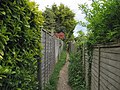
 Field edge path near Oliver's Battery - geograph.org.uk - 4627900.jpg 640 × 427; 116 KB
-
 Field edge path to Oliver's Battery - geograph.org.uk - 4627895.jpg 640 × 427; 111 KB
-
 Houses, Parliament Place, Winchester - geograph.org.uk - 5709939.jpg 640 × 428; 113 KB
-
 New houses on Winchester Village Development - geograph.org.uk - 5457508.jpg 2,014 × 1,490; 1,022 KB
-
 Oliver's Battery earthworks, Winchester - geograph.org.uk - 1884693.jpg 4,000 × 3,000; 2.95 MB
-
 Oliver's Battery from Yew Hill - geograph.org.uk - 802863.jpg 640 × 480; 89 KB
-
 Olivers Battery.jpg 2,256 × 1,496; 1.44 MB
-
 Port Lane approaching Oliver's Battery - geograph.org.uk - 5281618.jpg 640 × 480; 122 KB
-
 Roundabout on Badger Farm Road, Olivers Battery - geograph.org.uk - 5810463.jpg 2,009 × 1,506; 1.76 MB
-

-
 Shops at Oliver's Battery - geograph.org.uk - 3078885.jpg 3,872 × 2,592; 4.18 MB
-
 Small Orchard off the Clarendon Way - geograph.org.uk - 1869287.jpg 2,816 × 2,112; 2.4 MB
-
 Texas Drive, Oliver's Battery - geograph.org.uk - 829749.jpg 640 × 424; 107 KB
-

-
 Underpass, Oliver's Battery, Winchester - geograph.org.uk - 1884661.jpg 3,547 × 2,704; 1.58 MB
-
 Village sign for Oliver's Battery - geograph.org.uk - 3078868.jpg 3,872 × 2,592; 4.85 MB


