Category:Ormesby St Michael
Jump to navigation
Jump to search
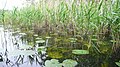
English: Ormesby St Michael is a small village and civil parish in the English county of Norfolk. It is situated some east of the city of Norwich. Nearby are Ormesby Broad and Ormesby Little Broad, both part of the Trinity Broads within the The Broads.
village and civil parish in Norfolk, United Kingdom  | |||||
| Upload media | |||||
| Instance of | |||||
|---|---|---|---|---|---|
| Location | Great Yarmouth, Norfolk, East of England, England | ||||
| Area |
| ||||
 | |||||
Subcategories
This category has the following 2 subcategories, out of 2 total.
M
O
- Ormesby Broad (14 F)
Media in category "Ormesby St Michael"
The following 72 files are in this category, out of 72 total.
-
 A frozen Rollesby Broad - geograph.org.uk - 2204878.jpg 640 × 480; 145 KB
-
 A track which is Burgh Wood Road at Rollesby - geograph.org.uk - 6007832.jpg 3,456 × 2,592; 3.98 MB
-
 A winter's evening on Rollesby Broad - geograph.org.uk - 2204888.jpg 640 × 480; 80 KB
-
 A149 towards Great Yarmouth - geograph.org.uk - 5876176.jpg 1,024 × 684; 220 KB
-
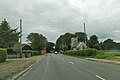
 A149, Ormesby St Michael - geograph.org.uk - 5876024.jpg 1,024 × 684; 247 KB
-
 A149, Ormesby St Michael - geograph.org.uk - 5876034.jpg 1,024 × 684; 166 KB
-
 A149. Ormesby St Michael - geograph.org.uk - 5875979.jpg 1,024 × 684; 165 KB
-
 Bat House - geograph.org.uk - 2439592.jpg 4,224 × 2,376; 2.83 MB
-
 Beer garden at Eels Foot Inn - geograph.org.uk - 4681676.jpg 640 × 360; 286 KB
-
 Bends on Decoy Road - geograph.org.uk - 4681648.jpg 640 × 360; 272 KB
-
 Boats on Rollesby Broad - geograph.org.uk - 3329126.jpg 2,544 × 1,880; 1.81 MB
-

-

-
-
 Coot - geograph.org.uk - 6007771.jpg 3,456 × 2,592; 3.7 MB
-
 Coot and Mallards - geograph.org.uk - 2204146.jpg 700 × 525; 142 KB
-
 Cottages near Petingall Farm - geograph.org.uk - 4543706.jpg 1,024 × 768; 567 KB
-
 Crop field south of Decoy Road - geograph.org.uk - 4938763.jpg 640 × 480; 55 KB
-
 Decoy Farm (farm sign) - geograph.org.uk - 4681638.jpg 469 × 640; 414 KB
-
 Decoy Road - geograph.org.uk - 4681639.jpg 640 × 360; 350 KB
-
 Decoy Road - geograph.org.uk - 4938878.jpg 640 × 480; 60 KB
-
 Decoy Road to Decoy Farm - geograph.org.uk - 4681642.jpg 640 × 360; 241 KB
-
 Decoy Road, Ormesby - geograph.org.uk - 4544076.jpg 1,024 × 768; 527 KB
-
 Decoy Road, Ormesby St Margaret - geograph.org.uk - 4938758.jpg 640 × 480; 79 KB
-
 Drain beside Decoy Road - geograph.org.uk - 4938765.jpg 640 × 480; 84 KB
-
 Drain near Broiler Farm - geograph.org.uk - 4938883.jpg 640 × 480; 118 KB
-

-

-
 From field to factory - geograph.org.uk - 4681632.jpg 640 × 360; 240 KB
-
 Gated track to Dunham Cottages - geograph.org.uk - 4681646.jpg 640 × 360; 347 KB
-
 Grazing and stables - geograph.org.uk - 4938750.jpg 640 × 480; 119 KB
-
 Grazing off Decoy Road - geograph.org.uk - 4938753.jpg 640 × 480; 95 KB
-
 House on Main Road, Ormesby St Michael - geograph.org.uk - 4938900.jpg 3,648 × 2,736; 1.33 MB
-

-
 Ice on Rollesby Broad - geograph.org.uk - 2204884.jpg 640 × 561; 104 KB
-
 Landing stage by the Eels Foot Inn - geograph.org.uk - 4681682.jpg 640 × 360; 251 KB
-
 Landing stage in Ormesby Little Broad - geograph.org.uk - 4681683.jpg 640 × 360; 233 KB
-

-
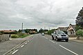
 Main Road (A149) - geograph.org.uk - 4938887.jpg 640 × 480; 84 KB
-
 Mallard drake - geograph.org.uk - 6007769.jpg 3,456 × 2,592; 3.82 MB
-
 Mallards walking on Rollesby Broad - geograph.org.uk - 2204880.jpg 640 × 480; 131 KB
-
 Old Milepost - geograph.org.uk - 1737418.jpg 1,200 × 1,600; 680 KB
-
 On the edge of Ormesby Little Broad - geograph.org.uk - 4681677.jpg 640 × 360; 279 KB
-
 Open cowshed at Barn Farm, Ormesby - geograph.org.uk - 4543714.jpg 1,024 × 768; 384 KB
-
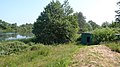
 Ormesby Broad - geograph.org.uk - 6007773.jpg 3,456 × 2,592; 3.89 MB
-
 Ormesby Little Broad - geograph.org.uk - 4681681.jpg 640 × 360; 227 KB
-

-
 Ormesby St Michael Village Hall - geograph.org.uk - 4938893.jpg 640 × 426; 51 KB
-
 Pair of Black Headed gulls - geograph.org.uk - 6007768.jpg 3,456 × 2,592; 3.43 MB
-
 Rollesby Broad - geograph.org.uk - 2358200.jpg 1,600 × 900; 518 KB
-
 Rollesby Broad - geograph.org.uk - 3640823.jpg 640 × 409; 42 KB
-
 Rollesby Broad in winter - geograph.org.uk - 2204883.jpg 640 × 545; 173 KB
-
 Rollesby Broad Neck - geograph.org.uk - 2439570.jpg 4,224 × 2,376; 2.86 MB
-

-

-
 Sugar beet awaiting collection - geograph.org.uk - 4681637.jpg 640 × 360; 322 KB
-
 Sugar beet collection - geograph.org.uk - 4681630.jpg 640 × 360; 253 KB
-
 Sugar beet collection on Decoy Road - geograph.org.uk - 4681628.jpg 640 × 360; 253 KB
-
 Swans, Coots and Mallards - geograph.org.uk - 2204139.jpg 700 × 525; 227 KB
-
 The Eels Foot Inn - geograph.org.uk - 4681684.jpg 640 × 360; 245 KB
-
 The Eels Foot Inn - geograph.org.uk - 4681686.jpg 640 × 360; 282 KB
-
 The Eels Foot Inn - geograph.org.uk - 522033.jpg 640 × 480; 86 KB
-
 To North Walsham 18 - geograph.org.uk - 1737413.jpg 1,600 × 1,200; 637 KB
-
 Track towards Burghwood Farm - geograph.org.uk - 4938910.jpg 640 × 480; 116 KB
-
 Unusual mail box in Burgh Wood Road (a Track) - geograph.org.uk - 6007828.jpg 3,456 × 2,592; 3.99 MB
-

-
 View along Decoy Road - geograph.org.uk - 4681635.jpg 640 × 360; 347 KB
-
 Village sign, Ormesby St Michael - geograph.org.uk - 772854.jpg 480 × 640; 110 KB
-
 Waterfowl on a frozen Rollesby Broad - geograph.org.uk - 2204881.jpg 640 × 560; 138 KB
-
 Winter solstice on Rollesby Broad - geograph.org.uk - 2204890.jpg 640 × 480; 106 KB
-
 A149, Ormesby St Michael - geograph.org.uk - 772862.jpg 640 × 476; 80 KB
-
 Eels Foot Inn, Ormesby St Michael - geograph.org.uk - 772833.jpg 640 × 480; 99 KB


_-_geograph.org.uk_-_4681638.jpg)


_-_geograph.org.uk_-_4938887.jpg)


_-_geograph.org.uk_-_6007828.jpg)


