Category:Oude Boteringestraat 71 (Groningen)
Jump to navigation
Jump to search
| Object location | | View all coordinates using: OpenStreetMap |
|---|
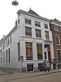
building in Groningen, Netherlands  | |||||
| Upload media | |||||
| Instance of | |||||
|---|---|---|---|---|---|
| Location | Groningen, Netherlands | ||||
| Street address |
| ||||
| Heritage designation |
| ||||
 | |||||
|
This is a category about rijksmonument number 18625
|
| Address |
|
Media in category "Oude Boteringestraat 71 (Groningen)"
The following 2 files are in this category, out of 2 total.
-
 Groningen Oude Boteringestraat 71.JPG 2,448 × 3,264; 3.03 MB
-
 Voorgevel - Groningen - 20093600 - RCE.jpg 810 × 1,200; 212 KB
