Category:Oude Kerk (Ermelo)
Jump to navigation
Jump to search
| Object location | | View all coordinates using: OpenStreetMap |
|---|
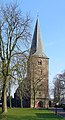
church in Ermelo, Netherlands  | |||||
| Upload media | |||||
| Instance of | |||||
|---|---|---|---|---|---|
| Location | Ermelo, Gelderland, Netherlands | ||||
| Street address |
| ||||
| Located on street |
| ||||
| Heritage designation |
| ||||
| Religion or worldview | |||||
 | |||||
|
This is a category about rijksmonument number 15365
|
| Address |
|
Subcategories
This category has the following 2 subcategories, out of 2 total.
I
- Interior of Oude Kerk, Ermelo (17 F)
R
Media in category "Oude Kerk (Ermelo)"
The following 21 files are in this category, out of 21 total.
-
 1-Ermelo - Oude kerk - 2014 - Gerestaureerde haan teruggeplaatst.JPG 2,848 × 4,272; 965 KB
-
 Boerderij naast kerk, zuid-oost zijde - Ermelo - 20072294 - RCE.jpg 1,200 × 960; 255 KB
-
 Boerderij naast kerk, zuid-westzijde - Ermelo - 20072296 - RCE.jpg 1,200 × 960; 297 KB
-
 Ermelo oude kerk 2008 002.jpg 600 × 1,109; 293 KB
-
 Ermelo-Oude kerk.JPG 3,088 × 2,056; 4.55 MB
-
 Exterieur - Ermelo - 20072135 - RCE.jpg 1,200 × 808; 168 KB
-
 Exterieur en boerderij - Ermelo - 20072248 - RCE.jpg 1,200 × 960; 207 KB
-
 Exterieur noord-oost zijde - Ermelo - 20072246 - RCE.jpg 1,200 × 960; 212 KB
-
 Exterieur noord-oost zijde - Ermelo - 20072247 - RCE.jpg 960 × 1,200; 257 KB
-
 Exterieur noord-west zijde - Ermelo - 20072179 - RCE.jpg 1,200 × 969; 332 KB
-
 Exterieur vanuit het zuid-westen - Ermelo - 20072133 - RCE.jpg 1,200 × 871; 220 KB
-
 Exterieur vanuit het zuid-westen - Ermelo - 20072134 - RCE.jpg 880 × 1,200; 244 KB
-
 Exterieur zuid-oost zijde - Ermelo - 20072241 - RCE.jpg 960 × 1,200; 342 KB
-
 Exterieur zuid-oost zijde - Ermelo - 20072245 - RCE.jpg 1,200 × 960; 253 KB
-
 Koor, zuid-zijde - Ermelo - 20072243 - RCE.jpg 960 × 1,200; 330 KB
-
 Noordzijde schip - Ermelo - 20072244 - RCE.jpg 1,200 × 960; 290 KB
-
 Oude Kerk Ermelo (25317346179).jpg 2,592 × 3,872; 4.63 MB
-
 Overzicht zuidoostgevel - Ermelo - 20359718 - RCE.jpg 950 × 1,200; 298 KB
-
 Steen, oostwand koor - Ermelo - 20072262 - RCE.jpg 1,200 × 950; 387 KB
-
 Toren westzijde - Ermelo - 20072240 - RCE.jpg 960 × 1,200; 325 KB
-
 Zuidgevel schip - Ermelo - 20072242 - RCE.jpg 1,200 × 960; 323 KB


.jpg)


