Category:Oude kerk, Zoetermeer
Jump to navigation
Jump to search
| Object location | | View all coordinates using: OpenStreetMap |
|---|
church in Zoetermeer   | |||||
| Upload media | |||||
| Instance of | |||||
|---|---|---|---|---|---|
| Location | Zoetermeer, South Holland, Netherlands | ||||
| Street address |
| ||||
| Located on street | |||||
| Architectural style | |||||
| Architect | |||||
| Heritage designation |
| ||||
| Inception |
| ||||
| Religion or worldview | |||||
 | |||||
|
This is a category about rijksmonument number 41023
|
| Address |
|
Subcategories
This category has the following 2 subcategories, out of 2 total.
I
Media in category "Oude kerk, Zoetermeer"
The following 51 files are in this category, out of 51 total.
-
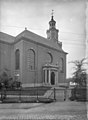
 'Oude Kerk' Zoetermeer (331809583).jpg 800 × 535; 173 KB
-
 'Oude Kerk' Zoetermeer (331809653).jpg 800 × 566; 146 KB
-
 'Oude Kerk' Zoetermeer (331809697).jpg 488 × 600; 95 KB
-
 'Oude Kerk' Zoetermeer (331809731).jpg 450 × 600; 80 KB
-
 'Oude Kerk' Zoetermeer (344354782).jpg 800 × 528; 169 KB
-
 Oude kerk Zoetermeer Armatuur.JPG 1,428 × 1,904; 950 KB
-
 Exterieur vanuit het noord-oosten - Zoetermeer - 20224480 - RCE.jpg 964 × 1,200; 366 KB
-
 Exterieur vanuit het zuid-oosten - Zoetermeer - 20224481 - RCE.jpg 959 × 1,200; 356 KB
-
 Exterieur vanuit het zuid-oosten - Zoetermeer - 20224482 - RCE.jpg 962 × 1,200; 321 KB
-
 Exterieur voet van toren - Zoetermeer - 20224479 - RCE.jpg 963 × 1,200; 250 KB
-
 Kerk naar het noorden - Zoetermeer - 20224455 - RCE.jpg 958 × 1,200; 265 KB
-
 Kerk vanuit het zuid-oosten - Zoetermeer - 20224468 - RCE.jpg 883 × 1,200; 176 KB
-
 Kerk vanuit het zuid-oosten - Zoetermeer - 20224469 - RCE.jpg 888 × 1,200; 189 KB
-
 Noordgevel - Zoetermeer - 20224477 - RCE.jpg 1,200 × 960; 197 KB
-
 Noordgevel - Zoetermeer - 20224478 - RCE.jpg 1,200 × 952; 255 KB
-
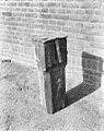 Offerblok - Zoetermeer - 20224465 - RCE.jpg 950 × 1,200; 288 KB
-

-
 Oude kerk Zoetermeer 1e steen.JPG 2,832 × 2,128; 2.28 MB
-
 Oude kerk Zoetermeer Balken toren.JPG 2,832 × 2,128; 2.28 MB
-
 Oude kerk Zoetermeer Balkverbinding toren.JPG 2,832 × 2,128; 2.24 MB
-
 Oude kerk Zoetermeer Bijaard 1.JPG 2,128 × 2,832; 2.27 MB
-
 Oude kerk Zoetermeer Bijaard 2.JPG 2,832 × 2,128; 2.23 MB
-
 Oude kerk Zoetermeer Bijaard speeltafel 1.JPG 2,128 × 2,832; 2.2 MB
-
 Oude kerk Zoetermeer Bijaard speeltafel 2.JPG 2,832 × 2,128; 2.22 MB
-
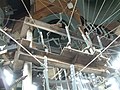
 Oude kerk Zoetermeer Kapconstructie.JPG 2,832 × 2,128; 2.14 MB
-
 Oude kerk Zoetermeer Kerkhof 1.JPG 2,128 × 2,832; 2.2 MB
-
 Oude kerk Zoetermeer Kerkhof 2.JPG 2,126 × 1,594; 1.1 MB
-
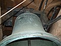 Oude kerk Zoetermeer Luidklok.JPG 2,832 × 2,128; 2.22 MB
-
 Oude kerk Zoetermeer Monumentenstatus.JPG 1,354 × 1,805; 827 KB
-
 Oude kerk Zoetermeer Sponsors.JPG 4,288 × 2,848; 4.72 MB
-
 Oude kerk Zoetermeer steen toren.JPG 2,128 × 2,832; 2.16 MB
-
 Oude kerk Zoetermeer Toren 1.JPG 2,128 × 2,832; 1.84 MB
-
 Oude kerk Zoetermeer Toren 2.JPG 2,832 × 2,128; 1.71 MB
-
 Oude kerk Zoetermeer Toren 3.JPG 2,128 × 2,832; 2.26 MB
-
 Oude kerk Zoetermeer Toren 4.JPG 2,128 × 2,832; 2.22 MB
-
 Oude kerk Zoetermeer Veiligheidshaken.JPG 2,128 × 2,832; 2.24 MB
-
 Oude kerk Zoetermeer Vooraanzicht 2.JPG 2,128 × 2,832; 1.96 MB
-
 Oude kerk Zoetermeer Vooraanzicht.JPG 2,128 × 2,832; 2.28 MB
-
 Oude kerk Zoetermeer Zijingang frontaal.JPG 1,560 × 2,079; 877 KB
-
 Oude kerk Zoetermeer Zijingang.JPG 2,128 × 2,832; 2.19 MB
-
 Oude Kerk Zoetermeer.jpg 1,600 × 1,200; 1.16 MB
-
 OudeKerk.jpg 700 × 1,050; 453 KB
-
 Overzicht - Zoetermeer - 20224476 - RCE.jpg 1,200 × 945; 217 KB
-
 Overzicht toren met ingangsportaal - Zoetermeer - 20390033 - RCE.jpg 928 × 1,200; 157 KB
-
 Spaarboog - Zoetermeer - 20224461 - RCE.jpg 1,200 × 956; 293 KB
-
 Spaarboog ? - Zoetermeer - 20224460 - RCE.jpg 934 × 1,200; 317 KB
-
 Toren - Zoetermeer - 20224475 - RCE.jpg 894 × 1,200; 189 KB
-
 Toren naar het noord-oosten - Zoetermeer - 20224456 - RCE.jpg 957 × 1,200; 237 KB
-
 View on Zoetermeer village.JPG 1,725 × 1,619; 830 KB
-
 Zoeterm.jpg 768 × 1,024; 222 KB
-
 Zoetermeer dorp.jpg 400 × 300; 93 KB
.jpg)
.jpg)
.jpg)
.jpg)
.jpg)


