Category:Ouvrage de La Ferté
Jump to navigation
Jump to search
|
This building is inscrit au titre des monuments historiques de la France. It is indexed in the base Mérimée, a database of architectural heritage maintained by the French Ministry of Culture, under the references PA00078542
|
| Object location | | View all coordinates using: OpenStreetMap |
|---|
Maginot Line at Villy and La Ferté-sur-Chiers (Ardennes, France)  | |||||
| Upload media | |||||
| Instance of | |||||
|---|---|---|---|---|---|
| Location |
| ||||
| Heritage designation |
| ||||
| Inception |
| ||||
| official website | |||||
 | |||||
Media in category "Ouvrage de La Ferté"
The following 22 files are in this category, out of 22 total.
-
 Carte postale Ouvrage de la Ferté (bloc 2).jpg 500 × 327; 37 KB
-
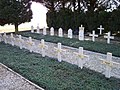 Cimetière du fort de Villy-la Ferté 1.jpg 2,580 × 1,932; 2.34 MB
-
 Cimetière du fort de Villy-la Ferté 2.jpg 2,580 × 1,932; 1.22 MB
-
 Cloche gfm2.jpg 480 × 360; 42 KB
-
 Créneau FM -Ferté.jpg 533 × 800; 56 KB
-
 LA FERTE BLOC 1 ETAGE INFERIEUR.jpg 655 × 441; 31 KB
-
 LA FERTE BLOC 1 ETAGE SUPERIEUR.jpg 611 × 409; 38 KB
-
 LA FERTE BLOC 2 ETAGE SUPERIEUR.jpg 635 × 423; 43 KB
-
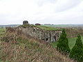
 La Ferté 01.JPG 4,000 × 3,000; 4.72 MB
-
 La Ferté 02.JPG 3,000 × 4,000; 2.69 MB
-
 La Ferté 03.JPG 3,000 × 4,000; 1.79 MB
-
 La Ferté 04.JPG 3,000 × 4,000; 2.61 MB
-
 Laferte bloc2.JPG 2,080 × 1,560; 1.34 MB
-
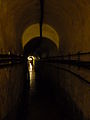
 Laferte chambredetir.jpg 480 × 360; 39 KB
-
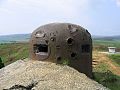
 Laferte tourelle am.JPG 2,080 × 1,560; 1.23 MB
-
 Monument aux morts - fort de Villy-la Ferté.jpg 2,580 × 1,932; 906 KB
-
 Ouvrage de la Ferté B 2.jpg 2,000 × 1,074; 175 KB
-
 Ouvrage La Ferté carte V2.svg 901 × 570; 69 KB
-
 Ouvrage La Ferté carte V3.png 901 × 570; 69 KB
-
 Ouvrage La Ferté carte V3.svg 901 × 570; 69 KB
-
 Ouvrage La Ferté carte.png 901 × 570; 36 KB
-
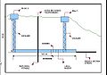 Profil La Ferté.jpg 598 × 420; 31 KB
.jpg)


