Category:Owston Ferry
Jump to navigation
Jump to search
English: Owston Ferry is a village and civil parish in North Lincolnshire, England. It lies on the west bank of the River Trent, north of Gainsborough, and has a total resident population of 1,128.
village and civil parish in Lincolnshire, England, UK  | |||||
| Upload media | |||||
| Instance of | |||||
|---|---|---|---|---|---|
| Location | North Lincolnshire, Lincolnshire, Yorkshire and the Humber, England | ||||
 | |||||
Subcategories
This category has the following 11 subcategories, out of 11 total.
A
B
C
H
- Heckdyke (22 F)
I
- Isle Coaches (bus company) (6 F)
M
O
- The Old Smithy, Owston Ferry (6 F)
- Owston Ferry Pumping Station (4 F)
- Owston Ferry War Memorial (2 F)
W
- The White Hart, Owston Ferry (5 F)
Media in category "Owston Ferry"
The following 200 files are in this category, out of 366 total.
(previous page) (next page)-

-
 7 High Street, Owston Ferry - geograph.org.uk - 2312045.jpg 1,280 × 959; 487 KB
-
 A bend in Stockwith Road - geograph.org.uk - 4372592.jpg 640 × 480; 44 KB
-
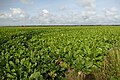 A very large turnip field (1) - geograph.org.uk - 4680610.jpg 800 × 533; 160 KB
-
 A very large turnip field (2) - geograph.org.uk - 4680613.jpg 800 × 533; 128 KB
-
 Abandoned building on Owston Ferry Road - geograph.org.uk - 5616084.jpg 800 × 600; 135 KB
-
 Access to a private road - geograph.org.uk - 4654066.jpg 800 × 533; 113 KB
-
 Albion Place, Owston Ferry - geograph.org.uk - 1913379.jpg 1,600 × 1,200; 293 KB
-
 Anglers access Bridge - geograph.org.uk - 1250949.jpg 640 × 480; 105 KB
-
-
 Bank of Warping Drain - geograph.org.uk - 1913582.jpg 1,600 × 1,200; 436 KB
-
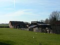
 Barn Owston Ferry Isle of Axholme North Lincolnshire - geograph.org.uk - 5594076.jpg 4,608 × 3,456; 3.72 MB
-
 Barns at the end of a track - geograph.org.uk - 3588739.jpg 640 × 427; 58 KB
-
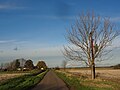
 Bend in the road, High Melwood - geograph.org.uk - 4372522.jpg 640 × 480; 39 KB
-
 Bend on Melwood Hill - geograph.org.uk - 4775104.jpg 1,600 × 1,022; 221 KB
-

-
 Blackdykes Road - geograph.org.uk - 6265597.jpg 4,000 × 3,000; 4.56 MB
-
 Blowing in the wind - geograph.org.uk - 711606.jpg 640 × 418; 56 KB
-
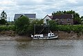 Boat moored on the River Trent - geograph.org.uk - 5429653.jpg 800 × 540; 114 KB
-
 Brickyard Cottages - geograph.org.uk - 4765050.jpg 800 × 533; 89 KB
-
 Bridge over Ferry Drain - geograph.org.uk - 1913563.jpg 1,600 × 1,200; 561 KB
-
 Bridge over the Warping Drain - geograph.org.uk - 2311023.jpg 1,280 × 959; 861 KB
-
 Buildings at Owston Ferry - geograph.org.uk - 2311971.jpg 1,280 × 959; 589 KB
-
 Burnham Road - geograph.org.uk - 4952195.jpg 640 × 480; 50 KB
-
 Burnham Road, Owston Ferry - geograph.org.uk - 2312439.jpg 1,280 × 959; 622 KB
-
 Burnham Road, Owston Ferry - geograph.org.uk - 2312446.jpg 1,280 × 959; 554 KB
-
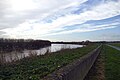
 By the banks of the Trent (2) - geograph.org.uk - 2225340.jpg 1,024 × 768; 189 KB
-
 By the banks of the Trent (3) - geograph.org.uk - 2225356.jpg 1,024 × 768; 157 KB
-
 By the banks of the Trent - geograph.org.uk - 2225334.jpg 1,024 × 768; 260 KB
-
 By the Trent - geograph.org.uk - 2225915.jpg 1,024 × 768; 152 KB
-
 Cables in the sky - geograph.org.uk - 2678492.jpg 1,024 × 768; 114 KB
-
 Carr Lane Junction - geograph.org.uk - 1250293.jpg 640 × 480; 69 KB
-
 Castle Hill - geograph.org.uk - 1913400.jpg 1,600 × 1,200; 556 KB
-
 Castle Hill - geograph.org.uk - 1913404.jpg 1,600 × 1,200; 541 KB
-
 Church gates - geograph.org.uk - 2811656.jpg 640 × 427; 162 KB
-

-

-
 Conservation Walks sign - geograph.org.uk - 494357.jpg 640 × 480; 148 KB
-
 Cornish boilers, Owston Ferry - geograph.org.uk - 2309467.jpg 1,280 × 853; 422 KB
-
 Cottage at Loundrates Farm - geograph.org.uk - 4684694.jpg 800 × 533; 118 KB
-
 Cow path between Warping Drain and Ferry Drain - geograph.org.uk - 2678478.jpg 1,024 × 768; 241 KB
-
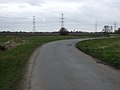
 Crop field and pylons - geograph.org.uk - 4371568.jpg 478 × 640; 56 KB
-
 Crop field near High Melwood - geograph.org.uk - 4371565.jpg 640 × 480; 86 KB
-
 Crop field off Station Road - geograph.org.uk - 4372561.jpg 640 × 480; 61 KB
-
 Crop fields and pylons - geograph.org.uk - 4372552.jpg 640 × 480; 73 KB
-
 Crossroads - geograph.org.uk - 2883851.jpg 640 × 427; 62 KB
-
 Crossroads on Owston Ferry Road - geograph.org.uk - 1250298.jpg 640 × 480; 57 KB
-
 Dead tree by Gunthorpe Road - geograph.org.uk - 2678494.jpg 1,024 × 768; 215 KB
-
 Deep water^ You ain't kidding^ - geograph.org.uk - 3588734.jpg 640 × 427; 67 KB
-
 Disused clay pit at High Melwood - geograph.org.uk - 3588726.jpg 640 × 427; 55 KB
-
 Disused Clay Pits at High Melwood - geograph.org.uk - 1231291.jpg 640 × 480; 91 KB
-
 Disused Clay Pits at High Melwood - geograph.org.uk - 1231295.jpg 640 × 480; 52 KB
-
 Drain beside Gunthorpe Road - geograph.org.uk - 4372578.jpg 640 × 480; 83 KB
-
 Drain off Owston Ferry Road - geograph.org.uk - 4372581.jpg 640 × 480; 81 KB
-
 Drainage tool, Owston Ferry - geograph.org.uk - 2309471.jpg 853 × 1,280; 764 KB
-
 Drainhead Farm next to the River Trent - geograph.org.uk - 5428679.jpg 800 × 639; 151 KB
-
 Dry ditch on the north side of Tindale Bank Road - geograph.org.uk - 2652504.jpg 1,024 × 768; 197 KB
-
 Dry drain and farmland - geograph.org.uk - 4372574.jpg 640 × 480; 78 KB
-
 Dry drain near Low Melwood - geograph.org.uk - 4372525.jpg 640 × 480; 91 KB
-
 East Ferry - geograph.org.uk - 2311960.jpg 1,280 × 959; 535 KB
-
 East Ferry by The River Trent - geograph.org.uk - 4713989.jpg 5,090 × 3,492; 5.44 MB
-
 Eighteenth century warehouse under conversion - geograph.org.uk - 1913368.jpg 1,600 × 1,200; 379 KB
-
 Electricity cables over Epworth Road - geograph.org.uk - 4775011.jpg 1,600 × 1,067; 311 KB
-
 Electricity Pylons off Gunthorpe Road - geograph.org.uk - 3498146.jpg 1,504 × 2,256; 1.94 MB
-
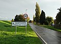
 Entering Gunthorpe - geograph.org.uk - 1250300.jpg 640 × 480; 55 KB
-
 Entering Gunthorpe from north - geograph.org.uk - 4681180.jpg 3,072 × 1,728; 1.47 MB
-
 Entering Gunthorpe from the north - geograph.org.uk - 4714003.jpg 4,974 × 3,553; 4.34 MB
-
 Entering Owston Ferry - geograph.org.uk - 1231303.jpg 640 × 480; 65 KB
-
 Entering Owston Ferry - geograph.org.uk - 1250517.jpg 640 × 480; 63 KB
-
 Entering Owston Ferry - geograph.org.uk - 2302923.jpg 800 × 600; 272 KB
-
 Entering Owston Ferry - geograph.org.uk - 4372532.jpg 640 × 480; 75 KB
-
 Entering Owston Ferry - geograph.org.uk - 711611.jpg 640 × 480; 58 KB
-
 Entrance to Trent Farm - geograph.org.uk - 2312010.jpg 1,280 × 959; 705 KB
-
 Epworth Road - geograph.org.uk - 4774777.jpg 1,600 × 1,072; 523 KB
-
 Epworth Road postbox ref, DN9 107 - geograph.org.uk - 2312047.jpg 1,280 × 959; 686 KB
-
 Epworth Road, Owston Ferry - geograph.org.uk - 2312413.jpg 1,280 × 959; 594 KB
-
 Farm building off Owston Ferry Road - geograph.org.uk - 4372586.jpg 640 × 480; 75 KB
-
 Farm Track from Stockwith Road - geograph.org.uk - 3497050.jpg 1,504 × 2,256; 2.41 MB
-
 Farm Track near Gunthorpe - geograph.org.uk - 3498239.jpg 1,504 × 2,256; 2.18 MB
-
 Farm track off Station Road - geograph.org.uk - 4372557.jpg 640 × 480; 85 KB
-
 Farm track to the south of Gunthorpe - geograph.org.uk - 4714004.jpg 3,888 × 5,184; 6.63 MB
-
 Farmland and a bend in the road south of Owston Ferry - geograph.org.uk - 4713997.jpg 5,105 × 3,741; 5.02 MB
-
 Farmland beside drain - geograph.org.uk - 4372589.jpg 640 × 480; 64 KB
-
 Farmland near Low Melwood - geograph.org.uk - 4372527.jpg 640 × 480; 74 KB
-
 Farmland off Owston Ferry Road - geograph.org.uk - 4372584.jpg 640 × 480; 61 KB
-
 Farmland south of Low Melwood Farm - geograph.org.uk - 4713967.jpg 3,888 × 5,184; 5.48 MB
-
 Farmyard on South Street - geograph.org.uk - 2312006.jpg 1,280 × 959; 656 KB
-
 Farmyard on South Street - geograph.org.uk - 2312007.jpg 1,280 × 959; 484 KB
-
 Ferry Drain - geograph.org.uk - 1250296.jpg 640 × 480; 30 KB
-
 Ferry Drain - geograph.org.uk - 1913556.jpg 1,200 × 1,600; 461 KB
-
 Ferry Drain - geograph.org.uk - 4681260.jpg 3,072 × 1,728; 3.66 MB
-
 Ferry Drain - geograph.org.uk - 4684687.jpg 800 × 533; 110 KB
-

-

-
 Field drain near Owston Ferry - geograph.org.uk - 2311028.jpg 1,280 × 959; 684 KB
-
 Field footpath at Owston Ferry - geograph.org.uk - 2310570.jpg 1,280 × 959; 600 KB
-
 Fields and pylons - geograph.org.uk - 4372540.jpg 640 × 480; 55 KB
-
 Fields near Low Melwood - geograph.org.uk - 1231300.jpg 640 × 480; 49 KB
-
 Fields to east of East Lound - geograph.org.uk - 4681291.jpg 3,072 × 1,728; 2.21 MB
-
 Flood bank and wall beside River Trent - geograph.org.uk - 4767818.jpg 3,040 × 1,670; 3.23 MB
-
 Flood defence beside the River Trent - geograph.org.uk - 4765052.jpg 800 × 533; 78 KB
-
 Footbridge near Lady Croft Farm - geograph.org.uk - 2311036.jpg 1,280 × 959; 733 KB
-
 Footbridge over drain - geograph.org.uk - 4372569.jpg 640 × 480; 111 KB
-
 Footbridge over the Ferry Drain - geograph.org.uk - 2310567.jpg 1,280 × 959; 580 KB
-
 Footpath across drain at Owston Ferry - geograph.org.uk - 4767814.jpg 3,072 × 1,728; 4.41 MB
-
-
 Footpath near Owston Ferry - geograph.org.uk - 2311027.jpg 1,280 × 959; 1.04 MB
-
 Footpath to Owston Ferry - geograph.org.uk - 2311040.jpg 1,280 × 959; 710 KB
-
 Footpath to Owston Ferry - geograph.org.uk - 2678500.jpg 1,024 × 768; 164 KB
-
 Footpath to Owston Ferry - geograph.org.uk - 2810911.jpg 640 × 427; 86 KB
-
 Former quarry at Low Melwood - geograph.org.uk - 2312425.jpg 1,280 × 959; 841 KB
-
 Four Bridges Pumping Station - geograph.org.uk - 1250916.jpg 640 × 480; 71 KB
-
 Fourway Fisheries Gunthorpe - geograph.org.uk - 1250299.jpg 640 × 480; 49 KB
-
 Gate in Hillcrest Paddock - geograph.org.uk - 494314.jpg 640 × 480; 114 KB
-
 Gautry Lane - geograph.org.uk - 2312025.jpg 1,280 × 959; 741 KB
-
 Gautry Lane - geograph.org.uk - 6265595.jpg 4,000 × 3,000; 4.68 MB
-
 Green Track - geograph.org.uk - 293540.jpg 640 × 480; 149 KB
-
 Gunthorpe Main Street postbox ref, DN9 232 - geograph.org.uk - 2313255.jpg 959 × 1,280; 590 KB
-
 Gunthorpe Road - geograph.org.uk - 2310559.jpg 1,280 × 959; 503 KB
-
 Gunthorpe Road - geograph.org.uk - 2313247.jpg 1,280 × 951; 433 KB
-
 Gunthorpe Road - geograph.org.uk - 4372576.jpg 640 × 480; 53 KB
-
 Gunthorpe Road near Intake Farm - geograph.org.uk - 2313242.jpg 1,280 × 959; 530 KB
-
 Hay bale on Warping Drain's south bank - geograph.org.uk - 2652325.jpg 1,024 × 768; 203 KB
-
 High and Low Melwood, aerial - geograph.org.uk - 3125041.jpg 640 × 427; 62 KB
-
 High Melwood clay pits, aerial - geograph.org.uk - 3096218.jpg 640 × 427; 68 KB
-
 High Street, Owston Ferry - geograph.org.uk - 2311977.jpg 1,280 × 959; 451 KB
-
 High Street, Owston Ferry - geograph.org.uk - 2311988.jpg 1,280 × 959; 468 KB
-
 High Street, Owston Ferry - geograph.org.uk - 2312033.jpg 1,280 × 946; 593 KB
-
 High Street, Owston Ferry - geograph.org.uk - 2312044.jpg 1,280 × 959; 617 KB
-
 Honesty shop at High Melwood - geograph.org.uk - 5615751.jpg 800 × 600; 156 KB
-
 Houses at Gunthorpe and the River Trent - geograph.org.uk - 5431332.jpg 800 × 470; 117 KB
-
 Houses on Epworth Road, Owston Ferry - geograph.org.uk - 4372531.jpg 640 × 480; 70 KB
-
 In Owston Ferry's marketplace - geograph.org.uk - 4713977.jpg 3,751 × 4,957; 5.27 MB
-
 Jetty on the River Trent - geograph.org.uk - 4177076.jpg 640 × 480; 62 KB
-
-
 Junction to Blackdykes Road - geograph.org.uk - 2312012.jpg 1,280 × 959; 771 KB
-
 Kelfield Isle of Axholme North Lincolnshire - geograph.org.uk - 5474231.jpg 5,184 × 3,888; 4.23 MB
-
 Kelfield Isle of Axholme North Lincolnshire - geograph.org.uk - 5594071.jpg 4,608 × 3,456; 3.15 MB
-
 Kinnaird Castle - geograph.org.uk - 2811584.jpg 640 × 427; 96 KB
-
 Lady Croft Farm - geograph.org.uk - 2311033.jpg 1,280 × 959; 702 KB
-
 Lady Croft Farm may be behind those conifers, centre left - geograph.org.uk - 4681199.jpg 3,072 × 1,728; 3.56 MB
-
 Landscape near High Melwood - geograph.org.uk - 2312441.jpg 1,280 × 959; 774 KB
-
 Landscape near Owston Ferry - geograph.org.uk - 2312456.jpg 1,280 × 959; 454 KB
-
 Landscape with power - geograph.org.uk - 2312476.jpg 1,280 × 959; 521 KB
-
 Large bare field west of Stockwith Road - geograph.org.uk - 2652489.jpg 1,024 × 768; 131 KB
-
 Left then right - geograph.org.uk - 2225828.jpg 1,024 × 768; 149 KB
-
 Lincolnshire farmland - geograph.org.uk - 5615759.jpg 800 × 600; 86 KB
-
 Looking across the River Trent - geograph.org.uk - 4177046.jpg 640 × 480; 64 KB
-
 Looking across the River Trent at Owston Ferry - geograph.org.uk - 6265589.jpg 4,000 × 3,000; 4.99 MB
-
 Looking across the River Trent at Owston Ferry - geograph.org.uk - 6265591.jpg 4,000 × 3,000; 4.89 MB
-
 Looking towards Newlands Farm - geograph.org.uk - 2225840.jpg 1,024 × 768; 170 KB
-
-
 Lound Road - geograph.org.uk - 4372551.jpg 640 × 480; 61 KB
-
 Low Melwood Farm - geograph.org.uk - 1231307.jpg 640 × 480; 55 KB
-
 Low Melwood Farm - geograph.org.uk - 2312415.jpg 1,280 × 959; 634 KB
-
 Low Melwood Farm - geograph.org.uk - 3588733.jpg 640 × 427; 50 KB
-
 Market Place, Owston Ferry - geograph.org.uk - 2311975.jpg 1,280 × 959; 457 KB
-
 Melwood Grange - geograph.org.uk - 3588702.jpg 640 × 427; 52 KB
-
 Minor road beside the River Trent - geograph.org.uk - 4684684.jpg 800 × 533; 89 KB
-
 Minor road junction - geograph.org.uk - 4684691.jpg 800 × 533; 117 KB
-
 Minor road near Low Hall Farm - geograph.org.uk - 4372541.jpg 640 × 480; 42 KB
-
 Minor road near Owston Grange - geograph.org.uk - 4372554.jpg 640 × 480; 51 KB
-
 Minor road towards Owston Ferry - geograph.org.uk - 4371566.jpg 640 × 480; 60 KB
-
 Minor road towards Owston Ferry - geograph.org.uk - 4372530.jpg 640 × 480; 56 KB
-
 Minor road towards Owston Ferry - geograph.org.uk - 4372555.jpg 640 × 480; 51 KB
-
 Moat at Low Melwood - geograph.org.uk - 2312418.jpg 1,280 × 959; 598 KB
-
 Nameplate for The Windmill - geograph.org.uk - 2311062.jpg 1,280 × 959; 946 KB
-
 National Grid trunk line - geograph.org.uk - 2312431.jpg 1,280 × 959; 569 KB
-
 Near Low Melwood Farm - geograph.org.uk - 2532997.jpg 1,024 × 768; 257 KB
-
 New plantation and paddock - geograph.org.uk - 1913410.jpg 1,600 × 1,200; 397 KB
-
 No Through Road - geograph.org.uk - 2234189.jpg 1,024 × 768; 90 KB
-

-
 North Street and Trent Flood Bank in Owston Ferry - geograph.org.uk - 4861377.jpg 4,608 × 3,456; 3.73 MB
-
 Northern End of Gunthorpe Village - geograph.org.uk - 4861350.jpg 4,534 × 3,352; 3.45 MB
-
 Ornamental plough on Gunthorpe Road - geograph.org.uk - 5616082.jpg 800 × 600; 130 KB
-
 Outlet pipes, South Street Pumping Station - geograph.org.uk - 2309473.jpg 1,280 × 853; 579 KB
-

-
 Owston Ferry approach - geograph.org.uk - 2311939.jpg 1,280 × 938; 636 KB
-
 Owston Ferry Cemetery - geograph.org.uk - 3588826.jpg 640 × 427; 67 KB
-
 Owston Ferry Cemetery - geograph.org.uk - 5615757.jpg 800 × 600; 130 KB
-
 Owston Ferry Clock - geograph.org.uk - 2311981.jpg 988 × 1,280; 499 KB
-
 Owston Ferry Environment Agency Depot - geograph.org.uk - 2311942.jpg 1,280 × 959; 436 KB
-
 Owston Ferry Mill - geograph.org.uk - 2310591.jpg 1,280 × 959; 483 KB
-
 Owston Ferry Mill - geograph.org.uk - 2310592.jpg 1,280 × 959; 601 KB
-
 Owston Ferry Mill - geograph.org.uk - 2311052.jpg 1,280 × 959; 572 KB
-

-
 Owston Ferry Post Office - geograph.org.uk - 2311983.jpg 1,280 × 959; 385 KB
-
 Owston Ferry Post Office postbox ref, DN9 269 - geograph.org.uk - 2311984.jpg 959 × 1,280; 434 KB
-

-
 Owston Ferry Pumping Station, Heritage Open Day 2019 (2) - geograph.org.uk - 6272712.jpg 1,152 × 1,728; 544 KB
-

-
 Owston Ferry Recreation Ground - geograph.org.uk - 2312038.jpg 1,280 × 959; 784 KB
-
 Owston Ferry Road - geograph.org.uk - 1756358.jpg 640 × 429; 66 KB
-
 Owston Ferry Road - geograph.org.uk - 4372571.jpg 640 × 480; 59 KB
-
 Owston Ferry Road - geograph.org.uk - 4372585.jpg 640 × 480; 60 KB
-
 Owston Ferry Road - geograph.org.uk - 4372587.jpg 640 × 480; 56 KB
-
 Owston Ferry road - geograph.org.uk - 4774753.jpg 1,600 × 1,067; 309 KB
-

-
 Owston Ferry village store - geograph.org.uk - 2312037.jpg 1,280 × 959; 527 KB
-
 Owston Ferry windmill, aerial 2013 - geograph.org.uk - 3449857.jpg 640 × 427; 75 KB
.jpg)


_-_geograph.org.uk_-_4680610.jpg)
_-_geograph.org.uk_-_4680613.jpg)


_-_geograph.org.uk_-_2225340.jpg)
_-_geograph.org.uk_-_2225356.jpg)


_-_geograph.org.uk_-_6272693.jpg)
_-_geograph.org.uk_-_6272712.jpg)
_-_geograph.org.uk_-_6272720.jpg)


