Category:Passo Garlenda
Jump to navigation
Jump to search
|
Passo Garlenda has an entry on OpenStreetMap (show). |
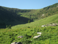
mountain pass in Italy  | |||||
| Upload media | |||||
| Instance of | |||||
|---|---|---|---|---|---|
| Location |
| ||||
| Mountain range | |||||
| Elevation above sea level |
| ||||
 | |||||
Media in category "Passo Garlenda"
The following 2 files are in this category, out of 2 total.
-
 Passo garlenda lato tanaro.png 4,288 × 3,216; 21.43 MB
-
 Passo garlenda ruderi.png 3,148 × 1,683; 7.44 MB
