Category:Penallt
Vai alla navigazione
Vai alla ricerca
village in Monmouthshire, Wales, UK  | |||||
| Carica un file multimediale | |||||
| Istanza di | |||||
|---|---|---|---|---|---|
| Luogo | Monmouthshire, Galles | ||||
 | |||||
Sottocategorie
Questa categoria contiene le 3 sottocategorie indicate di seguito, su un totale di 3.
P
- Penallt Viaduct (22 F)
T
- The Boat Inn, Penallt (9 F)
File nella categoria "Penallt"
Questa categoria contiene 42 file, indicati di seguito, su un totale di 42.
-
 Barn near Meend Farm - geograph.org.uk - 471908.jpg 640 × 480; 89 KB
-
 Former Baptist Chapel, Penallt - geograph.org.uk - 4512699.jpg 640 × 480; 69 KB
-
 Fungi growing on a tree at The Argoed - geograph.org.uk - 262813.jpg 480 × 640; 194 KB
-
 Grade II listed Old Vicarage in Penallt - geograph.org.uk - 4285875.jpg 800 × 662; 145 KB
-

-
 Old Baptist Chapel in Penallt - geograph.org.uk - 4286080.jpg 800 × 543; 117 KB
-
 Old Church Cottage, Penallt - geograph.org.uk - 4291822.jpg 800 × 568; 165 KB
-
 Old School, Penallt - geograph.org.uk - 4285562.jpg 800 × 584; 119 KB
-
 Pen-twyn - plaque on former school - geograph.org.uk - 478357.jpg 640 × 418; 124 KB
-
 Penallt - Pelham Hall - geograph.org.uk - 473937.jpg 640 × 480; 142 KB
-
 Penallt information board - geograph.org.uk - 4285428.jpg 800 × 616; 157 KB
-
 Penallt village sign - geograph.org.uk - 2246366.jpg 800 × 600; 449 KB
-
 Penallt War Memorial - geograph.org.uk - 4286036.jpg 800 × 524; 159 KB
-

-
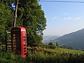 Rural phone box, leaning phone pole - geograph.org.uk - 153922.jpg 640 × 480; 102 KB
-
 The Argoed - geograph.org.uk - 260586.jpg 640 × 480; 111 KB
-
 The Argoed Penallt.jpg 640 × 480; 81 KB
-
 The Boat Inn, Penallt, Monmouthshire - geograph.org.uk - 3048657.jpg 640 × 480; 115 KB
-
 The Bush Inn, Pen-twyn - geograph.org.uk - 261138.jpg 640 × 480; 110 KB
-
 The Bush Inn, Penallt - geograph.org.uk - 3048958.jpg 640 × 480; 88 KB
-
 The War Memorial in Pen-twyn - geograph.org.uk - 261718.jpg 640 × 480; 141 KB
-
 View from Krymin Road 3.jpg 4 056 × 3 042; 4,06 MB
-
 View from Krymin Road 4.jpg 4 320 × 3 240; 3,81 MB
-
 View from Penallt churchyard - geograph.org.uk - 1400055.jpg 640 × 480; 86 KB
-
 War Memorials in Britain After the First World War Q48443.jpg 567 × 800; 70 KB
-
 Autumn colours above the Wye Valley - geograph.org.uk - 605152.jpg 426 × 640; 105 KB
-
 Disused farm buildings at Tre-gagle - geograph.org.uk - 261724.jpg 640 × 480; 183 KB
-
 Farmland to the south of Troy Farm - geograph.org.uk - 606771.jpg 426 × 640; 74 KB
-

-
 Footpath to Troypark Wood - geograph.org.uk - 606767.jpg 426 × 640; 94 KB
-
 Frostland Farm, Penallt Common - geograph.org.uk - 261119.jpg 640 × 480; 135 KB
-
 House in the Wye Valley - geograph.org.uk - 605143.jpg 426 × 640; 96 KB
-
 Lane to Penallt church - geograph.org.uk - 324028.jpg 640 × 480; 116 KB
-
 Logging in Pwllplythin Wood - geograph.org.uk - 260578.jpg 640 × 480; 172 KB
-

-
 Lord's Grove, the Wye Valley - geograph.org.uk - 605146.jpg 640 × 426; 123 KB
-
 Meend Farm - geograph.org.uk - 324036.jpg 640 × 480; 81 KB
-
 North of Coxbury Farm - geograph.org.uk - 707644.jpg 637 × 436; 61 KB
-
 Old chapel, Pen-twyn - geograph.org.uk - 261719.jpg 640 × 480; 110 KB
-
 Ruins of an old mill at New Mills. - geograph.org.uk - 261123.jpg 640 × 480; 174 KB
-
 Silver Birch tree near Penallt Church - geograph.org.uk - 606778.jpg 640 × 426; 74 KB
-
 Silver Birch tree near Penallt Church - geograph.org.uk - 606779.jpg 426 × 640; 98 KB


