Category:Monmouthshire
Jump to navigation
Jump to search
principal area in south-east Wales, United Kingdom   | |||||
| Upload media | |||||
| Instance of | |||||
|---|---|---|---|---|---|
| Location | Wales | ||||
| Located in or next to body of water | |||||
| Capital | |||||
| Population |
| ||||
| Area |
| ||||
| Replaces | |||||
| Different from | |||||
| official website | |||||
 | |||||

English: Monmouthshire is a principal area and historic county in south east Wales. From 1974 until 1996 the area was organised under the county of Gwent.
Cymraeg: Sir Fynwy.


Subcategories
This category has the following 25 subcategories, out of 25 total.
A
B
C
E
G
H
I
M
- Monmouthshire Building Society (17 F)
N
P
Q
- Quality images of Monmouthshire (28 F)
S
T
V
Media in category "Monmouthshire"
The following 200 files are in this category, out of 447 total.
(previous page) (next page)-
 Flag of Monmouthshire.svg 500 × 300; 2 KB
-
 A pair of houses, and Blorenge - geograph.org.uk - 1279642.jpg 640 × 480; 43 KB
-
 A4136 leaving the Forest of Dean - geograph.org.uk - 1725300.jpg 640 × 374; 78 KB
-
 Abergavenny Castle Lodge.jpg 4,000 × 2,666; 10.1 MB
-
 Agricultural land near Carrow Hill - geograph.org.uk - 4209249.jpg 800 × 451; 169 KB
-
 An almost vertical lawn, Symonds Yat West - geograph.org.uk - 757421.jpg 480 × 640; 225 KB
-
 Angiddy Blast Furnace - geograph.org.uk - 1286754.jpg 640 × 480; 126 KB
-
 Angiddy Stream at Tintern.jpg 5,184 × 3,456; 6.85 MB
-
 Approaching Newcastle from the south - geograph.org.uk - 1242388.jpg 640 × 480; 92 KB
-
 Arable land beside the River Usk - geograph.org.uk - 1280145.jpg 640 × 426; 82 KB
-
 Araucaria tree and house - geograph.org.uk - 1286792.jpg 480 × 640; 105 KB
-

-
 B4233 Rockfield Road - geograph.org.uk - 1084503.jpg 640 × 480; 226 KB
-
 B4293 passing through Trellech - geograph.org.uk - 1025662.jpg 640 × 480; 140 KB
-
 B4347 passing Pool Farm - geograph.org.uk - 1241419.jpg 640 × 480; 81 KB
-
 B4347 passing through Grosmont - geograph.org.uk - 1191817.jpg 640 × 480; 101 KB
-
 B4347 to Newcastle - geograph.org.uk - 1241424.jpg 640 × 453; 84 KB
-

-
 Baled straw behind the churchyard - geograph.org.uk - 1024912.jpg 640 × 480; 170 KB
-
 Banks of the River Wye - geograph.org.uk - 1179647.jpg 640 × 480; 66 KB
-
 Barton Bridge crosses Barton Brook - geograph.org.uk - 1760801.jpg 640 × 427; 150 KB
-
 Barton Brook from Barton Bridge, Raglan - geograph.org.uk - 1754394.jpg 427 × 640; 263 KB
-

-
 Best kept village 2003 - geograph.org.uk - 1191470.jpg 640 × 480; 133 KB
-
 Bridge carrying the M48, Mathern - geograph.org.uk - 1131160.jpg 640 × 427; 91 KB
-
 Broadstone, near Staunton - geograph.org.uk - 736823.jpg 640 × 426; 84 KB
-
 Broadstone, near Staunton - geograph.org.uk - 736831.jpg 640 × 426; 105 KB
-
 Brown waters of the River Monnow - geograph.org.uk - 1190066.jpg 640 × 480; 153 KB
-
 Bryn Deri - geograph.org.uk - 888814.jpg 640 × 480; 65 KB
-

-
 Cairn and Chwarel y Fan - geograph.org.uk - 1753408.jpg 640 × 426; 100 KB
-
 Cairn near Chwarel y Fan - geograph.org.uk - 1753418.jpg 3,008 × 2,000; 1.5 MB
-
 Cairn near Chwarel y Fan - geograph.org.uk - 1753433.jpg 640 × 426; 100 KB
-
 Camp Wood, Llancayo, Monmouthshire - geograph - 3222953.jpg 1,024 × 680; 236 KB
-
 Carrow Hill - geograph.org.uk - 4209266.jpg 800 × 451; 208 KB
-
 Charles1stEarlOfMacclesfield.jpg 202 × 231; 7 KB
-
 Charston Rock lighthouse - geograph.org.uk - 916574.jpg 640 × 413; 47 KB
-
 Checking out the new surroundings - geograph.org.uk - 1190233.jpg 640 × 468; 135 KB
-
 Chepstow Castle Birds and Sky.jpg 5,184 × 3,456; 6.91 MB
-
 Chepstow Castle Window and Walls.jpg 3,456 × 5,184; 6.92 MB
-
 Chepstow Road, Raglan - geograph.org.uk - 1754153.jpg 640 × 404; 139 KB
-
 Church path - geograph.org.uk - 1372421.jpg 426 × 640; 122 KB
-
 Church tower and The Old School, Raglan - geograph.org.uk - 1754384.jpg 427 × 640; 108 KB
-
 Cottage at Newbridge on Usk - geograph.org.uk - 1253030.jpg 426 × 640; 93 KB
-
 Country lane meets dual carriageway - geograph.org.uk - 1760794.jpg 640 × 448; 147 KB
-
 Crossroads at Croes Llywarch - geograph.org.uk - 1709214.jpg 3,296 × 2,472; 1.83 MB
-
 Crossroads, Raglan - geograph.org.uk - 1754011.jpg 640 × 407; 96 KB
-
 Cyclists descending - geograph.org.uk - 1190245.jpg 640 × 480; 146 KB
-
-
 Descending Gray Hill - geograph.org.uk - 5199391.jpg 640 × 448; 181 KB
-
 Descending Hatterrall Hill - geograph.org.uk - 1705216.jpg 640 × 480; 82 KB
-
 Dewstow Golf Course - geograph.org.uk - 4209026.jpg 800 × 451; 208 KB
-
 Dewstow Road, 1 - geograph.org.uk - 4208203.jpg 800 × 451; 172 KB
-
 Disk plough on Cefn Hill - geograph.org.uk - 1269747.jpg 640 × 426; 99 KB
-
 Disused post-box inside the garden of Roughton Lodge - geograph.org.uk - 1702776.jpg 3,296 × 2,472; 1.84 MB
-
 Disused school building, Caerwent - geograph.org.uk - 1161804.jpg 640 × 480; 149 KB
-
 Disused school in Caerwent - geograph.org.uk - 1160203.jpg 640 × 480; 187 KB
-
 Dixton Ferry and Church, Monmouth-LCCN2002697079.tif 3,670 × 2,747; 28.85 MB
-
 Down Dewstow Road towards Caldicot - geograph.org.uk - 4803951.jpg 800 × 600; 153 KB
-
 Driveway to Brook House - geograph.org.uk - 1751337.jpg 640 × 480; 133 KB
-
-
 East Bank of the Wye.jpg 5,184 × 3,456; 9.39 MB
-
 East of Coed-duon - geograph.org.uk - 930149.jpg 640 × 427; 165 KB
-
 East of Coed-duon - geograph.org.uk - 930154.jpg 640 × 427; 178 KB
-
 Entrance to Candwr Farm - geograph.org.uk - 1702767.jpg 3,296 × 2,472; 1.92 MB
-
 Entrance to Croes Llywarch, near Tredunnock - geograph.org.uk - 1702599.jpg 3,296 × 2,472; 1.89 MB
-
 Entrance to Croeswen Farm - geograph.org.uk - 1705204.jpg 3,296 × 2,472; 1.84 MB
-
 Entrance to Cwmffrwd Farm - geograph.org.uk - 1704286.jpg 3,296 × 2,472; 1.89 MB
-
 Entrance to Cwrt Perrott - geograph.org.uk - 1706041.jpg 3,296 × 2,472; 1.84 MB
-
 Entrance to Garn-fawr, Llanhennock - geograph.org.uk - 1701004.jpg 3,296 × 2,472; 1.87 MB
-
 Entrance to Pant Farm - geograph.org.uk - 1709196.jpg 3,296 × 2,472; 1.81 MB
-
 Entrance to Pentwyn Farm - geograph.org.uk - 1705914.jpg 3,296 × 2,472; 1.82 MB
-
 Entrance to Whitehouse Farm - geograph.org.uk - 1706561.jpg 3,296 × 2,472; 1.81 MB
-
 Farm buildings, Pen-y-glôg Farm - geograph.org.uk - 1706049.jpg 3,296 × 2,472; 1.95 MB
-
 Farm buildings, Trellech - geograph.org.uk - 1024751.jpg 640 × 480; 131 KB
-
 Farm road to Trestevan - geograph.org.uk - 1268586.jpg 426 × 640; 113 KB
-
 Farm track in the snow - geograph.org.uk - 1657208.jpg 640 × 480; 57 KB
-
 Farmland - geograph.org.uk - 928878.jpg 640 × 480; 76 KB
-
 Farmland at Llanhennock - geograph.org.uk - 1261068.jpg 640 × 426; 79 KB
-
 Farmland at St Arvans - geograph.org.uk - 803445.jpg 426 × 640; 108 KB
-
 Farmland beside the road to Coed-y-paen - geograph.org.uk - 1705241.jpg 3,296 × 2,472; 1.88 MB
-
 Farmland near Abergavenny - geograph.org.uk - 1286260.jpg 640 × 426; 101 KB
-
 Farmland near Tredunnoc - geograph.org.uk - 1258578.jpg 640 × 426; 85 KB
-
 Farmland near Tredunnock - geograph.org.uk - 1701032.jpg 3,296 × 2,472; 1.92 MB
-
 Farmland near Wyndcliffe Court - geograph.org.uk - 803449.jpg 640 × 426; 78 KB
-
 Farmland overlooking Brecon Beacons - geograph.org.uk - 808498.jpg 640 × 480; 77 KB
-
 Field and Upper Seven Acres Wood - geograph.org.uk - 4209257.jpg 800 × 451; 200 KB
-

-
 Field beside Croeswen Farm - geograph.org.uk - 1705217.jpg 3,296 × 2,472; 1.85 MB
-
 Field edge in deep shadow - geograph.org.uk - 4209271.jpg 800 × 451; 217 KB
-
 Fields near Cwmyoy - geograph.org.uk - 1705253.jpg 640 × 480; 51 KB
-
 Filling station, High Street, Raglan - geograph.org.uk - 1753997.jpg 640 × 408; 103 KB
-
 Fingerpost near the entrance to Box Farm - geograph.org.uk - 1190177.jpg 640 × 480; 109 KB
-
 First day out - geograph.org.uk - 1190228.jpg 640 × 480; 129 KB
-
 Fish and Ship - geograph.org.uk - 1760806.jpg 640 × 422; 88 KB
-

-
 Flowers on Usk Bridge.jpg 5,184 × 3,456; 9.48 MB
-
 Footbridge across the Sôr Brook, Llandegveth - geograph.org.uk - 1706037.jpg 3,296 × 2,472; 1.93 MB
-

-
 Footpath crosses the B4347 - geograph.org.uk - 1190169.jpg 640 × 480; 105 KB
-

-

-
 Footpath sign for Brockweir, Offa's Dyke, Devil's Pulpit & Tidenham.jpg 3,919 × 2,939; 2.7 MB
-
 Footpath through Beaulieu Wood - geograph.org.uk - 1725529.jpg 640 × 480; 134 KB
-
 Footpath to Maryland - geograph.org.uk - 1025659.jpg 480 × 640; 160 KB
-
 Footpath to Tump Terret - geograph.org.uk - 1039171.jpg 640 × 427; 105 KB
-
 Forest footpath users 4 - geograph.org.uk - 1441632.jpg 640 × 480; 253 KB
-
 Forest of Dean, Reddings Inclosure - geograph.org.uk - 1724868.jpg 640 × 480; 139 KB
-
 Forest Reflection in the Wye.jpg 2,592 × 3,456; 9.2 MB
-
 Former pound - geograph.org.uk - 1025675.jpg 640 × 458; 140 KB
-
 Foxhunter's Carpark, Blorenge - geograph.org.uk - 1105375.jpg 640 × 480; 26 KB
-
 Gaer hill and the Skirrid from Crug Mawr - geograph.org.uk - 1671540.jpg 2,592 × 1,944; 1.14 MB
-
 Gardens at Usk Castle.jpg 5,184 × 3,456; 10.91 MB
-
 Garn Farm, Llanhennock - geograph.org.uk - 1701005.jpg 3,296 × 2,472; 1.77 MB
-
 Gateway to Lan Sôr - geograph.org.uk - 1704244.jpg 3,296 × 2,472; 1.88 MB
-
 Glebe Farm - geograph.org.uk - 1705987.jpg 3,296 × 2,472; 1.84 MB
-
 Govilon Sunlight - geograph.org.uk - 1692032.jpg 1,600 × 1,200; 345 KB
-
 Granary Farm - geograph.org.uk - 1705958.jpg 3,296 × 2,472; 1.93 MB
-
 Grassed-over stubble - geograph.org.uk - 1631654.jpg 640 × 480; 244 KB
-
 Grazing land at Llangybi - geograph.org.uk - 1268970.jpg 640 × 426; 104 KB
-
 Grazing land in the Usk Valley - geograph.org.uk - 1269693.jpg 640 × 426; 94 KB
-
 Grazing land near Llangybi - geograph.org.uk - 1269687.jpg 640 × 426; 103 KB
-
 Green Lane - geograph.org.uk - 4209262.jpg 800 × 451; 212 KB
-
 Green lane ascending Graig Syfyrddin - geograph.org.uk - 1070749.jpg 640 × 480; 165 KB
-
 Green lane ascends Graig Syfyrddin - geograph.org.uk - 1070757.jpg 480 × 640; 170 KB
-
 Grosmont Railway embankment at Werngifford.jpg 1,000 × 667; 767 KB
-
 Hall Farm, Newbridge on Usk - geograph.org.uk - 1256094.jpg 640 × 426; 97 KB
-
 Harvest time in Grosmont - geograph.org.uk - 972859.jpg 640 × 426; 87 KB
-
 Head of Cwm Gwent - geograph.org.uk - 1300336.jpg 640 × 480; 108 KB
-
 Heading north on the A449 - geograph.org.uk - 1635893.jpg 640 × 480; 127 KB
-
 Heading north on the A449 - geograph.org.uk - 1635896.jpg 640 × 480; 136 KB
-
 Hedge full of snow - geograph.org.uk - 1657216.jpg 480 × 640; 50 KB
-
 High Street, Raglan - geograph.org.uk - 1754002.jpg 640 × 458; 93 KB
-
 Highmoor Lane - geograph.org.uk - 4209238.jpg 800 × 451; 198 KB
-
 Highmoor Lane - geograph.org.uk - 4209244.jpg 800 × 451; 193 KB
-
-
 House by a country lane - geograph.org.uk - 4209250.jpg 800 × 451; 213 KB
-
 House, Caerwent, Wales - geograph.org.uk - 1217747.jpg 640 × 426; 82 KB
-

-

-
-
 In the Black Mountains - geograph.org.uk - 1705169.jpg 640 × 480; 72 KB
-
 Inside a castle keep - geograph.org.uk - 1426231.jpg 612 × 640; 168 KB
-
 Iron Mountain trail post - geograph.org.uk - 901618.jpg 480 × 640; 104 KB
-

-
 King's Wood - geograph.org.uk - 929135.jpg 640 × 480; 82 KB
-
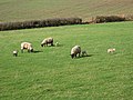
 Lambs in a field enjoying hay in the evening - geograph.org.uk - 1805056.jpg 1,600 × 1,200; 473 KB
-
 Lane junction south of Penhow - geograph.org.uk - 4212264.jpg 800 × 451; 239 KB
-
 Lane leading from A48 into Caerwent - geograph.org.uk - 1161875.jpg 640 × 480; 162 KB
-
 Lane past Little Barn - geograph.org.uk - 4209269.jpg 800 × 451; 234 KB
-
 Lane to Llanvaches - geograph.org.uk - 4209253.jpg 800 × 451; 265 KB
-
 Late brambles - geograph.org.uk - 4209246.jpg 800 × 800; 375 KB
-
 Linda Vista and the Blorenge.jpg 5,472 × 3,648; 9.97 MB
-
 Lion in the Grotto.jpg 2,592 × 3,456; 8.42 MB
-
 Litter warning and river meadow - geograph.org.uk - 780201.jpg 640 × 426; 72 KB
-
 Llanthony Priory landscape view.jpg 3,456 × 2,304; 3.96 MB
-
 Llanvihangel Gobion, crop field - geograph.org.uk - 1432131.jpg 640 × 480; 126 KB
-

-
 Local enterprise, Skenfrith - geograph.org.uk - 1405990.jpg 640 × 480; 120 KB
-

-
 Looking S along Pound Lane - geograph.org.uk - 1161842.jpg 640 × 480; 201 KB
-
 Looking south from Tintern Abbey - geograph.org.uk - 1705988.jpg 1,024 × 768; 369 KB
-
 Looking Up at Sugar loaf - panoramio.jpg 2,128 × 1,409; 1.2 MB
-
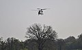 Low flying chinook - geograph.org.uk - 1286235.jpg 640 × 397; 49 KB
-
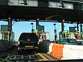 M4 toll booth - geograph.org.uk - 1105709.jpg 640 × 480; 159 KB
-
 Malthouse Wood - geograph.org.uk - 1190060.jpg 640 × 480; 99 KB
-
 Managed bracken moorland on the Deri - geograph.org.uk - 1125717.jpg 640 × 480; 89 KB
-
 Meadow near Perthi-bich Lane - geograph.org.uk - 448920.jpg 640 × 427; 242 KB
-
 Middle Hendre Round Barrow - geograph - 3502426.jpg 640 × 480; 109 KB
-
 Misty Morning. - geograph.org.uk - 735689.jpg 640 × 424; 84 KB
-
 Monmouthshire (1131293).jpg 1,000 × 1,447; 512 KB
-
 Monmouthshire (3375384).jpg 587 × 850; 284 KB
-
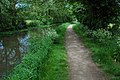
 Monmouthshire and Brecon Canal - geograph.org.uk - 1317373.jpg 640 × 426; 103 KB
-
 Monmouthshire and Brecon Canal - geograph.org.uk - 1317632.jpg 640 × 426; 98 KB
-
 Monmouthshire and Brecon Canal - geograph.org.uk - 1318251.jpg 640 × 426; 116 KB
-
 Monmouthshire and Brecon Canal - geograph.org.uk - 1318260.jpg 640 × 426; 117 KB
-
 Monmouthshire and Brecon Canal - geograph.org.uk - 1318319.jpg 640 × 426; 93 KB
-
 Monmouthshire and Brecon Canal - geograph.org.uk - 1318424.jpg 640 × 426; 107 KB
-
 Monmouthshire and Brecon Canal - geograph.org.uk - 1318588.jpg 640 × 426; 108 KB
-
 Monmouthshire and Brecon Canal - geograph.org.uk - 1319490.jpg 640 × 426; 94 KB
-
 Monmouthshire and Brecon Canal - geograph.org.uk - 1320139.jpg 640 × 426; 114 KB
-
-
 Monmouthshire County RFC.svg 600 × 660; 94 KB
-
 Monmouthshire Flag at Devauden.jpg 1,103 × 1,454; 335 KB
-
 Monmouthshire Map.png 4,967 × 4,967; 4.15 MB
-
 MONMOUTHSHIRE Shield.svg 600 × 660; 202 KB
-
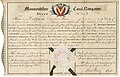 Monmoutshire Canal Navigation 1799.jpg 4,650 × 3,001; 4.05 MB
-
 Mud, glorious mud^ - geograph.org.uk - 1705173.jpg 640 × 480; 59 KB
-
 Muddy bridleway, Mitchel Troy - geograph.org.uk - 1025654.jpg 480 × 640; 220 KB
-
 Muddy brown river - geograph.org.uk - 1190022.jpg 640 × 480; 170 KB
-
 Mute swan and the River Usk - geograph.org.uk - 1273042.jpg 640 × 426; 68 KB
-
 National boundary at Kenchurch - geograph.org.uk - 972920.jpg 640 × 426; 113 KB
-
 Near Tintern, A466 towards Chepstow - geograph.org.uk - 1090950.jpg 640 × 480; 96 KB
-
 New Build during construction .jpg 2,897 × 3,423; 1.8 MB
-
 New footbridge across the River Monnow - geograph.org.uk - 1190068.jpg 640 × 480; 138 KB
-
 New Market street - geograph.org.uk - 960746.jpg 640 × 480; 75 KB
-
 New Weir, on the Wye.jpeg 750 × 547; 204 KB
-
 New Weir.jpeg 750 × 651; 195 KB
-
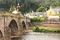
 Newbridge on Usk - geograph.org.uk - 1255643.jpg 640 × 426; 86 KB
-
 No white lines - geograph.org.uk - 1190242.jpg 640 × 480; 115 KB


.jpg)
.jpg)


