Category:Peng Chau Ferry Pier
Jump to navigation
Jump to search
| Object location | | View all coordinates using: OpenStreetMap |
|---|
.jpg) | |||||
| Upload media | |||||
| Instance of | |||||
|---|---|---|---|---|---|
| Location | Hong Kong, PRC | ||||
 | |||||
Media in category "Peng Chau Ferry Pier"
The following 17 files are in this category, out of 17 total.
-
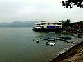
 HKK 1 at Peng Chau (2024).jpg 6,000 × 3,368; 5.89 MB
-
 Peng Chau Ferry Pier (2).jpg 816 × 612; 80 KB
-
 Peng Chau Ferry Pier (Hong Kong).jpg 4,000 × 2,663; 2.56 MB
-
 Peng Chau Ferry Pier gate.jpg 816 × 612; 108 KB
-
 Peng Chau Ferry Pier HKKF entry gate.jpg 816 × 612; 97 KB
-
 Peng Chau Ferry Pier Peng Chau Island Hong Kong - panoramio.jpg 2,400 × 1,800; 2.61 MB
-
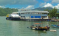 Peng Chau Ferry Pier.jpg 3,820 × 2,308; 5.62 MB
-
 Peng Chau from Nam Wan promenade.jpg 4,032 × 3,024; 5.85 MB
-
 Peng Chau Pier 06-07-2022(1).jpg 4,032 × 3,024; 2.12 MB
-
 Peng Chau Pier 06-07-2022(2).jpg 4,032 × 3,024; 4.16 MB
-
 Peng Chau Pier 07-07-2022.jpg 4,032 × 3,024; 2.8 MB
-
 Peng Chau Pier HKKF entry gate 06-07-2023.jpg 4,032 × 3,024; 4.22 MB
-
 Peng Chau Pier.jpg 3,712 × 2,784; 2.74 MB
-
 Ping Isand 1.JPG 1,600 × 1,200; 584 KB
-
 Ping Isand Pier.JPG 1,600 × 1,200; 598 KB
-
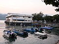
 Port of peng chau.jpg 3,648 × 2,736; 2.1 MB
-
 Sea Supreme HKKF Central to Peng Chau.jpg 816 × 612; 64 KB
.jpg)
.jpg)


.jpg)
.jpg)


