Category:Penitencia Creek (VTA)
Jump to navigation
Jump to search
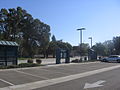
English: Media pertaining to the Penitencia Creek (VTA) light rail and bus station in San José, California, USA.
| Object location | | View all coordinates using: OpenStreetMap |
|---|
VTA light rail station in San Jose, California  | |||||
| Upload media | |||||
| Instance of | |||||
|---|---|---|---|---|---|
| Location | San Jose, Silicon Valley, California, Pacific States Region | ||||
| Transport network | |||||
| Owned by | |||||
| Inception |
| ||||
| Date of official opening |
| ||||
| Connecting line |
| ||||
| Adjacent station |
| ||||
 | |||||
Media in category "Penitencia Creek (VTA)"
The following 16 files are in this category, out of 16 total.
-
 Penitencia Creek VTA 1896 01.JPG 2,048 × 1,536; 771 KB
-
 Penitencia Creek VTA 1897 02.JPG 2,048 × 1,536; 774 KB
-
 Penitencia Creek VTA 1898 03.JPG 2,048 × 1,536; 762 KB
-
 Penitencia Creek VTA 1899 04.JPG 2,048 × 1,536; 721 KB
-
 Penitencia Creek VTA 1900 05.JPG 2,048 × 1,536; 880 KB
-
 Penitencia Creek VTA 1901 06.JPG 2,048 × 1,536; 843 KB
-
 Penitencia Creek VTA 1902 07.JPG 2,048 × 1,536; 814 KB
-
 Penitencia Creek VTA 1903 08.JPG 2,048 × 1,536; 772 KB
-
 Penitencia Creek VTA 1904 09.JPG 2,048 × 1,536; 876 KB
-
 Penitencia Creek VTA 1905 10.JPG 2,048 × 1,536; 831 KB
-
 Penitencia Creek VTA 1906 11.JPG 2,048 × 1,536; 913 KB
-
 Penitencia Creek VTA 1907 12.JPG 2,048 × 1,536; 874 KB
-
 Penitencia Creek VTA 1908 13.JPG 2,048 × 1,536; 894 KB
-
 Penitencia Creek VTA 1909 14.JPG 2,048 × 1,536; 970 KB
-
 Penitencia Creek VTA 1910 15.JPG 1,536 × 2,048; 1.15 MB
-
 VTA light rail san jose penitencia creek station.jpg 1,797 × 1,740; 2.47 MB


