Category:Penycloddiau Hillfort
Jump to navigation
Jump to search
hillfort primarily located in Ysceifiog community, Flintshire ,_Bryniau_Clwyd_(archaic,_colonial_spelling_%27Clwydian_Range%27)_23.png) ,_Bryniau_Clwyd_(archaic,_colonial_spelling_%27Clwydian_Range%27)_36.png) | |||||
| Upload media | |||||
| Instance of |
| ||||
|---|---|---|---|---|---|
| Location |
| ||||
| Heritage designation | |||||
| Significant event |
| ||||
| Mountain range | |||||
| Topographic prominence |
| ||||
| Area |
| ||||
| Elevation above sea level |
| ||||
| Parent peak | |||||
 | |||||
Scheduled monuments ID (NPRN): FL009
Subcategories
This category has the following 5 subcategories, out of 5 total.
A
P
Media in category "Penycloddiau Hillfort"
The following 66 files are in this category, out of 66 total.
-
 Bryngaer Penycloddiau Hillfort; Bryniau Clwyd; Gogledd Cymru North Wales 01.JPG 4,272 × 2,848; 1.48 MB
-
 Bryngaer Penycloddiau Hillfort; Bryniau Clwyd; Gogledd Cymru North Wales 02.JPG 4,272 × 2,848; 2.04 MB
-
 Bryngaer Penycloddiau Hillfort; Bryniau Clwyd; Gogledd Cymru North Wales 03.JPG 4,272 × 2,848; 1.8 MB
-
 Bryngaer Penycloddiau Hillfort; Bryniau Clwyd; Gogledd Cymru North Wales 04.JPG 4,272 × 2,848; 540 KB
-
 Bryngaer Penycloddiau Hillfort; Bryniau Clwyd; Gogledd Cymru North Wales 05.JPG 4,272 × 2,848; 2.18 MB
-
 Bryngaer Penycloddiau Hillfort; Bryniau Clwyd; Gogledd Cymru North Wales 06.JPG 4,272 × 2,848; 1.85 MB
-
 Bryngaer Penycloddiau Hillfort; Bryniau Clwyd; Gogledd Cymru North Wales 07.JPG 4,272 × 2,848; 1.75 MB
-
 Bryngaer Penycloddiau Hillfort; Bryniau Clwyd; Gogledd Cymru North Wales 08.JPG 4,272 × 2,848; 1.31 MB
-
 Bryngaer Penycloddiau Hillfort; Bryniau Clwyd; Gogledd Cymru North Wales 09.JPG 4,272 × 2,848; 1.55 MB
-
 Bryngaer Penycloddiau Hillfort; Bryniau Clwyd; Gogledd Cymru North Wales 10.JPG 4,272 × 2,848; 1.84 MB
-
 Bryngaer Penycloddiau Hillfort; Bryniau Clwyd; Gogledd Cymru North Wales 11.JPG 4,272 × 2,848; 1.21 MB
-
 Bryngaer Penycloddiau Hillfort; Bryniau Clwyd; Gogledd Cymru North Wales 12.JPG 4,272 × 2,848; 1.55 MB
-
 Bryngaer Penycloddiau Hillfort; Bryniau Clwyd; Gogledd Cymru North Wales 13.JPG 2,848 × 4,272; 2.53 MB
-
 Bryngaer Penycloddiau Hillfort; Bryniau Clwyd; Gogledd Cymru North Wales 14.JPG 4,272 × 2,848; 1.62 MB
-
 Bryngaer Penycloddiau Hillfort; Bryniau Clwyd; Gogledd Cymru North Wales 15.JPG 4,272 × 2,848; 1.65 MB
-
 Bryngaer Penycloddiau Hillfort; Bryniau Clwyd; Gogledd Cymru North Wales 16.JPG 4,272 × 2,848; 1.79 MB
-
 Bryngaer Penycloddiau Hillfort; Bryniau Clwyd; Gogledd Cymru North Wales 17.JPG 4,272 × 2,848; 1.76 MB
-
 Bryngaer Penycloddiau Hillfort; Bryniau Clwyd; Gogledd Cymru North Wales 18.JPG 2,848 × 4,272; 2.77 MB
-
 Bryngaer Penycloddiau Hillfort; Bryniau Clwyd; Gogledd Cymru North Wales 19.JPG 4,272 × 2,848; 2.14 MB
-
 Bryngaer Penycloddiau Hillfort; Bryniau Clwyd; Gogledd Cymru North Wales 20.JPG 4,272 × 2,848; 1.45 MB
-
 Bryngaer Penycloddiau Hillfort; Bryniau Clwyd; Gogledd Cymru North Wales 21.JPG 4,272 × 2,848; 2.27 MB
-
 Bryngaer Penycloddiau Hillfort; Bryniau Clwyd; Gogledd Cymru North Wales 22.JPG 4,272 × 2,848; 1.72 MB
-
 Bryngaer Penycloddiau Hillfort; Bryniau Clwyd; Gogledd Cymru North Wales 23.JPG 4,272 × 2,848; 2.34 MB
-
 Bryngaer Penycloddiau Hillfort; Bryniau Clwyd; Gogledd Cymru North Wales 24.JPG 4,272 × 2,848; 1.8 MB
-
 Bryngaer Penycloddiau Hillfort; Bryniau Clwyd; Gogledd Cymru North Wales 25.JPG 4,272 × 2,848; 1.76 MB
-
 Bryngaer Penycloddiau Hillfort; Bryniau Clwyd; Gogledd Cymru North Wales 26.JPG 4,272 × 2,848; 1.58 MB
-
 Bryngaer Penycloddiau Hillfort; Bryniau Clwyd; Gogledd Cymru North Wales 27.JPG 4,272 × 2,848; 1.47 MB
-
 Bryngaer Penycloddiau Hillfort; Bryniau Clwyd; Gogledd Cymru North Wales 28.JPG 4,272 × 2,848; 2.73 MB
-
 Bryngaer Penycloddiau Hillfort; Bryniau Clwyd; Gogledd Cymru North Wales 29.JPG 4,272 × 2,848; 1.95 MB
-
 Bryngaer Penycloddiau Hillfort; Bryniau Clwyd; Gogledd Cymru North Wales 30.JPG 4,272 × 2,848; 2.35 MB
-
 Bryngaer Penycloddiau Hillfort; Bryniau Clwyd; Gogledd Cymru North Wales 31.JPG 4,272 × 2,848; 796 KB
-
 Bryngaer Penycloddiau Hillfort; Bryniau Clwyd; Gogledd Cymru North Wales 32.JPG 4,272 × 2,848; 2.19 MB
-
 Bryngaer Penycloddiau Hillfort; Bryniau Clwyd; Gogledd Cymru North Wales 33.JPG 4,272 × 2,848; 2.42 MB
-
 Bryngaer Penycloddiau Hillfort; Bryniau Clwyd; Gogledd Cymru North Wales 34.JPG 4,272 × 2,848; 1.83 MB
-
 Bryngaer Penycloddiau Hillfort; Bryniau Clwyd; Gogledd Cymru North Wales 35.JPG 4,272 × 2,848; 1.6 MB
-
 Bryngaer Penycloddiau Hillfort; Bryniau Clwyd; Gogledd Cymru North Wales 36.JPG 2,848 × 4,272; 1.93 MB
-
 Bryngaer Penycloddiau Hillfort; Bryniau Clwyd; Gogledd Cymru North Wales 37.JPG 4,272 × 2,848; 1.85 MB
-
 Bryngaer Penycloddiau Hillfort; Bryniau Clwyd; Gogledd Cymru North Wales 38.JPG 4,272 × 2,848; 1.77 MB
-
 Bryngaer Penycloddiau Hillfort; Bryniau Clwyd; Gogledd Cymru North Wales 39.JPG 2,848 × 4,272; 1.99 MB
-
 Bryngaer Penycloddiau Hillfort; Bryniau Clwyd; Gogledd Cymru North Wales 40.JPG 4,272 × 2,848; 866 KB
-
 Bryngaer Penycloddiau Hillfort; Bryniau Clwyd; Gogledd Cymru North Wales 41.JPG 2,848 × 4,272; 1.6 MB
-
 Bryngaer Penycloddiau Hillfort; Bryniau Clwyd; Gogledd Cymru North Wales 42.JPG 2,848 × 4,272; 2.06 MB
-
 Bryngaer Penycloddiau Hillfort; Bryniau Clwyd; Gogledd Cymru North Wales 43.JPG 4,272 × 2,848; 2.24 MB
-
 Bryngaer Penycloddiau Hillfort; Bryniau Clwyd; Gogledd Cymru North Wales 44.JPG 4,272 × 2,848; 2.26 MB
-
 Bryngaer Penycloddiau Hillfort; Bryniau Clwyd; Gogledd Cymru North Wales 45.JPG 4,272 × 2,848; 2.16 MB
-
 Bryngaer Penycloddiau Hillfort; Bryniau Clwyd; Gogledd Cymru North Wales 46.JPG 4,272 × 2,848; 1.54 MB
-
 Bryngaer Penycloddiau Hillfort; Bryniau Clwyd; Gogledd Cymru North Wales 47.JPG 4,272 × 2,848; 1.93 MB
-
 Bryngaer Penycloddiau Hillfort; Bryniau Clwyd; Gogledd Cymru North Wales 48.JPG 4,272 × 2,848; 1.84 MB
-
 Bryngaer Penycloddiau Hillfort; Bryniau Clwyd; Gogledd Cymru North Wales 49.JPG 4,272 × 2,848; 1.84 MB
-
 Bryngaer Penycloddiau Hillfort; Bryniau Clwyd; Gogledd Cymru North Wales 50.JPG 4,272 × 2,848; 2.31 MB
-
 Offa's Dyke Path - geograph.org.uk - 241679.jpg 640 × 480; 99 KB
-
 Offa's Dyke Path - geograph.org.uk - 241691.jpg 640 × 480; 82 KB
-
 Pen-y-Cloddiau - geograph.org.uk - 241687.jpg 640 × 480; 67 KB
-
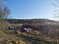 Penycloddiau car park.jpg 3,648 × 2,736; 4.29 MB
-
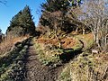 Penycloddiau footpaths.jpg 3,648 × 2,736; 6.89 MB
-
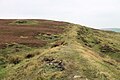
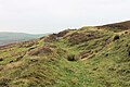
 Penycloddiau hillfort, Wales.jpg 4,200 × 2,700; 2.41 MB
-
 Penycloddiau uplands.jpg 3,648 × 2,736; 2.72 MB
-

-
-

-

-

-

-

-

-


,_Wales_01.png)
,_Wales_02.png)
,_Wales_03.png)
,_Wales_04.png)
,_Wales_05.png)
,_Wales_06.png)
,_Wales_07.png)
,_Wales_08.png)
,_Wales_09.png)