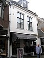
Category:Peperstraat 24, Wijk bij Duurstede
Jump to navigation
Jump to search
| Object location | | View all coordinates using: OpenStreetMap |
|---|
building in Wijk bij Duurstede, Netherlands  | |||||
| Upload media | |||||
| Instance of | |||||
|---|---|---|---|---|---|
| Location | Wijk bij Duurstede, Utrecht, Netherlands | ||||
| Street address |
| ||||
| Located on street |
| ||||
| Heritage designation |
| ||||
 | |||||
|
This is a category about rijksmonument number 39720
|
| Address |
|
Media in category "Peperstraat 24, Wijk bij Duurstede"
The following 3 files are in this category, out of 3 total.
-
 Achtergevel - Wijk bij Duurstede - 20213451 - RCE.jpg 951 × 1,200; 246 KB
-
 Peperstr 24 Mon 39720.jpg 1,712 × 2,288; 835 KB
-
 Voorgevel - Wijk bij Duurstede - 20213450 - RCE.jpg 953 × 1,200; 222 KB

