Category:Petworth, West Sussex
Jump to navigation
Jump to search
town and civil parish in the Chichester District of West Sussex, England  | |||||
| Upload media | |||||
| Instance of | |||||
|---|---|---|---|---|---|
| Located in protected area | |||||
| Location | Chichester, West Sussex, South East England, England | ||||
| Area |
| ||||
| Different from | |||||
 | |||||
English: Petworth is a small town and civil parish in the Chichester District of West Sussex, England. It is located at the junction of the A272 east-west road from Heathfield to Winchester and the A283 Milford to Shoreham-by-Sea road. Some twelve miles (21 km) to the south west of Petworth along the A285 road lies Chichester and the south-coast. The parish includes the settlements of Byworth and Hampers Green and covers an area of 2690 hectares (6644 acres). In 2001 the population of the parish was 2775 persons living in 1200 households of whom 1326 were economically active.
Italiano: Petworth è una cittadina di 2.775 abitanti del distretto di Chichester, nella contea del West Sussex, in Inghilterra (Regno Unito)
Polski: Petworth - miasto w Wielkiej Brytanii, w Anglii, w regionie South East England, w hrabstwie West Sussex. W 2001r. miasto to zamieszkiwało 2 775 osób.
Română: Petworth este un oraş în comitatul West Sussex, regiunea South East England, Anglia. Oraşul se află în districtul Chichester.
Subcategories
This category has the following 15 subcategories, out of 15 total.
B
- Barton Lane Cemetery, Petworth (30 F)
- Byworth (31 F)
C
F
- Flexham Park (17 F)
H
P
- Petworth Canal (2 F)
- Petworth Fair (10 F)
- Petworth War Memorial (2 F)
R
S
- Shopham Bridge (3 F)
- Streets in Petworth (44 F)
Media in category "Petworth, West Sussex"
The following 200 files are in this category, out of 823 total.
(previous page) (next page)-
 'Augustus Brandt', antiques shop, Petworth - geograph.org.uk - 3296332.jpg 1,024 × 649; 123 KB
-
 1 to 4 High Street, Petworth - geograph.org.uk - 4605577.jpg 2,816 × 1,880; 1.5 MB
-
 2016, a year on Geograph (Day 40) - geograph.org.uk - 4821584.jpg 640 × 480; 66 KB
-
 3 to 9 New Street, Petworth - geograph.org.uk - 4605071.jpg 2,816 × 1,880; 1.32 MB
-

-
 A field with much Crosswort - geograph.org.uk - 2951545.jpg 640 × 480; 112 KB
-
 A first glimpse of Petworth House - geograph.org.uk - 6262311.jpg 1,024 × 769; 189 KB
-
 A quiet spot for a cuppa - geograph.org.uk - 5524456.jpg 480 × 640; 82 KB
-
 A view of Petworth Downs Golf Course - geograph.org.uk - 1836468.jpg 800 × 447; 70 KB
-
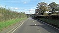
 A272 - geograph.org.uk - 5222413.jpg 640 × 426; 74 KB
-
 A272 - geograph.org.uk - 5222416.jpg 640 × 374; 32 KB
-
 A272 approaching Petworth - geograph.org.uk - 2907354.jpg 640 × 428; 68 KB
-
 A272 at Tillington village boundary - geograph.org.uk - 3123955.jpg 640 × 481; 57 KB
-
 A272 descends Oldham Hill - geograph.org.uk - 3228406.jpg 2,870 × 2,048; 1,006 KB
-
 A272 in Banniards Copse - geograph.org.uk - 6215344.jpg 1,600 × 1,284; 1.18 MB
-
 A272 north of Flathurst Stables - geograph.org.uk - 3228381.jpg 3,648 × 2,048; 1.66 MB
-
 A272 northeast of Selscome Farm - geograph.org.uk - 3228427.jpg 3,648 × 2,048; 2.09 MB
-
 A272 south of Banniard's Copse - geograph.org.uk - 3228416.jpg 3,648 × 2,048; 1.74 MB
-
 A272 south of Petworth Cemetery - geograph.org.uk - 3228395.jpg 3,648 × 2,048; 1.77 MB
-
 A272, eastbound - geograph.org.uk - 5222391.jpg 640 × 426; 46 KB
-
 A272, Foxhill - geograph.org.uk - 5224174.jpg 640 × 426; 94 KB
-
 A272, Petworth - geograph.org.uk - 5222402.jpg 640 × 426; 79 KB
-
 A272, Petworth - geograph.org.uk - 5222411.jpg 640 × 426; 67 KB
-
 A272, Petworth - geograph.org.uk - 5631949.jpg 640 × 425; 74 KB
-
 A283 - geograph.org.uk - 5631927.jpg 640 × 426; 67 KB
-
 A283 - geograph.org.uk - 5631953.jpg 640 × 426; 74 KB
-
 A283 east of Lower Pond - geograph.org.uk - 3228372.jpg 3,211 × 2,048; 1.07 MB
-
 A283 enters Petworth - geograph.org.uk - 3228375.jpg 3,648 × 2,048; 1.84 MB
-
 A283 passes Limbo Farm - geograph.org.uk - 3228363.jpg 3,648 × 2,048; 1.95 MB
-
 A283 passes Raffling Farm - geograph.org.uk - 3228367.jpg 3,648 × 2,048; 1.3 MB
-
 A283 west of Osiers Farm - geograph.org.uk - 3228357.jpg 3,104 × 1,976; 1.19 MB
-
 A283, northbound - geograph.org.uk - 5631956.jpg 640 × 391; 63 KB
-
 A283, northbound - geograph.org.uk - 5631957.jpg 640 × 426; 72 KB
-
 A283, northbound - geograph.org.uk - 5631960.jpg 640 × 426; 75 KB
-
 A285 - geograph.org.uk - 5631937.jpg 640 × 426; 44 KB
-
 A285 - geograph.org.uk - 5631941.jpg 640 × 426; 59 KB
-
 A285 at Petworth boundary - geograph.org.uk - 3123928.jpg 640 × 480; 54 KB
-
 A285 looking north at Badgers Inn - geograph.org.uk - 3123920.jpg 640 × 480; 66 KB
-
 A285, Petworth - geograph.org.uk - 5631946.jpg 640 × 426; 62 KB
-
 Advent at St Mary, Petworth (a) - geograph.org.uk - 6004230.jpg 640 × 480; 77 KB
-
 Advent at St Mary, Petworth (b) - geograph.org.uk - 6004247.jpg 480 × 640; 80 KB
-
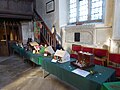 Advent at St Mary, Petworth (c) - geograph.org.uk - 6004267.jpg 640 × 480; 70 KB
-
 Alders by the Lower Pond, Petworth Park (1) - geograph.org.uk - 3739440.jpg 768 × 1,024; 326 KB
-
 Alders by the Lower Pond, Petworth Park (2) - geograph.org.uk - 3739446.jpg 768 × 1,024; 309 KB
-
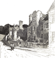 Almshouse at Petworth.png 1,727 × 1,822; 2.65 MB
-
 Along Lombard Street - geograph.org.uk - 6000756.jpg 683 × 1,024; 464 KB
-
 Along the wall - geograph.org.uk - 6009963.jpg 683 × 1,024; 610 KB
-
 An "n" gaging sign in Petworth - geograph.org.uk - 1858401.jpg 480 × 640; 93 KB
-
 Angel Street - geograph.org.uk - 6000753.jpg 683 × 1,024; 406 KB
-
 Anthony Short Antiques on Pound Street, Petworth - geograph.org.uk - 4597643.jpg 2,560 × 1,920; 1.99 MB
-
 Approaching Birch Wood - geograph.org.uk - 5952750.jpg 1,600 × 1,200; 854 KB
-
 Approaching Heath End - geograph.org.uk - 4951076.jpg 4,608 × 3,244; 5.43 MB
-
 Approaching High Hoes - geograph.org.uk - 5953000.jpg 1,600 × 1,200; 576 KB
-
-

-

-

-
 Archaeological dig - Petworth House - geograph.org.uk - 3556220.jpg 1,600 × 1,200; 479 KB
-

-
 Art Gallery, Petworth House - geograph.org.uk - 4813232.jpg 2,875 × 2,275; 2.41 MB
-
 Attractive balcony - geograph.org.uk - 1836440.jpg 800 × 600; 91 KB
-
 Augustus Brandt - geograph.org.uk - 5222399.jpg 640 × 426; 73 KB
-
 Augustus Brandt, Petworth - geograph.org.uk - 6162960.jpg 1,024 × 778; 176 KB
-
 Austin Sevens on the A272 - geograph.org.uk - 2938929.jpg 640 × 428; 69 KB
-
 Avenings, Golden Square, Petworth - geograph.org.uk - 3892965.jpg 3,264 × 2,448; 2.7 MB
-
 Azaleas and the Rotunda, Petworth Park - geograph.org.uk - 3969835.jpg 1,152 × 1,536; 1,015 KB
-
 Barn at Gunter's Bridge - geograph.org.uk - 4632907.jpg 1,600 × 1,064; 342 KB
-
 Barns, Blackbrook Farm - geograph.org.uk - 2951530.jpg 640 × 480; 92 KB
-
 Barton Lane, Petworth - geograph.org.uk - 3967923.jpg 1,536 × 1,152; 1,013 KB
-
 Bend in unnamed road by High Hoes Cottages - geograph.org.uk - 2536109.jpg 4,000 × 3,000; 3.48 MB
-
 Bend on the A272 going west to Petworth - geograph.org.uk - 2234320.jpg 800 × 600; 164 KB
-
 Bigenor Farm - geograph.org.uk - 5952745.jpg 1,024 × 768; 172 KB
-
 Blackbrook Farm - geograph.org.uk - 6011110.jpg 1,600 × 1,200; 598 KB
-
 Blackhouse Lane - geograph.org.uk - 2404576.jpg 4,000 × 3,000; 3.43 MB
-
 Blackhouse Lane - geograph.org.uk - 255047.jpg 640 × 480; 159 KB
-
 Blackhouse Lane - geograph.org.uk - 6011112.jpg 2,048 × 1,536; 1.22 MB
-
 Bluebell wood - geograph.org.uk - 4951045.jpg 4,608 × 3,456; 7.96 MB
-
 Bluebells and new leaves on the trees at Petworth - geograph.org.uk - 3967908.jpg 1,536 × 1,152; 1.63 MB
-
 Bluebells in Rushout Wood - geograph.org.uk - 1836248.jpg 800 × 600; 224 KB
-
 Boggy ground near Lower Pond - geograph.org.uk - 6008478.jpg 1,024 × 683; 581 KB
-
 Bottom end of Lombard Street - geograph.org.uk - 5524460.jpg 480 × 640; 75 KB
-
 Bottom of Lombard Street, Petworth - geograph.org.uk - 3891871.jpg 3,264 × 2,448; 2.39 MB
-

-
 Bridleway 653 in Pondtail Copse - geograph.org.uk - 2404593.jpg 4,000 × 3,000; 3.49 MB
-

-

-

-
 Bridleway bridge, Duncton Common - geograph.org.uk - 2110475.jpg 640 × 428; 162 KB
-

-
 Bridleway crossroads near Medhone Copse - geograph.org.uk - 2404537.jpg 4,000 × 3,000; 3.33 MB
-
 Bridleway enters field near Ratford Farm - geograph.org.uk - 1836226.jpg 600 × 800; 150 KB
-

-
 Bridleway junction with the A285 - geograph.org.uk - 2534366.jpg 4,000 × 3,000; 3.09 MB
-
 Bridleway near the Welldiggers Arms - geograph.org.uk - 2234419.jpg 800 × 600; 203 KB
-
 Bridleway on Duncton Common - geograph.org.uk - 4958907.jpg 4,608 × 3,456; 6.24 MB
-
 Bridleway on Duncton Common - geograph.org.uk - 4959094.jpg 4,608 × 3,456; 7.57 MB
-
 Bridleway sign in tree - geograph.org.uk - 2234271.jpg 800 × 600; 146 KB
-
 Bridleway sign on Blackhouse Lane - geograph.org.uk - 2404587.jpg 4,000 × 3,000; 3.55 MB
-
 Bridleway to Blackbrook Farm - geograph.org.uk - 2394551.jpg 800 × 600; 162 KB
-
 Bridleway west of Crawfold Furze - geograph.org.uk - 2393966.jpg 600 × 800; 164 KB
-

-
 Bridleway with logpile in Medhone Copse - geograph.org.uk - 2394588.jpg 800 × 600; 185 KB
-
 Bridleway, Duncton Common - geograph.org.uk - 2110471.jpg 640 × 428; 150 KB
-
 Bridleways crossing near Blackbrook Farm - geograph.org.uk - 2394548.jpg 800 × 600; 133 KB
-
 Brinkshole Heath - geograph.org.uk - 255019.jpg 640 × 480; 194 KB
-
 Broadbean feast - geograph.org.uk - 2406113.jpg 4,000 × 3,000; 3.41 MB
-
 Brook at Gunter's Bridge - geograph.org.uk - 363059.jpg 640 × 480; 157 KB
-

-
 Buildings at Moor Farm - geograph.org.uk - 1836237.jpg 800 × 600; 97 KB
-
 Bunting in Lombard Street - geograph.org.uk - 1891045.jpg 480 × 640; 101 KB
-
 Burrell’s Cottage - geograph.org.uk - 6010339.jpg 2,048 × 1,536; 1.03 MB
-
 Bus stop in Market Square - geograph.org.uk - 1891105.jpg 480 × 640; 67 KB
-
 By Ratford Farm - geograph.org.uk - 255155.jpg 640 × 480; 105 KB
-
 By Rushout Wood - geograph.org.uk - 255122.jpg 640 × 480; 185 KB
-
 Byworth wall postbox - geograph.org.uk - 5515574.jpg 4,032 × 3,024; 3.74 MB
-
 Camouflaged log pile on the Serpent Trail - geograph.org.uk - 2534352.jpg 4,000 × 3,000; 3.41 MB
-
 Canada Geese by Upper Pond - geograph.org.uk - 3556106.jpg 1,600 × 1,200; 519 KB
-

-
 Church mice- Petworth style - geograph.org.uk - 1879039.jpg 480 × 640; 68 KB
-
 Church of St Mary - geograph.org.uk - 5631950.jpg 640 × 426; 50 KB
-
 Church of St. Mary the Virgin^ - geograph.org.uk - 2788081.jpg 1,391 × 2,028; 289 KB
-

-

-
 Clump of trees on hilltop east of Petworth - geograph.org.uk - 2403390.jpg 4,000 × 3,000; 3.55 MB
-
 Clumps of trees in Petworth Park - geograph.org.uk - 6009945.jpg 1,024 × 683; 496 KB
-
 Co-op goods delivery building - geograph.org.uk - 3891865.jpg 3,264 × 2,448; 2.51 MB
-
 Cobbled alley off East Street, Petworth - geograph.org.uk - 4167492.jpg 1,200 × 900; 342 KB
-
 Common by Horsham Road, Petworth - geograph.org.uk - 5887063.jpg 1,920 × 1,280; 1.15 MB
-

-
 Copse of trees in Petworth Park - geograph.org.uk - 6215356.jpg 1,600 × 1,200; 1.01 MB
-
 Corner of conifer plantation - geograph.org.uk - 2951501.jpg 640 × 480; 105 KB
-
 Cottage by a wall, Petworth Park - geograph.org.uk - 3744657.jpg 715 × 1,024; 225 KB
-
 Cottage in Petworth Park - geograph.org.uk - 3744633.jpg 788 × 1,024; 293 KB
-
 Cottages in Middle Street, Petworth - geograph.org.uk - 3574229.jpg 640 × 427; 63 KB
-
 Cottages, Gunter's Bridge - geograph.org.uk - 2907568.jpg 640 × 428; 109 KB
-
 Coultershaw beam pump - geograph.org.uk - 3855491.jpg 640 × 424; 97 KB
-
 Coultershaw Bridge - geograph.org.uk - 4597639.jpg 2,560 × 1,920; 1.98 MB
-
 Coultershaw farm house - geograph.org.uk - 4597206.jpg 2,560 × 1,920; 2.03 MB
-
 Coultershaw Heritage Site - geograph.org.uk - 4114232.jpg 640 × 427; 97 KB
-
 Coultershaw Heritage Site - geograph.org.uk - 4600021.jpg 2,560 × 1,920; 1.99 MB
-

-
 Coultershaw Pump - hydraulic ram - geograph.org.uk - 3856663.jpg 640 × 419; 92 KB
-
 Country road to Gunter's Bridge - geograph.org.uk - 2406010.jpg 4,000 × 3,000; 3.43 MB
-
 Covered passageway to Brewhouse Cottage, Petworth - geograph.org.uk - 4167439.jpg 1,200 × 1,600; 383 KB
-
 Cow with calf at Bigenor Farm - geograph.org.uk - 2359930.jpg 800 × 600; 169 KB
-
 Cowyard Tunnel at Petworth Park - geograph.org.uk - 3942461.jpg 1,200 × 900; 1.01 MB
-
 Cross roads at Foxhill - geograph.org.uk - 1263316.jpg 640 × 480; 103 KB
-
 Cross roads at the top of Oldham Hill - geograph.org.uk - 2404017.jpg 4,000 × 3,000; 3.57 MB
-

-
 Crossroads at Haslingbourne ( A285 ) - geograph.org.uk - 320204.jpg 640 × 479; 54 KB
-
 Crossroads at Oldham Hill - geograph.org.uk - 6013816.jpg 1,600 × 1,200; 821 KB
-
 Crossroads on Horsham Road, Foxhill - geograph.org.uk - 4597436.jpg 2,560 × 1,920; 2.02 MB
-
 Crossroads on the A285 south of Petworth - geograph.org.uk - 4597230.jpg 2,560 × 1,920; 1.97 MB
-
 Crossroads on the A285 south of Petworth - geograph.org.uk - 4597244.jpg 2,560 × 1,920; 1.97 MB
-
 Cutting and tunnel - geograph.org.uk - 6007520.jpg 1,024 × 683; 655 KB
-
 Cycling through Petworth - geograph.org.uk - 2967219.jpg 1,024 × 768; 154 KB
-
 Cyclists on Glasshouse Lane - geograph.org.uk - 2404248.jpg 4,000 × 3,000; 3.34 MB
-
 Damer's Bridge - geograph.org.uk - 3455220.jpg 913 × 684; 133 KB
-
 Dead trees on the River Rother bank - geograph.org.uk - 2534865.jpg 4,000 × 3,000; 4.02 MB
-
 Deep Valley East of Petworth - geograph.org.uk - 4377474.jpg 1,024 × 768; 410 KB
-
 Deer grazing in Stedmans Journey - geograph.org.uk - 1836256.jpg 800 × 516; 107 KB
-
 Derelict farm buildings by Kilsham Lane - geograph.org.uk - 2538388.jpg 4,000 × 3,000; 3.43 MB
-
-
 Dog of Alcibiades, Petworth Park - geograph.org.uk - 4901396.jpg 480 × 640; 105 KB
-
 Doric Temple view, Petworth House - geograph.org.uk - 3685337.jpg 4,576 × 1,974; 2.85 MB
-
 Doric Temple, Petworth Park - geograph.org.uk - 3967912.jpg 1,152 × 1,536; 1.48 MB
-
 Doric Temple, Petworth Park - geograph.org.uk - 6163001.jpg 1,024 × 757; 193 KB
-

-
 East across field to Birch Wood - geograph.org.uk - 2536075.jpg 4,000 × 3,000; 3.37 MB
-
 East Street - geograph.org.uk - 6000751.jpg 683 × 1,024; 444 KB
-
 East Street at the junction of the A272, Petworth - geograph.org.uk - 4597256.jpg 2,560 × 1,920; 1.99 MB
-
 East Street, Petworth, April 2007 - geograph.org.uk - 3809041.jpg 2,048 × 3,072; 2.11 MB
-
 East Street, Petworth, June 1928 - geograph.org.uk - 3809024.jpg 566 × 757; 78 KB
-
 Edge of Upper Pond - geograph.org.uk - 6000746.jpg 1,024 × 683; 735 KB
-
 End of the A285, Petworth - geograph.org.uk - 5631948.jpg 640 × 425; 51 KB
-
 Entering Petworth, A272 - geograph.org.uk - 5222395.jpg 640 × 426; 55 KB
-
 Entrance from North Street - geograph.org.uk - 6007518.jpg 1,024 × 683; 430 KB
-
 Entrance into Highhoes Copse - geograph.org.uk - 2009774.jpg 2,592 × 1,944; 1.86 MB
-
 Entrance into Rushout Wood - geograph.org.uk - 2405963.jpg 4,000 × 3,000; 3.37 MB
-
 Entrance to Cemetery - geograph.org.uk - 3234759.jpg 4,000 × 3,000; 3.59 MB
-
 Entrance to Hoes Farm - geograph.org.uk - 4950036.jpg 4,608 × 3,456; 4.47 MB
-
 Entrance to sand quarry off the A285 - geograph.org.uk - 2534370.jpg 4,000 × 3,000; 3.52 MB
-

-
 Estate cottages in New Street - geograph.org.uk - 5524442.jpg 640 × 480; 70 KB
-
 Estate road to Stagpark Farm - geograph.org.uk - 5499768.jpg 4,608 × 3,456; 3.78 MB
-

-
 Exit from Access land onto the A272 - geograph.org.uk - 1263295.jpg 640 × 480; 125 KB
-
 Exit from Brinksole Heath - geograph.org.uk - 2234397.jpg 800 × 600; 191 KB
-
 Farm entrance - geograph.org.uk - 3235880.jpg 4,000 × 3,000; 2.88 MB
-
 Farmhouse on Riverhill Lane - geograph.org.uk - 2234432.jpg 800 × 600; 158 KB
-
 Fence near Upper Pond - geograph.org.uk - 6009957.jpg 1,024 × 683; 607 KB
-
 Fenced area near Upper Pond - geograph.org.uk - 6009950.jpg 1,024 × 683; 504 KB
-
 Field adjacent to A285 - geograph.org.uk - 4912926.jpg 4,608 × 3,456; 5.72 MB
-
 Field at Moor Farm, Petworth - geograph.org.uk - 4597647.jpg 2,560 × 1,920; 1.27 MB
-
 Field at Moor Farm, Petworth - geograph.org.uk - 4597648.jpg 2,560 × 1,920; 1.98 MB
-
 Field beside Glasshouse Lane - geograph.org.uk - 6013830.jpg 1,600 × 1,200; 472 KB
-
 Field by Medhone Copse - geograph.org.uk - 2394117.jpg 800 × 600; 118 KB
-
 Field by Petsalls Copse - geograph.org.uk - 2394579.jpg 800 × 600; 78 KB
-

-


_-_geograph.org.uk_-_4821584.jpg)


_-_geograph.org.uk_-_6004230.jpg)
_-_geograph.org.uk_-_6004247.jpg)
_-_geograph.org.uk_-_6004267.jpg)
_-_geograph.org.uk_-_3739440.jpg)
_-_geograph.org.uk_-_3739446.jpg)


_-_geograph.org.uk_-_5524459.jpg)


_-_geograph.org.uk_-_320204.jpg)


