Category:Photos by Stephan van Helden
Jump to navigation
Jump to search
Recognized images:
Nature:
Other:
Media in category "Photos by Stephan van Helden"
The following 200 files are in this category, out of 470 total.
(previous page) (next page)-
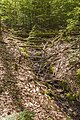 Bach aus der Luisenquelle im Koppenwinder Forst 2.jpg 4,000 × 6,000; 15.17 MB
-
 Bach aus der Luisenquelle im Koppenwinder Forst.jpg 6,000 × 4,000; 15 MB
-
 Bach aus der Wilhelmsquelle im Koppenwinder Forst 2.jpg 4,000 × 6,000; 13.48 MB
-
 Bach aus der Wilhelmsquelle im Koppenwinder Forst 3.jpg 6,000 × 4,000; 11.5 MB
-
 Bach aus der Wilhelmsquelle im Koppenwinder Forst 4.jpg 6,000 × 4,000; 14.82 MB
-
 Bach aus der Wilhelmsquelle im Koppenwinder Forst 5.jpg 6,000 × 4,000; 14.4 MB
-
 Bach aus der Wilhelmsquelle im Koppenwinder Forst.jpg 6,000 × 4,000; 14.88 MB
-
 Baum am Dorfweiher Marktsteinach.jpg 4,000 × 6,000; 14.55 MB
-
 Baum an der Riether Straße nördlich von Schweickershausen.jpg 4,000 × 4,889; 10.4 MB
-
 Biberskulptur am Fichtelsee (1).jpg 5,302 × 3,041; 8.29 MB
-
 Biberskulptur am Fichtelsee (2).jpg 4,692 × 3,594; 10.06 MB
-
 Biberskulptur und Verbiss am Fichtelsee.jpg 4,932 × 3,666; 11.64 MB
-
 Bildstock 1300 Jahre Kiliansmartyrium südwestlich von Koppenwind 2.jpg 4,000 × 5,400; 12.65 MB
-
 Bildstock 1300 Jahre Kiliansmartyrium südwestlich von Koppenwind 3.jpg 2,520 × 3,849; 4.56 MB
-
 Bildstock 1300 Jahre Kiliansmartyrium südwestlich von Koppenwind.jpg 4,000 × 4,889; 12.11 MB
-
 Birnbaum zwischen HAS 5 und Deponie westlich von Haßfurt.jpg 4,000 × 4,827; 9.41 MB
-
 Blick auf ein Mohnfeld östlich von Gompertshausen.jpg 6,000 × 4,000; 12.67 MB
-
 Blick vom Altan des Schlosses Heidelberg auf die Altstadt.jpg 6,000 × 4,000; 10.9 MB
-
 Blick vom Altan des Schlosses Heidelberg zum Wasserkraftwerk Karlstor.jpg 6,000 × 4,000; 11.17 MB
-
 Blick vom Aussichtspsunkt am Schlangenweg auf die Altstadt Heidelberg.jpg 6,000 × 4,000; 9.85 MB
-
 Blick vom Bahnsteig Neuhausen Rheinfall Richtung Eisenbahnbrücke und Schloss Laufen.jpg 6,000 × 4,000; 8.73 MB
-
 Blick vom Bahnsteig Neuhausen Rheinfall über den Rheinfall am Abend 2.jpg 6,000 × 4,000; 7.7 MB
-
 Blick vom Bahnsteig Neuhausen Rheinfall über den Rheinfall am Abend 3.jpg 8,608 × 3,517; 8.85 MB
-
 Blick vom Bahnsteig Neuhausen Rheinfall über den Rheinfall am Abend 4.jpg 7,195 × 3,638; 8.13 MB
-
 Blick vom Bahnsteig Neuhausen Rheinfall über den Rheinfall am Abend.jpg 9,170 × 3,641; 14.06 MB
-
 Blick vom Hügel im Süden auf die Talsperre Westhausen.jpg 6,000 × 4,000; 12.62 MB
-
 Blick vom Leinpfad beim Felseck über den Neckar zum Restaurant Pier 4.jpg 6,000 × 4,000; 10.42 MB
-
 Blick vom Mühlerad über den Rheinfall zum Schloss Laufen.jpg 6,000 × 4,000; 13.06 MB
-
 Blick vom Neckarstrand am Neckarstaden Heidelberg zum Michelsberg und Heiligenberg.jpg 6,000 × 4,000; 9.47 MB
-
 Blick vom Neckarstrand am Neckarstaden Heidelberg zur Neuenheimer Landstraße.jpg 6,000 × 3,543; 9.62 MB
-
 Blick vom Neckarstrand am Neckarstaden Heidelberg über den Neckar nach Osten.jpg 6,000 × 4,000; 10.28 MB
-
 Blick vom Neckarufer nördlich der Stadthalle Heidelberg über den Neckar.jpg 6,000 × 4,000; 11.24 MB
-
 Blick vom Nordhang des Klebheimer Bergs auf Untersteinbach 2.jpg 3,738 × 1,260; 2.56 MB
-
 Blick vom Nordhang des Klebheimer Bergs auf Untersteinbach.jpg 6,000 × 4,000; 10.14 MB
-
 Blick vom Nordhang des Klebheimer Bergs bei Untersteinbach Richtung Kirchberg 2.jpg 6,000 × 4,000; 11.44 MB
-
 Blick vom Nordhang des Klebheimer Bergs bei Untersteinbach Richtung Kirchberg 3.jpg 6,000 × 4,000; 12.33 MB
-
 Blick vom Nordhang des Klebheimer Bergs bei Untersteinbach Richtung Kirchberg.jpg 6,000 × 4,000; 10.9 MB
-
 Blick vom nördlichen Aussichtspunkt am Rheinweg zum Rheinfallfelsen.jpg 6,000 × 4,000; 13.88 MB
-
 Blick vom Rheinfallquai am Mühlerad auf den Rheinfall.jpg 9,114 × 5,806; 21.59 MB
-
 Blick vom Rheinfallquai beim Parkrestaurant auf den Rheinfall 2.jpg 6,000 × 4,000; 9.75 MB
-
 Blick vom Rheinfallquai beim Parkrestaurant auf den Rheinfall.jpg 6,000 × 4,000; 11.53 MB
-
 Blick vom Rheinfallquai südöstlich des Pumpenhauses auf den Rheinfall.jpg 6,000 × 4,000; 10.73 MB
-
 Blick vom Rheinfallquai westlich des Pumpenhauses auf den Rheinfall 2.jpg 5,648 × 2,648; 6.18 MB
-
 Blick vom Rheinfallquai westlich des Pumpenhauses auf den Rheinfall.jpg 5,931 × 3,675; 6.08 MB
-
 Blick vom Schlöschen Wörth auf Rheinfall und Schloss Laufen.jpg 6,000 × 4,000; 9.75 MB
-
 Blick vom südlichen Aussichtspunkt am Rheinweg zum Schloss Laufen.jpg 6,000 × 4,000; 11.85 MB
-
 Blick von der Alten Brücke Heidelberg nach Westen.jpg 6,000 × 4,000; 8.83 MB
-
 Blick von der Bismarcksäule Heidelberg auf den Gaisberg.jpg 5,926 × 3,951; 10.59 MB
-
 Blick von der Nepomuk-Terasse in Heidelberg über den Neckar zum Schloss.jpg 6,000 × 4,000; 12.47 MB
-
 Blick von der Rheinbrücke bei Laufen nach Süden.jpg 6,000 × 4,000; 13.46 MB
-
 Blick von der Rheinbrücke bei Laufen über den Rheinfall 2.jpg 6,000 × 4,000; 10.41 MB
-
 Blick von der Rheinbrücke bei Laufen über den Rheinfall 3.jpg 6,000 × 4,000; 10.97 MB
-
 Blick von der Rheinbrücke bei Laufen über den Rheinfall.jpg 6,000 × 4,000; 9.23 MB
-
 Blick von der Schurmannstraße auf die Neckarwiese mit Pappel in Heidelberg.jpg 6,000 × 4,000; 11.68 MB
-
 Blick von der Schurmanstraße Heidelberg Richtung Neuenheimer Feld.jpg 6,000 × 4,000; 8.87 MB
-
 Blick von der Schurmanstraße Heidelberg zum Michelsberg und Heiligenberg.jpg 6,000 × 4,000; 8.96 MB
-
 Blick von Süden auf Gellershausen.jpg 6,000 × 4,000; 11.25 MB
-
 Blick über den Dorfweiher Marktsteinach von Osten.jpg 6,000 × 4,000; 9.94 MB
-
 Blick über den Nordhang des Klebheimer Bergs auf Untersteinbach.jpg 6,000 × 4,000; 7.9 MB
-
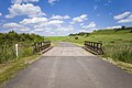 Brücke des Seewegs über die Gompertshäuser Kreck.jpg 6,000 × 4,000; 9.3 MB
-
 Brückentor mit Touristen in Heidelberg.jpg 3,054 × 5,253; 5.26 MB
-
 Bäume am Friedhofseingang Gellershausen.jpg 3,560 × 4,693; 8.54 MB
-
 D-6-5928-0002 Turmhügel Hundsrück (Wülflingen) (1).jpg 17,187 × 6,146; 58.96 MB
-
 D-6-5928-0002 Turmhügel Hundsrück (Wülflingen) (2).jpg 12,844 × 3,274; 16.52 MB
-
 D-6-5928-0002 Turmhügel Hundsrück (Wülflingen) (3).jpg 14,578 × 3,440; 21.57 MB
-
 D-6-5928-0002 Turmhügel Hundsrück (Wülflingen) (4).jpg 5,767 × 3,845; 9.26 MB
-
 D-6-5928-0002 Turmhügel Hundsrück (Wülflingen) (5).jpg 12,171 × 3,550; 22.65 MB
-
 D-6-5928-0002 Turmhügel Hundsrück (Wülflingen) (6).jpg 6,000 × 4,000; 10.21 MB
-
 D-6-5929-0020 Krumenstein, Abschnittswall im Osten, Blick von Norden 2.jpg 6,048 × 5,506; 19.96 MB
-
 D-6-5929-0020 Krumenstein, Abschnittswall im Osten, Blick von Norden.jpg 5,802 × 4,421; 17.04 MB
-
 D-6-5929-0020 Krumenstein, Abschnittswall im Osten, Blick von Südosten 2.jpg 6,000 × 4,000; 14.87 MB
-
 D-6-5929-0020 Krumenstein, Abschnittswall im Osten, Blick von Südosten.jpg 6,000 × 4,000; 15.82 MB
-
 D-6-5929-0020 Krumenstein, Abschnittswall im Osten, Südspitze.jpg 6,000 × 4,000; 17.52 MB
-
 D-6-5929-0020 Krumenstein, Bebauungsreste am Graben des Ringwalls im Osten 2.jpg 4,000 × 6,000; 12.98 MB
-
 D-6-5929-0020 Krumenstein, Bebauungsreste am Graben des Ringwalls im Osten.jpg 6,000 × 4,000; 11.38 MB
-
 D-6-5929-0020 Krumenstein, Bebauungsreste am Randwall im Süden.jpg 4,530 × 3,167; 10.05 MB
-
 D-6-5929-0020 Krumenstein, Bebauungsreste im Nordosten des Burghügels 2.jpg 6,000 × 4,000; 15.8 MB
-
 D-6-5929-0020 Krumenstein, Bebauungsreste im Nordosten des Burghügels 3.jpg 6,000 × 4,000; 15.1 MB
-
 D-6-5929-0020 Krumenstein, Bebauungsreste im Nordosten des Burghügels.jpg 6,000 × 4,000; 14.62 MB
-
 D-6-5929-0020 Krumenstein, Bebauungsreste im Osten 2.jpg 6,000 × 4,000; 14.01 MB
-
 D-6-5929-0020 Krumenstein, Bebauungsreste im Osten.jpg 5,372 × 3,810; 13.94 MB
-
 D-6-5929-0020 Krumenstein, Bebauungsreste im Südwesten des Burghügels 2.jpg 6,000 × 4,000; 13.49 MB
-
 D-6-5929-0020 Krumenstein, Bebauungsreste im Südwesten des Burghügels.jpg 6,000 × 4,000; 14.05 MB
-
 D-6-5929-0020 Krumenstein, Blick von Nordwesten auf das Plateau östlich des Ringwalls.jpg 6,000 × 4,000; 13.5 MB
-
 D-6-5929-0020 Krumenstein, Burghügel im Südwesten.jpg 6,000 × 4,000; 17.24 MB
-

-
 D-6-5929-0020 Krumenstein, Graben zwischen Ringwall und Burghügel im Norden 2.jpg 6,000 × 4,000; 15.95 MB
-
 D-6-5929-0020 Krumenstein, Graben zwischen Ringwall und Burghügel im Norden 3.jpg 6,000 × 4,000; 16.05 MB
-
 D-6-5929-0020 Krumenstein, Graben zwischen Ringwall und Burghügel im Norden.jpg 6,000 × 4,000; 18.36 MB
-
 D-6-5929-0020 Krumenstein, Graben zwischen Ringwall und Burghügel im Nordwesten 2.jpg 5,910 × 6,182; 24.41 MB
-
 D-6-5929-0020 Krumenstein, Graben zwischen Ringwall und Burghügel im Nordwesten.jpg 5,987 × 5,385; 22.66 MB
-
 D-6-5929-0020 Krumenstein, Graben zwischen Ringwall und Burghügel im Osten 10.jpg 4,000 × 6,000; 15.37 MB
-
 D-6-5929-0020 Krumenstein, Graben zwischen Ringwall und Burghügel im Osten 11.jpg 6,000 × 4,000; 15.56 MB
-
 D-6-5929-0020 Krumenstein, Graben zwischen Ringwall und Burghügel im Osten 12.jpg 6,000 × 4,000; 15.32 MB
-
 D-6-5929-0020 Krumenstein, Graben zwischen Ringwall und Burghügel im Osten 2.jpg 6,000 × 4,000; 16.73 MB
-
 D-6-5929-0020 Krumenstein, Graben zwischen Ringwall und Burghügel im Osten 3.jpg 6,000 × 4,000; 17.19 MB
-
 D-6-5929-0020 Krumenstein, Graben zwischen Ringwall und Burghügel im Osten 4.jpg 6,000 × 4,000; 16.91 MB
-
 D-6-5929-0020 Krumenstein, Graben zwischen Ringwall und Burghügel im Osten 5.jpg 6,000 × 4,000; 16.93 MB
-
 D-6-5929-0020 Krumenstein, Graben zwischen Ringwall und Burghügel im Osten 6.jpg 6,000 × 4,000; 15.95 MB
-
 D-6-5929-0020 Krumenstein, Graben zwischen Ringwall und Burghügel im Osten 7.jpg 6,000 × 4,000; 21.9 MB
-
 D-6-5929-0020 Krumenstein, Graben zwischen Ringwall und Burghügel im Osten 8.jpg 5,630 × 5,452; 20.47 MB
-
 D-6-5929-0020 Krumenstein, Graben zwischen Ringwall und Burghügel im Osten 9.jpg 4,000 × 6,000; 15.25 MB
-
 D-6-5929-0020 Krumenstein, Graben zwischen Ringwall und Burghügel im Osten.jpg 6,000 × 4,000; 17.72 MB
-
 D-6-5929-0020 Krumenstein, Graben zwischen Ringwall und Burghügel im Südwesten.jpg 6,000 × 4,000; 15.79 MB
-
 D-6-5929-0020 Krumenstein, Graben zwischen Ringwall und Burghügel im Westen 2.jpg 6,000 × 4,000; 18.18 MB
-
 D-6-5929-0020 Krumenstein, Graben zwischen Ringwall und Burghügel im Westen.jpg 6,000 × 4,000; 21.25 MB
-
 D-6-5929-0020 Krumenstein, Grenzstein im Randwall im Süden.jpg 4,000 × 4,064; 11.34 MB
-
 D-6-5929-0020 Krumenstein, Grube im Süden des Burghügels 2.jpg 6,000 × 4,000; 16.15 MB
-
 D-6-5929-0020 Krumenstein, Grube im Süden des Burghügels.jpg 6,000 × 4,000; 15.44 MB
-
 D-6-5929-0020 Krumenstein, Grube im Südwesten des Burghügels 2.jpg 6,000 × 4,000; 15.57 MB
-
 D-6-5929-0020 Krumenstein, Grube im Südwesten des Burghügels 3.jpg 4,000 × 6,000; 16.68 MB
-
 D-6-5929-0020 Krumenstein, Grube im Südwesten des Burghügels 4.jpg 6,000 × 4,000; 14.39 MB
-
 D-6-5929-0020 Krumenstein, Grube im Südwesten des Burghügels 5.jpg 6,000 × 4,000; 19.02 MB
-
 D-6-5929-0020 Krumenstein, Grube im Südwesten des Burghügels.jpg 6,000 × 4,000; 19.85 MB
-
 D-6-5929-0020 Krumenstein, Mauerreste im Graben auf der Ostseite des Burghügels.jpg 5,478 × 3,684; 13.08 MB
-
 D-6-5929-0020 Krumenstein, Plateau oberhalb des Randwalls im Süden 2.jpg 6,000 × 4,000; 15.98 MB
-
 D-6-5929-0020 Krumenstein, Plateau oberhalb des Randwalls im Süden.jpg 6,000 × 4,000; 18.12 MB
-

-

-

-
 D-6-5929-0020 Krumenstein, Plateau östlich des Abschnittswalls im Osten 2.jpg 5,978 × 7,892; 31.69 MB
-
 D-6-5929-0020 Krumenstein, Plateau östlich des Abschnittswalls im Osten 3.jpg 6,194 × 6,005; 29.13 MB
-
 D-6-5929-0020 Krumenstein, Plateau östlich des Abschnittswalls im Osten 4.jpg 6,026 × 5,692; 20.06 MB
-
 D-6-5929-0020 Krumenstein, Plateau östlich des Abschnittswalls im Osten.jpg 8,412 × 5,761; 31.61 MB
-
 D-6-5929-0020 Krumenstein, Ringwall im Südwesten 2.jpg 7,989 × 6,150; 29.16 MB
-
 D-6-5929-0020 Krumenstein, Ringwall im Südwesten.jpg 6,000 × 4,000; 15.09 MB
-
 D-6-5929-0020 Krumenstein, Ringwall, Außenseite im Nordwesten.jpg 6,000 × 4,000; 18.16 MB
-
 D-6-5929-0020 Krumenstein, Ringwall, Außenseite im Westen 2.jpg 6,000 × 4,000; 18.12 MB
-
 D-6-5929-0020 Krumenstein, Ringwall, Außenseite im Westen.jpg 6,000 × 4,000; 17.96 MB
-
 D-6-5929-0020 Krumenstein, Stein im Graben zwischen Ringwall und Burghügel im Osten.jpg 6,000 × 4,000; 13.69 MB
-
 D-6-5929-0020 Krumenstein, Stein im Plateau östlich des Abschnittswalls im Osten.jpg 6,000 × 4,000; 13.21 MB
-
 D-6-6029-0020 Burgstall Trauberg, Graben nordöstlich des Gipfels.jpg 6,000 × 4,000; 14.25 MB
-
 D-6-6029-0020 Burgstall Trauberg, Graben und Steinreste nordöstlich des Gipfels.jpg 6,000 × 4,000; 16.7 MB
-
 D-6-6029-0020 Burgstall Trauberg, Rest eines Walls am Gipfel.jpg 6,000 × 4,000; 17.6 MB
-
 D-6-6029-0020 Burgstall Trauberg, Reste eines Walls nordöstlich des Gipfels.jpg 6,000 × 4,000; 14.04 MB
-
 D-6-6029-0020 Burgstall Trauberg, Steinreste am Gipfel 2.jpg 6,000 × 4,000; 14.14 MB
-
 D-6-6029-0020 Burgstall Trauberg, Steinreste am Gipfel 3.jpg 4,000 × 6,000; 14.29 MB
-
 D-6-6029-0020 Burgstall Trauberg, Steinreste am Gipfel 4.jpg 6,000 × 4,000; 14.77 MB
-
 D-6-6029-0020 Burgstall Trauberg, Steinreste am Gipfel 5.jpg 4,536 × 3,054; 11.1 MB
-
 D-6-6029-0020 Burgstall Trauberg, Steinreste am Gipfel 6.jpg 6,000 × 4,000; 12.29 MB
-
 D-6-6029-0020 Burgstall Trauberg, Steinreste am Gipfel.jpg 6,000 × 4,000; 15.52 MB
-
 D-6-6029-0020 Burgstall Trauberg, Strukturen am Gipfel 2.jpg 5,984 × 5,503; 18.85 MB
-
 D-6-6029-0020 Burgstall Trauberg, Strukturen am Gipfel.jpg 6,000 × 4,000; 15.47 MB
-
 D-6-6029-0020 Burgstall Trauberg, Stukturen nordöstlich des Gipfels.jpg 6,000 × 4,000; 17.56 MB
-
 D-6-6029-0020 Burgstall Trauberg, östliche Ecke 2.jpg 6,000 × 4,000; 13.47 MB
-
 D-6-6029-0020 Burgstall Trauberg, östliche Ecke.jpg 6,000 × 4,000; 12.73 MB
-
 D-6-6029-0020 Höhenrücken des Traubergs im Norden des Burgstalls (2).jpg 4,000 × 6,000; 12.41 MB
-
 D-6-6029-0020 Höhenrücken des Traubergs im Norden des Burgstalls.jpg 6,000 × 4,000; 14.23 MB
-
 D-6-6029-0020 Im Nordosten des Burgstalls Trauberg 2.jpg 6,000 × 4,000; 15.32 MB
-
 D-6-6029-0020 Im Nordosten des Burgstalls Trauberg.jpg 6,000 × 4,000; 15.4 MB
-
 D-6-78-124-21 Holzlege, Kirchstraße 9, Donnersdorf.jpg 5,428 × 3,607; 8.8 MB
-
 D-6-78-124-21 Reste des Gasthauses und Pforte, Kirchstraße 9, Donnersdorf.jpg 6,000 × 2,725; 4.5 MB
-
 D-6-78-130-14 Wappenrelief Gasthaus Zur Schwane, Frankenwinheim.jpg 782 × 464; 283 KB
-
 D-6-78-130-16 Nepomukstatue in Frankenwinheim.jpg 4,000 × 5,418; 12.59 MB
-
 D-6-78-130-8 Kreuzschlepper vor Lülsfelder Straße 2, Frankenwinheim.jpg 3,472 × 5,744; 10.73 MB
-
 D-6-78-134-139 Altarbildstocksockel, Hägern, Gerolzhofen 2.jpg 4,435 × 3,255; 6.56 MB
-
 D-6-78-134-139 Altarbildstocksockel, Hägern, Gerolzhofen 3.jpg 6,000 × 4,000; 17.19 MB
-
 D-6-78-134-139 Altarbildstocksockel, Hägern, Gerolzhofen.jpg 4,440 × 3,602; 11.75 MB
-
 D-6-78-134-76 Bildstock, Nikolaus-Fey-Straße 10, Gerolzhofen.jpg 738 × 1,040; 451 KB
-
 Denkmal Aluminiumindustrie am Rheinfallquai.jpg 3,274 × 4,429; 5.59 MB
-
 Die Rauhe Ebrach westlich der Ebracher Straße in Untersteinbach.jpg 4,000 × 6,000; 11.9 MB
-
 Die Rauhe Ebrach östlich der Ebracher Straße in Untersteinbach.jpg 6,000 × 4,000; 16.41 MB
-
 Die Schloss Heidelberg vom Neckarufer nördlich der Stadthalle Heidelberg.jpg 2,620 × 1,764; 2.62 MB
-
 Die Schloss Heidelberg vor der Stadthalle Heidelberg.jpg 1,847 × 1,104; 1.21 MB
-
 Die Steinach am Sportplatz bei Marktsteinach.jpg 6,000 × 4,000; 13.6 MB
-
 Dorfstraße Gompertshausen, von der Ecke Brunnengasse Richtung Westen.jpg 6,000 × 4,000; 9.73 MB
-
 Dorfstraße Gompertshausen, von der Ecke Kirchgasse Richtung Osten.jpg 6,000 × 4,000; 8.04 MB
-
 Dorfweiher bei Marktsteinach von Westen.jpg 6,000 × 4,000; 10.33 MB
-
 Dorfweiher Marktsteinach von Norden.jpg 6,000 × 4,000; 16.37 MB
-
 Dorfweiher Marktsteinach von Süden 2.jpg 10,633 × 3,508; 8.36 MB
-
 Dorfweiher Marktsteinach von Süden.jpg 6,000 × 4,000; 6.33 MB
-
 Echium vulgare am Weinberg westlich von Trunstadt 2.jpg 4,000 × 6,000; 7.64 MB
-
 Echium vulgare am Weinberg westlich von Trunstadt 3.jpg 6,000 × 4,000; 10.68 MB
-
 Echium vulgare am Weinberg westlich von Trunstadt.jpg 4,000 × 6,000; 9.74 MB
-
 Ente am Dorfweiher bei Marktsteinach 2.jpg 6,000 × 4,000; 16.13 MB
-
 Ente am Dorfweiher bei Marktsteinach.jpg 2,892 × 2,321; 4.94 MB
-
 Feldweg südwestlich von Koppenwind.jpg 6,000 × 4,000; 15.87 MB
-
 Fernmeldeturm Heidelberg auf dem Königstuhl.jpg 2,954 × 4,112; 4.86 MB
-
 Feuchtbrache-Tümpel am Glockengraben südwestlich von Koppenwind 2.jpg 6,000 × 4,000; 13.27 MB
-
 Feuchtbrache-Tümpel am Glockengraben südwestlich von Koppenwind 3.jpg 6,000 × 4,000; 15.29 MB
-
 Feuchtbrache-Tümpel am Glockengraben südwestlich von Koppenwind 4.jpg 6,000 × 4,000; 16.2 MB
-
 Feuchtbrache-Tümpel am Glockengraben südwestlich von Koppenwind 5.jpg 8,835 × 3,604; 26.87 MB
-
 Feuchtbrache-Tümpel am Glockengraben südwestlich von Koppenwind.jpg 9,124 × 3,797; 7.31 MB
-
 Friedhof Koppenwind, Aussegnungshalle.jpg 4,788 × 3,086; 6.34 MB
-
 Friedhof Koppenwind, Friedhofskreuz.jpg 2,051 × 4,503; 3.8 MB
-
 Friedhof Koppenwind, Kreuz in der Aussegnungshalle.jpg 3,966 × 5,081; 7.77 MB
-
 Friedhof Koppenwind.jpg 6,000 × 4,000; 14.73 MB
-
 Frischlinge im Wildpark Schloss Tambach Juni 2024.jpg 6,000 × 4,000; 17.4 MB
-
 Früchte am Birnbaum zwischen HAS 5 und Deponie westlich von Haßfurt.jpg 4,000 × 6,000; 8.24 MB
-
 Gedenkkreuz am Klebheimer Berg bei Untersteinbach.jpg 4,000 × 6,000; 15.39 MB
-
 Gedenkstein im Eichelseeschlag nördlich des Golfplatzes Löffelsterz 2.jpg 3,704 × 5,744; 8.34 MB
-
 Gedenkstein im Eichelseeschlag nördlich des Golfplatzes Löffelsterz 3.jpg 4,000 × 6,000; 10.74 MB
-
 Gedenkstein im Eichelseeschlag nördlich des Golfplatzes Löffelsterz.jpg 4,000 × 6,000; 10 MB
-
 Gedenkstein Joseph von Eichendorff im Philosophengärtchen Heidelberg.jpg 4,000 × 6,000; 14.27 MB
-
 Gehölz am Erlenbach südwestlich von Koppenwind 2.jpg 6,000 × 4,000; 13.5 MB
-
 Gehölz am Erlenbach südwestlich von Koppenwind 3.jpg 6,000 × 4,000; 10.18 MB
-
 Gehölz am Erlenbach südwestlich von Koppenwind.jpg 6,000 × 4,000; 14.21 MB
-
 Gehölz am Glockengraben südwestlich von Koppenwind.jpg 6,000 × 4,000; 13.64 MB
-
 Gehölz am Jugendzeltplatz Koppenwind.jpg 6,000 × 4,000; 10.12 MB
-
 Geologischer Aufschluss am Oberen Philosophenweg in Heidelberg.jpg 6,000 × 4,000; 12.6 MB


.jpg)
.jpg)


_(4).jpg)
_(6).jpg)


.jpg)


_(1).jpg)
_(2).jpg)
_(3).jpg)
_(5).jpg)