Category:Pilton, Somerset
Jump to navigation
Jump to search
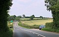
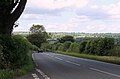
English: Pilton is a village and civil parish in Somerset, England, situated on the A361 road in the Mendip district, 3 miles (5 km) south-west of Shepton Mallet and 6 miles (10 km) east of Glastonbury. The village has a population of 1,030 (2002 estimate). The parish includes the hamlets of West Compton, East Compton, Westholme, Beardly Batch and Cannards Grave.
Italiano: Pilton si può riferire a:
village in Somerset, England  | |||||
| Upload media | |||||
| Instance of | |||||
|---|---|---|---|---|---|
| Location | Mendip, Somerset, South West England, England | ||||
| Said to be the same as | Pilton (Wikimedia duplicated page, civil parish) | ||||
 | |||||
Subcategories
This category has the following 5 subcategories, out of 5 total.
Media in category "Pilton, Somerset"
The following 194 files are in this category, out of 194 total.
-
 2011 , A361 about to enter Pilton - geograph.org.uk - 2469098.jpg 2,801 × 2,233; 1.75 MB
-
 2011 , A361 about to plunge down Whitstone Hill - geograph.org.uk - 2642123.jpg 4,095 × 2,890; 4.84 MB
-
 2011 , A361 at the end of Bowermead Lane - geograph.org.uk - 2642096.jpg 3,962 × 2,379; 4.26 MB
-
 2011 , A37 near Platterwell Lane and Beard Hill Farm - geograph.org.uk - 2497337.jpg 3,424 × 2,173; 2.19 MB
-
 2011 , Across the meadow to Folly Wood - geograph.org.uk - 2643726.jpg 3,995 × 2,598; 5.16 MB
-
 2011 , Allotments seen from John Burns Close - geograph.org.uk - 2457946.jpg 4,427 × 2,797; 4.11 MB
-
 2011 , B3136 approaching Shepton Mallet - geograph.org.uk - 2466163.jpg 4,016 × 2,658; 2.66 MB
-
 2011 , B3136 heading south at Elm Farm - geograph.org.uk - 2466253.jpg 3,578 × 2,392; 2.5 MB
-
 2011 , B3136 passing Elm Farm - geograph.org.uk - 2466180.jpg 3,080 × 2,624; 2.53 MB
-
 2011 , Compton Lane - nearly there - geograph.org.uk - 2497225.jpg 4,267 × 2,428; 4.79 MB
-
 2011 , Compton Lane from Ridge Lane - geograph.org.uk - 2496381.jpg 4,589 × 2,883; 7.77 MB
-
 2011 , Compton Lane looking north - geograph.org.uk - 2497221.jpg 3,952 × 2,756; 3.76 MB
-
 2011 , Compton Road heading north for Shepton Mallet - geograph.org.uk - 2496388.jpg 4,019 × 2,610; 4.5 MB
-
 2011 , Cottages at the southern end of Neat Lane - geograph.org.uk - 2469116.jpg 3,338 × 2,419; 3.01 MB
-
 2011 , East Compton Farm - geograph.org.uk - 2491338.jpg 4,364 × 2,689; 3.4 MB
-
 2011 , East from Stoodly Lane - geograph.org.uk - 2646718.jpg 4,752 × 3,168; 4.74 MB
-
 2011 , East of north from Ridge Lane - geograph.org.uk - 2457902.jpg 4,347 × 2,419; 3.48 MB
-
 2011 , East Town Lane looking west - geograph.org.uk - 2491398.jpg 3,776 × 2,762; 5 MB
-
 2011 , Elm Farm on the B3136 - geograph.org.uk - 2457919.jpg 3,684 × 2,863; 3.01 MB
-
 2011 , Farm track and footpath to East Compton - geograph.org.uk - 2497220.jpg 3,273 × 2,257; 3.28 MB
-
 2011 , Field recently mowed and raked - geograph.org.uk - 2642141.jpg 4,732 × 2,677; 4.31 MB
-
 2011 , First hints of autumn on Folly Lane - geograph.org.uk - 2631960.jpg 4,305 × 3,153; 7.52 MB
-
 2011 , Glastonbury Festival Preparations plus four - geograph.org.uk - 2469073.jpg 4,166 × 2,829; 3.42 MB
-
 2011 , House at the end of Bowermead Lane - geograph.org.uk - 2642163.jpg 3,775 × 2,691; 3.32 MB
-
 2011 , Knowle Hill with valley and cattle - geograph.org.uk - 2475201.jpg 1,446 × 1,219; 769 KB
-
 2011 , Maize and a herd of grass conversion units - geograph.org.uk - 2497255.jpg 3,425 × 2,021; 2.41 MB
-
 2011 , Making hay while the sun shines - geograph.org.uk - 2491419.jpg 3,237 × 1,736; 2.09 MB
-
 2011 , Near the eastern end of Platterwell Lane - geograph.org.uk - 2491442.jpg 4,073 × 2,749; 5.5 MB
-
 2011 , No heavy metal - geograph.org.uk - 2469074.jpg 3,491 × 2,406; 2.36 MB
-
 2011 , NorNorWest on Stoodly Lane, near the bottom - geograph.org.uk - 2646760.jpg 4,752 × 3,168; 7.23 MB
-
 2011 , North east from Stoodly Lane - geograph.org.uk - 2642379.jpg 4,234 × 2,810; 4.55 MB
-
 2011 , North east from Stoodly Lane - geograph.org.uk - 2646671.jpg 4,752 × 3,168; 6.32 MB
-
 2011 , North from Ridge Road - geograph.org.uk - 2465839.jpg 4,294 × 2,174; 3.58 MB
-
 2011 , North of east from Compton Lane - geograph.org.uk - 2497234.jpg 4,461 × 2,087; 3.13 MB
-
 2011 , North on Ridge Lane top of Lambert's Hill - geograph.org.uk - 2465910.jpg 4,566 × 2,359; 3.19 MB
-
 2011 , North west from Bowermead Lane - geograph.org.uk - 2631899.jpg 4,068 × 2,539; 3.97 MB
-
 2011 , Open barn off Platterwell Lane - geograph.org.uk - 2497245.jpg 4,158 × 2,738; 4.43 MB
-
 2011 , Platterwell Lane looking east - geograph.org.uk - 2497248.jpg 3,667 × 2,203; 5.19 MB
-
 2011 , Platterwell Lane looking west - geograph.org.uk - 2497263.jpg 3,237 × 2,398; 2.96 MB
-
 2011 , Platterwell Lane near Kienton Farm - geograph.org.uk - 2497270.jpg 2,534 × 2,136; 2.47 MB
-
 2011 , Ridge Lane aka Ridge Road near Shepton Mallet - geograph.org.uk - 2465815.jpg 2,947 × 2,260; 3.47 MB
-
 2011 , Ripening wheat on Beard Hill - geograph.org.uk - 2497331.jpg 4,213 × 2,670; 4.35 MB
-
 2011 , Scene through a hedgerow on Stoodly Lane - geograph.org.uk - 2643750.jpg 4,752 × 3,168; 4.99 MB
-
 2011 , South east from Stoodly Lane - geograph.org.uk - 2642418.jpg 4,752 × 3,168; 6.05 MB
-
 2011 , South from Folly Lane - geograph.org.uk - 2643707.jpg 2,000 × 1,334; 656 KB
-
 2011 , South from Ridge Lane - geograph.org.uk - 2496369.jpg 3,933 × 2,610; 4.81 MB
-
 2011 , South of west near Stump Cross - geograph.org.uk - 2465769.jpg 4,593 × 2,168; 3.87 MB
-
 2011 , South west from Stoodly Lane - geograph.org.uk - 2642406.jpg 4,597 × 2,502; 4.01 MB
-
 2011 , Stoodly Lane looking east - geograph.org.uk - 2642426.jpg 2,000 × 1,334; 1.64 MB
-
 2011 , Stoodly Lane on the brink - geograph.org.uk - 2642438.jpg 2,000 × 1,417; 1.5 MB
-
 2011 , Stoodly Lane, the steep bit - geograph.org.uk - 2646736.jpg 3,896 × 2,850; 6.5 MB
-
 2011 , Summer haze in October on Stoodly Lane - geograph.org.uk - 2631926.jpg 4,029 × 2,856; 3.68 MB
-
 2011 , West along Ridge Lane - geograph.org.uk - 2496357.jpg 4,031 × 2,968; 5.2 MB
-
 2011 , West of south from Bowermead Lane - geograph.org.uk - 2642201.jpg 4,752 × 3,168; 5.89 MB
-
 2011 , West over a maize field - geograph.org.uk - 2491314.jpg 3,976 × 2,500; 3.95 MB
-
 2011 , Wheatfield on Beard Hill - geograph.org.uk - 2497322.jpg 4,341 × 2,225; 3.73 MB
-
 2012 , Farmland south west of Pylle Road - geograph.org.uk - 2969827.jpg 4,284 × 2,577; 4.73 MB
-
 2012 , North west from Cockmill Lane - geograph.org.uk - 2971526.jpg 4,409 × 2,683; 4.25 MB
-
 2012 , Northern end of Cockmill Lane - geograph.org.uk - 2970234.jpg 3,926 × 2,565; 4.98 MB
-
 2012 , Pastures west of Pylle Road - geograph.org.uk - 2969803.jpg 4,472 × 2,746; 5.25 MB
-
 2012 , South on Cockmill Lane - geograph.org.uk - 2969850.jpg 4,147 × 2,999; 6.59 MB
-
 2012 , West of Cockmill Lane - geograph.org.uk - 2970256.jpg 4,485 × 2,350; 2.86 MB
-
 2012 , West of north west from Cockmill Lane - geograph.org.uk - 2971540.jpg 3,536 × 2,337; 2.79 MB
-
 2012 -Festival entrance on Cockmill Lane looking south - geograph.org.uk - 2970242.jpg 4,752 × 3,168; 6.66 MB
-
 A37 northbound - geograph.org.uk - 3004420.jpg 640 × 428; 50 KB
-
 A37 northbound - geograph.org.uk - 3004427.jpg 640 × 361; 43 KB
-
 Access road to Beard Hill Farm - geograph.org.uk - 5238205.jpg 1,600 × 1,200; 872 KB
-
 Approaching Pilton - geograph.org.uk - 468040.jpg 640 × 480; 91 KB
-
 Bark 'n Muck - geograph.org.uk - 2874330.jpg 640 × 480; 85 KB
-
 Buildings at Pilton - geograph.org.uk - 3052023.jpg 640 × 408; 78 KB
-
 Bus shelter, Whitstone Hill, Pilton - geograph.org.uk - 5474655.jpg 1,600 × 941; 649 KB
-
 Cattle by Cockmill Lane - geograph.org.uk - 3051779.jpg 640 × 422; 74 KB
-
 Cattle by Cockmill Lane - geograph.org.uk - 3051809.jpg 640 × 392; 68 KB
-
 Cattle in Pasture, Lambert's Hill - geograph.org.uk - 2874179.jpg 640 × 480; 78 KB
-
 Cranesbill, Pilton - geograph.org.uk - 3052008.jpg 522 × 640; 138 KB
-

-
 Entrance to Cockmill Croft Farm - geograph.org.uk - 2877959.jpg 640 × 463; 74 KB
-
 Entrance to North Wootton - geograph.org.uk - 4369792.jpg 3,776 × 2,520; 3.97 MB
-
 Entrance to Windinglake Farm yard - geograph.org.uk - 2996122.jpg 640 × 480; 137 KB
-
 Entrance to Worthy Farm - geograph.org.uk - 2874318.jpg 640 × 480; 88 KB
-
 Field and hedge, Windinglake Farm - geograph.org.uk - 3051999.jpg 640 × 480; 67 KB
-
 Field below Kings Hill - geograph.org.uk - 3050456.jpg 640 × 480; 62 KB
-
 Field boundary, Pilton Park - geograph.org.uk - 3052144.jpg 480 × 640; 92 KB
-
 Field in Whitelake valley - geograph.org.uk - 3050704.jpg 640 × 440; 68 KB
-
 Field in Whitelake valley - geograph.org.uk - 3051053.jpg 640 × 484; 82 KB
-
 Field, Glastonbury Festival site - geograph.org.uk - 3051393.jpg 640 × 499; 104 KB
-
 Field, Pilton - geograph.org.uk - 3052007.jpg 471 × 640; 89 KB
-
 Fields near Springfield House. - geograph.org.uk - 2874276.jpg 640 × 480; 85 KB
-
 Footpath, Pilton - geograph.org.uk - 1500437.jpg 640 × 480; 202 KB
-
 Ford on Cockmill Lane - geograph.org.uk - 2877963.jpg 640 × 496; 131 KB
-

-
 Former Railway Line - geograph.org.uk - 4191872.jpg 640 × 417; 331 KB
-

-
 Glastonbury Festival fields - geograph.org.uk - 32812.jpg 640 × 480; 104 KB
-
 Glen Tilbrook - geograph.org.uk - 5930421.jpg 2,598 × 3,897; 7.68 MB
-
 Green Kids Field - geograph.org.uk - 3051171.jpg 640 × 437; 64 KB
-
 Hedgerow and Tree - geograph.org.uk - 4191877.jpg 640 × 427; 399 KB
-
 Holt Farm - geograph.org.uk - 3052163.jpg 501 × 640; 87 KB
-
 House on Whitstone Hill - geograph.org.uk - 2903597.jpg 640 × 480; 65 KB
-
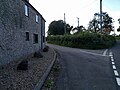
 Houses and lanes in Pilton - geograph.org.uk - 2065559.jpg 640 × 480; 179 KB
-
 Houses in Pilton - geograph.org.uk - 2065562.jpg 640 × 480; 147 KB
-
-
 Lane and gate - geograph.org.uk - 2504200.jpg 640 × 480; 168 KB
-
 Lay-by on Lambert's Hill (B3136) - geograph.org.uk - 5474635.jpg 1,600 × 1,200; 814 KB
-
 Maize below Kings Hill - geograph.org.uk - 3050568.jpg 640 × 480; 111 KB
-
 Meadowsweet, Cockmill Lane - geograph.org.uk - 3051642.jpg 459 × 640; 80 KB
-
 Neat Lane, near West Compton - geograph.org.uk - 5474645.jpg 1,600 × 1,200; 769 KB
-
 New House, West Compton Lane - geograph.org.uk - 2118285.jpg 640 × 480; 79 KB
-
 New Houses in Pilton - geograph.org.uk - 2903608.jpg 640 × 480; 52 KB
-
 New Houses Neat Lane - geograph.org.uk - 2874293.jpg 640 × 480; 66 KB
-

-

-

-

-

-

-

-
 Old Direction Sign - Signpost by St Mary's Lane, Pilton - geograph.org.uk - 6048775.jpg 1,115 × 1,714; 224 KB
-

-
 Old Milepost by the A361, Park Hill, Pilton - geograph.org.uk - 6045685.jpg 1,512 × 1,014; 422 KB
-
 Old Milepost by the A37, Beard Hill, Pilton Parish (geograph 6045080).jpg 718 × 1,050; 130 KB
-
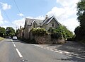 Old School House, Pilton - geograph.org.uk - 6236990.jpg 1,024 × 755; 168 KB
-
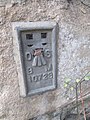 Ordnance Survey Flush Bracket (10723) - geograph.org.uk - 4262430.jpg 480 × 640; 106 KB
-
 Parson's Batch, Pilton - geograph.org.uk - 5474664.jpg 1,600 × 1,200; 774 KB
-
 Part of Glastonbury Festival site - geograph.org.uk - 3051621.jpg 640 × 460; 77 KB
-
 Pasture by Pylle Road - geograph.org.uk - 3051849.jpg 640 × 455; 84 KB
-
 Pilton Ford - geograph.org.uk - 4873822.jpg 1,600 × 1,067; 1.85 MB
-
 Pilton House - geograph.org.uk - 231247.jpg 640 × 480; 95 KB
-
 Pilton Parish Church - geograph.org.uk - 5930406.jpg 5,077 × 3,385; 5.04 MB
-
 Pilton village hall - geograph.org.uk - 1084422.jpg 640 × 480; 186 KB
-
 Pilton, bins - geograph.org.uk - 5862593.jpg 1,024 × 768; 210 KB
-
 Pilton, Brimley Lane - geograph.org.uk - 5862589.jpg 1,024 × 768; 256 KB
-
 Pilton, Brimley Lane - geograph.org.uk - 5862611.jpg 1,024 × 768; 303 KB
-
 Pilton, cattle grazing - geograph.org.uk - 5862597.jpg 1,024 × 758; 186 KB
-
 Pilton, Mary's Gate - geograph.org.uk - 5862585.jpg 1,024 × 762; 162 KB
-
 Pilton, power lines - geograph.org.uk - 5862616.jpg 746 × 1,024; 131 KB
-
 Pilton, Pyramid Stage - geograph.org.uk - 5862609.jpg 1,024 × 768; 148 KB
-
 Pylon by Cockmill Lane - geograph.org.uk - 3051829.jpg 472 × 640; 57 KB
-
 Railings, Pylle Road - geograph.org.uk - 3052003.jpg 480 × 640; 131 KB
-
 Repairing a wall at Elm Farm - geograph.org.uk - 5474639.jpg 1,600 × 1,200; 720 KB
-
 Rickety Barns, Ridge Lane - geograph.org.uk - 2874190.jpg 640 × 480; 79 KB
-

-
 Road next to the church, Pilton - geograph.org.uk - 1310910.jpg 640 × 480; 177 KB
-
 Road passing the church, Pilton - geograph.org.uk - 1310907.jpg 640 × 480; 162 KB
-
 Sheep on an escarpment, near East Pennard - geograph.org.uk - 730489.jpg 640 × 480; 157 KB
-
 Ship, Glastonbury Festival site - geograph.org.uk - 3051156.jpg 543 × 640; 104 KB
-
 Shutwell Lane, Pilton - geograph.org.uk - 5474660.jpg 1,600 × 1,200; 737 KB
-
 Signpost, Pylle Road - geograph.org.uk - 3052004.jpg 469 × 640; 73 KB
-
 Stile, Pilton - geograph.org.uk - 1500425.jpg 640 × 480; 211 KB
-
 Stream near East Pennard - geograph.org.uk - 1702658.jpg 640 × 480; 210 KB
-
 Track below Kings Hill - geograph.org.uk - 3050476.jpg 640 × 464; 67 KB
-
 Track from Cockmill Lane - geograph.org.uk - 3051747.jpg 640 × 447; 60 KB
-
 Track in Pilton Park - geograph.org.uk - 3050575.jpg 524 × 640; 83 KB
-
 Track to Steanbow Park - geograph.org.uk - 732611.jpg 640 × 480; 115 KB
-
 Track, Glastonbury Festival site - geograph.org.uk - 3051368.jpg 459 × 640; 95 KB
-
 Traffic approaching Pilton - geograph.org.uk - 2065549.jpg 640 × 480; 135 KB
-
 View south from the church porch - geograph.org.uk - 1084410.jpg 640 × 480; 237 KB
-
 West Compton Lane, a view across the valley - geograph.org.uk - 2497303.jpg 1,024 × 708; 226 KB
-
 Western edge of Pilton - geograph.org.uk - 2065554.jpg 640 × 480; 170 KB
-
 Wheat, Whitelake valley - geograph.org.uk - 3050945.jpg 640 × 480; 83 KB
-
 Wheat, Whitelake valley - geograph.org.uk - 3050953.jpg 502 × 640; 93 KB
-
 Wheat, Whitelake valley - geograph.org.uk - 3052152.jpg 490 × 640; 107 KB
-
 Brook House farm - geograph.org.uk - 191600.jpg 640 × 480; 97 KB
-
 Burford - geograph.org.uk - 191622.jpg 640 × 480; 86 KB
-
 Cattle near Croscombe - geograph.org.uk - 1503834.jpg 640 × 481; 128 KB
-
 Crossroads near Pilton - geograph.org.uk - 32798.jpg 640 × 480; 160 KB
-
 East Compton - geograph.org.uk - 468038.jpg 640 × 480; 76 KB
-
 East Town Lane - geograph.org.uk - 468043.jpg 640 × 480; 121 KB
-
 Farm buildings from Watery Lane - geograph.org.uk - 229008.jpg 640 × 480; 80 KB
-
 Farmland near East Pennard - geograph.org.uk - 732454.jpg 640 × 480; 120 KB
-
 Farmyard - geograph.org.uk - 229021.jpg 640 × 480; 59 KB
-
 Field margin off Platterwell Lane - geograph.org.uk - 468047.jpg 640 × 480; 105 KB
-
 Flying saucers have landed - geograph.org.uk - 570348.jpg 640 × 480; 62 KB
-
 Footbridge over Bradley Brook - geograph.org.uk - 454585.jpg 480 × 640; 170 KB
-
 Horses by Watery Lane - geograph.org.uk - 229007.jpg 640 × 480; 111 KB
-
 House in Steanbow - geograph.org.uk - 229040.jpg 640 × 480; 158 KB
-
 Lake and pagoda in Burford gardens - geograph.org.uk - 191616.jpg 640 × 480; 134 KB
-
 Lambert's Hill Farm - geograph.org.uk - 456035.jpg 640 × 480; 132 KB
-
 Lamberts Hill, Shepton Mallet - geograph.org.uk - 420507.jpg 587 × 440; 99 KB
-
 Lower Westholme - geograph.org.uk - 229014.jpg 640 × 480; 118 KB
-
 Lower Westholme - geograph.org.uk - 229016.jpg 640 × 480; 150 KB
-
 Manor House at Pylle - geograph.org.uk - 457054.jpg 480 × 640; 173 KB
-
 Mill lane track - geograph.org.uk - 191595.jpg 480 × 640; 124 KB
-
 Pilton Park - geograph.org.uk - 570362.jpg 640 × 480; 93 KB
-
 Pilton village centre - geograph.org.uk - 273003.jpg 640 × 480; 120 KB
-
 Platterwell Lane - geograph.org.uk - 468049.jpg 640 × 480; 97 KB
-
 Smallholding in Steanbow - geograph.org.uk - 229035.jpg 640 × 480; 117 KB
-
 Smallholding land in Steanbow - geograph.org.uk - 229038.jpg 640 × 480; 89 KB
-
 South from Steanbow Farm - geograph.org.uk - 229033.jpg 640 × 480; 87 KB
-
 Steanbow Farm - geograph.org.uk - 229026.jpg 640 × 480; 90 KB
-
 Steps and stile - geograph.org.uk - 191609.jpg 480 × 640; 154 KB
-
 Stile near Bourne Farm - geograph.org.uk - 468045.jpg 640 × 480; 80 KB
-
 The A361 - geograph.org.uk - 567209.jpg 640 × 480; 70 KB
-
 The Apple Tree and the A361 - geograph.org.uk - 567206.jpg 640 × 480; 76 KB


_-_geograph.org.uk_-_5474635.jpg)


.jpg)

_-_geograph.org.uk_-_4262430.jpg)


