Category:Pizol
Salti al navigilo
Salti al serĉilo
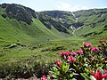
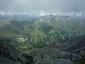
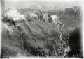
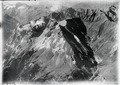
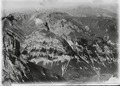
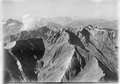
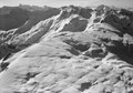
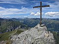
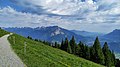
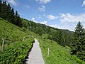
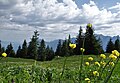
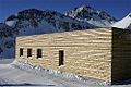
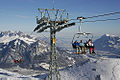
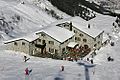
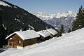
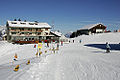
Deutsch: Der Pizol (Romanisch für Hohe Spitze) ist ein 2844 m hohes Bergmassiv im Sarganserland im Kanton St. Gallen. Er liegt 16 km nordwestlich von Chur, zwischen dem Weisstannental, dem Taminatal und dem Calfeisental. Andere Gipfel im Bergmassiv sind das Sazmartinshorn (2827 m), das Zanaihorn (2821 m), die Schwarzen Hörner (2645 m), und der Muntaluna (2422 m). Unterhalb des Pizol-Gipfels befindet sich der kleine Pizolgletscher, der etwa 400 m lang ist. Als Pizol wird landläufig auch das Wander- und Skigebiet auf der Nordostseite des Pizols, oberhalb der Ortschaften Wangs und Bad Ragaz bezeichnet.
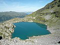
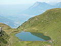
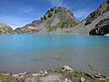
English: The Pizol is a mountain in the Glarus Alps, Canton of St. Gallen in Switzerland. There are five mountain lakes (Pizolseen) on Pizol: Wangsersee at Pizolhütte, Wildsee, Schottensee, Schwarzsee (2368 m) and Baschalvasee (2174 m).
mountain in the canton of St. Gallen, Switzerland  | |||||
| Alŝuti plurmedion | |||||
| Estas | |||||
|---|---|---|---|---|---|
| Loko | Sankt-Galo, Svislando | ||||
| Montaro |
| ||||
| Elstaro |
| ||||
| Supermara alteco |
| ||||
| Patra pinto | |||||
 | |||||
Subkategorioj
Ĉi tiu kategorio havas la 5 jenajn subkategoriojn, el 5 entute.
Dosieroj en kategorio “Pizol”
La jenaj 155 dosieroj estas en ĉi tiu kategorio, el 155 entute.
-
 2019-06-09 Gnalp – 300 Jahre Liechtenstein 103 (KPFC).jpg 6 016 × 4 010; 7,59 MB
-
 Abend am Pizol - panoramio.jpg 4 000 × 3 000; 4,62 MB
-
 Alpenblumen 01.jpg 4 896 × 3 672; 6,44 MB
-
 Alpenblumen 02.jpg 4 896 × 3 672; 7,49 MB
-
 Alpenblumen 03.jpg 4 896 × 3 672; 7,75 MB
-
 Alpenblumen 04.jpg 4 896 × 3 672; 7,21 MB
-
 Alpenblumen 05.jpg 4 896 × 3 672; 7,38 MB
-
 Alpenblumen 06.jpg 4 896 × 3 672; 7,5 MB
-
 Alpenblumen 07.jpg 4 896 × 3 672; 7,56 MB
-
 Alpenblumen 08.jpg 4 896 × 3 672; 6,95 MB
-
 Alpenblumen 09.jpg 4 896 × 3 672; 7,7 MB
-
 Alpenblumen 10.jpg 4 896 × 3 672; 7,65 MB
-
 Alpenblumen 11.jpg 4 896 × 3 672; 7,04 MB
-
 Alpiner Wildsee am Pizol.jpg 3 456 × 2 304; 4,58 MB
-
 At the edge of the world.jpg 3 888 × 2 592; 2,09 MB
-
 Baby blue.jpg 3 888 × 2 592; 2,55 MB
-
 Baschalvasee - panoramio.jpg 2 048 × 1 536; 1,34 MB
-
 Baschalvasee01.jpg 4 000 × 3 000; 5,78 MB
-
 Blick zum Schottensee.jpg 3 456 × 2 304; 3,24 MB
-
 Calfeisen Hangsack-Zanai.JPG 3 072 × 2 304; 3,05 MB
-
 Der Schottensee.jpg 3 456 × 2 304; 2,81 MB
-
 ETH-BIB-Drachenberg, Calanda, Vättis v. W. aus 3000 m-Inlandflüge-LBS MH01-003050.tif 6 240 × 4 439; 79,41 MB
-

-
 ETH-BIB-Drachenberg, Drachenloch aus 2700 m-Inlandflüge-LBS MH01-003058.tif 6 311 × 4 369; 79,05 MB
-

-
 ETH-BIB-Drachenberg, Piz da Sterls, Tristelhorn aus 2800 m-Inlandflüge-LBS MH01-003593.tif 6 547 × 4 553; 85,41 MB
-
 ETH-BIB-Drachenberg, Pizol v. S. O. aus 3000 m-Inlandflüge-LBS MH01-003046.tif 6 150 × 4 407; 77,67 MB
-
 ETH-BIB-Drachenberg, Pizol, Piz Sardona aus 3000 m-Inlandflüge-LBS MH01-003045.tif 6 244 × 4 442; 79,53 MB
-
 ETH-BIB-Drachenberg, Sardona v. O. aus 2800 m-Inlandflüge-LBS MH01-003592.tif 6 541 × 4 653; 87,16 MB
-
 ETH-BIB-Drachenberg, Vätterchopf v. S. aus 3000 m-Inlandflüge-LBS MH01-003051.tif 6 248 × 4 572; 81,89 MB
-
 ETH-BIB-Drachenberg, Vätterchopf, Gelbberg v. O. aus 3000 m-Inlandflüge-LBS MH01-003054.tif 6 437 × 4 632; 85,42 MB
-

-
 ETH-BIB-Drachenberg, Vätterchopf, Vättis, Taminatal v. S. 3000 m-Inlandflüge-LBS MH01-003053.tif 6 235 × 4 449; 79,51 MB
-
-
 ETH-BIB-Drachenberg-Inlandflüge-LBS MH01-000908.tif 4 604 × 6 819; 89,91 MB
-
 ETH-BIB-Graue Hörner m. Weisstannental u. Glärnisch-Inlandflüge-LBS MH01-000900.tif 5 493 × 4 070; 64,17 MB
-
 ETH-BIB-Graue Hörner, Pizol, Churfirsten v. S. aus 3000 m-Inlandflüge-LBS MH01-003043.tif 6 126 × 4 422; 77,66 MB
-
 ETH-BIB-Graue Hörner, Pizol, Glärnisch v. S. O. aus 3200 m-Inlandflüge-LBS MH01-003040.tif 6 302 × 4 407; 79,61 MB
-

-
 ETH-BIB-Graue Hörner, Pizol-Inlandflüge-LBS MH01-000907.tif 4 635 × 6 733; 89,4 MB
-
 ETH-BIB-Pizol, Blick nach Südsüdost Calanda-LBS H1-011475.tif 6 716 × 4 660; 89,69 MB
-
 ETH-BIB-Pizol, Gaffia, Wildseelücke-LBS H1-018373.tif 6 837 × 4 800; 94,01 MB
-
 ETH-BIB-Pizol, Seilbahn Wangs , Skilift Ragaz-LBS H1-018307.tif 6 784 × 4 742; 92,16 MB
-
 ETH-BIB-Pizol, Seilbahn Wangs-LBS H1-018309.tif 6 793 × 4 739; 92,26 MB
-
 ETH-BIB-Pizol, Seilbahn Wangs-LBS H1-018311.tif 6 784 × 4 710; 91,58 MB
-
 ETH-BIB-Pizol, Skilift Ragaz, Wildseelücke-LBS H1-018374.tif 6 847 × 4 791; 93,97 MB
-
 ETH-BIB-Pizol, Skilift Ragaz-LBS H1-018303.tif 6 736 × 4 707; 90,89 MB
-
 ETH-BIB-Pizol, Skilift Ragaz-LBS H1-018304.tif 6 757 × 4 737; 91,68 MB
-
 ETH-BIB-Pizol, Skilift Ragaz-LBS H1-018305.tif 6 768 × 4 736; 91,86 MB
-
 ETH-BIB-Pizol, Skilift Ragaz-LBS H1-018306.tif 6 751 × 4 695; 90,84 MB
-
 ETH-BIB-Pizol, Skilift Ragaz-LBS H1-018308.tif 6 782 × 4 715; 91,63 MB
-
 ETH-BIB-Pizolhütte, Blick nach Südwest Pizol-LBS H1-011476.tif 6 767 × 4 650; 90,16 MB
-
 ETH-BIB-Pizolhütte, Blick nach Südwesten Pizol-LBS H1-011477.tif 6 771 × 4 656; 90,39 MB
-
 ETH-BIB-Pizolhütte, Blick nach Südwesten Pizol-LBS H1-011478.tif 6 737 × 4 650; 89,79 MB
-
 ETH-BIB-Wangs Pizol, Blick nach Südsüdwest Schwarze Hörner-LBS H1-011479.tif 6 719 × 4 660; 89,69 MB
-
 Furt - panoramio.jpg 2 048 × 1 536; 1,35 MB
-
 Gaffia Pizol - panoramio.jpg 2 048 × 1 536; 1,44 MB
-
 HeideSchweiz01.jpg 4 000 × 3 000; 5,97 MB
-
 Hochnebel 0819h.jpg 3 072 × 2 048; 2,09 MB
-
 HochwartPizol3.jpg 4 000 × 3 000; 3,4 MB
-
 Kuh auf dem Pizol.jpg 2 268 × 4 032; 5,05 MB
-
 Maienfeldschlossbrandis.jpg 2 272 × 1 704; 1,4 MB
-
 Mittagspause mit besonderer Aussicht.jpg 3 888 × 2 592; 2,93 MB
-
 Mt Pizol (119878117).jpeg 2 048 × 1 367; 521 KB
-
 Pardiel 01.jpg 4 000 × 2 250; 2,9 MB
-
 Pardiel 02.jpg 4 992 × 1 824; 4,19 MB
-
 Pardiel 03.jpg 4 000 × 2 250; 2,14 MB
-
 Pardiel 04.jpg 4 896 × 3 672; 6,56 MB
-
 Pardiel 05.jpg 4 896 × 3 672; 6,04 MB
-
 Pardiel 06.jpg 4 873 × 3 358; 3,09 MB
-
 Pardiel 07.jpg 4 877 × 3 083; 3,92 MB
-
 Picswiss SG-36-10.jpg 500 × 333; 34 KB
-
 Picswiss SG-37-04.jpg 500 × 333; 40 KB
-
 Picswiss SG-37-05.jpg 501 × 333; 59 KB
-
 Picswiss SG-37-06.jpg 500 × 333; 46 KB
-
 Picswiss SG-37-07.jpg 500 × 333; 50 KB
-
 Picswiss SG-37-08.jpg 500 × 333; 54 KB
-
 Picswiss SG-37-09.jpg 500 × 333; 49 KB
-
 Picswiss SG-37-10.jpg 500 × 333; 43 KB
-
 Picswiss SG-37-11.jpg 499 × 333; 55 KB
-
 Picswiss SG-37-12.jpg 300 × 450; 36 KB
-
 Picswiss SG-37-13.jpg 500 × 332; 53 KB
-
 Picswiss SG-37-14.jpg 500 × 333; 60 KB
-
 Picswiss SG-37-15.jpg 500 × 333; 21 KB
-
 Picswiss SG-37-16.jpg 300 × 450; 49 KB
-
 Picswiss SG-37-17.jpg 500 × 333; 58 KB
-
 Picswiss SG-37-18.jpg 300 × 450; 48 KB
-
 Picswiss SG-37-19.jpg 500 × 333; 35 KB
-
 Picswiss SG-37-20.jpg 500 × 333; 58 KB
-
 Picswiss SG-37-21.jpg 500 × 333; 50 KB
-
 Picswiss SG-37-22.jpg 500 × 333; 53 KB
-
 Picswiss SG-37-23.jpg 500 × 333; 42 KB
-
 Picswiss SG-37-24.jpg 500 × 333; 59 KB
-
 Picswiss SG-37-25.jpg 500 × 333; 43 KB
-
 Picswiss SG-37-26.jpg 500 × 333; 59 KB
-
 Picswiss SG-37-27.jpg 500 × 333; 42 KB
-
 Picswiss SG-37-28.jpg 500 × 333; 53 KB
-
 Picswiss SG-37-29.jpg 500 × 333; 47 KB
-
 Picswiss SG-37-30.jpg 500 × 333; 48 KB
-
 Picswiss SG-37-31.jpg 500 × 333; 52 KB
-
 Picswiss SG-37-32.jpg 501 × 333; 50 KB
-
 Picswiss SG-37-33.jpg 500 × 332; 46 KB
-
 Picswiss SG-37-34.jpg 500 × 333; 58 KB
-
 Picswiss SG-37-35.jpg 500 × 333; 53 KB
-
 Picswiss SG-37-36.jpg 500 × 333; 51 KB
-
 Picswiss SG-37-37.jpg 500 × 333; 45 KB
-
 Picswiss SG-37-38.jpg 500 × 333; 62 KB
-
 Picswiss SG-37-39.jpg 500 × 333; 54 KB
-
 Picswiss SG-37-40.jpg 500 × 333; 26 KB
-
 Pizol - panoramio - scudici (1).jpg 3 888 × 2 592; 3,71 MB
-
 Pizol - panoramio - scudici.jpg 3 888 × 2 592; 3,25 MB
-
 Pizol - panoramio.jpg 3 888 × 2 592; 3,56 MB
-
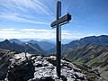
 Pizol Gipfelkreuz 080222.jpg 2 304 × 3 072; 452 KB
-
 Pizol Skidepot 080222.jpg 3 072 × 2 304; 643 KB
-
 Pizol View.jpg 1 500 × 1 499; 2,15 MB
-
 Pizol von der Scharte 080222.jpg 3 072 × 2 304; 713 KB
-
 Pizol1.JPG 2 048 × 1 536; 1,32 MB
-
 Pizol2.JPG 2 048 × 1 536; 1,4 MB
-
 Pizol3.JPG 2 048 × 1 536; 1,34 MB
-
 Pizol4.JPG 2 048 × 1 536; 1,31 MB
-
 PizolGipfel03.jpg 4 000 × 3 000; 2,95 MB
-
 Pizolhütte - panoramio.jpg 2 272 × 1 704; 1,72 MB
-
 Pizolhütte View.jpg 1 500 × 1 499; 2,09 MB
-
 PizolPanorama03.jpg 9 000 × 1 670; 4,43 MB
-
 Rhein Liechtenstein.png 4 368 × 2 380; 12,32 MB
-
 Sargans DSC 2322 (6156245434).jpg 4 928 × 3 264; 7,9 MB
-
 Schotensee.jpg 1 500 × 1 499; 2,51 MB
-
 Schottensee Pizol.jpg 7 700 × 3 828; 24,2 MB
-
 Schottensee.jpg 2 848 × 4 272; 3,56 MB
-
 SchottenseePizol01.jpg 4 000 × 3 000; 5,72 MB
-
 SchwarzseePizol01.jpg 4 000 × 3 000; 5,5 MB
-
 Schöner Wildsee.jpg 2 304 × 3 456; 4,45 MB
-
 Sender Wannenberg und Glarner Alpen vom Berghaus.jpg 5 472 × 3 648; 4,36 MB
-
 Silum Ausblick Pizol – WAF 300 J FL.jpg 4 912 × 3 264; 5,71 MB
-
 Skigebiet Pizol - panoramio.jpg 2 048 × 1 536; 1,38 MB
-
 Skilift.jpg 500 × 333; 47 KB
-
 Small house in Pizol.jpg 3 000 × 2 003; 2,11 MB
-
 St. Margrethenberg - panoramio - scudici.jpg 1 600 × 1 200; 810 KB
-
 Steinmännchen Pizol.jpg 4 000 × 3 000; 4,4 MB
-
 Vilters-Wangs, Switzerland - panoramio.jpg 3 264 × 2 448; 2,57 MB
-
 Viltersersee - panoramio.jpg 2 048 × 1 536; 1,46 MB
-
 Viltersersee01.jpg 4 000 × 3 000; 5,56 MB
-
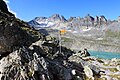 Wegweiser an der Wildseelugge.jpg 3 456 × 2 304; 4,47 MB
-
 WEITSICHT KAI - panoramio.jpg 640 × 480; 136 KB
-
 Wikiolo in Liechtenstein (190).jpg 5 760 × 3 840; 5,59 MB
-
 Wikiolo in Liechtenstein (240).jpg 5 760 × 3 840; 4,67 MB
-
 Wikiolo in Liechtenstein (281).jpg 5 760 × 3 840; 4,89 MB
-
 Wikiolo in Liechtenstein (325).jpg 5 760 × 3 840; 7,75 MB
-
 Wikiolo in Liechtenstein (374).jpg 3 840 × 5 760; 7,1 MB
-
 Wikiolo in Liechtenstein (376).jpg 5 760 × 3 840; 4,91 MB
-
 Wikiolo in Liechtenstein (377).jpg 5 760 × 3 840; 5,85 MB
-
 Wikiolo in Liechtenstein (396).jpg 5 760 × 3 840; 4,06 MB
-
 Wildsee , Grauhörner und Pizol.jpg 3 456 × 2 304; 3,96 MB
-
 Wildsee15.jpg 4 000 × 3 000; 3,66 MB
-
 WildseePizol01.jpg 4 590 × 2 550; 4,47 MB
.jpg)


.jpeg)


.jpg)


.jpg)


.jpg)
.jpg)
.jpg)
.jpg)
.jpg)
.jpg)
.jpg)
.jpg)


