Category:Plaistow, West Sussex
Jump to navigation
Jump to search
Plaistow is a village and civil parish in the Chichester District of West Sussex, England.

village and civil parish in Chichester, West Sussex, England  | |||||
| Upload media | |||||
| Instance of | |||||
|---|---|---|---|---|---|
| Location | Chichester, West Sussex, South East England, England | ||||
| Population |
| ||||
 | |||||
Subcategories
This category has the following 3 subcategories, out of 3 total.
Media in category "Plaistow, West Sussex"
The following 200 files are in this category, out of 406 total.
(previous page) (next page)-
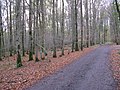
 "The Ride" in Ifold - geograph.org.uk - 2225666.jpg 800 × 600; 168 KB
-
 A muddy stretch of the Wey South Path - geograph.org.uk - 2395164.jpg 640 × 430; 141 KB
-
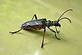 A resident of Ash Park Wood - geograph.org.uk - 2967644.jpg 640 × 428; 67 KB
-
 A view south-southeast - geograph.org.uk - 3261246.jpg 4,000 × 3,000; 4.73 MB
-
 Above Southlands lock - geograph.org.uk - 2211808.jpg 640 × 426; 258 KB
-
 Advance warning of T-junction at Ifold - geograph.org.uk - 2160100.jpg 2,592 × 1,944; 2.16 MB
-
 Alpaca at Plaistow - geograph.org.uk - 2595383.jpg 1,920 × 2,560; 1.67 MB
-
 Apartheid, Ifold - geograph.org.uk - 2392257.jpg 640 × 480; 172 KB
-
 Approach to Crouchland Farm - geograph.org.uk - 2391614.jpg 640 × 480; 154 KB
-
 Approaching Birchfold Copse - geograph.org.uk - 6018336.jpg 1,024 × 768; 218 KB
-
 Approaching China Bridge - geograph.org.uk - 6017698.jpg 1,600 × 1,200; 914 KB
-
 Approaching Firth Lodge - geograph.org.uk - 6017610.jpg 1,600 × 1,200; 887 KB
-
 Approaching the T Junction - geograph.org.uk - 5850173.jpg 1,024 × 691; 296 KB
-
 Approaching Wephurst Wood - geograph.org.uk - 5849867.jpg 1,024 × 672; 179 KB
-
 Ash Park Wood - geograph.org.uk - 2967307.jpg 640 × 480; 168 KB
-
 Barn and outbuilding at Haymans Farm - geograph.org.uk - 2163068.jpg 2,592 × 1,944; 1.64 MB
-
 Barn near Sparrwood Farm - geograph.org.uk - 5542270.jpg 640 × 428; 182 KB
-
 Barn, Sparrwood Farm - geograph.org.uk - 335430.jpg 640 × 428; 120 KB
-
 Barrier at opening into Hog Wood - geograph.org.uk - 2160513.jpg 2,592 × 1,944; 2.35 MB
-
 Beggars Copse SE of Plaistow - geograph.org.uk - 2158579.jpg 2,592 × 1,944; 2.3 MB
-
 Below Southlands lock - geograph.org.uk - 2211796.jpg 640 × 425; 228 KB
-
 Bend at Rickman's Lane - geograph.org.uk - 1165957.jpg 640 × 480; 115 KB
-

-
 Beware of the Dog. GR - geograph.org.uk - 2594580.jpg 2,560 × 1,920; 1.61 MB
-
 Biogas plant at Crouchland Farm - geograph.org.uk - 2164888.jpg 2,592 × 1,944; 1.68 MB
-
 Biogas unit at Crouchland Farm - geograph.org.uk - 2164876.jpg 2,592 × 1,944; 1.4 MB
-
 Birchfield near Plaistow - geograph.org.uk - 1749387.jpg 800 × 600; 101 KB
-
 Birchfold Copse - geograph.org.uk - 2163110.jpg 2,592 × 1,944; 2.44 MB
-
 Break in unnamed wood near Plaistow - geograph.org.uk - 2384075.jpg 600 × 800; 192 KB
-

-
 Bridleway along The Plantation - geograph.org.uk - 6017484.jpg 1,600 × 1,200; 910 KB
-
 Bridleway crosses the Wey South Path - geograph.org.uk - 2396161.jpg 640 × 430; 136 KB
-
 Bridleway in Durfold Wood - geograph.org.uk - 1918852.jpg 1,600 × 1,200; 709 KB
-
 Bridleway into Birchfold Copse - geograph.org.uk - 2967462.jpg 640 × 480; 142 KB
-
 Bridleway junction in Birchfield Copse - geograph.org.uk - 2163099.jpg 2,592 × 1,944; 2.2 MB
-
 Bridleway leaving the Shillinglee Road - geograph.org.uk - 6018219.jpg 1,024 × 768; 355 KB
-
 Bridleway on the border - geograph.org.uk - 6018537.jpg 1,600 × 1,200; 975 KB
-
 Bridleway only for The Lane - geograph.org.uk - 2160345.jpg 2,592 × 1,944; 2.32 MB
-
 Bridleway through Birchfold Copse - geograph.org.uk - 6018362.jpg 1,024 × 768; 397 KB
-
 Bridleway to Rickman's Lane - geograph.org.uk - 2115422.jpg 2,592 × 1,944; 1.89 MB
-
 Bridleway to Rickman's Lane - geograph.org.uk - 2384489.jpg 600 × 800; 153 KB
-
 Bridleway to Wephurst Wood - geograph.org.uk - 5849822.jpg 1,024 × 663; 173 KB
-
 Bungalow on the bend of Rickman's Lane - geograph.org.uk - 1568633.jpg 640 × 480; 118 KB
-
 Bus shelter at the corner of Chalk Road and Plaistow road - geograph.org.uk - 2160164.jpg 2,592 × 1,944; 2.13 MB
-
 Bushes fringing a stream - geograph.org.uk - 2396154.jpg 640 × 430; 112 KB
-
 By Park Mill Farm - geograph.org.uk - 1519761.jpg 640 × 480; 108 KB
-

-
 Canal Milestone - geograph.org.uk - 3260295.jpg 4,000 × 3,000; 4.77 MB
-
 Canal Milestone, Southlands Lock - geograph.org.uk - 2594650.jpg 1,920 × 2,560; 1.76 MB
-
 Canal Reclamation Work - geograph.org.uk - 2594680.jpg 1,920 × 2,560; 1.68 MB
-
 Cars on forecourt of repair centre - geograph.org.uk - 2160276.jpg 2,592 × 1,944; 1.74 MB
-
 Cattle sheds at Crouchland Farm - geograph.org.uk - 1568753.jpg 640 × 480; 98 KB
-
 Charleshurst Farm - geograph.org.uk - 2595351.jpg 2,560 × 1,920; 1.87 MB
-
 Chilsfold Farm under reconstruction - geograph.org.uk - 592043.jpg 836 × 540; 143 KB
-
 China Bridge, Shillinglee Park - geograph.org.uk - 3494846.jpg 1,024 × 768; 334 KB
-
 Church and pub, Plaistow.JPG 3,264 × 2,448; 2.19 MB
-

-
 Conifers in Roundwyck Copse - geograph.org.uk - 2164819.jpg 2,592 × 1,944; 2.07 MB
-
-
 Corner of church with cottage beyond - geograph.org.uk - 3908030.jpg 427 × 640; 99 KB
-
 Costrong Farm - geograph.org.uk - 5849781.jpg 1,024 × 664; 158 KB
-
 Costrong Farm on the Plaistow Road - geograph.org.uk - 5849789.jpg 1,024 × 641; 148 KB
-
 Cottage beside Wephurst Wood - geograph.org.uk - 5849902.jpg 1,024 × 635; 152 KB
-
 Cottage on Shillinglee Road - geograph.org.uk - 2226493.jpg 800 × 600; 142 KB
-
 Cottage on The Street, Plaistow - geograph.org.uk - 5873203.jpg 1,982 × 1,274; 1.78 MB
-
 Cottages on Rickman's Lane - geograph.org.uk - 2117229.jpg 2,592 × 1,944; 1.44 MB
-
 Crossroads in Plaistow - geograph.org.uk - 2165795.jpg 2,592 × 1,944; 1.58 MB
-
 Crossroads, Ifold - geograph.org.uk - 2594782.jpg 2,560 × 1,920; 1.75 MB
-
 December sky at dusk - geograph.org.uk - 4764959.jpg 800 × 600; 52 KB
-
 Deer Tower - geograph.org.uk - 6017727.jpg 1,600 × 1,200; 822 KB
-
 Derelict farm implement at Swear Farm - geograph.org.uk - 1569361.jpg 640 × 480; 122 KB
-
 Derelict Hardnip's Barn - geograph.org.uk - 2164896.jpg 2,592 × 1,944; 1.44 MB
-
 Derelict Wey ^ Arun Canal - geograph.org.uk - 2594632.jpg 2,560 × 1,920; 1.71 MB
-
 Disused, Wey and Arun Canal - geograph.org.uk - 2400241.jpg 640 × 430; 103 KB
-
 Driveway on the Wephurst Park estate - geograph.org.uk - 2117517.jpg 2,592 × 1,944; 1.27 MB
-
 Dung^ - geograph.org.uk - 5873204.jpg 2,034 × 1,356; 1.79 MB
-
 Dunsfold Road junction with The Street, Plaistow - geograph.org.uk - 4057377.jpg 3,648 × 2,736; 1.68 MB
-
 Dunsfold Road passes Old Dungate Farm - geograph.org.uk - 4057156.jpg 3,648 × 2,736; 1.88 MB
-
 Dunsfold Road passes Weald Barkfold Farm - geograph.org.uk - 4057359.jpg 3,413 × 2,617; 2.05 MB
-
 Dunsfold Road, near Plaistow, West Sussex - geograph.org.uk - 2716247.jpg 1,600 × 1,200; 271 KB
-
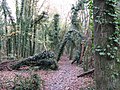
 Durfold Wood - geograph.org.uk - 1518795.jpg 640 × 480; 146 KB
-
 Durfold Wood - geograph.org.uk - 4060355.jpg 2,048 × 1,536; 1.14 MB
-
 Eagle gate pillars to Wephurst Park house - geograph.org.uk - 2117501.jpg 2,592 × 1,944; 2.19 MB
-
 East End Farm House - geograph.org.uk - 6018195.jpg 1,600 × 1,200; 406 KB
-
 East on Loxwood Road, Plaistow - geograph.org.uk - 2165805.jpg 2,592 × 1,944; 1.68 MB
-
 Electricity Sub Station - geograph.org.uk - 5849826.jpg 1,024 × 664; 154 KB
-
 Emu in the grounds of Quennells - geograph.org.uk - 2158601.jpg 2,592 × 1,944; 1.51 MB
-
-
 Entering Plaistow - geograph.org.uk - 2391797.jpg 640 × 480; 159 KB
-
 Entrance to 'Lakeside', near Gospel Green - geograph.org.uk - 2715067.jpg 1,600 × 1,059; 576 KB
-
 Entrance to Crouchland - geograph.org.uk - 1167109.jpg 640 × 480; 109 KB
-

-
 Fallow deer near Charleshurst Farm - geograph.org.uk - 2159930.jpg 2,592 × 1,944; 1.66 MB
-
 Farm entrance on Dunsfold Road, Plaistow - geograph.org.uk - 5874700.jpg 2,034 × 1,356; 2.27 MB
-
 Farm Lane - geograph.org.uk - 5849770.jpg 1,024 × 661; 142 KB
-
 Farm reservoir near Plaistow - geograph.org.uk - 2383822.jpg 800 × 600; 101 KB
-
 Farm road at Haymans Farm - geograph.org.uk - 2163040.jpg 2,592 × 1,944; 2.05 MB
-
 Fence panels on footpath leading to Hogwood Road - geograph.org.uk - 2160226.jpg 2,592 × 1,944; 2.05 MB
-

-
 Field and Ditch (Ha-Ha) at Firth Lodge - geograph.org.uk - 6017558.jpg 1,600 × 1,200; 769 KB
-
 Field and gateway near Plaistow - geograph.org.uk - 2383812.jpg 800 × 600; 150 KB
-
 Field and woodland near Plaistow - geograph.org.uk - 2383804.jpg 800 × 600; 78 KB
-
 Field gate on the West Sussex border - geograph.org.uk - 4581196.jpg 800 × 600; 231 KB
-
 Field with tractor by Ifold Copse - geograph.org.uk - 2226487.jpg 800 × 600; 182 KB
-
 Fields near Hardnip's Barn - geograph.org.uk - 2391683.jpg 640 × 480; 131 KB
-
 Fieldway to Rumbolds Farm - geograph.org.uk - 2384424.jpg 600 × 800; 78 KB
-
 Fiery trees - geograph.org.uk - 1184152.jpg 640 × 328; 67 KB
-
 Firth Lodge - geograph.org.uk - 6017497.jpg 1,024 × 768; 337 KB
-
 Footpath and stream on the edge of Kingspark Wood - geograph.org.uk - 2161837.jpg 2,592 × 1,944; 2.43 MB
-

-

-

-
 Footpath junction east of Dunsfold Road - geograph.org.uk - 2225646.jpg 800 × 600; 196 KB
-

-
 Footpath off Durfold Wood - geograph.org.uk - 4060353.jpg 2,048 × 1,536; 1.37 MB
-
 Footpath off Rickmans Lane - geograph.org.uk - 2226478.jpg 800 × 600; 210 KB
-
 Footpath Through Hog Wood - geograph.org.uk - 2594464.jpg 2,560 × 1,920; 1.45 MB
-

-
 Forestry Commission track in Ash Park - geograph.org.uk - 3489100.jpg 768 × 1,024; 303 KB
-
 Forestry in Wephurst Wood - geograph.org.uk - 2391542.jpg 640 × 480; 178 KB
-
 Forestry road in Ash Park - geograph.org.uk - 2161811.jpg 2,592 × 1,944; 2.24 MB
-
 Foxbridge Golf Club from the air - geograph.org.uk - 5151368.jpg 2,048 × 1,536; 811 KB
-
 Foxbridge golf course - geograph.org.uk - 2117246.jpg 2,592 × 1,944; 1.79 MB
-
 Frith Lodge - geograph.org.uk - 2971836.jpg 1,024 × 741; 246 KB
-
 Fruit Farm and Nursery - geograph.org.uk - 5849792.jpg 1,024 × 663; 146 KB
-
 Gate across the Wey South Path - geograph.org.uk - 2395181.jpg 640 × 430; 150 KB
-
 Giant Hogweed Lacecap - geograph.org.uk - 2594722.jpg 2,560 × 1,920; 2.42 MB
-
 Green Corner - geograph.org.uk - 5849890.jpg 1,600 × 1,076; 671 KB
-
 Harvest at Plaistow Place - geograph.org.uk - 2594315.jpg 2,560 × 1,920; 1.77 MB
-
 Haymans Farmhouse, Plaistow 01.jpg 4,000 × 3,000; 3.65 MB
-
 Haymans Farmhouse, Plaistow 02.jpg 4,000 × 3,000; 3.92 MB
-
 Hedgerow oak - geograph.org.uk - 2967237.jpg 640 × 480; 116 KB
-
 Highland cattle near Flitchings Farm - geograph.org.uk - 2159909.jpg 2,592 × 1,944; 1.84 MB
-

-
 Hog Copse next to Hog Wood - geograph.org.uk - 2160376.jpg 2,592 × 1,944; 2.33 MB
-
 Hog Wood from the air - geograph.org.uk - 5151537.jpg 1,399 × 924; 428 KB
-
 Hogwood - geograph.org.uk - 2594493.jpg 2,560 × 1,920; 1.61 MB
-
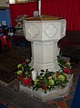
 Holy Trinity church, Plaistow - geograph.org.uk - 3908018.jpg 640 × 427; 92 KB
-

-
 Holy Trinity Plaistow, mid January 2014 - geograph.org.uk - 3817594.jpg 640 × 480; 104 KB
-
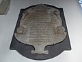
 Holy Trinity Plaistow, Roll of Honour - geograph.org.uk - 3817589.jpg 640 × 470; 106 KB
-
 House at Newhouse Farm - geograph.org.uk - 6017995.jpg 1,024 × 768; 265 KB
-
 House on Foxbridge Lane, Ifold - geograph.org.uk - 4601836.jpg 2,560 × 1,920; 1.99 MB
-
 House, Shillinglee Park - geograph.org.uk - 5542403.jpg 640 × 428; 109 KB
-
 Houses at Plaistow.JPG 3,264 × 2,448; 2.09 MB
-
 Ifold and Plaistow Scout Guide HQ - geograph.org.uk - 2160114.jpg 2,592 × 1,944; 2.18 MB
-
 Ifold Bridge Lane - geograph.org.uk - 2594603.jpg 2,560 × 1,920; 1.75 MB
-
 Ifold, The Ride - geograph.org.uk - 2594773.jpg 2,560 × 1,920; 1.61 MB
-
 Ifoldhurst from Plaistow Road - geograph.org.uk - 4598991.jpg 2,560 × 1,920; 2.09 MB
-
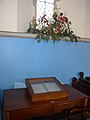
 Inside Holy Trinity Plaistow (10) - geograph.org.uk - 3817608.jpg 640 × 474; 53 KB
-
 Inside Holy Trinity Plaistow (11) - geograph.org.uk - 3817610.jpg 464 × 640; 43 KB
-
 Inside Holy Trinity Plaistow (12) - geograph.org.uk - 3817612.jpg 480 × 640; 73 KB
-
 Inside Holy Trinity Plaistow (2) - geograph.org.uk - 3817581.jpg 480 × 640; 49 KB
-
 Inside Holy Trinity Plaistow (3) - geograph.org.uk - 3817585.jpg 470 × 640; 58 KB
-
 Inside Holy Trinity Plaistow (4) - geograph.org.uk - 3817595.jpg 640 × 467; 44 KB
-
 Inside Holy Trinity Plaistow (5) - geograph.org.uk - 3817597.jpg 480 × 640; 26 KB
-
 Inside Holy Trinity Plaistow (6) - geograph.org.uk - 3817600.jpg 480 × 640; 65 KB
-
 Inside Holy Trinity Plaistow (7) - geograph.org.uk - 3817601.jpg 472 × 640; 60 KB
-
 Inside Holy Trinity Plaistow (8) - geograph.org.uk - 3817602.jpg 480 × 640; 55 KB
-
 Inside Holy Trinity Plaistow (9) - geograph.org.uk - 3817605.jpg 640 × 480; 42 KB
-
 Inside Holy Trinity, Plaistow (1) - geograph.org.uk - 3817575.jpg 480 × 640; 43 KB
-
 Ivy clad trees in Poundfield Wood - geograph.org.uk - 2160213.jpg 2,592 × 1,944; 2.5 MB
-

-
 Kelsey Hall in Ifold - geograph.org.uk - 2225673.jpg 800 × 526; 138 KB
-

-
 Landscaped garden on Rickmans Lane - geograph.org.uk - 2165768.jpg 2,592 × 1,944; 1.81 MB
-
 Lanes meet at the Corner - geograph.org.uk - 5849802.jpg 1,024 × 680; 167 KB
-
 Large silo - geograph.org.uk - 1167097.jpg 640 × 480; 78 KB
-

-
 Leafy Lane, Ifold Bridge Lane - geograph.org.uk - 2594596.jpg 2,560 × 1,920; 1.67 MB
-
 Leaving Wephurst Wood - geograph.org.uk - 5849894.jpg 1,024 × 671; 192 KB
-
 Llamas on guard at Quennells Farm - geograph.org.uk - 2158573.jpg 2,592 × 1,944; 1.3 MB
-
 Log cutting on the edge of Thirds Copse - geograph.org.uk - 2160528.jpg 2,592 × 1,944; 2.41 MB
-
 Log Pile at Wephurst Wood - geograph.org.uk - 5849877.jpg 1,600 × 1,070; 632 KB
-
 Logging in Wephurst Wood - geograph.org.uk - 2384520.jpg 800 × 600; 169 KB
-
 Looking along the West Sussex border - geograph.org.uk - 4581188.jpg 800 × 600; 179 KB
-
 Looking south along Plaistow Road - geograph.org.uk - 2250359.jpg 800 × 600; 82 KB
-
 Loxwood Road alpaca - geograph.org.uk - 2595379.jpg 2,560 × 1,920; 1.93 MB
-
 Loxwood Road entering Plaistow - geograph.org.uk - 2158568.jpg 2,592 × 1,944; 2.35 MB
-
 Loxwood Road Lay-by - geograph.org.uk - 2595362.jpg 2,560 × 1,920; 1.79 MB
-
 Loxwood Road west to Plaistow - geograph.org.uk - 2158558.jpg 2,592 × 1,944; 2.24 MB
-
 Loxwoodhills Pond - geograph.org.uk - 2594740.jpg 2,560 × 1,920; 1.77 MB
-
 Lyon's Farm - geograph.org.uk - 2225656.jpg 800 × 600; 194 KB
-
 Lyons Green Cottages on Shillinglee Road - geograph.org.uk - 2161682.jpg 2,592 × 1,944; 1.55 MB
-
 Manor Hill House Farm - geograph.org.uk - 6018079.jpg 1,600 × 1,200; 769 KB
-
 Milestone, Wey and Arun Canal - geograph.org.uk - 2396177.jpg 640 × 430; 122 KB
-
 Model cattle - geograph.org.uk - 1132692.jpg 640 × 360; 81 KB
-
 Muddy bridleway, Ifold Copse - geograph.org.uk - 5542312.jpg 428 × 640; 192 KB
-
 Muddy part of the Wey South Path - geograph.org.uk - 2396148.jpg 640 × 430; 117 KB
-
 Near Haymans Farm - geograph.org.uk - 1519739.jpg 640 × 480; 144 KB
-
 Nell Ball - geograph.org.uk - 2161621.jpg 2,592 × 1,944; 1.07 MB
-
 Nell Ball, Plaistow - geograph.org.uk - 5873202.jpg 2,034 × 1,356; 1.56 MB
-
 New irrigation reservoir - geograph.org.uk - 1569265.jpg 640 × 480; 78 KB
-
 New silo at Crouchland Farm - geograph.org.uk - 1568771.jpg 640 × 480; 100 KB
-
 New waymarker at corner of Wephurst Wood - geograph.org.uk - 1568531.jpg 640 × 480; 141 KB
-
 Nissen hut barn near Sparrwood Farm - geograph.org.uk - 5542301.jpg 640 × 428; 115 KB
-
 North Pound Cottages - geograph.org.uk - 6017985.jpg 1,024 × 768; 256 KB
-
 Nuthurst on Rickmans Lane - geograph.org.uk - 2226472.jpg 800 × 600; 187 KB
-
 Oak Lane - geograph.org.uk - 6018084.jpg 1,024 × 768; 333 KB
-
 Oakhurst - geograph.org.uk - 2594454.jpg 2,560 × 1,920; 1.98 MB


_at_Firth_Lodge_-_geograph.org.uk_-_6017558.jpg)


_-_geograph.org.uk_-_2384009.jpg)
_-_geograph.org.uk_-_2384059.jpg)


_-_geograph.org.uk_-_3817608.jpg)
_-_geograph.org.uk_-_3817610.jpg)
_-_geograph.org.uk_-_3817612.jpg)
_-_geograph.org.uk_-_3817581.jpg)
_-_geograph.org.uk_-_3817585.jpg)
_-_geograph.org.uk_-_3817595.jpg)
_-_geograph.org.uk_-_3817597.jpg)
_-_geograph.org.uk_-_3817600.jpg)
_-_geograph.org.uk_-_3817601.jpg)
_-_geograph.org.uk_-_3817602.jpg)
_-_geograph.org.uk_-_3817605.jpg)
_-_geograph.org.uk_-_3817575.jpg)


