Category:Platanenweg 29 (Bonn)
Jump to navigation
Jump to search
| Object location | | View all coordinates using: OpenStreetMap |
|---|
 | |||||
| Upload media | |||||
| Instance of | |||||
|---|---|---|---|---|---|
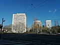
| Location | Beuel, Bonn, Cologne Government Region, North Rhine-Westphalia, Germany | ||||
| Street address |
| ||||
| Inception |
| ||||
| Height |
| ||||
 | |||||
Media in category "Platanenweg 29 (Bonn)"
The following 8 files are in this category, out of 8 total.
-
 2018-04-22-bonn-platanenweg-29-01.jpg 3,456 × 5,184; 7.78 MB
-
 2018-04-22-bonn-platanenweg-29-02.jpg 2,964 × 5,184; 8.37 MB
-
 2018-04-22-bonn-platanenweg-29-03.jpg 3,456 × 5,184; 9.79 MB
-
 Hochhaeuser am Platanenweg 31 maerz 2020.jpg 4,000 × 3,000; 3.51 MB
-
 Hochhaus am Platanenweg 29 12 januar 2021 2.jpg 3,000 × 4,000; 2.25 MB
-
 Hochhaus am Platanenweg 29 12 januar 2021.jpg 3,000 × 4,000; 1.83 MB
-
 Hochhaus am Platanenweg 29 31 Maerz 2020 02.jpg 2,448 × 3,264; 1.98 MB
-
 Hochhaus am Platanenweg 29 31 Maerz 2020.jpg 3,000 × 4,000; 3.67 MB


