Category:Plumstead, Norfolk
Jump to navigation
Jump to search
English: Plumstead is a village and a civil parish in the English county of Norfolk. The village is to the north west of the village. The nearest railway station is in the town of Sheringham where access to the national rail network can be made via the Bittern Line to Norwich. The nearest airport is Norwich International Airport. Plumstead falls within the area covered by North Norfolk District Council.
village and civil parish in North Norfolk, United Kingdom  | |||||
| Upload media | |||||
| Instance of | |||||
|---|---|---|---|---|---|
| Location | North Norfolk, Norfolk, East of England, England | ||||
| Area |
| ||||
 | |||||
Subcategories
This category has only the following subcategory.
M
Media in category "Plumstead, Norfolk"
The following 92 files are in this category, out of 92 total.
-
 A field of ripening barley - geograph.org.uk - 876113.jpg 640 × 444; 148 KB
-
 A modern house with a living roof - geograph.org.uk - 544882.jpg 480 × 640; 75 KB
-
 AA Milage Plaque, Church Street, Plumstead - geograph.org.uk - 5974668.jpg 1,600 × 1,064; 795 KB
-
-
 Approaching Plumstead Green - geograph.org.uk - 3664063.jpg 640 × 445; 176 KB
-
 Approaching Plumstead Green - geograph.org.uk - 543408.jpg 480 × 640; 100 KB
-

-
 Avenue to Barningham Hall - geograph.org.uk - 3938124.jpg 640 × 480; 67 KB
-
 Barns at Plumstead Hall Farm - geograph.org.uk - 5974761.jpg 1,600 × 1,061; 530 KB
-

-
 Building and old watertower - geograph.org.uk - 3938050.jpg 640 × 480; 60 KB
-
 Building and old watertower - geograph.org.uk - 3938052.jpg 640 × 480; 65 KB
-
 Cattle grazing on Plumstead Heath - geograph.org.uk - 3664052.jpg 640 × 480; 262 KB
-
 Cherry Tree House - geograph.org.uk - 544924.jpg 640 × 480; 88 KB
-
 Church Street, Plumstead - geograph.org.uk - 5974676.jpg 1,600 × 1,064; 541 KB
-
 East end of Northfield Lane - geograph.org.uk - 3938122.jpg 640 × 480; 62 KB
-

-
 Entrance to Site 3 - geograph.org.uk - 4191715.jpg 640 × 480; 217 KB
-
 Fields by Nuttery Plantation - geograph.org.uk - 3938147.jpg 640 × 480; 184 KB
-
 Fields by Plumstead Green - geograph.org.uk - 3664064.jpg 640 × 426; 136 KB
-
 Fields west of Plumstead Green - geograph.org.uk - 3664069.jpg 640 × 480; 197 KB
-
 Fingerpost on Northfield Lane - geograph.org.uk - 5974590.jpg 1,600 × 1,064; 806 KB
-
 Former telephone kiosk on Church Street, Plumstead - geograph.org.uk - 5974675.jpg 1,064 × 1,600; 1.06 MB
-

-

-
 Half a tree is better than no tree - geograph.org.uk - 3938080.jpg 640 × 480; 43 KB
-
 Hall Farm near Plumstead - geograph.org.uk - 544931.jpg 640 × 480; 75 KB
-
 Heading east towards Plumstead - geograph.org.uk - 544917.jpg 640 × 480; 94 KB
-
 Lane past Fir Plantation - geograph.org.uk - 3664071.jpg 640 × 480; 265 KB
-
 Lane past Gap Plantation - geograph.org.uk - 5610828.jpg 1,600 × 1,200; 252 KB
-
 Lane past Green Farm - geograph.org.uk - 3938200.jpg 640 × 433; 219 KB
-
 Lane to Plumstead Green - geograph.org.uk - 3664058.jpg 480 × 640; 259 KB
-

-
 Mill Lane, Plumstead Green - geograph.org.uk - 3664060.jpg 640 × 437; 177 KB
-
 Northfield Lane turnoff with fingerpost and footpath - geograph.org.uk - 5592604.jpg 3,456 × 2,592; 3.8 MB
-

-
 Oilseed rapr crop fields by Heath Farm - geograph.org.uk - 3938118.jpg 640 × 440; 140 KB
-
 Ordnance Survey Cut Mark - geograph.org.uk - 4561377.jpg 4,000 × 3,000; 4.44 MB
-
 Path skirting Plumstead Heath - geograph.org.uk - 3664053.jpg 640 × 428; 230 KB
-
 Path to Barningham Green - geograph.org.uk - 3664055.jpg 640 × 480; 255 KB
-
 Path to Barningham Green - geograph.org.uk - 3664057.jpg 640 × 480; 269 KB
-
 Plumstead church across the fields - geograph.org.uk - 3938092.jpg 636 × 480; 45 KB
-
 Plumstead Green - geograph.org.uk - 3938403.jpg 640 × 480; 58 KB
-
 Plumstead Green Road by Mill Lane - geograph.org.uk - 3664059.jpg 640 × 480; 210 KB
-
 Plumstead Hall Farm - the farmhouse - geograph.org.uk - 3938128.jpg 611 × 640; 270 KB
-

-
 Plumstead WW1 Memorial - geograph.org.uk - 4600956.jpg 2,592 × 3,456; 2.8 MB
-
 Plumstead WW2 Memorial - geograph.org.uk - 4600958.jpg 2,592 × 3,456; 2.88 MB
-
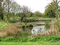 Pond in Plumstead Green - geograph.org.uk - 3938196.jpg 640 × 480; 225 KB
-
 Primroses and Plumstead Hall Farm - geograph.org.uk - 3938085.jpg 640 × 480; 88 KB
-

-

-
 Public footpath to Church Street - geograph.org.uk - 545792.jpg 480 × 640; 63 KB
-

-
 Ruined building in Plumstead Green - geograph.org.uk - 3664065.jpg 640 × 480; 173 KB
-
 Ruins and rubble - geograph.org.uk - 876135.jpg 480 × 640; 161 KB
-
 Sheds and barn by Plumstead Hall Farm - geograph.org.uk - 3938126.jpg 640 × 480; 179 KB
-

-
 St Michael's Church, Plumstead - geograph.org.uk - 5974671.jpg 1,600 × 1,064; 869 KB
-
 St Michael's Church, Plumstead - geograph.org.uk - 5974680.jpg 1,600 × 1,064; 1.4 MB
-
 St Michael's Church, Plumstead - geograph.org.uk - 5974681.jpg 1,064 × 1,600; 354 KB
-
 St Michael's Church, Plumstead - geograph.org.uk - 5974686.jpg 1,009 × 1,519; 707 KB
-
 St Michael's Church, Plumstead - geograph.org.uk - 5974687.jpg 1,064 × 1,600; 444 KB
-
 St Michael's Church, Plumstead - geograph.org.uk - 5974690.jpg 619 × 1,600; 414 KB
-
 St Michael's Church, Plumstead - geograph.org.uk - 5974692.jpg 844 × 1,600; 525 KB
-
 St Michael's Church, Plumstead - geograph.org.uk - 5974757.jpg 1,064 × 1,600; 355 KB
-
 Straw bales by Range Farm - geograph.org.uk - 3664046.jpg 640 × 480; 175 KB
-

-
 The Church of St Michael at Plumstead - geograph.org.uk - 4561379.jpg 4,000 × 3,000; 3.22 MB
-
 The track beside Old Wood - geograph.org.uk - 270682.jpg 480 × 640; 208 KB
-
 This way to Matlaske - geograph.org.uk - 3938198.jpg 640 × 508; 244 KB
-
 Track into Little Wood - geograph.org.uk - 3664045.jpg 640 × 480; 297 KB
-
 Track to Birch Hole Plantation - geograph.org.uk - 3664049.jpg 640 × 480; 195 KB
-
 View along Plumstead Road - geograph.org.uk - 4190915.jpg 640 × 480; 192 KB
-
 View north on Plumstead Road - geograph.org.uk - 544930.jpg 640 × 480; 60 KB
-

-

-

-

-
 View towards Field Plantation - geograph.org.uk - 3938145.jpg 640 × 480; 143 KB
-
 View west on Northfield Lane - geograph.org.uk - 545774.jpg 640 × 480; 90 KB
-
 West on Plumstead Road past Mill Farm - geograph.org.uk - 544947.jpg 640 × 480; 73 KB
-
 WW2 building (interior) - geograph.org.uk - 4191741.jpg 640 × 530; 226 KB
-
 WW2 building (interior) on Site 3 - geograph.org.uk - 4191738.jpg 640 × 565; 179 KB
-
 WW2 building - geograph.org.uk - 4191729.jpg 640 × 480; 249 KB
-
 WW2 building - geograph.org.uk - 4191732.jpg 640 × 480; 316 KB
-
 WW2 building - geograph.org.uk - 4191735.jpg 640 × 480; 304 KB
-
 WW2 building on Site 3 - geograph.org.uk - 4191721.jpg 640 × 480; 295 KB
-
 WW2 building on Site 3 - geograph.org.uk - 4191725.jpg 640 × 480; 272 KB
-
 WW2 building on Site 3 - geograph.org.uk - 4191726.jpg 640 × 480; 327 KB
-
 Big Norfolk sky - geograph.org.uk - 783353.jpg 640 × 480; 175 KB
-
 The Old Smithy - geograph.org.uk - 291448.jpg 640 × 480; 61 KB


_-_geograph.org.uk_-_4191741.jpg)
_on_Site_3_-_geograph.org.uk_-_4191738.jpg)


