Category:Plytenberg
Jump to navigation
Jump to search
| Object location | | View all coordinates using: OpenStreetMap |
|---|
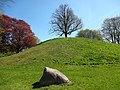
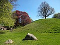
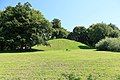
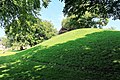
archaeological site in Leer, Germany  | |||||
| Upload media | |||||
| Instance of | |||||
|---|---|---|---|---|---|
| Location | Leer, Lower Saxony, Germany | ||||
| Heritage designation | |||||
 | |||||
Subcategories
This category has the following 2 subcategories, out of 2 total.
F
- Findling am Plytenberg (16 F)
V
- Views from Plytenberg (4 F)
Media in category "Plytenberg"
The following 27 files are in this category, out of 27 total.
-
 Findling am Plytenberg 2019-04-21 -1.jpg 4,896 × 3,672; 6.8 MB
-
 Findling am Plytenberg 2019-04-21 -6.jpg 4,896 × 3,672; 7.38 MB
-
 Findling am Plytenberg 2019-04-21 -7.jpg 4,896 × 3,672; 7.34 MB
-
 Leer - Plytenbergstraße + Plytenberg 01 ies.jpg 5,616 × 3,744; 28.04 MB
-
 Leer - Plytenbergstraße + Plytenberg 02 ies.jpg 5,616 × 3,744; 27.91 MB
-
 Leer - Plytenbergstraße - Plytenberg + Findling 01 ies.jpg 5,616 × 3,744; 24.56 MB
-
 Leer - Plytenbergstraße - Plytenberg + Findling 02 ies.jpg 5,616 × 3,744; 36.83 MB
-
 Leer - Plytenbergstraße - Plytenberg 01 ies.jpg 5,616 × 3,744; 28.49 MB
-
 Leer - Plytenbergstraße - Plytenberg 02 ies.jpg 3,744 × 5,616; 25.97 MB
-
 Leer - Plytenbergstraße - Plytenberg 03 ies.jpg 5,616 × 3,744; 29.96 MB
-
 Leer - Plytenbergstraße - Plytenberg 04 ies.jpg 5,616 × 3,744; 25.4 MB
-
 Leer - Plytenbergstraße - Plytenberg 05 ies.jpg 5,616 × 3,744; 23.08 MB
-
 Leer - Plytenbergstraße - Plytenberg 06 ies.jpg 3,744 × 5,616; 25.62 MB
-
 Leer - Plytenbergstraße - Plytenberg 07 ies.jpg 8,138 × 3,637; 32.44 MB
-
 Leer - Plytenbergstraße - Plytenberg 08 ies.jpg 5,616 × 3,744; 29.3 MB
-
 Leer - Plytenbergstraße - Plytenberg 09 ies.jpg 5,616 × 3,744; 25.08 MB
-
 Leer - Plytenbergstraße - Plytenberg 10 ies.jpg 5,616 × 3,744; 25.07 MB
-
 Leer - Plytenbergstraße - Plytenberg 11 ies.jpg 3,744 × 5,616; 27.45 MB
-
 Leer - Plytenbergstraße - Plytenberg 12 ies.jpg 5,616 × 3,744; 27.75 MB
-
 Leer - Plytenbergstraße - Plytenberg 13 ies.jpg 5,616 × 3,744; 30.13 MB
-
 Leer - Plytenbergstraße - Plytenberg 14 ies.jpg 5,616 × 3,744; 30.38 MB
-
 Leer - Plytenbergstraße - Plytenberg 15 ies.jpg 5,616 × 3,744; 21.82 MB
-
 Leer - Plytenbergstraße - Plytenberg 16 ies.jpg 5,616 × 3,744; 25.16 MB
-
 Leer Plytenberg.JPG 3,456 × 2,592; 3.9 MB
-
 Linde auf dem Plytenberg in Leer Ostfriesland ND-LER 001.jpg 1,920 × 2,560; 1.34 MB
-
 ND-LER 001 Plytenberg mit 1 Linde in Leer.jpg 5,184 × 3,888; 6.97 MB
-
 Plytenberg.jpg 744 × 519; 342 KB


