Category:Polk County, Oregon
Sari la navigare
Sari la căutare
Counties of Oregon: Baker · Benton · Clackamas · Clatsop · Columbia · Coos · Crook · Curry · Deschutes · Douglas · Gilliam · Grant · Harney · Hood River · Jackson · Jefferson · Josephine · Klamath · Lake · Lane · Lincoln · Linn · Malheur · Marion · Morrow · Multnomah · Polk · Sherman · Tillamook · Umatilla · Union · Wallowa · Wasco · Washington · Wheeler · Yamhill
comitat din Statele Unite ale Americii   | |||||
| Încarcă multimedia | |||||
| Este un/o | |||||
|---|---|---|---|---|---|
| Numit(ă) după | |||||
| Locul actual | Oregon, SUA | ||||
| Capitală | |||||
| Înființare |
| ||||
| Populație |
| ||||
| Suprafață |
| ||||
| Diferit(ă) de | |||||
| site oficial | |||||
 | |||||
Subcategorii
Această categorie conține următoarele 22 de subcategorii, dintr-un total de 22.
B
- Baskett Slough National Wildlife Refuge (1 P, 24 F)
- Buena Vista Ferry (5 F)
C
D
F
G
- Grand Ronde, Oregon (11 F)
H
I
M
P
- Perrydale, Oregon (15 F)
- Postcards of Polk County, Oregon (10 F)
R
S
- Scenic images of Polk County, Oregon (108 F)
W
- Willamina, Oregon (33 F)
Fișiere media din categoria „Polk County, Oregon”
Următoarele 81 fișiere se află în această categorie, dintr-un total de 81.
-
 22 - panoramio (3).jpg 2.592x1.936; 1,69 MB
-
 7S5 Hangars.JPG 3.872x2.592; 4,23 MB
-
 7S5 Ramp.JPG 3.872x2.592; 3,59 MB
-
 And finally, the sun comes out (34350833621).jpg 2.048x1.226; 2,59 MB
-
 Ballston Oregon grain tower.JPG 2.830x2.173; 2,06 MB
-
 Barn and field - Ellendale Oregon.jpg 4.752x3.168; 5,56 MB
-
 Barn in Polk County Oregon.JPG 3.243x2.074; 2,41 MB
-
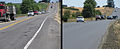 Before and after paving on OR22 (3808774559).jpg 720x294; 219 KB
-
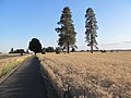 Bike path in Willamette Valley north of Monmouth, Oregon (6111718532).jpg 1.824x1.368; 643 KB
-
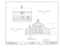
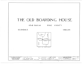 Boarding House, Ellendale, Polk County, OR HABS ORE,27-DAL.V,1- (sheet 0 of 7).png 9.312x7.584; 1,23 MB
-
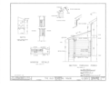
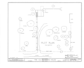 Boarding House, Ellendale, Polk County, OR HABS ORE,27-DAL.V,1- (sheet 1 of 7).png 9.308x7.584; 1,43 MB
-
 Boarding House, Ellendale, Polk County, OR HABS ORE,27-DAL.V,1- (sheet 2 of 7).png 9.312x7.584; 1,45 MB
-
 Boarding House, Ellendale, Polk County, OR HABS ORE,27-DAL.V,1- (sheet 3 of 7).png 9.316x7.584; 1,39 MB
-
 Boarding House, Ellendale, Polk County, OR HABS ORE,27-DAL.V,1- (sheet 4 of 7).png 9.312x7.584; 1,78 MB
-
 Boarding House, Ellendale, Polk County, OR HABS ORE,27-DAL.V,1- (sheet 5 of 7).png 9.312x7.584; 1,75 MB
-
 Boarding House, Ellendale, Polk County, OR HABS ORE,27-DAL.V,1- (sheet 6 of 7).png 9.304x7.584; 1,71 MB
-
 Boarding House, Ellendale, Polk County, OR HABS ORE,27-DAL.V,1- (sheet 7 of 7).png 9.312x7.584; 1,69 MB
-
 Bridge over Luckiamute River.JPG 2.592x3.872; 3,65 MB
-
 Buena Vista Park.JPG 3.872x2.592; 4,66 MB
-
 Flood plain report- Polk County, Oregon (IA CAT75658187).pdf 1.285 × 1.643, 18 pagini; 1,1 MB
-
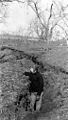
 Coyote (8413530832).jpg 1.600x1.200; 812 KB
-
 EolaSchool.JPG 2.048x1.536; 730 KB
-
 Field rainbow (14629214377).jpg 3.683x1.780; 8,11 MB
-
 Fish6555 - Flickr - NOAA Photo Library.jpg 3.892x2.652; 6,78 MB
-

-

-

-

-

-

-

-

-
 Harvesting hops near Independence, Oregon.jpg 4.256x2.676; 1,35 MB
-
-

-
 JanMichaelLookingWolf.jpg 581x800; 57 KB
-
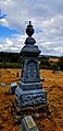
 Joel Redon Gravestone at Zena, Oregon.JPG 1.600x1.200; 826 KB
-
 Lightning 02 (14721613997).jpg 1.200x839; 429 KB
-
 Lightning 03 (14885181366).jpg 1.200x800; 378 KB
-
 Line of lavender along Highway 99 west south of Monmouth, Oregon (6111174517).jpg 1.824x1.368; 1,12 MB
-
 Little Luckiamute River in 2010.jpg 5.616x3.744; 18,28 MB
-
 Lone tree near Perrydale Oregon.JPG 3.872x1.369; 1,48 MB
-
 Luckiamute River at Helmick.JPG 3.872x2.276; 3,35 MB
-
 Luckiamute Valley Charter School - Bridgeport Oregon.jpg 3.909x2.179; 3,12 MB
-
 Mostly silhouette (14629229297).jpg 3.976x2.658; 8,18 MB
-
 Oregon 22 at 223.jpg 2.048x1.536; 553 KB
-
 Oregon 22 at 99W.jpg 1.024x768; 147 KB
-
 Political orientations in Polk County, Oregon (2009).gif 388x288; 5 KB
-
 Polk County Hills.png 2.998x1.867; 3,37 MB
-
 Polk County, 12 Gold Medal Jersey cows, ca. 1937 (5710802777).jpg 1.000x555; 119 KB
-
 Polk County, Man Power Shortage, ca. 1942 (5710803093).jpg 1.000x687; 138 KB
-
 Rickreall Creek at OR 99.JPG 2.048x1.536; 1,58 MB
-
 Rogue river (south yamhill river).jpg 4.288x2.848; 10,07 MB
-
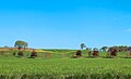 Rural (34196353443).jpg 2.048x1.250; 2,39 MB
-
 Soil Erosion, Polk County (5711362226).jpg 569x1.000; 156 KB
-
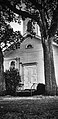
 Spring Valley Presbyterian Church 01.jpg 1.960x4.032; 3,19 MB
-
 Spring Valley Presbyterian Church 02.jpg 1.960x4.032; 2,66 MB
-
 Spring Valley Presbyterian Church 03.jpg 4.032x1.960; 1,57 MB
-
 Spring Valley Presbyterian Church 04.jpg 4.032x1.960; 1,74 MB
-
 Spring Valley Presbyterian Church 06.jpg 1.960x4.032; 2,3 MB
-
 Spring Valley Presbyterian Church 07.jpg 1.960x4.032; 1,83 MB
-
 Spring Valley Presbyterian Church 08.jpg 4.032x1.960; 2,42 MB
-
 Spring Valley Presbyterian Church 09.jpg 4.032x1.960; 3,59 MB
-
 Spring Valley Presbyterian Church 10.jpg 1.960x4.032; 2,88 MB
-
 Spring Valley Presbyterian Church 11.jpg 1.960x4.032; 1,36 MB
-
 Spring Valley Presbyterian Church 12.jpg 1.960x4.032; 1,31 MB
-
 Spring Valley Presbyterian Church 13.jpg 1.960x4.032; 2,58 MB
-
 Support our troops independence oregon.JPG 1.536x2.048; 1,37 MB
-
 Support our troops independence oregon2.JPG 2.048x1.536; 1,29 MB
-
 The side of a barn (24052376366).jpg 4.276x2.850; 9,18 MB
-
 There is no blue without yellow (21858084554).jpg 3.264x5.495; 8,85 MB
-
 Tom Murphy shooting Lavender Eyes.JPG 3.264x2.448; 3,32 MB
-
 USA Polk, Oregon age pyramid.svg 520x600; 7 KB
-
-
 Valley and Siletz Railroad.jpg 640x355; 85 KB
-
 Valsetz, Oregon May 10 2009.jpg 1.600x1.071; 349 KB
-
 Water covers OR 153 (50835674546).jpg 4.815x3.210; 2,49 MB
-
 Windmill and farm (8695329504).jpg 1.911x3.144; 9,61 MB
-
 Wvatbethel1.jpg 3.872x2.592; 1,39 MB
-
 Wvatbethel2.jpg 3.872x2.592; 2,08 MB
-
 Young Christmas trees in Polk County Oregon.JPG 3.872x2.592; 3,85 MB
.jpg)


.jpg)


.jpg)
.png)
.png)
.png)
.png)
.png)
.png)
.png)
.png)


.jpg)

.jpg)


.jpg)
.jpg)
.jpg)


.jpg)


.gif)

.jpg)
.jpg)

.jpg)
.jpg)
.jpg)


.jpg)
.jpg)


.jpg)


.jpg)
.jpg)


.jpg)