Category:Polstraat 14, Deventer
Jump to navigation
Jump to search
| Object location | | View all coordinates using: OpenStreetMap |
|---|
house in Deventer, Netherlands  | |||||
| Upload media | |||||
| Instance of | |||||
|---|---|---|---|---|---|
| Location | Deventer, Overijssel, Netherlands | ||||
| Street address |
| ||||
| Located on street | |||||
| Heritage designation |
| ||||
 | |||||
Polstraat 14
|
This is a category about rijksmonument number 12754
|
Polstraat 14a
|
This is a category about rijksmonument number 12755
|
| Address |
|
Media in category "Polstraat 14, Deventer"
The following 7 files are in this category, out of 7 total.
-
 Exterieur INGANGSPARTIJ, TEKST IN MARMER - Deventer - 20277135 - RCE.jpg 1,200 × 1,195; 243 KB
-
 Exterieur OVERZICHT VOORGEVELS - Deventer - 20277848 - RCE.jpg 965 × 1,200; 230 KB
-
 Gevel - Deventer - 20056423 - RCE.jpg 802 × 1,200; 160 KB
-
 Gevel - Deventer - 20056426 - RCE.jpg 803 × 1,200; 152 KB
-
 Ingang - Deventer - 20056425 - RCE.jpg 958 × 1,200; 155 KB
-
 Polstraat 14 tekst.JPG 3,072 × 2,304; 3.27 MB
-
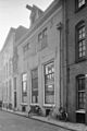
 Polstraat 14-14a.JPG 3,072 × 2,304; 3.52 MB


