Category:Polstraat 24, Deventer
Jump to navigation
Jump to search
| Object location | | View all coordinates using: OpenStreetMap |
|---|
house in Deventer, Netherlands  | |||||
| Upload media | |||||
| Instance of | |||||
|---|---|---|---|---|---|
| Location | Deventer, Overijssel, Netherlands | ||||
| Street address |
| ||||
| Heritage designation | |||||
 | |||||
|
This is a category about rijksmonument number 12761
|
| Address |
|
Media in category "Polstraat 24, Deventer"
The following 10 files are in this category, out of 10 total.
-
 Achtergevel - Deventer - 20056445 - RCE.jpg 1,195 × 1,200; 393 KB
-
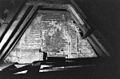
 Dwarsmuur op zolder voorzijde - Deventer - 20056448 - RCE.jpg 1,200 × 788; 205 KB
-
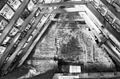
 Dwarsmuur op zolder voorzijde - Deventer - 20353779 - RCE.jpg 1,200 × 788; 239 KB
-
 Dwarsmuur op zolder voorzijde, aan achterzijde - Deventer - 20353778 - RCE.jpg 1,200 × 788; 263 KB
-
 Dwarsmuur op zolder, achterzijde - Deventer - 20056447 - RCE.jpg 1,200 × 788; 203 KB
-
 Gevels - Deventer - 20056446 - RCE.jpg 801 × 1,200; 160 KB
-
 Overzicht - Deventer - 20056442 - RCE.jpg 1,185 × 1,200; 282 KB
-
 Polstraat 24.JPG 2,304 × 3,072; 3.71 MB
-
 Voorgevel - Deventer - 20056443 - RCE.jpg 1,192 × 1,200; 257 KB
-
 Voorgevel - Deventer - 20056444 - RCE.jpg 1,192 × 1,200; 265 KB


