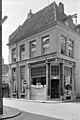
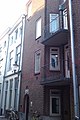
Category:Polstraat 55, Deventer
Jump to navigation
Jump to search
| Object location | | View all coordinates using: OpenStreetMap |
|---|
 | |||||
| Upload media | |||||
| Instance of |
| ||||
|---|---|---|---|---|---|
| Location | Deventer, Overijssel, Netherlands | ||||
| Street address |
| ||||
| Located on street | |||||
| Heritage designation |
| ||||
 | |||||
|
This is a category about rijksmonument number 12751
|
| Address |
|
Media in category "Polstraat 55, Deventer"
The following 8 files are in this category, out of 8 total.
-
 Aanzicht - Deventer - 20056478 - RCE.jpg 802 × 1,200; 189 KB
-
 Nissen - Deventer - 20056475 - RCE.jpg 1,200 × 799; 201 KB
-
 Nissen - Deventer - 20056476 - RCE.jpg 1,200 × 798; 240 KB
-
 Nissen - Deventer - 20056477 - RCE.jpg 1,200 × 796; 196 KB
-
 Polstraat 55 Deventer.jpg 1,712 × 2,560; 1.23 MB
-
 Zijtopgevel, console, nis - Deventer - 20056472 - RCE.jpg 1,200 × 800; 238 KB
-
 Zijtopgevel, console, nis - Deventer - 20056473 - RCE.jpg 801 × 1,200; 232 KB
-
 Zijtopgevel, console, nis - Deventer - 20056474 - RCE.jpg 806 × 1,200; 227 KB


