Category:Pomp Complex Akkerstraat (Vught)
Jump to navigation
Jump to search
| Object location | | View all coordinates using: OpenStreetMap |
|---|
 | |||||
| Upload media | |||||
| Instance of | |||||
|---|---|---|---|---|---|
| Part of | |||||
| Location | Vught, North Brabant, Netherlands | ||||
| Street address |
| ||||
| Heritage designation |
| ||||
 | |||||
|
This is a category about rijksmonument number 521285
|
| Address |
|
Media in category "Pomp Complex Akkerstraat (Vught)"
The following 8 files are in this category, out of 8 total.
-
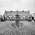
 Exterieur OVERZICHT - Vught - 20286171 - RCE.jpg 1,193 × 1,200; 350 KB
-
 Exterieur OVERZICHT - Vught - 20286172 - RCE.jpg 1,188 × 1,200; 343 KB
-
 Hoogstraat 1-Vught.JPG 3,008 × 2,000; 1.42 MB
-
 Hoogstraat pomp-Vught.JPG 2,000 × 3,008; 2.1 MB
-
 Overzicht - Vught - 20341225 - RCE.jpg 1,195 × 1,200; 245 KB
-
 Overzicht met gazon, pomp en geveldecoratie - Vught - 20341231 - RCE.jpg 1,189 × 1,200; 299 KB
-
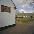
 Overzicht met geveldecoratie - Vught - 20341228 - RCE.jpg 1,192 × 1,200; 276 KB
-
 Pomp op gazon voor Hoogstraat 1-23 - Vught - 20341252 - RCE.jpg 1,197 × 1,200; 425 KB


