Category:Portsmouth
Jump to navigation
Jump to search
city in Hampshire, England    | |||||
| Upload media | |||||
| Instance of | |||||
|---|---|---|---|---|---|
| Patron saint | |||||
| Location | City of Portsmouth, Hampshire, South East England, Inglaterra | ||||
| Significant event |
| ||||
| Population |
| ||||
| Area |
| ||||
| official website | |||||
 | |||||

Mga ubos-nga-kaarangay
Ini nga kaarangay mayda han mga nasunod nga 29 nga mga ubos-nga-kaarangay, tikang hin 29 nga kabug-osan.
*
- Quality images of Portsmouth (67 F)
A
- Aerial photographs of Portsmouth (39 F)
C
E
F
G
H
I
M
N
P
- Panoramics of Portsmouth (15 F)
- Playgrounds in Portsmouth (18 F)
S
- Skylines of Portsmouth (36 F)
- Sunsets of Portsmouth (30 F)
T
V
Mga pakli ha kaarangay nga "Portsmouth"
Ini nga kaarangay mayda han amo la nga nasunod nga pakli.
Media ha kaarangay nga "Portsmouth"
An mga nasunod nga 200 ka mga fayl aada han hini nga kaarangay, tikang hin 404 nga kabug-osan.
(nahiuna nga pakli) (masunod nga pakli)-
 20mph zone, Fratton - geograph.org.uk - 6443060.jpg 1,024 × 681; 129 nga KB
-
 A2030 - geograph.org.uk - 6516652.jpg 1,024 × 681; 132 nga KB
-
 A27 - geograph.org.uk - 6512405.jpg 1,024 × 681; 169 nga KB
-
 Andrew Bell St - geograph.org.uk - 6047314.jpg 1,024 × 681; 182 nga KB
-
 Aylen Rd - geograph.org.uk - 6467878.jpg 1,024 × 681; 110 nga KB
-
 Balcony view overlooking Watts Road - geograph.org.uk - 5165906.jpg 640 × 427; 63 nga KB
-
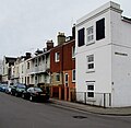
 Bishop Chrispian Way, Portsmouth - geograph.org.uk - 6121515.jpg 2,560 × 1,920; 2.03 nga MB
-
 Brewhouse ^ Kitchen - geograph.org.uk - 6522448.jpg 1,024 × 681; 169 nga KB
-
 Church hall at the western end of Queens Road - geograph.org.uk - 1996356.jpg 480 × 640; 85 nga KB
-
 City of Portsmouth , The A27 - geograph.org.uk - 5738952.jpg 6,000 × 4,000; 7.15 nga MB
-
 Claremont Rd - geograph.org.uk - 6047342.jpg 1,024 × 681; 130 nga KB
-
 Clarence St - geograph.org.uk - 6047311.jpg 1,024 × 681; 182 nga KB
-
 Coach waiting by York Place - geograph.org.uk - 897343.jpg 640 × 480; 109 nga KB
-
 Consort House in Princes Street - geograph.org.uk - 2278267.jpg 480 × 640; 70 nga KB
-
 Corner of Kingston Road and New Road - geograph.org.uk - 5165874.jpg 640 × 427; 63 nga KB
-
 Corner shop at Church Road and Lords Street - geograph.org.uk - 5165896.jpg 640 × 427; 73 nga KB
-
 Corpus Christi Presbytery - geograph.org.uk - 723136.jpg 640 × 480; 54 nga KB
-
 Council Offices - geograph.org.uk - 6522470.jpg 1,024 × 681; 129 nga KB
-
 Crane in Exchange Street - geograph.org.uk - 3821361.jpg 480 × 640; 54 nga KB
-
 Crane silhouetted against an angry sky - geograph.org.uk - 720085.jpg 640 × 480; 43 nga KB
-
 Crazy Kaves - geograph.org.uk - 6463383.jpg 1,024 × 681; 106 nga KB
-
 Curious structure at St Mary's - geograph.org.uk - 692860.jpg 480 × 640; 130 nga KB
-
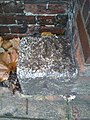
 Cut Mark, Portsmouth, Tide Gauge Aux 3 - geograph.org.uk - 3586762.jpg 518 × 640; 78 nga KB
-
 Cut through to Hanway Rd - geograph.org.uk - 6446807.jpg 1,024 × 681; 135 nga KB
-
 Daisy Row behind Balliol and Kingston Roads - geograph.org.uk - 876458.jpg 640 × 480; 55 nga KB
-
 Dead end at Veolia - geograph.org.uk - 858449.jpg 640 × 480; 58 nga KB
-
 Dead end in Shore Avenue - geograph.org.uk - 1071599.jpg 640 × 480; 63 nga KB
-
 Derelict office block with reflections - geograph.org.uk - 4512686.jpg 1,280 × 960; 152 nga KB
-
 Devon Rd - geograph.org.uk - 6467880.jpg 1,024 × 681; 123 nga KB
-
 Discarded nitrous oxide canisters.jpg 3,456 × 4,608; 7.34 nga MB
-
 Dombey Court in Victoria Street - geograph.org.uk - 2278244.jpg 640 × 480; 69 nga KB
-
 Empty washing lines in Yorke Street - geograph.org.uk - 1940355.jpg 640 × 480; 97 nga KB
-
En-uk-Portsmouth.ogg 2.0 s; 13 nga KB
-
 Flats in Broom Square - geograph.org.uk - 1071464.jpg 640 × 480; 62 nga KB
-
 Flats in St Paul's Square - geograph.org.uk - 1940389.jpg 640 × 480; 77 nga KB
-
 Flats in Victoria Street - geograph.org.uk - 2278233.jpg 640 × 480; 60 nga KB
-
 Flats on Fratton Rd - geograph.org.uk - 6446782.jpg 1,024 × 681; 175 nga KB
-
 Flats, Buckingham Green - geograph.org.uk - 5057137.jpg 640 × 480; 94 nga KB
-
 Flats, Turners Rd - geograph.org.uk - 6446776.jpg 1,024 × 681; 160 nga KB
-
 Former car park - geograph.org.uk - 3610281.jpg 640 × 480; 108 nga KB
-
 Former chapel in Rosebery Avenue - geograph.org.uk - 714980.jpg 640 × 480; 54 nga KB
-
 Francis Avenue - geograph.org.uk - 6443097.jpg 1,024 × 681; 138 nga KB
-
 Friendly feline near Maidford Crescent - geograph.org.uk - 855004.jpg 480 × 640; 84 nga KB
-
 Furze Lane - geograph.org.uk - 4432531.jpg 640 × 426; 51 nga KB
-
 Furze Lane - geograph.org.uk - 6450861.jpg 1,024 × 681; 132 nga KB
-
 Gantry over the A27 - geograph.org.uk - 3673911.jpg 640 × 430; 52 nga KB
-
 Garage in Queens Road - geograph.org.uk - 1996323.jpg 640 × 480; 60 nga KB
-
 Garage in St Paul's Square - geograph.org.uk - 1940408.jpg 640 × 480; 57 nga KB
-
 Garage, Rodney Road.jpg 4,608 × 3,456; 4.82 nga MB
-
 Garfield Road in mid February - geograph.org.uk - 2280395.jpg 640 × 427; 59 nga KB
-
 Gas installation, Dickinson Road, Portsmouth - geograph.org.uk - 5303044.jpg 800 × 658; 104 nga KB
-
 Gatcombe Avenue - geograph.org.uk - 6467876.jpg 1,024 × 681; 103 nga KB
-
 Godwit Rd - geograph.org.uk - 4432209.jpg 640 × 426; 59 nga KB
-
 Goldsmith Avenue - geograph.org.uk - 6472768.jpg 1,024 × 681; 139 nga KB
-
 Goldsmith Avenue - geograph.org.uk - 6478160.jpg 1,024 × 681; 179 nga KB
-

-
 Grosvenor Casino - geograph.org.uk - 6487923.jpg 630 × 1,024; 120 nga KB
-
 Guildhall ^ War Memorial, Portsmouth - geograph.org.uk - 6522494.jpg 1,024 × 681; 137 nga KB
-
 Gunwharf Quays - entrance lodge (former) - geograph.org.uk - 6478226.jpg 681 × 1,024; 106 nga KB
-
 Gunwharf Quays - geograph.org.uk - 6482946.jpg 1,024 × 681; 126 nga KB
-
 Gunwharf Quays - geograph.org.uk - 6483030.jpg 1,024 × 681; 86 nga KB
-
 Hanway Rd - geograph.org.uk - 6446784.jpg 1,024 × 681; 127 nga KB
-
 Harbourside Park, Baffins, Portsmouth - geograph.org.uk - 2044447.jpg 640 × 480; 81 nga KB
-
 Heidelberg Road, Portsmouth - geograph.org.uk - 5304889.jpg 800 × 633; 123 nga KB
-
 Holiday Inn, Gunwharf Quays - geograph.org.uk - 6478228.jpg 681 × 1,024; 104 nga KB
-
 Hope Street beside HMS Nelson - geograph.org.uk - 3696949.jpg 2,973 × 2,118; 1.1 nga MB
-
 Horse riders and kite surfers on East Winner sandbank, off Hayling Island - geograph.org.uk - 6484078.jpg 3,072 × 2,304; 1.25 nga MB
-
 Houses in Agincourt Road - geograph.org.uk - 2654874.jpg 640 × 480; 68 nga KB
-
 Houses in Malins Road - geograph.org.uk - 2278285.jpg 480 × 640; 68 nga KB
-
 Houses in Mayhall Road - geograph.org.uk - 1992077.jpg 640 × 480; 70 nga KB
-
 Houses in Portchester Road - geograph.org.uk - 1996294.jpg 640 × 480; 58 nga KB
-
 Houses in Queens Road - geograph.org.uk - 1996327.jpg 640 × 480; 73 nga KB
-
 Houses in Telephone Road - geograph.org.uk - 2395421.jpg 640 × 480; 66 nga KB
-
 Housing estate south of Sultan Road - geograph.org.uk - 5165915.jpg 640 × 427; 74 nga KB
-

-
 Ibis Hotel - geograph.org.uk - 6522407.jpg 1,024 × 681; 174 nga KB
-
 Isambard Brunel Rd - geograph.org.uk - 4750546.jpg 640 × 426; 53 nga KB
-

-

-
 Kilmiston Close - geograph.org.uk - 6446780.jpg 1,024 × 702; 195 nga KB
-
 Kissing gate to Farlington Marshes - geograph.org.uk - 6470607.jpg 2,640 × 1,980; 665 nga KB
-
 Lake Rd, A2030 - geograph.org.uk - 6047320.jpg 1,024 × 681; 200 nga KB
-
 Lamppost in Woodville Drive - geograph.org.uk - 1995040.jpg 640 × 480; 69 nga KB
-
 Landrover in Victoria Street - geograph.org.uk - 2278239.jpg 640 × 480; 72 nga KB
-
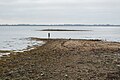
 Langstone Harbour - geograph.org.uk - 6511876.jpg 1,024 × 681; 69 nga KB
-
 Langstone Harbour - geograph.org.uk - 6511894.jpg 1,024 × 681; 75 nga KB
-
 Langstone Harbour - geograph.org.uk - 6511903.jpg 1,024 × 681; 68 nga KB
-
 Langstone Harbour - geograph.org.uk - 6512381.jpg 1,024 × 681; 66 nga KB
-
 Langstone Harbour - geograph.org.uk - 6512407.jpg 1,024 × 681; 70 nga KB
-
 Langstone Harbour - geograph.org.uk - 6512411.jpg 1,024 × 681; 51 nga KB
-
 Langstone Harbour - geograph.org.uk - 6512417.jpg 1,024 × 681; 96 nga KB
-
 Leamington House - geograph.org.uk - 6522401.jpg 1,024 × 681; 139 nga KB
-
 Locks Sailing Club - geograph.org.uk - 6450905.jpg 1,024 × 681; 120 nga KB
-
 Locksway Rd - geograph.org.uk - 6450921.jpg 1,024 × 681; 109 nga KB
-
 Lok'n'Store in Rudmore Road - geograph.org.uk - 2284015.jpg 640 × 480; 51 nga KB
-
 Longbridge House off St Paul's Square - geograph.org.uk - 1940312.jpg 640 × 480; 92 nga KB
-
 Looking west from Southwick Road - geograph.org.uk - 6175620.jpg 7,199 × 4,584; 4.5 nga MB
-
 Lorries in Flathouse Road - geograph.org.uk - 2275895.jpg 640 × 480; 92 nga KB
-
 Lucknow St - geograph.org.uk - 6443048.jpg 1,024 × 681; 172 nga KB
-
 Manners Rd - geograph.org.uk - 6054989.jpg 1,024 × 681; 124 nga KB
-
 Marker stone - geograph.org.uk - 3789527.jpg 1,224 × 1,632; 559 nga KB
-
 Mile End Road Automatic Monitoring Site, Portsmouth.jpg 3,936 × 5,248; 7.28 nga MB
-
 Mine all mine^ - geograph.org.uk - 2395093.jpg 640 × 480; 68 nga KB
-
 Moat, Hilsea Lines - geograph.org.uk - 6472815.jpg 1,024 × 876; 121 nga KB
-
 MOT Centre in Waterworks Road - geograph.org.uk - 639412.jpg 640 × 480; 46 nga KB
-
 Mouth of Portsmouth Harbour - geograph.org.uk - 6483153.jpg 1,024 × 681; 72 nga KB
-
 Multistorey flats, Fratton, Portsmouth - geograph.org.uk - 5305582.jpg 800 × 596; 102 nga KB
-
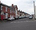
 Nancy Road, Fratton, Portsmouth - geograph.org.uk - 5305654.jpg 800 × 493; 64 nga KB
-
 National Cycle Route 22 - geograph.org.uk - 6470604.jpg 2,640 × 1,980; 1.34 nga MB
-
 National Cycle Route 22 - geograph.org.uk - 6512395.jpg 1,024 × 681; 234 nga KB
-
 National Cycle Route 22 - geograph.org.uk - 6512402.jpg 1,024 × 681; 213 nga KB
-
 Near Portcreek Junction - geograph.org.uk - 6442620.jpg 1,024 × 681; 151 nga KB
-
 New construction, Portsmouth - geograph.org.uk - 6522489.jpg 1,024 × 681; 115 nga KB
-
 New Hampshire Boulevard - geograph.org.uk - 6487930.jpg 1,024 × 681; 111 nga KB
-
 New Kwiki Mart - geograph.org.uk - 6446009.jpg 1,024 × 680; 160 nga KB
-
 New Kwiki Mart - geograph.org.uk - 6478154.jpg 1,024 × 681; 133 nga KB
-
 New Milton Fishery, Langstone Harbour - geograph.org.uk - 6507714.jpg 1,024 × 681; 52 nga KB
-
 New Milton Fishery, Langstone Harbour - geograph.org.uk - 6507717.jpg 1,024 × 681; 158 nga KB
-
 New Theatre Royal - geograph.org.uk - 6522450.jpg 681 × 1,024; 176 nga KB
-
 No access from Kingston Rd - geograph.org.uk - 6446794.jpg 1,024 × 681; 170 nga KB
-
 North Bastion, Gosport - geograph.org.uk - 6483154.jpg 1,024 × 681; 72 nga KB
-
 Northesk House - geograph.org.uk - 6446769.jpg 1,024 × 681; 206 nga KB
-
 Number 1 International Supermarket - geograph.org.uk - 6443065.jpg 1,024 × 681; 172 nga KB
-
 Nursery next to Ken's hairdressers - geograph.org.uk - 639442.jpg 640 × 480; 54 nga KB
-
 Old boat in the dockyard with rope (Unsplash).jpg 4,000 × 6,000; 14.25 nga MB
-
-
 On-street parking, Claremont Road, Fratton, Portsmouth - geograph.org.uk - 5326506.jpg 800 × 685; 110 nga KB
-
 One way to Hanway Rd - geograph.org.uk - 6446804.jpg 1,024 × 774; 171 nga KB
-
 Opening to Langstone Harbour - geograph.org.uk - 6507578.jpg 1,024 × 681; 93 nga KB
-
 Orchard Road, Portsmouth - geograph.org.uk - 5304887.jpg 800 × 666; 112 nga KB
-
 Orchard Road, Portsmouth - geograph.org.uk - 5304896.jpg 800 × 778; 109 nga KB
-
 Ordnance Row - geograph.org.uk - 3024074.jpg 640 × 480; 100 nga KB
-
 Ornate gates at Rydal Close - geograph.org.uk - 703938.jpg 640 × 480; 69 nga KB
-
 Park Rd - geograph.org.uk - 4411946.jpg 640 × 426; 87 nga KB
-
 Park Rd - geograph.org.uk - 6478218.jpg 1,024 × 681; 156 nga KB
-
 Park Rd - geograph.org.uk - 6478220.jpg 1,024 × 681; 157 nga KB
-
 Park Road, Portsmouth - geograph.org.uk - 3754358.jpg 800 × 589; 171 nga KB
-
 Path ahead for Plumpton Gardens - geograph.org.uk - 855073.jpg 640 × 480; 61 nga KB
-
 Paulsgrove Interchange (M275-M27) - geograph.org.uk - 3735230.jpg 640 × 480; 266 nga KB
-
 Pavement in Wallington Road - geograph.org.uk - 1992127.jpg 640 × 480; 70 nga KB
-
 Pavement in Wimborne Road - geograph.org.uk - 1419806.jpg 640 × 480; 101 nga KB
-
 Peacock Lane - geograph.org.uk - 1994824.jpg 640 × 480; 72 nga KB
-
 Percy Rd - geograph.org.uk - 6054995.jpg 1,024 × 681; 140 nga KB
-
 Peronne Close - geograph.org.uk - 776741.jpg 640 × 480; 55 nga KB
-
 Pet hospital in Middle Street - geograph.org.uk - 1940339.jpg 640 × 480; 113 nga KB
-
 PETA on the corner of Cow Lane and Northarbour Road - geograph.org.uk - 1492242.jpg 640 × 480; 56 nga KB
-
 Play area with autumn leaves next to Church Road - geograph.org.uk - 5165893.jpg 640 × 427; 139 nga KB
-
 Playzone in Northarbour Road - geograph.org.uk - 1492302.jpg 640 × 480; 55 nga KB
-
 Plug Cryostat Cosplay.jpg 344 × 611; 73 nga KB
-

-
 Pompey Centre - geograph.org.uk - 6472764.jpg 1,024 × 681; 110 nga KB
-
 Portsdown Hill Road - Portsmouth - geograph.org.uk - 784488.jpg 640 × 480; 87 nga KB
-
 Portsdown Hill Road approaching the Churchill Inn - geograph.org.uk - 3426113.jpg 640 × 442; 45 nga KB
-
 Portsea, Privett House - geograph.org.uk - 5439962.jpg 1,024 × 768; 190 nga KB
-
 Portsmouth , Alfred Road ^ Traffic Lights - geograph.org.uk - 2879818.jpg 2,560 × 1,920; 2.37 nga MB
-
 Portsmouth , Anglesea Road A3 - geograph.org.uk - 1990008.jpg 4,218 × 2,740; 4.7 nga MB
-
 Portsmouth , Commercial Road - geograph.org.uk - 1990001.jpg 4,214 × 2,730; 4.47 nga MB
-
 Portsmouth , Cornmill Street - geograph.org.uk - 1989189.jpg 4,218 × 2,740; 4.86 nga MB
-

-
 Portsmouth Carers Centre, Portsmouth - geograph.org.uk - 5304916.jpg 800 × 724; 85 nga KB
-
 Portsmouth Central Masjid - geograph.org.uk - 6443064.jpg 1,024 × 681; 155 nga KB
-
 Portsmouth collage.jpg 700 × 1,100; 393 nga KB
-
 Portsmouth Dockyard (1) - geograph.org.uk - 2962801.jpg 1,798 × 1,163; 1.6 nga MB
-
 Portsmouth Dockyard - geograph.org.uk - 6483045.jpg 1,024 × 681; 81 nga KB
-
 Portsmouth Dockyard - geograph.org.uk - 6483156.jpg 1,024 × 681; 107 nga KB
-
 Portsmouth Dockyard - geograph.org.uk - 6484259.jpg 1,024 × 681; 76 nga KB
-
 Portsmouth Dockyard - geograph.org.uk - 6484261.jpg 1,024 × 685; 63 nga KB
-
 Portsmouth Enterprise Centre in high winds - geograph.org.uk - 858443.jpg 640 × 480; 69 nga KB
-
 Portsmouth Guildhall - geograph.org.uk - 6522460.jpg 681 × 1,024; 179 nga KB
-
 Portsmouth Guildhall - geograph.org.uk - 6522466.jpg 1,024 × 694; 93 nga KB
-
 Portsmouth Guildhall - geograph.org.uk - 6522488.jpg 1,024 × 681; 136 nga KB
-
 Portsmouth Job Centre - geograph.org.uk - 657943.jpg 640 × 480; 67 nga KB
-
 Portsmouth montage.png 600 × 1,200; 1.23 nga MB
-
 Portsmouth UK ward map 2023.svg 1,055 × 1,226; 271 nga KB
-
 Portsmouth UK ward map 2024.svg 1,055 × 1,226; 271 nga KB
-
 Portsmouth War Memorial - geograph.org.uk - 6522492.jpg 1,024 × 681; 207 nga KB
-
 Portsmouth, Hope Street - geograph.org.uk - 3621927.jpg 640 × 480; 309 nga KB
-
 Portsmouth, Kent Street looking towards the Spinnaker Tower - geograph.org.uk - 2395148.jpg 768 × 1,024; 74 nga KB
-
 Postie rounding a corner in Crasswell Street - geograph.org.uk - 2334578.jpg 640 × 480; 87 nga KB
-
 Precision House in Northarbour Road - geograph.org.uk - 1492312.jpg 640 × 480; 56 nga KB
-

-
 Protype in York Terrace - geograph.org.uk - 777060.jpg 640 × 480; 49 nga KB
-
 Queens Road in early July - geograph.org.uk - 1996346.jpg 640 × 480; 66 nga KB
-
 Racing starts near Farmlea Road - geograph.org.uk - 706533.jpg 640 × 480; 56 nga KB
-
 Raffles and Lucas at southern end of Mitchell Way - geograph.org.uk - 861542.jpg 640 × 480; 57 nga KB
-
 Railway line by playground in Medina Road - geograph.org.uk - 675566.jpg 480 × 640; 56 nga KB
-
 Rear of Baptist Church Hall - geograph.org.uk - 703857.jpg 640 × 480; 74 nga KB
-
 Rear of Community Offices - geograph.org.uk - 703806.jpg 640 × 480; 62 nga KB
-
 Rear of H J Everitt Ltd as seen from Vectis Way - geograph.org.uk - 1141125.jpg 640 × 443; 68 nga KB
-
 Rear of houses off Clydebank Road - geograph.org.uk - 770344.jpg 640 × 480; 44 nga KB
-
 Rear of Maydman Square - geograph.org.uk - 854209.jpg 640 × 480; 66 nga KB
-
 Rear of Portsmouth Enterprise Centre - geograph.org.uk - 858461.jpg 640 × 480; 49 nga KB
-
 Rear of units on Limberline Road - geograph.org.uk - 776878.jpg 640 × 480; 46 nga KB
-
 Rear of Wastwater House and Buttermere House - geograph.org.uk - 1177344.jpg 640 × 480; 61 nga KB
-
 Rear of York Place - geograph.org.uk - 897356.jpg 640 × 480; 110 nga KB
-
 Road junction by Victoria Park - geograph.org.uk - 698531.jpg 640 × 480; 62 nga KB
-
 Road markings on Market Way - geograph.org.uk - 2275904.jpg 640 × 480; 58 nga KB
-
-
-
 Roadworks in Northarbour Road - geograph.org.uk - 1492321.jpg 640 × 480; 66 nga KB


_-_geograph.org.uk_-_6478226.jpg)


.jpg)


_-_geograph.org.uk_-_3735230.jpg)


_-_geograph.org.uk_-_2962801.jpg)


