Category:Potomac River
Saltar para a navegação
Saltar para a pesquisa
river in the mid-Atlantic United States   | |||||
| Carregar ficheiro | |||||
| Instância de | |||||
|---|---|---|---|---|---|
| Nomeado em referência a |
| ||||
| Localização |
| ||||
| Comprimento |
| ||||
| Desagua | |||||
| Bacia hidrográfica | |||||
| Estado ribeirinho | |||||
| Tributário |
| ||||
 | |||||
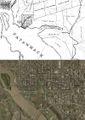
English: The Potomac River and Potomac River Watershed in the Southeastern United States.
- A drainage basin into the Chesapeake Bay Watershed.
Subcategorias
Esta categoria contém as seguintes 25 subcategorias (de um total de 25).
- Potomac River in art (36 F)
&
*
+
- Maps of the Potomac River (27 F)
C
D
F
- Potomac River floods (41 F)
- Frozen Potomac River (8 F)
G
H
N
- NARA images of the Potomac River (50 F)
P
- Potomac Conservancy (656 F)
R
S
- Signs for the Potomac River (8 F)
W
Multimédia na categoria "Potomac River"
Esta categoria contém os seguintes 200 ficheiros (de um total de 469).
(página anterior) (página seguinte)-

-
 (Water Runoff 2) 412-DSP-2-Runoff 219.jpg - DPLA - 74b8e519fdcdb720954c23a4eb81f9e0.jpg 4 800 × 3 200; 3,9 MB
-

-

-

-
 14, Jefferson, MD, USA - panoramio (4).jpg 2 976 × 3 968; 3,36 MB
-
 14, Jefferson, MD, USA - panoramio (5).jpg 3 906 × 2 897; 3,5 MB
-
 14, Jefferson, MD, USA - panoramio (6).jpg 3 968 × 2 976; 2,17 MB
-
 1907 Taneytown Road.png 472 × 1 479; 1,47 MB
-
 Southern View of the District of Columbia from the Washington Monument (3678165909).jpg 1 536 × 1 234; 1,09 MB
-
 Southwestern View of the District of Columbia from the Washington Monument (3678905464).jpg 1 536 × 1 217; 1,07 MB
-
 Southwestern View of the District of Columbia from the Washington Monument (3678959162).jpg 1 536 × 1 219; 1,02 MB
-
 View of the District of Columbia from Washington Monument (Before) (3678136447).jpg 1 536 × 1 249; 1,35 MB
-
 6701-JeffersonMemorial-WashDC.jpg 1 714 × 920; 1,12 MB
-
-
 Chesapeake and Ohio Canal National Historical Park (map).svg 1 003 × 2 514; 5,42 MB
-
 Chesapeake and Ohio Canal National Historical Park (map).jpg 2 740 × 7 248; 6,8 MB
-
 Aerial view of Lafayette Park and Washington Mall, Washington, D.C LCCN2010630447.tif 6 144 × 4 096; 144,03 MB
-
 2007 04 25 - WWB 39.JPG 1 741 × 1 473; 322 kB
-

-
 Arlington National Cemetery 2007.JPG 3 158 × 1 400; 2,89 MB
-
 2009 04 26 Old Town Alexandria 0469 edited-1.jpg 3 872 × 756; 754 kB
-
 Lightning in the clouds over Washington DC.jpg 1 152 × 768; 360 kB
-
 Jefferson Memorial 037.jpg 6 992 × 2 376; 11,98 MB
-
-

-

-

-

-

-
-

-

-

-

-

-

-

-

-

-

-

-

-
-

-

-
-

-

-

-

-

-

-

-

-

-
-

-

-

-

-

-

-
-
 Jefferson Memorial across the Potomac River.jpg 3 456 × 4 608; 3,39 MB
-

-

-

-

-

-

-

-

-

-

-
 28042007219.jpg 2 048 × 1 536; 878 kB
-
 5, Piscataway, MD, USA - panoramio.jpg 3 744 × 2 104; 1,04 MB
-
-

-
 Abschiedsdinner am Potomac River 01.jpg 2 700 × 1 518; 937 kB
-
 Abschiedsdinner am Potomac River 02.jpg 2 700 × 1 518; 838 kB
-
 Abschiedsdinner am Potomac River 04.jpg 2 700 × 1 520; 1,03 MB
-
 Abschiedsdinner am Potomac River 05.jpg 2 700 × 1 520; 948 kB
-
 Abschiedsdinner am Potomac River 06.jpg 2 700 × 1 519; 1,05 MB
-
 Abschiedsdinner am Potomac River 07.jpg 2 700 × 1 520; 1,08 MB
-
 Abschiedsdinner am Potomac River 08.jpg 2 700 × 1 519; 889 kB
-
 Abschiedsdinner am Potomac River 09.jpg 2 700 × 1 519; 853 kB
-

-

-
 Aerial view of Alexandria, Virginia LCCN2011632798.tif 2 284 × 1 497; 19,59 MB
-

-

-

-

-
 Aerial view of National Conservation Training Center near Potomac River, WV.jpg 3 019 × 2 034; 948 kB
-
-

-
 African American laborers at Alexandria, near coal wharf (4166259453).jpg 3 000 × 2 319; 2,22 MB
-
 Alberg 30 Sabrina 158 built in 1966, Potomac River, MD.jpg 288 × 362; 43 kB
-
 Alexandria Virginia Water Taxi - 2010-09-16.jpg 1 412 × 819; 1,65 MB
-
 Alexandria, Virginia (2730408663).jpg 1 600 × 1 200; 216 kB
-
 AlexandriaVAWaterfront.jpg 1 024 × 768; 397 kB
-

-
 Allens fresh zekiah.jpg 1 600 × 654; 207 kB
-
 American Shad by Duane Raver USFWS.jpg 500 × 221; 59 kB
-
 Amtrak Hilltopper.jpg 800 × 534; 65 kB
-
 Arlington - Pentagon from the Air.jpg 1 000 × 664; 350 kB
-
 Arlington House and Potomac River.JPG 3 251 × 1 304; 497 kB
-
 Arlington Memorial Bridge and monuments from water 2020.jpg 4 608 × 3 456; 2,65 MB
-
 B&O Great Cacopon, W. VA on March 2, 1969 (22524552255).jpg 2 000 × 1 363; 2,95 MB
-
 Backyard looking at the Potomac.jpg 5 312 × 2 988; 5,04 MB
-
 BargeNearGravellyPoint.jpg 3 264 × 2 448; 1,36 MB
-
 Billy Goat B Trail 6.jpg 4 352 × 3 264; 11,56 MB
-
 Boat and people fishing; Potomac River, Washington, D.C. LCCN2016889345.tif 10 008 × 7 752; 147,98 MB
-
 Boat docked on Potomac River; Washington Monument in background LCCN2016887253.tif 10 008 × 7 272; 138,81 MB
-
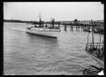
 Boat on Potomac River LCCN2016887256.jpg 10 056 × 7 320; 12,85 MB
-
 Boat on Potomac River LCCN2016887256.tif 10 056 × 7 320; 140,4 MB
-
 Boat on Potomac River LCCN2016887257.jpg 10 008 × 7 284; 11,41 MB
-
 Boat on Potomac River LCCN2016887257.tif 10 008 × 7 284; 139,04 MB
-

-
 Boat on Potomac River; Roosevelt Hall, Fort McNair in background, Washington, D.C. LCCN2016887254.tif 10 069 × 7 270; 139,62 MB
-
 Boats at Dock on Potomac River LCCN2016887258.jpg 10 128 × 7 452; 11,13 MB
-
 Boats on the Potomac River (3422730310).jpg 2 272 × 1 704; 874 kB
-
 Bridge and Tunnel at Harpers Ferry.jpg 5 895 × 3 316; 2,76 MB
-
-
-
 Brunswick Wastewater Treatment Plant.jpg 3 280 × 2 460; 1,29 MB
-
 C&O Canal (Shennandoah River high bridge).jpg 2 021 × 1 395; 1,5 MB
-
 C&O Canal BridgePiers.jpg 1 427 × 1 991; 2,65 MB
-
 C&O towpath at Big Slackwater MD1.jpg 5 043 × 2 434; 11,95 MB
-
 C-SPAN Bus 2012.jpg 1 024 × 432; 247 kB
-
 CA Fall Foliage (23663922028).jpg 5 152 × 3 864; 4,68 MB
-
 CaledonStatePark.png 3 264 × 2 448; 11,97 MB
-
 CAM00017.jpg 2 560 × 1 920; 1,44 MB
-
 Canadian AVGP swimming.jpg 3 000 × 2 204; 1,11 MB
-
 Canal, Potomac River, Georgetown LCCN2004661956.jpg 6 272 × 5 395; 5,06 MB
-
 Capital Beltway Anacostia Freeway junction.jpg 3 264 × 2 448; 3,26 MB
-
 Capitol Limited and Potomac River postcard.jpg 1 348 × 817; 320 kB
-
 Flood plain management study for Mattawoman Creek and tributaries, Charles and Prince Georges Counties, Maryland (IA CAT83790156).pdf 962 × 1 416, 110 páginas; 8,74 MB
-
 CG-station-St.Inigoes logo.jpg 184 × 200; 41 kB
-
 Chain Bridge (3361959232).jpg 1 200 × 1 600; 684 kB
-
 Chain Bridge, undated (27269156714).jpg 2 869 × 1 398; 655 kB
-
 ChesBay Basins-e1531252370325.jpg 3 400 × 4 400; 2,33 MB
-
 Chopawamsic Island.jpg 1 159 × 821; 444 kB
-
-
 Coast Guard and NOAA set buoy in Potomac River.jpg 2 592 × 3 776; 4,27 MB
-
 Cobb Neck Maryland 20201109.jpg 4 032 × 2 268; 3,27 MB
-
 Cockpit point LCCN2004661069.jpg 5 622 × 3 785; 3,12 MB
-
 Confluence of Monocacy and Potomac Rivers, Monocacy Aqueduct, C&O Canal, MD.jpg 15 249 × 3 813; 14,61 MB
-

-
 Courtney-Hanlan Washington DC race.jpg 640 × 424; 131 kB
-
 CrowsNestAcrossPotomac.JPG 998 × 667; 93 kB
-
 Crowsnestandlilies.JPG 859 × 599; 90 kB
-
 Dam No. 5 Potomac River 1.jpg 3 487 × 2 290; 5,27 MB
-
 DC Boundary Stone SE 9 (Columbia Historical Society, 1906).png 824 × 944; 638 kB
-
 DC-old-and-new.jpg 400 × 566; 53 kB
-
 DCFD Fireboat John Glenn and Tugboat Meagan Ann (26267138874).jpg 4 912 × 3 264; 2,88 MB
-
 Delta Over Pentagon (8110706339).jpg 4 752 × 2 271; 1,63 MB
-
 Difficult Run and Potomac River Confluence.JPG 3 840 × 2 160; 4,04 MB
-

-
 Dredging operations in Potomac River - 1930.jpg 3 656 × 2 267; 6,17 MB
-
 During water rescue in Potomac River 1982.jpg 950 × 751; 123 kB
-
 East Branch of the Potomac 1839 (via xparency) LOC.jpg 640 × 458; 40 kB
-
 EastPotomacParkAerial1935.jpg 4 770 × 3 368; 1,86 MB
-
 Fall Foliage Near Potomac River.jpg 3 976 × 2 829; 4,03 MB
-
 Fireboat John H. Glenn in Washington DC.jpg 4 000 × 1 479; 2,69 MB
-
 Fletcher's Cove on the Potomac River.jpg 4 896 × 3 264; 12,93 MB
-
 Fletchers cove seen from Virginia Geo Washington Parkway.jpg 4 896 × 3 264; 14,45 MB
-

-
 FMIB 52178 Hog-choker Sole, Achirus lineatus (L) Potomac River.jpeg 965 × 638; 265 kB
-
 Fort Washington from across the river.jpg 2 142 × 995; 1,32 MB
-
 Frank Leslie's scenes and portraits of the Civil War (1894) (14760738694).jpg 4 642 × 1 872; 2,18 MB
-
-
 Frozen Potomac Prints.jpg 4 159 × 2 192; 2,29 MB
-
 Fullmoon at Great Falls (Virginia).jpg 2 585 × 2 868; 7,14 MB
-
 Galley of the USCGC Ibis -a.jpg 2 100 × 1 397; 1,37 MB
-
 GaylordNationalResort.jpg 3 008 × 2 000; 711 kB
-
 George Washington Parkway 04 2012 1403.JPG 2 700 × 1 800; 5,17 MB
-
 Georgetown Riverview.jpg 2 504 × 1 810; 4,05 MB
-
 Georgetown waterfront in 1865.jpg 6 659 × 5 122; 7,19 MB
-
 GeorgetownUniv.jpg 2 000 × 1 148; 986 kB
-
 OVA-POLLUTION IN THE POTOMAC- EGG-BEARING MALE BASS AND IMPLICATIONS FOR HUMAN AND ECOLOGICAL HEALTH (IA gov.gpo.fdsys.CHRG-109hhrg30340).pdf 1 275 × 1 650, 145 páginas; 4,84 MB
-
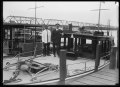
 Government coal wharf - NARA - 529387.jpg 3 000 × 2 305; 2,18 MB
-
 Government coal wharf, Alexandria, Va. LCCN2005689615.tif 7 827 × 5 557; 124,46 MB
-

-

-

-
-

-

-

-
 Great falls - VA.jpg 8 582 × 2 702; 3,6 MB
-
 Great falls - VA1.jpg 12 314 × 2 703; 4,89 MB
-
 Great falls - VA2.jpg 10 357 × 2 610; 4,77 MB
-
 Great Falls dam (6330410281).jpg 1 850 × 862; 604 kB
-
 Great Falls from Overlook 1.jpg 5 184 × 3 456; 12,86 MB
-
 Great Falls of the Potomac LCCN2007662937.tif 5 096 × 4 126; 20,06 MB
-
 GreenleafPoint.JPG 480 × 480; 92 kB
-
 Hains Point.jpg 4 272 × 2 848; 15,59 MB
-
 Hancock potomac river.jpg 2 272 × 1 704; 952 kB
_412-DSP-2-Runoff_219.jpg_-_DPLA_-_74b8e519fdcdb720954c23a4eb81f9e0.jpg)
_412-DSP-2-StreamsLakesBays_009.jpg_-_DPLA_-_ab3c65b4fcee00b69ac3e00b60f42411.jpg)
_412-DSP-2-StreamsLakesBays_046.jpg_-_DPLA_-_e269a6d4893a17f75bbda749fbfc713e.jpg)
_412-DSP-2-StreamsLakesBays_047.jpg_-_DPLA_-_1dfa294c3eb6afeb820a0864c632e2da.jpg)
.jpg)
.jpg)
.jpg)
.jpg)
.jpg)
.jpg)
_(3678136447).jpg)

_off_Washington_D.C._(USA),_on_9_March_1970_(K-81807).jpg)


_between_Loudoun_County,_Virginia_and_Point_of_Rocks,_Frederick_County,_Maryland.jpg)
_between_Loudoun_County,_Virginia_and_Point_of_Rocks,_Frederick_County,_Maryland.jpg)
_between_Loudoun_County,_Virginia_and_Point_of_Rocks,_Frederick_County,_Maryland.jpg)
_between_Brunswick,_Frederick_County,_Maryland_and_Loudoun_County,_Virginia.jpg)
_between_Brunswick,_Frederick_County,_Maryland_and_Loudoun_County,_Virginia.jpg)
_between_Washington_County,_Maryland_and_Loudoun_County,_Virginia.jpg)
_between_Washington_County,_Maryland_and_Loudoun_County,_Virginia.jpg)
_between_Washington_County,_Maryland_and_Shepherdstown,_Jefferson_County,_West_Virginia.jpg)
_between_Washington_County,_Maryland_and_Shepherdstown,_Jefferson_County,_West_Virginia.jpg)
_between_Marlowe,_Berkeley_County,_West_Virginia_and_Williamsport,_Washington_County,_Maryland.jpg)
_between_Marlowe,_Berkeley_County,_West_Virginia_and_Williamsport,_Washington_County,_Maryland.jpg)
_between_Hancock,_Washington_County,_Maryland_and_Morgan_County,_West_Virginia.jpg)
_between_Hancock,_Washington_County,_Maryland_and_Morgan_County,_West_Virginia.jpg)
_between_Paw_Paw,_Morgan_County,_West_Virginia_and_Allegany_County,_Maryland.jpg)
_between_Paw_Paw,_Morgan_County,_West_Virginia_and_Allegany_County,_Maryland.jpg)
_near_the_shore_of_Saint_Catherine_Sound_of_the_Potomac_River_in_Bushwood,_St._Mary%27s_County,_Maryland.jpg)


_just_south_of_the_Prospect_Peak_Overlook_in_Morgan_County,_West_Virginia.jpg)
_just_south_of_the_Prospect_Peak_Overlook_in_Morgan_County,_West_Virginia.jpg)
_just_south_of_the_Prospect_Peak_Overlook_in_Morgan_County,_West_Virginia.jpg)


_at_the_Potomac_River_in_Marshall_Hall,_Charles_County,_Maryland.jpg)
_in_Marshall_Hall,_Charles_County,_Maryland.jpg)
_in_Riverside,_Charles_County,_Maryland.jpg)
_in_Riverside,_Charles_County,_Maryland.jpg)
_in_Riverside,_Charles_County,_Maryland.jpg)
_in_Riverside,_Charles_County,_Maryland.jpg)
_connecting_National_Harbor,_Prince_Georges_County,_Maryland_and_Alexandria,_Virginia_via_Washington,_D.C..jpg)
_at_Exit_2_(Interstate_295,_Washington,_National_Harbor)_in_National_Harbor,_Prince_Georges_County,_Maryland.jpg)
,_looking_up_the_Potomac_River_along_the_border_of_Potomac,_Montgomery_County,_Maryland_and_McLean,_Fairfax_County,_Virginia.jpg)
,_looking_up_the_Potomac_River_along_the_border_of_Potomac,_Montgomery_County,_Maryland_and_McLean,_Fairfax_County,_Virginia.jpg)
,_looking_down_the_Potomac_River_along_the_border_of_Cabin_John,_Montgomery_County,_Maryland_and_McLean,_Fairfax_County,_Virginia.jpg)
,_looking_up_the_Potomac_River_along_the_border_of_Potomac,_Montgomery_County,_Maryland_and_McLean,_Fairfax_County,_Virginia.jpg)
,_looking_up_the_Potomac_River_along_the_border_of_Potomac,_Montgomery_County,_Maryland_and_McLean,_Fairfax_County,_Virginia.jpg)
_connecting_National_Harbor,_Prince_Georges_County,_Maryland_and_Alexandria,_Virginia.jpg)


_toward_the_Potomac_River_from_an_airplane_heading_for_Washington_Dulles_International_Airport_passing_over_Independent_Hill,_Prince_William_County,_Virginia.jpg)
_in_Arlington_County,_Virginia.jpg)
_in_Arlington_County,_Virginia.jpg)


_Oceanographic_Survey_Ship_USNS_BRUCE_C._HEEZEN_(T-AGS_64),_moored_to_the_pier_at_Robinson_Freight_Terminal_on_the_Potomac_Rive_-_DPLA_-_8e3112f21b29218cfa92416542ad2417.jpeg)
.jpg)


.jpg)


.jpg)

.jpg)


.jpg)


.jpg)


.jpg)


.jpg)


.jpg)
.jpg)


.png)

.jpg)
.jpg)

.jpg)


_LOC.jpg)


_Potomac_River.jpeg)


.jpg)


.jpg)
.jpg)
.jpg)
.jpg)
.jpg)
.jpg)

.jpg)


,_Md._Pontoon_bridge_and_ruins_of_the_stone_bridge_across_the_Potomac_(destroyed_in_1861))_LOC_5597849001.jpg)
.svg)
.jpg)
_just_south_of_the_Prospect_Peak_Overlook_in_Morgan_County,_West_Virginia.jpg)
_in_Riverside,_Charles_County,_Maryland.jpg)
_(14760738694).jpg)