Category:Rivers of Virginia
Jump to navigation
Jump to search
States of the United States: Alabama · Alaska · Arizona · Arkansas · California · Colorado · Connecticut · Delaware · Florida · Georgia · Hawaii · Idaho · Illinois · Indiana · Iowa · Kansas · Kentucky · Louisiana · Maine · Maryland · Massachusetts · Michigan · Minnesota · Mississippi · Missouri · Montana · Nebraska · Nevada · New Hampshire · New Jersey · New Mexico · New York · North Carolina · North Dakota · Ohio · Oklahoma · Oregon · Pennsylvania · Rhode Island · South Carolina · South Dakota · Tennessee · Texas · Utah · Vermont · Virginia · Washington · West Virginia · Wisconsin · Wyoming – Washington, D.C.
Guam · Puerto Rico
Guam · Puerto Rico
Wikimedia category | |||||
| Upload media | |||||
| Instance of | |||||
|---|---|---|---|---|---|
| Category combines topics | |||||
| Category contains | |||||
| Virginia | |||||
state of the United States of America  someja satełtar in marso     | |||||
| Pronunciation audio | |||||
| Instance of | |||||
| Part of |
| ||||
| Named after |
| ||||
| Location |
| ||||
| Located in or next to body of water | |||||
| Capital | |||||
| Legislative body | |||||
| Executive body | |||||
| Highest judicial authority | |||||
| Official language | |||||
| Anthem |
| ||||
| Head of government |
| ||||
| Inception |
| ||||
| Highest point | |||||
| Population |
| ||||
| Area |
| ||||
| Elevation above sea level |
| ||||
| Replaces |
| ||||
| Different from | |||||
| Maximum temperature record |
| ||||
| Minimum temperature record |
| ||||
| official website | |||||
 | |||||
Subcategories
This category has the following 64 subcategories, out of 64 total.
*
- Beaver dams in Virginia (1 F)
- River terraces in Virginia (1 F)
- Streambed boulders in Virginia (22 F)
+
.
- River name signs in Virginia (26 F)
A
B
- Bullpasture River (1 F)
C
- Catoctin Creek (Virginia) (22 F)
- Chickahominy River (17 F)
D
- Donaldson Run (7 F)
E
G
H
J
L
- Lafayette River (20 F)
M
- Machipongo River (3 F)
- Mechums River (5 F)
- Mosquito Creek (Virginia) (3 F)
N
- Nottoway River (6 F)
O
P
- Piankatank River (2 F)
- Pimmit Run (7 F)
- Piney River (Tye River) (2 F)
Q
- Quantico Creek (41 F)
R
- Rapidan River (9 F)
- Russell Fork (1 F)
S
- Sassafras River (2 F)
- Smith River (Virginia) (3 F)
- Stroubles Creek (5 F)
Y
Media in category "Rivers of Virginia"
The following 113 files are in this category, out of 113 total.
-
 2009 04 26 Old Town Alexandria 0466.jpg 3,872 × 2,592; 2.34 MB
-
 Abraham Lincoln and the battles of the Civil War (1886) (14576035040).jpg 2,134 × 1,530; 1.26 MB
-
 Aerial photograph of the Little River at Snowville, Virginia.jpg 2,816 × 2,112; 2.41 MB
-
-

-
 Aerial View of Schuyler Dam (7797547556).jpg 5,550 × 4,350; 1.68 MB
-
 Amtrak Engine 184 - A Little Closer (5650804375).jpg 1,932 × 2,706; 2.18 MB
-
 Autumn-flowing-forest-river - Virginia - ForestWander.jpg 5,129 × 3,613; 6.08 MB
-
 Bank of the Thornton River.jpg 3,264 × 2,448; 3.04 MB
-
 BlackwaterRiverCanoe1.jpg 2,048 × 1,536; 652 KB
-
 BlackwaterRiverCanoe2.jpg 1,280 × 1,024; 570 KB
-
 BlackwaterRiverCanoe3.jpg 1,280 × 1,024; 785 KB
-
 BlackwaterRiverCanoe4.jpg 1,280 × 1,024; 669 KB
-
 BlackwaterRiverCanoe5.jpg 2,048 × 1,536; 735 KB
-
 BlackwaterRiverCanoe6.jpg 2,048 × 1,536; 722 KB
-
 BlackwaterRiverCanoeTrescue1.jpg 1,280 × 1,024; 456 KB
-
 BlackwaterRiverCanoeTrescue2.jpg 1,280 × 1,024; 463 KB
-
 Bridge over a river in winter.jpg 4,032 × 3,024; 7.2 MB
-
 Broad River Fauquier County.jpg 1,944 × 1,296; 968 KB
-
 Buffalo Springs bridge and gazebo.jpg 6,016 × 4,000; 6.48 MB
-
 Bull Run, Va - NARA - 525208.jpg 3,000 × 2,704; 2.42 MB
-
 Bullpasture River above Williamsville.jpg 6,016 × 4,000; 6.49 MB
-
 Calfpasture River from Ramsey Gap Road.jpg 6,016 × 4,000; 6.24 MB
-
 Cameron Run 2015.jpg 3,264 × 2,448; 2.68 MB
-
 Cameron Run, looking downstream .jpg 2,560 × 1,920; 1.16 MB
-
 Cameron-Run-Holmes-Backlick-Confluence-Arlington-Virginia.jpg 4,608 × 3,456; 6.35 MB
-
-

-
 Catoctin Creek Bridge VA4.jpg 5,184 × 2,802; 18.32 MB
-
 CedarCreek.jpg 1,173 × 773; 812 KB
-
 Chopawamsic Creek.jpg 285 × 189; 56 KB
-
 City point waterfront.JPG 313 × 274; 34 KB
-
 Clinch River.jpg 345 × 245; 96 KB
-
 College Creek.jpg 3,264 × 2,448; 2.96 MB
-
 ColonelKayak2.jpg 720 × 960; 489 KB
-
 Cooks Creek.jpg 5,248 × 3,936; 9.29 MB
-
 CSSJamestown.jpg 738 × 419; 82 KB
-
 Damaged Homes along the Rockfish River (7797551880).jpg 5,550 × 4,350; 1.78 MB
-
 Dan River Danville Virginia.JPG 4,000 × 3,000; 4.4 MB
-
 Danville (Virginia) banner Dan River.JPG 4,000 × 574; 903 KB
-
 Debris on Rockfish River (7797550188).jpg 5,550 × 4,350; 1.78 MB
-
 Diascund Creek looking upstream below Mill Creek.jpg 4,599 × 2,096; 4.7 MB
-
 Diascund Creek RR bridge looking upstream.jpg 4,971 × 3,728; 11.21 MB
-
 Flood Damage East of Schuyler (7797526964).jpg 5,550 × 4,350; 1.89 MB
-
 FMIB 33783 Catch of Rainbow Trout from Laurel River, Virginia.jpeg 693 × 450; 68 KB
-
 Guest River.jpg 661 × 444; 279 KB
-
 Hampton Institute as seen from the Darling Bridge in Hampton.jpg 3,072 × 2,304; 3.71 MB
-
 Hampton Roads 1859.jpg 640 × 480; 71 KB
-
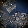
 Hampton roads from space.jpg 649 × 514; 98 KB
-
 HFCA 1607 NPS Employees 0005.jpg (80d049e6ffaf42fe9a2becea6a9dd35b).jpg 7,930 × 5,234; 4.36 MB
-
 HFCA 1607 NPS Employees 0006.jpg (abdc61996ea4453180c9018ebfc589eb).jpg 7,930 × 5,234; 4.03 MB
-
 HFCA 1607 NPS Employees 0007.jpg (6bf4ef0d0bab4fbe93690ee7c6cc358a).jpg 7,930 × 5,234; 3.65 MB
-
 HFCA 1607 NPS Employees 0046.jpg (eceeb7b800d045999c2871dd0d5f9182).jpg 7,930 × 5,234; 3.7 MB
-
 HFCA 1607 NPS Employees 0074.jpg (21136fd53a6b4b4fb5d85226222d4b31).jpg 7,930 × 5,234; 3.83 MB
-
 HFCA 1607 NPS Employees 0077.jpg (b3aaae2909ef4a079d78a1662ca84b89).jpg 7,930 × 5,234; 4.03 MB
-
 Hiking - Riding - Virginia - DPLA - 9fba757b9238533a767acfe3bc5536ea.jpg 4,773 × 3,834; 2.04 MB
-
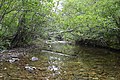
 Hughes River by the Corbin Cabin.jpg 6,016 × 4,000; 6.4 MB
-
 Hughesrivershenandoahnatlpark.jpg 1,030 × 1,600; 578 KB
-
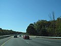 Interstate 95 - Virginia (8112211453).jpg 3,072 × 2,304; 569 KB
-
 Grundy Virginia flood 1984.jpg 1,500 × 1,023; 514 KB
-
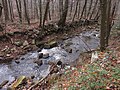 Little-Stony-Creek-Shenandoah-Virginia-12-Nov-2017.jpg 4,608 × 3,456; 7.65 MB
-
 Long Marsh Next To Villa LaRue Clarke County Virginia 1921 - Copy.JPG 534 × 400; 105 KB
-
 LostRiver.jpg 1,180 × 766; 576 KB
-
 LynnhavenRiverMap(USGS).jpg 1,236 × 675; 333 KB
-
 Manassas, Chinn Branch.jpg 1,313 × 1,000; 549 KB
-
 Mattaponi River 20170218.jpg 4,608 × 3,456; 4.8 MB
-
 Maury River Lexington Virginia.JPG 4,000 × 3,000; 4.37 MB
-
 Maury River.JPG 2,816 × 2,112; 1.94 MB
-
 Nansemond national wildlife refuge.jpg 1,097 × 609; 135 KB
-
 Newport news norfolk portsmouth rotated.jpg 3,850 × 3,903; 10.97 MB
-
 North Fork Holston River.jpg 341 × 174; 56 KB
-
 North Fork, Stony Creek, Giles County VA.jpg 3,024 × 3,024; 2.97 MB
-

-
 Old Rag Ice Dagger (50756825361).jpg 3,024 × 4,032; 5.28 MB
-
 Old Rag Old Bridge (50756764951).jpg 3,024 × 4,032; 5.61 MB
-
 Old Rag Stream (50756765116).jpg 3,024 × 4,032; 5.78 MB
-
 Paine Run from fire road crossing.jpg 6,016 × 4,000; 6.48 MB
-
 Passage Creek Virginia.jpg 2,448 × 3,264; 6.15 MB
-
 Pedlar River Virginia.jpg 2,048 × 1,360; 2.9 MB
-
 Popes creek.jpg 1,331 × 1,732; 722 KB
-
 Popes creek2.jpg 800 × 508; 97 KB
-
 Pound River.jpg 6,189 × 3,125; 13.37 MB
-
 Powell River bridge at Appalachia.jpg 6,016 × 4,000; 6.32 MB
-
 Powells Creek.jpg 3,264 × 2,448; 4 MB
-
 Rivana River-1.jpg 1,000 × 664; 503 KB
-
 Rivanna River at Union Mills.jpg 6,016 × 4,000; 6.44 MB
-
 RivannaRiver.jpg 800 × 533; 179 KB
-
 RivannaWithSwimmers.jpg 1,600 × 1,066; 743 KB
-
 River locks crossing (2898497187).jpg 750 × 590; 99 KB
-
 River seen from I-95 in Virginia.jpg 4,000 × 3,000; 2.4 MB
-
 River-picture.jpg 960 × 1,280; 613 KB
-
 Rockfish River, Virginia.JPG 3,072 × 2,304; 2.64 MB
-
 RockfishRiver.jpg 4,320 × 3,240; 3.48 MB
-

-
 Sandy River in Danville, Virginia.jpg 4,160 × 3,120; 7.67 MB
-
 Scene on River. Landing at City Point - NARA - 529304.jpg 3,000 × 2,305; 1.54 MB
-
 Scott's run.jpg 4,032 × 3,024; 3.51 MB
-
 Shoemaker River.jpg 5,152 × 3,864; 3.73 MB
-
 South River in Waynesboro, Virginia.jpg 2,272 × 1,704; 1.74 MB
-
 Stony Creek, Giles County, VA.jpg 3,023 × 2,368; 2.78 MB
-

-

-
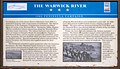 The Warwick River — 1862 Peninsula Campaign — (3446749520).jpg 1,600 × 925; 530 KB
-
 This is a view of the river from the camp ground Millrace. (28237563171).jpg 4,288 × 2,848; 3.08 MB
-
 Thornton River.jpg 2,448 × 3,264; 3.03 MB
-
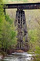 Tye River Trestle Supports (5650803563).jpg 2,592 × 3,888; 4.32 MB
-
 Virginia, Bull Run. Ruins of Stone Bridge - NARA - 533281.jpg 3,000 × 2,383; 2.52 MB
-
 Virginia, Chickahominy, Military Bridge across - NARA - 533291.jpg 3,000 × 2,423; 2.91 MB
-
 Walkers Creek, VA, USA - panoramio - Idawriter (9).jpg 2,592 × 1,944; 1.15 MB
-
 WestmorelandStateParkBeach.jpg 720 × 540; 130 KB
-
 WhiteoakCanyonShenandoahNP.jpg 2,580 × 1,932; 3.7 MB
-
 William McIlvaine - The Chickahominy - Sumners Upper Bridge.jpg 5,736 × 3,984; 12.5 MB
-
 Wreck Island Creek at Stonewall Mills.jpg 6,016 × 4,000; 6.38 MB

_(14576035040).jpg)


.jpg)
.jpg)


_(14776424851).jpg)


.jpg)

.jpg)


.jpg)


.jpg)
.jpg)
.jpg)
.jpg)
.jpg)
.jpg)


.jpg)


.jpg)


.jpg)
.jpg)
.jpg)
.jpg)


.jpg)


_(14759627631).jpg)
_(14762893785).jpg)
.jpg)
.jpg)

.jpg)


.jpg)


_banner_Dan_River.JPG)