Category:Potto, North Yorkshire
Jump to navigation
Jump to search
village in the United Kingdom  | |||||
| Upload media | |||||
| Instance of | |||||
|---|---|---|---|---|---|
| Location | Hambleton, North Yorkshire, Yorkshire and the Humber, England | ||||
| Population |
| ||||
| Area |
| ||||
 | |||||
English: Potto is a village and civil parish in the Hambleton district of North Yorkshire, England. It is 5 miles southwest of Stokesley and near the main A172 road.
Media in category "Potto, North Yorkshire"
The following 53 files are in this category, out of 53 total.
-
 Black horse lane - geograph.org.uk - 1004802.jpg 640 × 480; 49 KB
-
 Black Horse Lane - geograph.org.uk - 3824167.jpg 4,320 × 3,240; 1.52 MB
-
 Black Horse Lane, Thornhill - geograph.org.uk - 5089071.jpg 1,024 × 683; 309 KB
-
 Bridge Over Former Mineral Railway - geograph.org.uk - 589484.jpg 640 × 427; 101 KB
-
 Butcher Lane - geograph.org.uk - 123626.jpg 640 × 480; 78 KB
-
 Cooper Lane, Potto - geograph.org.uk - 3278954.jpg 640 × 480; 66 KB
-
 Corner of Beliack Plantation - geograph.org.uk - 1481394.jpg 640 × 427; 100 KB
-
 Cottage near Potto Hall - geograph.org.uk - 3278916.jpg 1,091 × 784; 171 KB
-
 Course of Former Railway - geograph.org.uk - 589558.jpg 640 × 427; 97 KB
-
 Drive, Potto - geograph.org.uk - 2435828.jpg 640 × 480; 86 KB
-
 Driveway to Potto Grange - geograph.org.uk - 3278965.jpg 1,200 × 900; 285 KB
-

-
 Farmland near Potto Grange - geograph.org.uk - 3278960.jpg 1,200 × 900; 293 KB
-
 Farmland off Parson Back Lane - geograph.org.uk - 3278905.jpg 640 × 480; 66 KB
-
 Farmland off Parson Back Lane - geograph.org.uk - 3278912.jpg 1,200 × 900; 260 KB
-
 Field Near Thorn Hill - geograph.org.uk - 201702.jpg 640 × 480; 110 KB
-
 Field Off Parson Back Lane - geograph.org.uk - 201700.jpg 480 × 640; 123 KB
-
 Fields off Black Horse Lane - geograph.org.uk - 5089056.jpg 1,024 × 683; 330 KB
-
 Footpath in Potto - geograph.org.uk - 2435773.jpg 640 × 480; 86 KB
-
 Gateway to Potto Hall - geograph.org.uk - 3278914.jpg 1,200 × 900; 307 KB
-
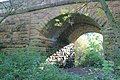
 Goldgate Bridge - geograph.org.uk - 3838113.jpg 4,000 × 3,000; 3.22 MB
-
 Goulton Lane towards Potto - geograph.org.uk - 3534153.jpg 1,024 × 768; 225 KB
-
 Hawthorn hedge sunset - geograph.org.uk - 1004807.jpg 640 × 480; 55 KB
-
 Lodge, Potto Grange - geograph.org.uk - 3278964.jpg 640 × 480; 75 KB
-
 Notice board and postbox, Potto - geograph.org.uk - 2435997.jpg 480 × 640; 96 KB
-
 Old railway track near Swainby - geograph.org.uk - 3836475.jpg 3,240 × 4,320; 1.94 MB
-
 Ordnance Survey Cut Bench Mark - geograph.org.uk - 5420236.jpg 4,000 × 3,000; 3.11 MB
-
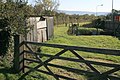
 Parson Back Lane - geograph.org.uk - 3278906.jpg 1,200 × 900; 262 KB
-
 Parson Back Lane - geograph.org.uk - 3278913.jpg 640 × 480; 80 KB
-
 Parson Back Lane - geograph.org.uk - 3824169.jpg 4,320 × 3,240; 1.84 MB
-
 Prestons of Potto haulage yard - geograph.org.uk - 3534210.jpg 1,024 × 768; 243 KB
-
 Public Footpath Near Potto Carr - geograph.org.uk - 1481397.jpg 427 × 640; 79 KB
-
 Public Footpath to Trenholme - geograph.org.uk - 1481467.jpg 427 × 640; 95 KB
-
 Road towards Hutton Rudby - geograph.org.uk - 3278961.jpg 1,024 × 768; 229 KB
-
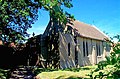
 St Mary's Church, Potto - geograph.org.uk - 3278919.jpg 1,200 × 900; 322 KB
-
 St Mary's Church, Potto.jpg 431 × 285; 49 KB
-
 The Dog and Gun public house Potto - geograph.org.uk - 1005357.jpg 640 × 480; 52 KB
-
 The Dog ^ Gun, Potto - geograph.org.uk - 3278956.jpg 640 × 480; 57 KB
-
 The walls looking east - geograph.org.uk - 1005345.jpg 640 × 346; 48 KB
-
 Tomahawk Steak House, Potto - geograph.org.uk - 6287713.jpg 4,909 × 3,509; 3.15 MB
-
 Track to Potto Carr - geograph.org.uk - 3278908.jpg 1,200 × 900; 270 KB
-
 Tree on Butcher Lane - geograph.org.uk - 1005352.jpg 640 × 505; 73 KB
-
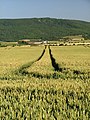
 Wheat Field Near Potto Carr - geograph.org.uk - 1481398.jpg 640 × 427; 80 KB
-
 Wheat field, Thorn Hill - geograph.org.uk - 5089068.jpg 1,024 × 683; 360 KB
-
 Goldgate Bridge - geograph.org.uk - 396409.jpg 640 × 480; 141 KB
-

-
 North East Railway Company Crane - geograph.org.uk - 589538.jpg 640 × 427; 59 KB
-
 Parson Back Lane - geograph.org.uk - 206458.jpg 640 × 480; 93 KB
-
 Potto From Butcher Lane - geograph.org.uk - 123627.jpg 640 × 480; 47 KB
-
 Public Bridleway Near Brookside - geograph.org.uk - 589535.jpg 640 × 427; 103 KB
-
 Public Bridleway to Goulton - geograph.org.uk - 589501.jpg 640 × 427; 79 KB
-
 Road Surface Store, Swainby - geograph.org.uk - 76981.jpg 640 × 480; 90 KB
-


