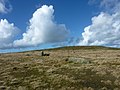
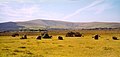
Category:Preseli Hills
Zur Navigation springen
Zur Suche springen
Gebirgszug  | |||||
| Medium hochladen | |||||
| Ist ein(e) | |||||
|---|---|---|---|---|---|
| Ort | Pembrokeshire, Wales | ||||
| Schutzkategorie | |||||
 | |||||
Unterkategorien
Es werden 9 von insgesamt 9 Unterkategorien in dieser Kategorie angezeigt:
In Klammern die Anzahl der enthaltenen Kategorien (K), Seiten (S), Dateien (D)
B
- Bedd Arthur (4 D)
C
- Carn Breseb (5 D)
- Carn Menyn (27 D)
- Cerrig Lladron (4 D)
F
- Foel Drygarn (15 D)
- Foel Feddau (7 D)
G
- Gors Fawr standing stones (21 D)
- Gors Fawr stone circle (14 D)
M
- Maenchlochog Standing Stones (6 D)
Medien in der Kategorie „Preseli Hills“
Folgende 51 Dateien sind in dieser Kategorie, von 51 insgesamt.
-
 160412 W Preseli Hills from NE (Tony Holkham).jpg 4.000 × 3.000; 8,22 MB
-
 2011-01-17 Preseli Panorama (5365044888).jpg 4.912 × 1.344; 5,1 MB
-
 Across the valley - geograph.org.uk - 323922.jpg 640 × 480; 111 KB
-
 Cairn near Carn Gwr (geograph 7177882).jpg 4.032 × 3.024; 4,11 MB
-
 Carn Menyn bluestones - geograph.org.uk - 1451509.jpg 640 × 480; 83 KB
-
 Carn Siân, Preseli Mountains - geograph.org.uk - 259497.jpg 640 × 476; 137 KB
-
 Carnau Lladron in the Preseli Hills - geograph.org.uk - 1732282.jpg 1.600 × 679; 101 KB
-
 Gors Fawr stone circle at sunset on the summer solstice.jpg 2.048 × 1.536; 630 KB
-
 Gors Fawr stone circle on the summer solstice.jpg 2.048 × 1.536; 861 KB
-

-
 In the Preseli foothills - geograph.org.uk - 1729106.jpg 800 × 271; 55 KB
-
 Meadows at the foot of the Preseli - geograph.org.uk - 650255.jpg 640 × 426; 111 KB
-
Monitro ystlumod yn Tŷ Canol - Monitoring the bats at Tŷ Canol.webm 22 s, 640 × 360; 2,27 MB
-

-

-
 Preseli hills (geograph 7177402).jpg 2.048 × 1.536; 990 KB
-
 Preseli Hills - geograph.org.uk - 1729208.jpg 2.048 × 1.146; 678 KB
-
 Preseli Hills H2a.jpg 4.592 × 3.448; 6,37 MB
-
 Preseli Hills H3a.jpg 4.592 × 3.448; 7,4 MB
-
 Preseli Hills H4a.jpg 4.592 × 3.448; 5,15 MB
-
 Preseli Hills H5a.jpg 4.592 × 3.448; 5,46 MB
-
 Preseli Hills H6a.jpg 4.592 × 3.448; 6,31 MB
-
 Preseli Hills H8a.jpg 4.592 × 3.448; 2,37 MB
-
 Preseli Hills H9a.jpg 4.592 × 3.448; 2,86 MB
-
 Preseli TV-Transmitter - geograph.org.uk - 310144.jpg 480 × 640; 50 KB
-
 Preseli.jpg 640 × 480; 79 KB
-
 Presili Hills (6081).jpg 4.288 × 2.848; 7 MB
-
 Presili Hills (6091).jpg 4.288 × 2.848; 4,34 MB
-
 Presili Hills (6092).jpg 4.288 × 2.848; 5,87 MB
-
 Presili Hills (6097).jpg 4.288 × 2.848; 5,33 MB
-
 Presili Hills (6098).jpg 4.288 × 2.848; 5,23 MB
-
 Presili Hills (6101).jpg 4.288 × 2.848; 6,41 MB
-
 Presili Hills (6102).jpg 4.288 × 2.848; 6,34 MB
-
 Presili Hills (6103).jpg 4.288 × 2.848; 6,44 MB
-
 Presili Hills (6104).jpg 4.288 × 2.848; 5,14 MB
-
 Presili Hills (6106).jpg 4.288 × 2.848; 6,72 MB
-
 Presili Hills (6123).jpg 4.288 × 2.848; 4,95 MB
-
 Presili Hills (6124).jpg 4.288 × 2.848; 5,16 MB
-
 Presili Hills (6164).jpg 4.288 × 2.848; 4,96 MB
-
 Sheep at Gors Fawr stone circle - geograph.org.uk - 1404597.jpg 640 × 480; 69 KB
-
 Sheep track, Preseli - geograph.org.uk - 1491441.jpg 640 × 427; 104 KB
-
 Skies and rocks - the Preseli landscape (geograph 7177621).jpg 4.032 × 2.642; 2,73 MB
-
-
 Stone Circle Gors Fawr - geograph.org.uk - 301094.jpg 640 × 302; 45 KB
-
 Television mast, Gwarllwyn Wood - geograph.org.uk - 527384.jpg 416 × 640; 79 KB
-

-
 View from Waun Fach across the Preselis - geograph.org.uk - 69437.jpg 640 × 480; 100 KB
-
 View north from the Presili Hills (6117).jpg 4.288 × 2.848; 5,68 MB
-
 View north from the Presili Hills (6125).jpg 4.288 × 2.848; 4,31 MB
-
 View north from the Presili Hills (6166).jpg 4.288 × 2.848; 5,1 MB
-
 View towards Mynydd Preseli - geograph.org.uk - 520848.jpg 640 × 480; 62 KB
.jpg)

.jpg)


.jpg)


.jpg)
.jpg)
.jpg)
.jpg)
.jpg)
.jpg)
.jpg)
.jpg)
.jpg)
.jpg)
.jpg)
.jpg)
.jpg)


.jpg)


.jpg)
.jpg)
.jpg)

.jpg)