Category:Ptolemy's 7th European Map
Jump to navigation
Jump to search
Media in category "Ptolemy's 7th European Map"
The following 33 files are in this category, out of 33 total.
-
 Map after Ptolemy's Geographia (Burney MS 111, f.34v).jpeg 5,207 × 6,887; 42.56 MB
-
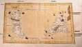
 Ptolemy Cosmographia 1467 - Sardinia + Sicily.jpg 1,539 × 1,088; 1.07 MB
-
 Seventh map of Europe (Sardinia and Sicily), in full gold border (NYPL b12455533-427025).tif 4,848 × 3,813; 53.1 MB
-
 Claudii Ptolomei Cosmographie VII.jpg 939 × 655; 558 KB
-
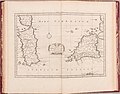
 Bodleian Libraries, Corsica, Sardinia and Sicily.jpg 1,000 × 675; 84 KB
-
 Tabula Sete II.jpg 2,182 × 1,446; 805 KB
-
 Tabula Sete.jpg 600 × 477; 291 KB
-
 Septima Europe Tabula (1478).jpg 3,231 × 2,133; 1.1 MB
-
 Septima Europe Tabula.jpg 700 × 400; 87 KB
-
 Tabula Septima de Europa.jpg 650 × 422; 34 KB
-

-

-

-

-
 Tabula Europae VII.jpg 556 × 450; 65 KB
-
 Geographiae Claudii Ptolemaei Alexandrini (Münster, 1552) 12.jpg 10,467 × 6,558; 6.48 MB
-
 Mercator's Orbis Antiqui Tabulae Geographicae Secundum Cl. Ptolemaeum (1730) 30.jpg 6,611 × 5,206; 4.25 MB
-

-
 Claudii Ptolemaei Tabulae geographicae Orbis Terrarum veteribus cogniti (1704) 31.jpg 9,894 × 7,389; 7.47 MB
-
 Eur. VII tab. - btv1b531704022 (2 of 3).jpg 8,721 × 6,488; 9.1 MB
-

-

-

-

-
 Europe VII sicily.jpg 1,600 × 1,200; 400 KB
-

-

-

-

-
 Ptolemy, Septima Europe Tabula (FL37479364 2590100).jpg 14,011 × 10,226; 184.2 MB
-
 Septima Europae tabula (7537879532).jpg 2,000 × 1,518; 2.74 MB
-
 Tab. VII Europeae Complecten Sardiniam, Siciliam, ac Corsicae partem.jpg 11,807 × 8,732; 16.08 MB
-
 Claudii Ptolemaei Tabulae geographicaei 1695 (102835645).jpg 14,489 × 10,448; 27.22 MB
.jpeg)


.jpg)


_(14780127224).jpg)
.jpg)
_-_btv1b59639166_(1_of_2).jpg)
_-_btv1b59639166_(2_of_2).jpg)

_12.jpg)
_30.jpg)
.jpg)
_31.jpg)
.jpg)
_;_(%C3%A9d._G._Trechsel)_-_btv1b5963915s_(1_of_2).jpg)
_;_(%C3%A9d._G._Trechsel)_-_btv1b5963915s_(2_of_2).jpg)
_-_btv1b5963917m_(1_of_2).jpg)
_-_btv1b5963917m_(2_of_2).jpg)


_09.jpg)
.jpg)
.jpg)

.jpg)