Category:Quainton
Aller à la navigation
Aller à la recherche
localité britannique du comté anglais de Buckinghamshire  | |||||
| Téléverser des médias | |||||
| Nature de l’élément | |||||
|---|---|---|---|---|---|
| Lieu | Buckinghamshire, Angleterre du Sud-Est, Angleterre | ||||
 | |||||
Quainton (formerly Quainton Malet) is a village in Buckinghamshire, England.
Sous-catégories
Cette catégorie comprend 9 sous-catégories, dont les 9 ci-dessous.
B
D
- Doddershall House (4 F)
M
Q
- Quainton Cross (6 F)
- Quainton Road railway station (45 F)
S
- Shipton Lee (8 F)
W
- Quainton Windmill (44 F)
- Winwood Almshouses, Quainton (9 F)
Média dans la catégorie « Quainton »
Cette catégorie comprend 381 fichiers, dont les 200 ci-dessous.
(page précédente) (page suivante)-
 "Stop HS2" poster (geograph 5007941).jpg 3 089 × 2 048 ; 2,71 Mio
-
 A stile on the Bernwood Jubilee Way - geograph.org.uk - 4365809.jpg 999 × 1 500 ; 405 kio
-
 A stile on the footpath to Calvert - geograph.org.uk - 4365817.jpg 1 500 × 999 ; 400 kio
-
 Aerial on top of Quainton Hill - geograph.org.uk - 118701.jpg 640 × 480 ; 106 kio
-
 Almshouses by the church - geograph.org.uk - 3573495.jpg 1 600 × 1 068 ; 408 kio
-
 Almshouses in front of Holy Cross and St. Mary's Church - geograph.org.uk - 3477478.jpg 3 264 × 2 448 ; 1,73 Mio
-
 Almshouses, Church Street, Quainton - geograph.org.uk - 6387839.jpg 1 024 × 768 ; 263 kio
-
 Aunt Sally back drop - geograph.org.uk - 3276523.jpg 2 560 × 1 920 ; 1,1 Mio
-
 Banner Farm House - geograph.org.uk - 939285.jpg 640 × 480 ; 215 kio
-
 Barn by the bridleway - geograph.org.uk - 3571954.jpg 1 600 × 1 068 ; 632 kio
-
 Barn Conversion, Station Road Farm - geograph.org.uk - 4410686.jpg 1 600 × 1 078 ; 235 kio
-
 Battery near Upper South Farm - geograph.org.uk - 1246772.jpg 640 × 480 ; 92 kio
-
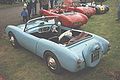 Berkeley Foursome.jpg 408 × 271 ; 21 kio
-
 Bernwood Way heading up to Quainton - geograph.org.uk - 714091.jpg 640 × 425 ; 58 kio
-
 Blackgrove cross roads from Quainton - geograph.org.uk - 2865542.jpg 640 × 479 ; 59 kio
-
 Blackgrove Road at Blackberry Farm entrance - geograph.org.uk - 3153674.jpg 640 × 480 ; 48 kio
-
 Blackgrove Road at start of footpath - geograph.org.uk - 3153677.jpg 640 × 448 ; 81 kio
-
 Bridge on route of old railway - geograph.org.uk - 5948133.jpg 1 024 × 684 ; 328 kio
-
 Bridge over River Ray - geograph.org.uk - 959614.jpg 480 × 640 ; 138 kio
-
 Bridge over the Chiltern Line railway - geograph.org.uk - 4365829.jpg 1 500 × 999 ; 154 kio
-

-
 Bridleway and level crossing - geograph.org.uk - 3571938.jpg 1 600 × 1 070 ; 624 kio
-
 Bridleway by Finmere Hill House - geograph.org.uk - 3571949.jpg 1 600 × 1 066 ; 528 kio
-
 Bridleway by the disused railway - geograph.org.uk - 3571482.jpg 1 600 × 1 067 ; 710 kio
-
 Bridleway going over the railway bridge - geograph.org.uk - 3571933.jpg 1 200 × 1 600 ; 638 kio
-
 Bridleway heading to Mill Mound - geograph.org.uk - 5190486.jpg 640 × 480 ; 49 kio
-
 Bridleway heading to Mill Mound - geograph.org.uk - 5190497.jpg 640 × 480 ; 62 kio
-
 Bridleway into Finmere Wood - geograph.org.uk - 3571943.jpg 1 600 × 1 068 ; 691 kio
-
 Bridleway near Finemere Wood - geograph.org.uk - 937002.jpg 640 × 480 ; 100 kio
-
 Bridleway near Lower South Farm 1 - geograph.org.uk - 1246789.jpg 480 × 640 ; 92 kio
-
 Bridleway near Lower South Farm 2 - geograph.org.uk - 1248322.jpg 640 × 480 ; 63 kio
-
 Bridleway near Lower South Farm 3 - geograph.org.uk - 1248330.jpg 640 × 480 ; 64 kio
-
 Bridleway near Railway Cottage - geograph.org.uk - 934076.jpg 640 × 480 ; 65 kio
-
 Bridleway past a horse in a cage - geograph.org.uk - 3571947.jpg 1 600 × 1 068 ; 570 kio
-
 Bridleway through Finmere Woods - geograph.org.uk - 3571945.jpg 1 200 × 1 600 ; 817 kio
-
 Bridleway to Finemere Wood - geograph.org.uk - 1716268.jpg 2 592 × 1 944 ; 2,56 Mio
-
 Bridleway to Finmere - geograph.org.uk - 3573518.jpg 1 600 × 1 067 ; 440 kio
-
 Bridleway to Lower Denham Farm - geograph.org.uk - 1626100.jpg 640 × 480 ; 95 kio
-
 Bridleway to Oak Tree Farm - geograph.org.uk - 3571477.jpg 1 200 × 1 600 ; 709 kio
-
 Carter's Lane - geograph.org.uk - 4403534.jpg 640 × 480 ; 117 kio
-
 Carter's Lane - geograph.org.uk - 6388024.jpg 1 024 × 768 ; 264 kio
-
 Carter's Lane - geograph.org.uk - 6388034.jpg 1 024 × 768 ; 381 kio
-
 Carter's Lane - geograph.org.uk - 6388103.jpg 1 024 × 768 ; 303 kio
-
 Carter's Lane, Pitchcott - geograph.org.uk - 610575.jpg 640 × 549 ; 203 kio
-
 Church of St Mary and the Holy Cross - geograph.org.uk - 4300645.jpg 4 320 × 3 240 ; 5,4 Mio
-
 Church Street - geograph.org.uk - 939248.jpg 640 × 480 ; 235 kio
-
 Church Street - geograph.org.uk - 939260.jpg 622 × 454 ; 304 kio
-
 Church Street - geograph.org.uk - 939265.jpg 627 × 462 ; 261 kio
-
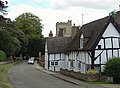
 Church Street, Quainton - geograph.org.uk - 6387827.jpg 1 024 × 768 ; 235 kio
-
 Church Street, Quainton with timber framed house - geograph.org.uk - 6387854.jpg 1 024 × 768 ; 212 kio
-
 Community Hall - geograph.org.uk - 939316.jpg 480 × 640 ; 347 kio
-
 Cottage by the green at Quainton - geograph.org.uk - 2865523.jpg 640 × 480 ; 72 kio
-
 Cottages by the Green in Quainton - geograph.org.uk - 3103729.jpg 1 500 × 1 000 ; 192 kio
-
 Cottages on the Green Quainton - geograph.org.uk - 4301662.jpg 4 320 × 3 240 ; 4,63 Mio
-
 Cottages Overlooking the Green, Quainton - geograph.org.uk - 1595501.jpg 640 × 449 ; 198 kio
-
 Covered reservoir with triangulation point on Quainton Hill - geograph.org.uk - 3573415.jpg 1 600 × 1 068 ; 339 kio
-
 Cows near Doddeshall House - geograph.org.uk - 1248348.jpg 640 × 480 ; 74 kio
-
 Cross and windmill - geograph.org.uk - 5392083.jpg 1 600 × 1 200 ; 743 kio
-
 Crossroads south west of Railway Centre - geograph.org.uk - 3924420.jpg 640 × 487 ; 50 kio
-
 Crossroads, Station Road - geograph.org.uk - 2339887.jpg 640 × 418 ; 99 kio
-
 Crossroads, Station Road - geograph.org.uk - 2339908.jpg 640 × 480 ; 99 kio
-
 Deep ditch alongside road - geograph.org.uk - 4301670.jpg 4 196 × 3 068 ; 4,26 Mio
-
 Denham Farm - geograph.org.uk - 3276555.jpg 640 × 480 ; 113 kio
-
 Dismantled Railway - geograph.org.uk - 1716248.jpg 2 592 × 1 944 ; 2,47 Mio
-
 Dismantled Railway - geograph.org.uk - 1716258.jpg 2 592 × 1 944 ; 2,56 Mio
-
 Dismantled Railway - geograph.org.uk - 1716900.jpg 2 592 × 1 944 ; 2,51 Mio
-
 Dismantled railway bed - geograph.org.uk - 3571932.jpg 1 200 × 1 600 ; 579 kio
-
 Dismantled railway looking north 1 - geograph.org.uk - 940432.jpg 640 × 480 ; 164 kio
-
 Dismantled railway to Quainton Road 1 - geograph.org.uk - 963232.jpg 640 × 480 ; 76 kio
-
 Dismantled railway to Quainton Road 2 - geograph.org.uk - 963247.jpg 640 × 480 ; 60 kio
-
 Dismantled railway to Quainton Road 3 - geograph.org.uk - 963265.jpg 640 × 480 ; 61 kio
-
 Dismantled railway to Quainton Road 4 - geograph.org.uk - 963270.jpg 640 × 480 ; 82 kio
-
 Dismantled railway to Quainton Road 5 - geograph.org.uk - 1030786.jpg 640 × 480 ; 137 kio
-
 Dismantled railway to Quainton Road 6 - geograph.org.uk - 1030790.jpg 640 × 480 ; 115 kio
-
 Dismantled railway to Quainton Road 7 - geograph.org.uk - 1038952.jpg 640 × 480 ; 90 kio
-
 Dismantled railway to Verney Junction 1 - geograph.org.uk - 1245451.jpg 640 × 480 ; 93 kio
-
 Dismantled railway to Verney Junction 2 - geograph.org.uk - 1245817.jpg 640 × 480 ; 54 kio
-
 Dismantled railway towards Quainton - geograph.org.uk - 3573525.jpg 1 600 × 1 067 ; 427 kio
-
 Don't call me Shirley........ - geograph.org.uk - 4402131.jpg 2 544 × 3 292 ; 1,11 Mio
-
 Dry Leys Farm - geograph.org.uk - 4301679.jpg 4 320 × 3 240 ; 5,4 Mio
-
 Earth works on Quainton Hill - geograph.org.uk - 3276531.jpg 2 560 × 1 920 ; 1,12 Mio
-
 Eastwards from the crossroads - geograph.org.uk - 2339952.jpg 640 × 480 ; 95 kio
-
 Entering Quainton by the Willows - geograph.org.uk - 2865520.jpg 640 × 486 ; 114 kio
-
 Entrance to Field Side Farm - geograph.org.uk - 4412169.jpg 3 872 × 2 684 ; 2,27 Mio
-
 Entrance to Quainton Railway Centre - geograph.org.uk - 3924414.jpg 640 × 381 ; 63 kio
-
 Entrance, Doddershall House - geograph.org.uk - 928901.jpg 640 × 480 ; 125 kio
-
 Farm buildings at the crossroads - geograph.org.uk - 2339919.jpg 640 × 437 ; 96 kio
-
 Farm track on to pasture by The Strand - geograph.org.uk - 3573451.jpg 1 600 × 1 073 ; 501 kio
-
 Farmland by the Railway Centre - geograph.org.uk - 2339970.jpg 640 × 479 ; 102 kio
-
 Farmland near Doddershall House - geograph.org.uk - 1253734.jpg 640 × 480 ; 69 kio
-
 Farmland near Doddershall House - geograph.org.uk - 963170.jpg 640 × 480 ; 44 kio
-
 Farmland near Doddershall House 2 - geograph.org.uk - 1250201.jpg 640 × 480 ; 82 kio
-
 Farmland near Doddershall House 3 - geograph.org.uk - 1250209.jpg 640 × 480 ; 75 kio
-
 Farmland near Railway Cottage - geograph.org.uk - 934068.jpg 640 × 480 ; 59 kio
-
 Farmland, Finemere Hill - geograph.org.uk - 1278428.jpg 640 × 480 ; 85 kio
-
 Fence, Doddershall House - geograph.org.uk - 928999.jpg 640 × 480 ; 142 kio
-
 Field and footpath near Quainton - geograph.org.uk - 408548.jpg 640 × 480 ; 99 kio
-
 Field edge near Doddershall House - geograph.org.uk - 1248349.jpg 640 × 480 ; 64 kio
-
 Field west of Carter's Lane - geograph.org.uk - 6388045.jpg 1 024 × 768 ; 364 kio
-
 Field west of Carter's Lane - geograph.org.uk - 6388115.jpg 1 024 × 768 ; 235 kio
-
 Fields near Doddershall House - geograph.org.uk - 1248353.jpg 640 × 480 ; 43 kio
-
 Finemere Hill - geograph.org.uk - 957479.jpg 640 × 480 ; 69 kio
-
 Fishing Lake, Woodlands Farm Fishery - geograph.org.uk - 1280017.jpg 640 × 480 ; 107 kio
-
 Footpath heading to Quainton - geograph.org.uk - 3281697.jpg 640 × 480 ; 79 kio
-
 Footpath into Quainton - geograph.org.uk - 3573442.jpg 1 600 × 1 070 ; 521 kio
-
 Footpath into Quainton - geograph.org.uk - 3573504.jpg 1 600 × 1 068 ; 599 kio
-
 Footpath near Doddershall House - geograph.org.uk - 926632.jpg 640 × 480 ; 78 kio
-
 Footpath near Doddershall House 2 - geograph.org.uk - 926651.jpg 640 × 480 ; 50 kio
-
 Footpath near Doddershall House 3 - geograph.org.uk - 926673.jpg 480 × 640 ; 125 kio
-
 Footpath near Doddershall House 4 - geograph.org.uk - 928828.jpg 480 × 640 ; 105 kio
-
 Footpath near Kitehill Farm - geograph.org.uk - 958517.jpg 480 × 640 ; 81 kio
-
 Footpath near Kitehill Farm 2 - geograph.org.uk - 958531.jpg 640 × 480 ; 66 kio
-
 Footpath near Quainton - geograph.org.uk - 4470555.jpg 4 000 × 3 000 ; 2,59 Mio
-
 Footpath near Quainton - geograph.org.uk - 484734.jpg 640 × 480 ; 89 kio
-
 Footpath near Railway Cottage - geograph.org.uk - 934073.jpg 640 × 480 ; 58 kio
-
 Footpath near Railway Cottage 2 - geograph.org.uk - 934077.jpg 640 × 480 ; 73 kio
-
 Footpath near Runt's Wood 2 - geograph.org.uk - 956217.jpg 640 × 480 ; 78 kio
-
 Footpath near Runt's Wood 3 - geograph.org.uk - 957469.jpg 480 × 640 ; 89 kio
-
 Footpath near Runt's Wood 4 - geograph.org.uk - 957474.jpg 640 × 480 ; 73 kio
-
 Footpath off Church Street - geograph.org.uk - 939250.jpg 640 × 480 ; 435 kio
-
 Footpath to Fieldside Farm - geograph.org.uk - 3573508.jpg 1 600 × 1 068 ; 490 kio
-
 Footpath to Hill Cottage along the old railway - geograph.org.uk - 3573534.jpg 1 600 × 1 068 ; 606 kio
-
 Footpath to Quainton - geograph.org.uk - 3573520.jpg 1 200 × 1 600 ; 622 kio
-
 Footpath to Quainton with Grange Hill in the distance - geograph.org.uk - 3573527.jpg 1 200 × 1 600 ; 522 kio
-
 Footpath under the wires - geograph.org.uk - 1716231.jpg 2 592 × 1 944 ; 2,41 Mio
-
 Former bakery, Quainton - geograph.org.uk - 939295.jpg 480 × 640 ; 279 kio
-
 Former railway bridge over the road to Edgcott - geograph.org.uk - 4365834.jpg 1 500 × 971 ; 239 kio
-
 Former railway crossing, Railway Cottage - geograph.org.uk - 934094.jpg 640 × 480 ; 89 kio
-
 Gate and bridge, Quainton Road - geograph.org.uk - 2339783.jpg 640 × 480 ; 99 kio
-
 Gate near Doddeshall House - geograph.org.uk - 1248893.jpg 640 × 468 ; 86 kio
-
 Gatehouse near Doddeshall House - geograph.org.uk - 1245845.jpg 640 × 480 ; 95 kio
-
 George and Dragon public house. - geograph.org.uk - 904413.jpg 640 × 426 ; 79 kio
-
 George ^ Dragon PH - geograph.org.uk - 5398167.jpg 1 600 × 1 200 ; 535 kio
-
 Grubs Up ^ - geograph.org.uk - 3276418.jpg 2 217 × 1 663 ; 837 kio
-
 Hawthorn and plantation on Quainton Hill - geograph.org.uk - 3573421.jpg 1 600 × 1 068 ; 437 kio
-
 Hedge by the edge of Quainton Hill - geograph.org.uk - 3573482.jpg 1 600 × 1 068 ; 508 kio
-
 Hedgerow near Lower South Farm - geograph.org.uk - 1248337.jpg 480 × 640 ; 85 kio
-
 Hedgerow near Railway Cottage - geograph.org.uk - 959615.jpg 480 × 640 ; 71 kio
-
 Hedgerow near Upper South Farm - geograph.org.uk - 1245854.jpg 640 × 480 ; 56 kio
-
 House by churchyard, Quainton - geograph.org.uk - 6387693.jpg 1 024 × 684 ; 258 kio
-
 Houses, Quainton - geograph.org.uk - 658773.jpg 640 × 480 ; 137 kio
-
 It's all up the road - geograph.org.uk - 4402121.jpg 3 888 × 2 592 ; 1,79 Mio
-
 Kitchen garden, Doddershall House - geograph.org.uk - 929001.jpg 640 × 480 ; 101 kio
-
 Lane by entrance to Knapps Hook Farm - geograph.org.uk - 5948004.jpg 1 024 × 684 ; 277 kio
-
 Lane to Denham - geograph.org.uk - 4403502.jpg 640 × 480 ; 124 kio
-
 Lane to Shipton Lee - geograph.org.uk - 1716223.jpg 2 592 × 1 944 ; 2,39 Mio
-
 Lane towards Edgcott - geograph.org.uk - 5948151.jpg 1 024 × 684 ; 214 kio
-
 Lane towards North Farm - geograph.org.uk - 5948011.jpg 1 024 × 684 ; 209 kio
-
 Lee Road into Quainton - geograph.org.uk - 4383391.jpg 1 500 × 999 ; 134 kio
-
 Lee Road to Quainton - geograph.org.uk - 4383384.jpg 1 500 × 991 ; 99 kio
-
 London House - geograph.org.uk - 3276516.jpg 1 770 × 2 360 ; 1,06 Mio
-
 London House - Lower Street - geograph.org.uk - 5398159.jpg 1 600 × 1 200 ; 666 kio
-
 Looking towards Quainton - geograph.org.uk - 60137.jpg 640 × 480 ; 113 kio
-
 Lower South Farm near Doddershall - geograph.org.uk - 1248305.jpg 640 × 480 ; 58 kio
-
 Lower Street in Quainton - geograph.org.uk - 4383439.jpg 1 500 × 973 ; 113 kio
-
 Lower Street Pump - geograph.org.uk - 939309.jpg 463 × 626 ; 333 kio
-
 Lower Street pump and thatched cottage - geograph.org.uk - 3573502.jpg 1 600 × 1 067 ; 463 kio
-
 Lower street Quainton - geograph.org.uk - 714077.jpg 640 × 425 ; 62 kio
-
 Lower Street through Quainton - geograph.org.uk - 4383404.jpg 1 500 × 999 ; 149 kio
-
 Many paths at Denham - geograph.org.uk - 3573432.jpg 1 600 × 1 069 ; 442 kio
-
 Mathews Way near the church - geograph.org.uk - 3573440.jpg 1 600 × 1 068 ; 627 kio
-
 Mathews Way out of the churchyard - geograph.org.uk - 3573493.jpg 1 200 × 1 600 ; 614 kio
-
 Matthew's Way, Quainton - geograph.org.uk - 566193.jpg 480 × 640 ; 196 kio
-
 Mature hedge in the grazing on Quainton Hill - geograph.org.uk - 3573480.jpg 1 600 × 1 068 ; 461 kio
-

-
 Minor road to Edgcott - geograph.org.uk - 4368544.jpg 1 500 × 999 ; 200 kio
-
 Moat near Doddershall House 1 - geograph.org.uk - 1248957.jpg 640 × 480 ; 118 kio
-
 Moat near Doddershall House 2 - geograph.org.uk - 1250149.jpg 640 × 479 ; 71 kio
-
 Moat near Doddershall House 3 - geograph.org.uk - 1250159.jpg 640 × 474 ; 68 kio
-
 Moat near Doddershall House 4 - geograph.org.uk - 1250163.jpg 505 × 640 ; 85 kio
-
 Moat near Doddershall House 5 - geograph.org.uk - 1250190.jpg 640 × 480 ; 60 kio
-
 Moat round Denham Lodge - geograph.org.uk - 3573426.jpg 1 600 × 1 068 ; 615 kio
-
 Moat, Doddershall House - geograph.org.uk - 929014.jpg 640 × 480 ; 118 kio
-
 Mounting steps by the junction with The Strand - geograph.org.uk - 3573446.jpg 1 600 × 1 068 ; 538 kio
-
 New Look for the Old Line - geograph.org.uk - 4404661.jpg 4 000 × 3 000 ; 2,76 Mio
-
 North Bucks Way - geograph.org.uk - 5186817.jpg 640 × 480 ; 59 kio
-
 Oak Tree Farm - geograph.org.uk - 4396131.jpg 3 868 × 2 624 ; 1,33 Mio
-
 Old Brick Houses, Quainton - geograph.org.uk - 4501432.jpg 3 424 × 2 052 ; 1,78 Mio
-
 OS cut mark on Quainton Church doorway - geograph.org.uk - 1852415.jpg 1 600 × 1 200 ; 553 kio
-
 Passing Place on the Rubbish Route - geograph.org.uk - 4404669.jpg 4 000 × 3 000 ; 1,9 Mio
-
 Pastures above Quainton - geograph.org.uk - 658772.jpg 640 × 480 ; 124 kio
-
 Pastures, Quainton - geograph.org.uk - 658774.jpg 640 × 480 ; 141 kio
-
 Pastures, Quainton - geograph.org.uk - 658775.jpg 640 × 480 ; 120 kio
-
 Pastures, Quainton - geograph.org.uk - 658776.jpg 640 × 480 ; 150 kio
-
 Pastures, Quainton - geograph.org.uk - 658777.jpg 640 × 480 ; 108 kio
-
 Pastures, Quainton - geograph.org.uk - 658778.jpg 640 × 480 ; 117 kio
-
 Pastures, Quainton - geograph.org.uk - 658780.jpg 640 × 480 ; 146 kio
-
 Pastures, Quainton - geograph.org.uk - 658782.jpg 640 × 480 ; 159 kio
-
 Pastures, Quainton - geograph.org.uk - 658786.jpg 640 × 480 ; 133 kio
-
 Pastures, Quainton - geograph.org.uk - 658793.jpg 640 × 480 ; 148 kio
-
 Pastures, Quainton - geograph.org.uk - 658825.jpg 640 × 480 ; 131 kio
-
 Pastures, Quainton - geograph.org.uk - 658827.jpg 640 × 480 ; 131 kio
-
 Pastures, Quainton - geograph.org.uk - 658829.jpg 640 × 480 ; 150 kio
-
 Path below Lower South Farm - geograph.org.uk - 5190479.jpg 640 × 480 ; 67 kio
-
 Path to North Marston - geograph.org.uk - 4758088.jpg 640 × 480 ; 75 kio
-
 Plaque on Almshouses, Quainton - geograph.org.uk - 6387864.jpg 1 024 × 1 024 ; 398 kio
-
 Pond Bay, River Ray - geograph.org.uk - 962463.jpg 640 × 480 ; 55 kio
-
 Pond Bay, River Ray 2 - geograph.org.uk - 962474.jpg 640 × 480 ; 58 kio
-
 Pond Bay, River Ray 3 - geograph.org.uk - 962494.jpg 640 × 480 ; 58 kio
-
 Pond Bay, River Ray 4 - geograph.org.uk - 962553.jpg 640 × 480 ; 63 kio
.jpg)


