Category:Queenborough
Zur Navigation springen
Zur Suche springen

Kleinstadt im Vereinigten Königreich  | |||||
| Medium hochladen | |||||
| Ist ein(e) | |||||
|---|---|---|---|---|---|
| Ort | Swale, Kent, Südostengland, England | ||||
 | |||||
Unterkategorien
Es werden 9 von insgesamt 9 Unterkategorien in dieser Kategorie angezeigt:
In Klammern die Anzahl der enthaltenen Kategorien (K), Seiten (S), Dateien (D)
B
D
- Deadmans Island (1 D)
H
K
- Kingsferry Bridge (20 D)
P
Q
- Queenborough Creek (5 D)
- Queenborough railway station (12 D)
- Queenborough War Memorial (5 D)
R
Medien in der Kategorie „Queenborough“
Folgende 200 Dateien sind in dieser Kategorie, von 499 insgesamt.
(vorherige Seite) (nächste Seite)-
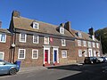
 "The White House" - geograph.org.uk - 389589.jpg 640 × 426; 90 KB
-
 36, South Street - geograph.org.uk - 5575374.jpg 2.448 × 3.264; 2,1 MB
-
 72-74 High Street, Queenborough - geograph.org.uk - 6270914.jpg 3.264 × 2.448; 2,73 MB
-
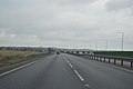
 A249 - geograph.org.uk - 4388158.jpg 640 × 426; 29 KB
-
 A249 - geograph.org.uk - 4388159.jpg 640 × 426; 30 KB
-
 A249 - geograph.org.uk - 4388160.jpg 640 × 426; 30 KB
-
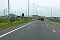
 A249 Brielle Way - geograph.org.uk - 5776399.jpg 640 × 428; 90 KB
-
 A249 Brielle Way - geograph.org.uk - 5776698.jpg 640 × 428; 86 KB
-

-
 A249 southbound - geograph.org.uk - 4343207.jpg 640 × 480; 40 KB
-
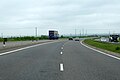 A249 towards Maidstone - geograph.org.uk - 5776691.jpg 640 × 428; 71 KB
-
 A249, lay-by - geograph.org.uk - 4343217.jpg 640 × 480; 47 KB
-
 A249, Sheppey Way - geograph.org.uk - 4388161.jpg 640 × 426; 30 KB
-
 Abbott Laboratories, Queenborough - geograph.org.uk - 2769510.jpg 4.000 × 3.000; 4,3 MB
-
 Admiralty Chart No 2572 West Swale Fowley Island to Queenborough, Published 1918.jpg 11.214 × 16.292; 65,47 MB
-
 Admiralty Charts No 2571 2572 Swale, Published 1918 (composite).jpg 30.461 × 16.311; 128,19 MB
-
 All that remains of Rushenden Road Crossing - geograph.org.uk - 4707191.jpg 3.264 × 2.448; 3,8 MB
-
 Along the estuary at Queenborough - geograph.org.uk - 2766544.jpg 4.000 × 3.000; 4,37 MB
-
 Alsager Avenue, Rushenden - geograph.org.uk - 3729036.jpg 3.488 × 2.616; 1,87 MB
-
 Alsager Avenue, Rushenden - geograph.org.uk - 5536071.jpg 3.264 × 2.448; 3,22 MB
-
 Approaching the Kings Ferry bridge - geograph.org.uk - 3730337.jpg 640 × 480; 58 KB
-
 Argent Road, Rushenden - geograph.org.uk - 3728924.jpg 3.488 × 2.616; 2,18 MB
-

-
 Blue hoarding along First Avenue - geograph.org.uk - 3699327.jpg 1.179 × 905; 149 KB
-
 Boat full of flowers - geograph.org.uk - 4309.jpg 640 × 480; 83 KB
-
 Boats at Queenborough Harbour - geograph.org.uk - 3728806.jpg 3.488 × 2.616; 1,77 MB
-
 Boats on the Swale - geograph.org.uk - 3729122.jpg 3.488 × 2.616; 2,23 MB
-
 Borough Hall, Queenborough - geograph.org.uk - 2996625.jpg 4.288 × 3.216; 3,29 MB
-
 Borough Road, Queenborough - geograph.org.uk - 3728868.jpg 3.488 × 2.616; 2,19 MB
-
 Bosuns Store, High Street - geograph.org.uk - 3702258.jpg 1.109 × 831; 216 KB
-
 Bridge View Industrial Estate - geograph.org.uk - 4969831.jpg 4.608 × 3.456; 3,61 MB
-
 Bridge View Industrial Estate - geograph.org.uk - 4969834.jpg 4.608 × 3.456; 3,56 MB
-
 Bridges across the Swale - geograph.org.uk - 3730320.jpg 3.488 × 2.616; 2,19 MB
-
 Bridges near Iwade (1) - geograph.org.uk - 4215799.jpg 640 × 405; 116 KB
-
 Bridges over the Swale - geograph.org.uk - 3730321.jpg 3.488 × 2.616; 1,75 MB
-
 Bridges over the Swale - geograph.org.uk - 3730340.jpg 3.488 × 2.616; 2,22 MB
-
 Broadness Creek, Chetney Marshes - geograph.org.uk - 4215754.jpg 640 × 408; 136 KB
-
 Building site, North Road - geograph.org.uk - 6006105.jpg 2.448 × 3.264; 2 MB
-
 Buoy in The Swale - geograph.org.uk - 2159590.jpg 640 × 430; 124 KB
-
 Buoy on Horse Reach, The Swale - geograph.org.uk - 5943788.jpg 1.024 × 768; 99 KB
-
 Canada geese over the Swale - geograph.org.uk - 256699.jpg 640 × 480; 31 KB
-
 Castle Street, Queenborough - geograph.org.uk - 3728836.jpg 3.488 × 2.616; 1,83 MB
-
 Castlemere Avenue, Queenborough - geograph.org.uk - 3728857.jpg 3.488 × 2.616; 1,76 MB
-
 Chalk Road, Queenborough - geograph.org.uk - 3728831.jpg 3.488 × 2.616; 2,32 MB
-
 Chetney Marshes - geograph.org.uk - 5924732.jpg 1.024 × 768; 207 KB
-
 Chetney Marshes - geograph.org.uk - 5929804.jpg 1.024 × 768; 191 KB
-
 Chetney Marshes at Stangate Spit - geograph.org.uk - 5293207.jpg 640 × 480; 78 KB
-
 Chetney Marshes by Long Reach - geograph.org.uk - 5293253.jpg 640 × 480; 51 KB
-
 Chetney Marshes by Stangate Creek - geograph.org.uk - 5292318.jpg 640 × 480; 71 KB
-
 Coastal path footbridge - geograph.org.uk - 5302601.jpg 5.202 × 3.465; 4,19 MB
-
 Construction of houses, 34-40, Rushenden Road - geograph.org.uk - 5170760.jpg 3.264 × 2.448; 3,77 MB
-
 Construction site, Rushenden Road - geograph.org.uk - 5574333.jpg 3.264 × 2.448; 1,63 MB
-
 Contract Engineering, South Street - geograph.org.uk - 5574382.jpg 3.264 × 2.448; 2,28 MB
-
 Corner of West St and North Road - geograph.org.uk - 5301258.jpg 5.184 × 3.456; 6,14 MB
-
 Coronation Crescent, Queenborough - geograph.org.uk - 3728817.jpg 3.488 × 2.616; 2,29 MB
-
 Creek on Tailness Marshes - geograph.org.uk - 5293225.jpg 640 × 480; 76 KB
-
-

-
-

-

-
 Creeks on the northern edge of Chetney Marshes - geograph.org.uk - 5924692.jpg 1.024 × 768; 232 KB
-
 Curves of the Sheppey Crossing - geograph.org.uk - 3037416.jpg 735 × 1.024; 74 KB
-

-

-
 Demolition of former Mechel Services UK Ltd - geograph.org.uk - 3700842.jpg 1.044 × 783; 229 KB
-
 Derelict Barge in the Swale - geograph.org.uk - 3729089.jpg 3.488 × 2.616; 2,14 MB
-
 Derelict Barge in the Swale - geograph.org.uk - 3729092.jpg 3.488 × 2.616; 1,89 MB
-

-
 Derelict building, South Street - geograph.org.uk - 5170799.jpg 3.264 × 2.448; 2,32 MB
-
 Derelict Industrial Site by Rushenden Pier - geograph.org.uk - 3729107.jpg 3.488 × 2.616; 1,93 MB
-
 Derelict Industrial Site near Rushenden - geograph.org.uk - 3728905.jpg 3.488 × 2.616; 2,22 MB
-
 Derelict Industrial Site, Rushenden - geograph.org.uk - 3729033.jpg 3.488 × 2.616; 1,79 MB
-
 Derelict outbuildings, Neats Court Farm - geograph.org.uk - 3704575.jpg 1.111 × 856; 213 KB
-
 Derelict site, Rushenden Crossing - geograph.org.uk - 5170833.jpg 3.264 × 2.448; 1,89 MB
-
 Descending the Sheppey Crossing - geograph.org.uk - 4388153.jpg 640 × 426; 38 KB
-
 Development of land beside A249 - geograph.org.uk - 5170746.jpg 3.191 × 2.448; 2,49 MB
-
 Disused Electricity Poles, Rushenden Marshes - geograph.org.uk - 3729170.jpg 3.488 × 2.616; 1,72 MB
-

-
 Drainage channels on Tailness Marshes - geograph.org.uk - 5926694.jpg 1.024 × 768; 254 KB
-
 Dumergue Avenue, Queenborough - geograph.org.uk - 3728850.jpg 3.488 × 2.616; 2,27 MB
-
 Dumergue Avenue, Queenborough - geograph.org.uk - 3728853.jpg 3.488 × 2.616; 2,32 MB
-
 Eastern Avenue, Queenborough - geograph.org.uk - 3728878.jpg 3.488 × 2.616; 1,83 MB
-
 Eastern Avenue, Queenborough - geograph.org.uk - 5536004.jpg 3.264 × 2.448; 1,81 MB
-
 Edward Road, Queenborough - geograph.org.uk - 3728858.jpg 3.488 × 2.616; 2,14 MB
-
-

-
 Entrance to Queenborough Harbour - geograph.org.uk - 1275709.jpg 640 × 480; 65 KB
-
 Estuary mud at Queenborough - geograph.org.uk - 2769492.jpg 4.000 × 3.000; 3,95 MB
-
 Ferry Road, Elmley - geograph.org.uk - 3738471.jpg 640 × 480; 67 KB
-
 Ferry Road, Elmley - geograph.org.uk - 3738479.jpg 3.488 × 2.616; 2,14 MB
-
 Ferry View, Rushenden - geograph.org.uk - 3729015.jpg 3.488 × 2.616; 1,56 MB
-
 First Avenue - geograph.org.uk - 6005484.jpg 3.264 × 2.448; 2,33 MB
-
 First Avenue, Rushenden - geograph.org.uk - 2758776.jpg 782 × 586; 128 KB
-
 First Avenue, Rushenden - geograph.org.uk - 3728909.jpg 3.488 × 2.616; 1,66 MB
-
 First Avenue, Rushenden - geograph.org.uk - 3729029.jpg 3.488 × 2.616; 2,16 MB
-
 First Avenue, Rushenden - geograph.org.uk - 5536068.jpg 3.264 × 2.448; 1,82 MB
-
 First Avenue, Rushenden - geograph.org.uk - 5536073.jpg 3.264 × 2.448; 1,78 MB
-
 Fishing Boat, Queenborough - geograph.org.uk - 2996642.jpg 3.216 × 4.288; 4,92 MB
-
 Fishing in the West Swale - geograph.org.uk - 1274817.jpg 640 × 480; 60 KB
-
 Flanagan Avenue - geograph.org.uk - 6005489.jpg 3.264 × 2.448; 2,44 MB
-
 Flat landscape - geograph.org.uk - 4343203.jpg 640 × 480; 79 KB
-
 Flat landscape, A249 - geograph.org.uk - 4343214.jpg 640 × 480; 51 KB
-
 Flying Dutchman sign - geograph.org.uk - 5301254.jpg 640 × 467; 83 KB
-
 Former Mechel Services UK Ltd site - geograph.org.uk - 3700829.jpg 1.077 × 807; 218 KB
-
 Former trackbed of Sheppey Light Railway - geograph.org.uk - 3061353.jpg 652 × 489; 130 KB
-
 Former trackbed of Sheppey Light Railway - geograph.org.uk - 3061366.jpg 685 × 513; 102 KB
-
 Foxley Road, Queenborough - geograph.org.uk - 3728828.jpg 3.488 × 2.616; 2,23 MB
-

-
 Gates at Rushenden Road Crossing - geograph.org.uk - 4708651.jpg 3.264 × 2.448; 3,65 MB
-

-
 Gordon Avenue, Queenborough - geograph.org.uk - 3728886.jpg 3.488 × 2.616; 2,09 MB
-
 Gordon Avenue, Queenborough - geograph.org.uk - 5536013.jpg 3.264 × 2.448; 2 MB
-
 Harold Street, Queenborough - geograph.org.uk - 3728884.jpg 3.488 × 2.616; 2,03 MB
-
 Harold Street, Queenborough - geograph.org.uk - 5536010.jpg 3.264 × 2.448; 1,85 MB
-
 High Street, Queenborough - geograph.org.uk - 2732869.jpg 640 × 427; 115 KB
-
 High Street, Queenborough - geograph.org.uk - 2732878.jpg 640 × 427; 96 KB
-
 High Street, Queenborough - geograph.org.uk - 2759938.jpg 894 × 670; 150 KB
-
 High Street, Queenborough - geograph.org.uk - 2759947.jpg 888 × 666; 132 KB
-
 High Street, Queenborough - geograph.org.uk - 2761027.jpg 782 × 586; 127 KB
-
 High Street, Queenborough - geograph.org.uk - 3728771.jpg 3.488 × 2.616; 2,16 MB
-
 High Street, Queenborough - geograph.org.uk - 3728776.jpg 3.488 × 2.616; 2,13 MB
-
 High Street, Queenborough - geograph.org.uk - 3728781.jpg 3.488 × 2.616; 2,56 MB
-
 High Street, Queenborough - geograph.org.uk - 3728837.jpg 3.488 × 2.616; 2,21 MB
-
 High Street, Queenborough - geograph.org.uk - 5536016.jpg 3.264 × 2.448; 1,67 MB
-
 High Street, Queenborough - geograph.org.uk - 5536019.jpg 3.264 × 2.448; 1,7 MB
-
 High Street, Queenborough - geograph.org.uk - 5536058.jpg 3.264 × 2.448; 1,96 MB
-
 High Street, Queenborough - geograph.org.uk - 5536060.jpg 3.264 × 2.448; 1,58 MB
-
 High Street, Queenborough - geograph.org.uk - 5670665.jpg 4.032 × 3.024; 2,99 MB
-
 Hillside Avenue, Rushenden - geograph.org.uk - 3729020.jpg 3.488 × 2.616; 1,76 MB
-
 HMS Wildfire III Memorial, Queenborough (I).jpg 3.290 × 4.398; 11,86 MB
-
 HMS Wildfire III Memorial, Queenborough (II).jpg 3.448 × 4.592; 8,99 MB
-
 HMS Wildfire III Memorial, Queenborough (III).jpg 4.233 × 3.181; 16,26 MB
-
 Horse Reach - geograph.org.uk - 2158027.jpg 640 × 430; 116 KB
-
 Horse Reach, The Swale (2) - geograph.org.uk - 5929852.jpg 1.024 × 768; 208 KB
-
 Horse Reach, The Swale (3) - geograph.org.uk - 5943775.jpg 1.024 × 768; 141 KB
-
 Horse Reach, The Swale (4) - geograph.org.uk - 5943794.jpg 1.024 × 768; 184 KB
-
 Horse Reach, The Swale (5) - geograph.org.uk - 5943798.jpg 1.024 × 768; 164 KB
-
 Horse Reach, The Swale (6) - geograph.org.uk - 5943807.jpg 1.024 × 768; 176 KB
-
 Horse Reach, The Swale - geograph.org.uk - 2158533.jpg 640 × 430; 122 KB
-
 Horse Reach, The Swale - geograph.org.uk - 3729153.jpg 3.488 × 2.616; 1,72 MB
-
 Horse Reach, The Swale - geograph.org.uk - 5294595.jpg 640 × 480; 63 KB
-
 Horse Reach, The Swale - geograph.org.uk - 5295340.jpg 640 × 480; 66 KB
-
 Horse Reach, The Swale - geograph.org.uk - 5929844.jpg 1.024 × 768; 202 KB
-
 Horses grazing by a drain on Chetney Marshes - geograph.org.uk - 5943771.jpg 1.024 × 768; 198 KB
-
 Imported cars at Sheerness Docks - geograph.org.uk - 2766488.jpg 4.000 × 3.000; 4,06 MB
-
 Isle of Sheppey, Kent - geograph.org.uk - 4195134.jpg 1.238 × 929; 830 KB
-
 Jetties east of Thamesport - geograph.org.uk - 4192480.jpg 640 × 427; 42 KB
-
 Jetty, Queenborough - geograph.org.uk - 6270926.jpg 3.264 × 2.448; 3,65 MB
-
 Joan Fleet - geograph.org.uk - 3729205.jpg 3.488 × 2.616; 1,52 MB
-
 Joan Fleet - geograph.org.uk - 3729214.jpg 3.488 × 2.616; 1,66 MB
-
 Joan Fleet - geograph.org.uk - 3730317.jpg 3.488 × 2.616; 2,23 MB
-
 Joan Fleet - geograph.org.uk - 3730327.jpg 3.488 × 2.616; 2,45 MB
-

-

-
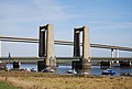
 Kingsferry Bridge - geograph.org.uk - 2003681.jpg 3.072 × 2.304; 2,39 MB
-
 Kingsferry Bridge - geograph.org.uk - 2157904.jpg 640 × 430; 120 KB
-
 Kingsferry Bridge - geograph.org.uk - 2157921.jpg 640 × 430; 119 KB
-
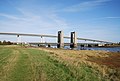 Kingsferry Bridge and Sheppey Crossing - geograph.org.uk - 2157857.jpg 640 × 430; 130 KB
-
 Kingsferry Bridge and Sheppey Crossing - geograph.org.uk - 2157959.jpg 640 × 430; 105 KB
-
 Kingsferry Bridge and Sheppey Crossing - geograph.org.uk - 2157966.jpg 640 × 430; 116 KB
-
 Kingsferry Bridge being raised - geograph.org.uk - 3738858.jpg 3.488 × 2.616; 2,02 MB
-
 Kingsferry Bridge raised - geograph.org.uk - 3738855.jpg 2.616 × 3.488; 1,95 MB
-
 Ladybirds Children’s Centre, First Avenue - geograph.org.uk - 4105595.jpg 1.175 × 881; 175 KB
-
 Large pond in Tailness Marshes (2) - geograph.org.uk - 5926657.jpg 1.024 × 768; 202 KB
-
 Large pond in Tailness Marshes (3) - geograph.org.uk - 5926660.jpg 1.024 × 768; 177 KB
-
 Large pond in Tailness Marshes - geograph.org.uk - 5926324.jpg 1.024 × 768; 166 KB
-
 Long Reach, Chetney Marshes - geograph.org.uk - 4215751.jpg 480 × 640; 175 KB
-
 Long Reach, The Swale - geograph.org.uk - 2159409.jpg 640 × 430; 119 KB
-
 Long Reach, The Swale - geograph.org.uk - 2159411.jpg 640 × 430; 117 KB
-
 Long Reach, The Swale - geograph.org.uk - 2159650.jpg 640 × 403; 70 KB
-
 Long Reach, The Swale - geograph.org.uk - 2159721.jpg 640 × 430; 109 KB
-
 Long Reach, The Swale - geograph.org.uk - 3729135.jpg 3.488 × 2.616; 2,14 MB
-
 Long Reach, The Swale - geograph.org.uk - 5926696.jpg 1.024 × 768; 180 KB
-
 Long Reach, The Swale - geograph.org.uk - 5929799.jpg 1.024 × 768; 179 KB
-
 Looking across The Swale - geograph.org.uk - 2159346.jpg 640 × 430; 120 KB
-
 Looking east-southeast across Thomsett Way - geograph.org.uk - 5273118.jpg 3.264 × 2.448; 3,8 MB
-
 Looking east-southeast along The Creek - geograph.org.uk - 4107392.jpg 1.175 × 881; 173 KB
-
 Looking north from Rushenden Hill - geograph.org.uk - 2759971.jpg 838 × 537; 107 KB
-
 Looking north-northeast along a seawall - geograph.org.uk - 4195013.jpg 1.109 × 831; 197 KB
-
 Looking NW across Rushenden Road towards former Caradon site - geograph.org.uk - 4708590.jpg 3.264 × 2.448; 1,56 MB
-
-
 Looking southeast along the waterfront - geograph.org.uk - 4107425.jpg 1.142 × 856; 183 KB
-
 Looking SSE across The Creek - geograph.org.uk - 5170813.jpg 3.264 × 2.448; 2,18 MB
-

-
 Looking towards Rushenden Pier and Ladies Hole Point - geograph.org.uk - 3729112.jpg 3.488 × 2.616; 2,19 MB
-

-
 Low tide, Horse Reach, The Swale - geograph.org.uk - 2158017.jpg 640 × 430; 105 KB
-
 Low tide, Horse Reach, The Swale - geograph.org.uk - 2159353.jpg 640 × 430; 127 KB
-
 Low tide, The Swale - geograph.org.uk - 2159637.jpg 640 × 430; 115 KB
-
 Main Road (B2007), Queenborough - geograph.org.uk - 2761134.jpg 894 × 670; 139 KB
-
 Main Road Bridges - geograph.org.uk - 1275697.jpg 640 × 480; 78 KB
-
 Main Road, Queenborough - geograph.org.uk - 3728860.jpg 3.399 × 2.071; 2 MB
-
 Main Road, Queenborough - geograph.org.uk - 3728893.jpg 3.488 × 2.616; 2,2 MB
-
 Manor Close, Rushenden - geograph.org.uk - 3728919.jpg 3.488 × 2.616; 1,55 MB
-
 Manor Road, Rushenden - geograph.org.uk - 3728916.jpg 3.488 × 2.616; 1,6 MB
-
 Manor Road, Rushenden - geograph.org.uk - 3728922.jpg 3.488 × 2.616; 1,36 MB
-
 Manor Road, Rushenden - geograph.org.uk - 3729007.jpg 3.488 × 2.616; 2,15 MB
-
 Marshall Crescent, Rushenden - geograph.org.uk - 3728961.jpg 3.488 × 2.616; 1,8 MB
-
 Medway buoy Z2 - geograph.org.uk - 4703325.jpg 640 × 480; 87 KB


.jpg)


_-_geograph.org.uk_-_4215799.jpg)


_-_geograph.org.uk_-_5924699.jpg)
_-_geograph.org.uk_-_5924705.jpg)
_-_geograph.org.uk_-_5924722.jpg)
_-_geograph.org.uk_-_5924725.jpg)
_-_geograph.org.uk_-_5924743.jpg)


.jpg)
.jpg)
.jpg)

_-_geograph.org.uk_-_5929852.jpg)
_-_geograph.org.uk_-_5943775.jpg)
_-_geograph.org.uk_-_5943794.jpg)
_-_geograph.org.uk_-_5943798.jpg)
_-_geograph.org.uk_-_5943807.jpg)


_-_geograph.org.uk_-_5926657.jpg)
_-_geograph.org.uk_-_5926660.jpg)


,_Queenborough_-_geograph.org.uk_-_2761134.jpg)


