Category:Quinault
Vai alla navigazione
Vai alla ricerca
Voce principale su Wikipedia: Quinault Indian Nation.
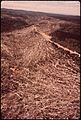
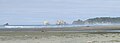
English: The Quinault or Quinaielt are a group of Native American peoples from western Washington in the United States. The Quinault Indian Reservation, at , is located on the Pacific coast of Washington, primarily in northwestern Grays Harbor County, with small parts extending north into southwestern Jefferson County. It has a land area of 819.294 km² (316.331 sq mi) and reported a resident population of 1,370 persons as of the 2000 census. The Quinault people settled onto reservation lands after signing the Quinault Treaty with the former Washington Territory in 1856. About 60% of the reservation's population lives in the community of Taholah, on the Pacific coast at the mouth of the Quinault River.
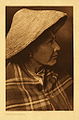
Native American people  Dona quinault per Edward S. Curtis, 1913  | |||||
| Carica un file multimediale | |||||
| Istanza di | |||||
|---|---|---|---|---|---|
| Luogo |
| ||||
| Lingua dell'opera o del nome | |||||
| Distinto da | |||||
| |||||
Sottocategorie
Questa categoria contiene le 7 sottocategorie indicate di seguito, su un totale di 7.
B
- Quinault baskets (10 F)
M
- Quinault Museum (9 F)
P
- Paddle to Quinault Totem (6 F)
Q
- Queets, Washington (3 F)
S
- Salmon River Fire Tower (4 F)
- Fawn Sharp (6 F)
File nella categoria "Quinault"
Questa categoria contiene 83 file, indicati di seguito, su un totale di 83.
-
 3040R Quinault Reservation Locator Map.svg 1 507 × 1 004; 7,16 MB
-
-

-
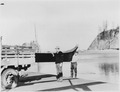
 A legal catch. Fifty pounds of meat to gorge the folks with - NARA - 298718.jpg 3 000 × 2 363; 809 KB
-

-

-

-
 The artificial propagation of salmon on the Pacific Coast of the United States (IA artificialpropag00ston).pdf 1 108 × 1 620, 70 pagine; 3,99 MB
-

-

-
 Beach closed 1462.jpg 4 608 × 3 072; 3,13 MB
-
 Carte populations salish de la cote.png 1 120 × 590; 186 KB
-
 CENTER OF THE QUINAULT INDIAN RESERVATION ON THE QUINAULT RIVER - NARA - 545121.jpg 3 000 × 2 031; 1,03 MB
-

-

-
 Edward S. Curtis Collection People 075.jpg 674 × 1 024; 123 KB
-
 Edward S. Curtis Collection People 076.jpg 758 × 1 024; 118 KB
-
 FISH HATCHERY ON THE QUINAULT INDIAN RESERVATION - NARA - 544969.jpg 3 000 × 2 032; 854 KB
-
 Flag of the Quinault Indian Nation.PNG 544 × 318; 12 KB
-

-

-
 GUY MCMINDS, A FISHERIES SCIENTIST, AND HIS ASSOCIATE BRIAN ALLEE - NARA - 544988.jpg 3 000 × 2 028; 1,07 MB
-

-

-

-

-

-
 Map of Quinault Canyon.png 1 617 × 2 004; 3,9 MB
-
 Museum of the North Beach 14.jpg 6 000 × 4 000; 12,32 MB
-
 Native American chilld in cradle board. Taholah Agency - NARA - 298663.jpg 1 744 × 3 000; 902 KB
-
 Native American family. Taholah Agency - NARA - 298664.jpg 1 738 × 3 000; 978 KB
-

-

-

-
 Olympic Mountains from Lake Quinault (3605177462).jpg 3 330 × 2 016; 1,09 MB
-

-

-

-

-

-

-

-

-

-

-

-
 Photograph of Quinaielt Indian Johnnie Saux, 1936 - NARA - 519172.jpg 2 052 × 3 000; 1,17 MB
-
 Point Grenville panorama.jpg 6 911 × 2 454; 7,14 MB
-

-

-
 Pt Grenville long pan 1450.jpg 4 608 × 3 072; 6,99 MB
-
 Queet.png 1 592 × 1 143; 3,08 MB
-

-
 Quinaielt Indian Reservation. Cook Creek Tree and surrounding territory. - NARA - 298662.jpg 2 437 × 3 000; 1,56 MB
-
 QUINAULT BEACH - NARA - 545117.jpg 2 017 × 3 000; 755 KB
-
 Quinault beach 1456.jpg 4 608 × 3 072; 2,97 MB
-
 Quinault beach panorama.jpg 12 924 × 2 749; 10 MB
-
 Quinault beach view 1447.jpg 4 608 × 3 072; 2,82 MB
-
 Quinault beach view 1448.jpg 4 608 × 3 072; 6,81 MB
-

-
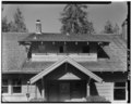
 Quinault Indian Nation administration building in Taholah, WA.jpg 4 912 × 3 264; 4,24 MB
-
 Quinault Indian Nation license plate.jpg 2 722 × 1 437; 1,1 MB
-
 Quinault Indian Nation, Washington (27252233954).jpg 1 632 × 1 224; 731 KB
-

-
 Quinault Nation flag.png 182 × 186; 49 KB
-
 Quinault.png 1 592 × 1 143; 3,13 MB
-

-

-

-

-

-

-
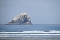
 Rocks 1446.jpg 4 608 × 3 072; 2,97 MB
-

-

-
-

-

-

-

-
-
 The American Museum journal (c1900-(1918)) (17971943640).jpg 616 × 2 402; 221 KB
-


_ON_THE_QUINAULT_INDIAN..._-_NARA_-_545138.jpg)


.jpg)


.jpg)
.jpg)


.jpg)


.jpg)


)_(17971943640).jpg)