Category:Raadhuis, Gennep
Jump to navigation
Jump to search
| Object location | | View all coordinates using: OpenStreetMap |
|---|
building in Gennep, Netherlands  | |||||
| Upload media | |||||
| Instance of | |||||
|---|---|---|---|---|---|
| Location | Gennep, Limburg, Netherlands | ||||
| Street address |
| ||||
| Located on street |
| ||||
| Heritage designation |
| ||||
 | |||||
|
This is a category about rijksmonument number 16084
|
| Address |
|
Media in category "Raadhuis, Gennep"
The following 34 files are in this category, out of 34 total.
-
 Achter- of noord-gevel - Gennep - 20077331 - RCE.jpg 890 × 1,200; 199 KB
-
 Achtergevel - Gennep - 20077332 - RCE.jpg 875 × 1,200; 162 KB
-
 Achtergevel - Gennep - 20325265 - RCE.jpg 900 × 1,200; 129 KB
-
 Bovendeel voorgevel - Gennep - 20077338 - RCE.jpg 802 × 1,200; 240 KB
-
 Bovenste deel zijgevel rechts - Gennep - 20325191 - RCE.jpg 844 × 1,200; 246 KB
-
 Deel achtergevel - Gennep - 20325190 - RCE.jpg 1,200 × 884; 279 KB
-
 Deel voorgevel - Gennep - 20325266 - RCE.jpg 903 × 1,200; 137 KB
-
 Deel zijgevel - Gennep - 20325115 - RCE.jpg 897 × 1,200; 275 KB
-
 Exterieur - Gennep - 20077324 - RCE.jpg 955 × 1,200; 208 KB
-
 Exterieur - Gennep - 20077325 - RCE.jpg 955 × 1,200; 246 KB
-
 Gennep - Markt 1.jpg 1,944 × 2,592; 1.21 MB
-
 Gennep, het stadhuis RM16084 IMG 8371 2021-02-22 12.33.jpg 2,271 × 4,221; 5.85 MB
-
 Gennep, kerk in oude centrum 2007-03-04 13.12.JPG 1,704 × 2,272; 1.04 MB
-
 Gezicht op het raadhuis van Gennep. NL-HlmNHA 1477 53009626.JPG 3,060 × 2,082; 2.33 MB
-

-
 Old townhall Gennep, now used for weddings etc. - panoramio.jpg 3,264 × 4,928; 7.09 MB
-
 Oost gevel en N.H.Kerk voorgevel - Gennep - 20077333 - RCE.jpg 882 × 1,200; 180 KB
-

-
 Stadhuisgennep.jpg 1,536 × 2,048; 644 KB
-
 Voor- of zuid-gevel - Gennep - 20077328 - RCE.jpg 885 × 1,200; 236 KB
-
 Voorgevel - Gennep - 20077327 - RCE.jpg 846 × 1,200; 195 KB
-
 Voorgevel - Gennep - 20077329 - RCE.jpg 867 × 1,200; 168 KB
-
 Voorgevel - Gennep - 20077330 - RCE.jpg 849 × 1,200; 204 KB
-
 Voorgevel - Gennep - 20077335 - RCE.jpg 1,200 × 879; 150 KB
-
 Voorgevel - Gennep - 20077336 - RCE.jpg 896 × 1,200; 179 KB
-
 Voorgevel - Gennep - 20077337 - RCE.jpg 875 × 1,200; 195 KB
-
 Voorgevel - Gennep - 20325264 - RCE.jpg 884 × 1,200; 147 KB
-
 Voorgevel - Gennep - 20325267 - RCE.jpg 1,200 × 869; 121 KB
-
 Voorgevel tijdens restauratie - Gennep - 20325268 - RCE.jpg 898 × 1,200; 169 KB
-
 Voorzijde tijdens restauratie - Gennep - 20326794 - RCE.jpg 889 × 1,200; 172 KB
-
 West-gevel - Gennep - 20077334 - RCE.jpg 885 × 1,200; 228 KB
-
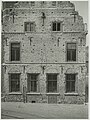
 Westgevel met schade na oorlogshandelingen - Gennep - 20324149 - RCE.jpg 865 × 1,200; 193 KB
-
 Zijgevel links gezien door steeg - Gennep - 20325192 - RCE.jpg 841 × 1,200; 186 KB
-
 Zijgevel rechts en achtergevel - Gennep - 20325193 - RCE.jpg 887 × 1,200; 171 KB


