Category:Raamgracht 12, Amsterdam
Jump to navigation
Jump to search
| Object location | | View all coordinates using: OpenStreetMap |
|---|
 | |||||
| Upload media | |||||
| Instance of |
| ||||
|---|---|---|---|---|---|
| Location | Amsterdam, North Holland, Netherlands | ||||
| Street address |
| ||||
| Located on street | |||||
| Heritage designation |
| ||||
 | |||||
|
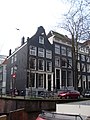
This is a category about rijksmonument number 4766
|
| Address |
|
Media in category "Raamgracht 12, Amsterdam"
The following 4 files are in this category, out of 4 total.
-
 Amsterdam , Netherlands - panoramio (41).jpg 2,848 × 4,272; 11.14 MB
-
 Amsterdam - Raamgracht 12.JPG 2,736 × 3,648; 4.34 MB
-
 Amsterdam - Raamgracht 6.jpg 1,936 × 2,592; 1.98 MB
-
 Woonhuis Raamgracht 12.JPG 2,304 × 3,072; 1.71 MB
.jpg)

