Category:Rapenburg 5, Amsterdam
Jump to navigation
Jump to search
|
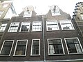
This is a category about rijksmonument number 4781
|
| Object location | | View all coordinates using: OpenStreetMap |
|---|
building in Amsterdam, Netherlands  | |||||
| Upload media | |||||
| Instance of | |||||
|---|---|---|---|---|---|
| Location | Amsterdam, North Holland, Netherlands | ||||
| Located on street | |||||
| Heritage designation |
| ||||
 | |||||
Media in category "Rapenburg 5, Amsterdam"
The following 3 files are in this category, out of 3 total.
-
 Rapenburg 5, Amsterdam.jpg 640 × 480; 86 KB
-
 Stadsarchief Amsterdam, Afb 012000003431.jpg 1,456 × 2,010; 417 KB
-
 Steenbergh, C.J. (1859-1939), Afb 012000003432.jpg 2,070 × 2,838; 948 KB

,_Afb_012000003432.jpg)