Category:Rathaus Leer (Ostfriesland)
Jump to navigation
Jump to search
| Object location | | View all coordinates using: OpenStreetMap |
|---|
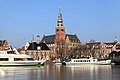
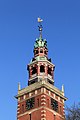
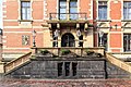
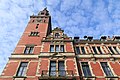
_Rathaus.jpg) | |||||
| Upload media | |||||
| Instance of | |||||
|---|---|---|---|---|---|
| Location | Leer, Lower Saxony, Germany | ||||
| Heritage designation | |||||
 | |||||
Subcategories
This category has the following 3 subcategories, out of 3 total.
I
N
R
Media in category "Rathaus Leer (Ostfriesland)"
The following 68 files are in this category, out of 68 total.
-
 20180605 bordes Rathaus Leer.jpg 5,184 × 3,456; 3.46 MB
-
 20180605 Rathaus1 Leer.jpg 3,456 × 5,184; 2.64 MB
-
 20180605 Rathaus2 Leer.jpg 3,456 × 5,184; 3 MB
-
 20180605 Rathaus3 Leer.jpg 3,456 × 5,184; 2.75 MB
-
 Buildings in de old town of Leer (Ost Friesland) 03.JPG 3,000 × 4,000; 2.32 MB
-
 Doktor-vom-Bruch-Brücke in Leer (2023).jpg 4,800 × 3,200; 11.16 MB
-
 Hafenmusik and der Waage in Leer - Ostfriesland - panoramio.jpg 923 × 588; 267 KB
-
 Heinrich Hermanns Rathaus und alte Waage in Leer.jpg 1,200 × 868; 657 KB
-
 Historisches Rathaus der Stadt Leer in Ostfriesland am Waageufer und Museumshafen.jpg 2,481 × 1,754; 1.39 MB
-
 Leer - Brunnenstraße - 39 - Stadtmodell 08 ies.jpg 5,616 × 3,744; 24.39 MB
-
 Leer - Brunnenstraße - 39 - Stadtmodell 09 ies.jpg 5,616 × 3,744; 25.65 MB
-
 Leer - Dr.-vom-Bruch-Brücke + Rathaus 01 ies.jpg 5,616 × 3,744; 20.05 MB
-
 Leer - Dr.-vom-Bruch-Brücke + Rathausstraße + Rathaus 01 ies.jpg 5,616 × 3,744; 20.09 MB
-
 Leer - Dr.-vom-Bruch-Brücke + Rathausstraße + Rathaus 02 ies.jpg 5,616 × 3,744; 17.79 MB
-
 Leer - Dr.-vom-Bruch-Brücke + Rathausstraße + Rathaus 03 ies.jpg 5,616 × 3,744; 17.1 MB
-
 Leer - Gallimarkt 2018 37 ies.jpg 5,616 × 3,744; 18.55 MB
-
 Leer - Königstraße + Rathaus + Rathausstraße + 4 01 ies.jpg 5,616 × 3,744; 20.64 MB
-
 Leer - Königstraße + Rathaus 01 ies.jpg 3,744 × 5,616; 18.02 MB
-
 Leer - Königstraße - Rathaus 01 ies.jpg 3,744 × 5,616; 20.44 MB
-
 Leer - Königstraße - Rathaus 02 ies.jpg 3,744 × 5,616; 24.62 MB
-
 Leer - Neue Straße - Alte Waage + 8Haus des Handwerks + Rathaus 01 ies.jpg 5,616 × 3,744; 19.12 MB
-
 Leer - Neue Straße - Alte Waage + 8Haus des Handwerks + Rathaus 02 ies.jpg 5,616 × 3,745; 18.27 MB
-
 Leer - Neue Straße - Alte Waage + Rathaus 01 ies .jpg 5,616 × 3,744; 16.38 MB
-
 Leer - Neue Straße - Museumshafen + Hafenmusik (Dr.-vom-Bruch-Brücke) 01 ies.jpg 5,616 × 3,744; 18.59 MB
-
 Leer - Neue Straße - Museumshafen + Hafenmusik (Dr.-vom-Bruch-Brücke) 02 ies.jpg 5,616 × 3,744; 18.79 MB
-
 Leer - Neue Straße - Museumshafen + Rathaus 01 ies.jpg 3,744 × 5,616; 18.34 MB
-
 Leer - Neue Straße - Museumshafen + Rathaus 02 ies.jpg 5,616 × 3,744; 21.2 MB
-
 Leer - Neue Straße - Museumshafen + Warsteiner Admiral + Hafenmusik 01 ies.jpg 5,616 × 3,744; 18.99 MB
-
 Leer - Neue Straße - Museumshafen + Warsteiner Admiral + Rathaus 01 ies.jpg 5,616 × 3,743; 17.75 MB
-
 Leer - Neue Straße - Museumshafen + Warsteiner Admiral + Rathaus 02 ies.jpg 5,616 × 3,744; 18.43 MB
-
 Leer - Neue Straße - Museumshafen + Warsteiner Admiral + Rathaus 03 ies.jpg 5,616 × 3,744; 18.13 MB
-
 Leer - Rathausinnenhof + Rathaus 01 ies.jpg 5,616 × 3,744; 19.04 MB
-
 Leer - Rathausstraße + Rathaus + 4 01 ies.jpg 5,616 × 3,744; 20.57 MB
-
 Leer - Rathausstraße + Rathaus + 4 02 ies.jpg 5,616 × 3,745; 19.84 MB
-
 Leer - Rathausstraße + Rathaus + 4 03 ies.jpg 3,744 × 5,616; 17.14 MB
-
 Leer - Rathausstraße + Rathaus 01 ies.jpg 5,616 × 3,745; 22.14 MB
-
 Leer - Rathausstraße + Rathaus 02 ies.jpg 3,744 × 5,616; 19.68 MB
-
 Leer - Rathausstraße - Rathaus 01 ies.jpg 3,744 × 5,616; 17.13 MB
-
 Leer - Rathausstraße - Rathaus 02 ies.jpg 5,616 × 3,744; 22.82 MB
-
 Leer - Rathausstraße - Rathaus 03 ies.jpg 5,616 × 3,744; 18.42 MB
-
 Leer - Rathausstraße - Rathaus 04 ies.jpg 5,616 × 3,744; 20.97 MB
-
 Leer - Rathausstraße 01 ies.jpg 5,616 × 3,744; 21.55 MB
-
 Leer Alte Waage Rathaus Bruecke (2008).JPG 2,560 × 1,920; 958 KB
-
 Leer Blick view 2008.JPG 2,560 × 1,920; 843 KB
-
 Leer Erzgebirgefigur.JPG 1,536 × 2,048; 592 KB
-
 Leer Ostfr Rathausturm (2010).JPG 800 × 1,066; 935 KB
-
 Leer Rathaus Hafen townhall harbour 2008.jpg 2,560 × 1,920; 1.05 MB
-
 Leer Rathaus Portal (01).jpg 3,456 × 5,184; 7.27 MB
-
 Leer Rathaus Portal (02).jpg 3,456 × 5,184; 6.91 MB
-
 Leer Rathausturm Alte Waage townhall Old Scale 2008.JPG 1,920 × 2,560; 954 KB
-
 Leer(Ostf) Rathaus.jpg 2,221 × 3,331; 6.74 MB
-
 Leer, Ostfriesland, Rathaus - panoramio.jpg 2,736 × 3,648; 2.52 MB
-
 Leer, stadhuis foto11 2010-05-17 09.19.JPG 2,592 × 3,456; 1.26 MB
-
 Leer-403.jpg 1,948 × 3,231; 5.76 MB
-
 LeerOstfriesland Rathaus.jpg 864 × 1,152; 183 KB
-
 Museumshafen-Leer-msu-2023-0I9A2303-.jpg 6,097 × 8,320; 16.42 MB
-
 Museumshafen-Leer-msu-2023-0I9A2305-.jpg 3,940 × 2,627; 3.54 MB
-
 Old city of Leer Germany 1.JPG 3,240 × 4,320; 2.78 MB
-
 Rathaus (Leer)-msu-7415-.jpg 3,614 × 6,425; 6.65 MB
-
 Rathaus Leer bearbeitet.jpg 587 × 587; 250 KB
-
 Rathaus Leer nachts beleuchtet.jpg 2,176 × 1,400; 856 KB
-
 Rathaus Leer.jpg 900 × 600; 324 KB
-
 Rathaus und Waage.jpg 2,048 × 1,360; 1.33 MB
-
 Rathaus-Leer-Weihnachten-msu-2302-.jpg 6,097 × 8,320; 6.5 MB
-
 Rathaus-Leer-Weihnachten-msu-2304-.jpg 3,940 × 2,627; 1.34 MB
-
 Rathausturm Leer (Ostfriesland).jpg 1,944 × 2,592; 651 KB
-
 Rathuas-Leer-Weihnachten-msu-2295.jpg 6,240 × 4,160; 1.68 MB
-
 Zicht op stad ( DSC8465) LR.jpg 6,016 × 4,016; 10.79 MB


_03.JPG)
.jpg)


_01_ies.jpg)
_02_ies.jpg)


.JPG)


.JPG)

.jpg)
.jpg)


-msu-7415-.jpg)


.jpg)

_LR.jpg)