Category:Ravenstone, Buckinghamshire
Aller à la navigation
Aller à la recherche
village britannique | |||||
| Téléverser des médias | |||||
| Nature de l’élément | |||||
|---|---|---|---|---|---|
| Lieu | Milton Keynes (borough), Buckinghamshire, Angleterre du Sud-Est, Angleterre | ||||
| Population |
| ||||
| site officiel | |||||
 | |||||
English: Ravenstone is a village and civil parish in the Borough of Milton Keynes and ceremonial Buckinghamshire, England. It is 2.5 miles west of Olney, 4 miles north of Newport Pagnell (and of the northern boundary of Milton Keynes itself).
Norsk bokmål: Ravenstone er en landsby i Milton Keynes i England. Den ligger ved distriktet nordlige grense, omkring 4 km vest for Olney og 6,5 km nord for Newport Pagnell.
Sous-catégories
Cette catégorie comprend 2 sous-catégories, dont les 2 ci-dessous.
A
Y
- Yardley Chase (1 F)
Média dans la catégorie « Ravenstone, Buckinghamshire »
Cette catégorie comprend 68 fichiers, dont les 68 ci-dessous.
-
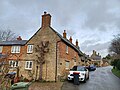
 10 Common Street, Ravenstone.jpg 4 000 × 3 000 ; 4,03 Mio
-
 11 Common Street, Ravenstone.jpg 4 000 × 3 000 ; 3,54 Mio
-
 14, 15 and 16 Common Street, Ravenstone.jpg 4 000 × 3 000 ; 2,94 Mio
-
 34 Common Street, Ravenstone 01.jpg 4 000 × 3 000 ; 3,35 Mio
-
 34 Common Street, Ravenstone 02.jpg 4 000 × 3 000 ; 2,92 Mio
-
 Aldersley Cottage - geograph.org.uk - 3293133.jpg 1 600 × 1 067 ; 411 kio
-
 Almshouses, Ravenstone 01.jpg 4 000 × 3 000 ; 3,85 Mio
-
 Almshouses, Ravenstone 02.jpg 4 000 × 3 000 ; 3,66 Mio
-
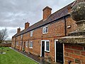 Almshouses, Ravenstone 03.jpg 4 000 × 3 000 ; 3,62 Mio
-
 Barn north of Chestnut Cottage, Ravenstone.jpg 4 000 × 3 000 ; 2,96 Mio
-
 Beside Great Wood - geograph.org.uk - 6130648.jpg 768 × 1 024 ; 237 kio
-
 Bridleway - geograph.org.uk - 204269.jpg 640 × 480 ; 99 kio
-
 Bridleway near Ravenstone - geograph.org.uk - 6130649.jpg 768 × 1 024 ; 261 kio
-
 Bridleway to Great Wood - geograph.org.uk - 3293122.jpg 1 600 × 1 067 ; 538 kio
-
 Bridleway towards the Great Wood - geograph.org.uk - 3293120.jpg 1 600 × 1 068 ; 559 kio
-
 Bridleway towards Weston Underwood - geograph.org.uk - 3293119.jpg 1 600 × 1 066 ; 633 kio
-
 Cemetery Gates - geograph.org.uk - 204287.jpg 640 × 480 ; 124 kio
-
 Country Houses - geograph.org.uk - 204283.jpg 640 × 480 ; 109 kio
-
 Fields and meadows - geograph.org.uk - 195526.jpg 640 × 480 ; 85 kio
-
 Footpath from the Weston Road - geograph.org.uk - 3293094.jpg 1 600 × 1 067 ; 710 kio
-
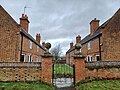
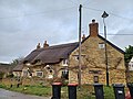
 Former Almshouses - geograph.org.uk - 204382.jpg 640 × 494 ; 108 kio
-
 Gates on the track to Hangar's Spinney - geograph.org.uk - 3293111.jpg 1 600 × 1 067 ; 514 kio
-
 George V postbox and Parish notices - geograph.org.uk - 3293147.jpg 1 600 × 1 067 ; 520 kio
-
 Hedge by the path down to the river - geograph.org.uk - 3301895.jpg 1 600 × 1 067 ; 270 kio
-
 Hedge in a stubble field - geograph.org.uk - 3301901.jpg 1 600 × 1 067 ; 400 kio
-
 Hedgerow by the Ravenstone Mill Road - geograph.org.uk - 3293149.jpg 1 600 × 1 067 ; 508 kio
-
 Home Farm, Ravenstone 01.jpg 4 000 × 3 000 ; 2,78 Mio
-
 Home Farm, Ravenstone 02.jpg 4 000 × 3 000 ; 3,53 Mio
-
 Home Farm, Ravenstone 03.jpg 4 000 × 3 000 ; 3,14 Mio
-
 Horseshoe Farmhouse, Ravenstone 01.jpg 4 000 × 3 000 ; 3,49 Mio
-
 Horseshoe Farmhouse, Ravenstone 02.jpg 4 000 × 3 000 ; 2,94 Mio
-
 Hot road^ - geograph.org.uk - 195523.jpg 525 × 640 ; 109 kio
-
 Keepers Cottage, Ravenstone 01.jpg 4 000 × 3 000 ; 3,26 Mio
-
 Keepers Cottage, Ravenstone 02.jpg 4 000 × 3 000 ; 3,32 Mio
-
 Keepers Cottage, Ravenstone 03.jpg 4 000 × 3 000 ; 3,3 Mio
-
 Milton Keynes Boundary Walk goes through the village playground - geograph.org.uk - 3293138.jpg 1 600 × 1 067 ; 456 kio
-
 New farm buildings and paved entrance - geograph.org.uk - 3293086.jpg 1 600 × 1 067 ; 295 kio
-

-
 Number 42 and Ivy Cottage, Ravenstone.jpg 4 000 × 3 000 ; 3,14 Mio
-
 On the Milton Keynes Boundary Walk - geograph.org.uk - 204401.jpg 640 × 480 ; 104 kio
-
 Path down to the river - geograph.org.uk - 3143925.jpg 1 200 × 1 600 ; 699 kio
-
 Path from the church to the village - geograph.org.uk - 3293126.jpg 1 600 × 1 074 ; 572 kio
-
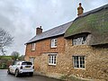
 Pear Tree Cottage, Ravenstone 01.jpg 4 000 × 3 000 ; 3,84 Mio
-
 Pear Tree Cottage, Ravenstone 02.jpg 4 000 × 3 000 ; 3,03 Mio
-
 Thatch - geograph.org.uk - 204394.jpg 640 × 480 ; 97 kio
-
 The Old Forge, Ravenstone - geograph.org.uk - 204395.jpg 640 × 480 ; 94 kio
-
 Ravenstone Great Wood - geograph.org.uk - 536205.jpg 640 × 426 ; 132 kio
-
 Ravenstone Village Hall - geograph.org.uk - 3293131.jpg 1 200 × 1 600 ; 545 kio
-

-
 Ravenstone, Milton Keynes Boundary Walk (1) - geograph.org.uk - 4341912.jpg 640 × 480 ; 95 kio
-
 Ravenstone, Milton Keynes Boundary Walk - geograph.org.uk - 4341879.jpg 640 × 480 ; 79 kio
-

-
 Ravenstone, The stream - geograph.org.uk - 4344016.jpg 640 × 474 ; 110 kio
-
 River by Ravenstone Mill - geograph.org.uk - 3143924.jpg 1 600 × 1 068 ; 622 kio
-
 Road to Ravenstone - geograph.org.uk - 204271.jpg 640 × 480 ; 121 kio
-
 Roadside brook runs past the Old Forge - geograph.org.uk - 3293136.jpg 1 200 × 1 600 ; 707 kio
-
 Rose Cottage, Ravenstone 01.jpg 4 000 × 3 000 ; 3,4 Mio
-
 Rose Cottage, Ravenstone 02.jpg 4 000 × 3 000 ; 3,05 Mio
-
 Rural Road - geograph.org.uk - 250845.jpg 640 × 480 ; 87 kio
-
 Sunnyside Cottage, Ravenstone.jpg 4 000 × 3 000 ; 3,24 Mio
-
 Thatched Cottage by Northend - geograph.org.uk - 3293113.jpg 1 600 × 1 067 ; 587 kio
-
 Thatched gate to the church and bus shelter - geograph.org.uk - 3293128.jpg 1 600 × 1 067 ; 484 kio
-
 The Old Vicarage - geograph.org.uk - 3293141.jpg 1 600 × 1 067 ; 587 kio
-
 The Old Vicarage, Ravenstone.jpg 4 000 × 3 000 ; 3,25 Mio
-
 Track along the Edge of Great Wood - geograph.org.uk - 204208.jpg 640 × 480 ; 103 kio
-
 Trees and footbridge by the Great Ouse - geograph.org.uk - 3143922.jpg 1 600 × 1 067 ; 584 kio
-
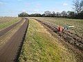
 View down track towards Parkfield Farm - geograph.org.uk - 535541.jpg 640 × 426 ; 132 kio
-
 View from the Milton Keynes Boundary Walk - geograph.org.uk - 204405.jpg 640 × 480 ; 75 kio


_-_geograph.org.uk_-_4341912.jpg)


