Category:Refugiehuis ('s-Hertogenbosch)
Jump to navigation
Jump to search
| Object location | | View all coordinates using: OpenStreetMap |
|---|
building in 's-Hertogenbosch, Netherlands  | |||||
| Upload media | |||||
| Instance of | |||||
|---|---|---|---|---|---|
| Location | 's-Hertogenbosch, North Brabant, Netherlands | ||||
| Street address |
| ||||
| Located on street | |||||
| Heritage designation |
| ||||
 | |||||
|
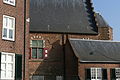
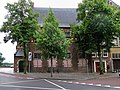
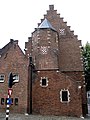
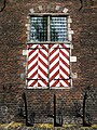
This is a category about rijksmonument number 21849
|
| Address |
|
Media in category "Refugiehuis ('s-Hertogenbosch)"
The following 10 files are in this category, out of 10 total.
-
 2015.02.16.135415 Refugiehuis Parkalaan 's-Hertogenbosch.jpg 2,736 × 1,824; 1.52 MB
-
 2015.02.16.135529 Refugiehuis Parkalaan 's-Hertogenbosch.jpg 2,736 × 1,824; 1.6 MB
-
 2015.02.16.135541 Refugiehuis Parkalaan 's-Hertogenbosch.jpg 2,736 × 1,824; 1.62 MB
-
 Aanzicht - 's-Hertogenbosch - 20110132 - RCE.jpg 1,200 × 806; 179 KB
-
 Denbosch refugiehuis1.jpg 3,939 × 2,953; 9.15 MB
-
 Denbosch refugiehuis2.jpg 4,000 × 3,000; 5.86 MB
-
 Denbosch refugiehuis3.jpg 3,000 × 4,000; 7.78 MB
-
 Denbosch refugiehuis4.jpg 2,981 × 3,977; 6.39 MB
-
 Denbosch refugiehuis5.jpg 3,000 × 4,000; 9.04 MB
-
 Denbosch refugiehuis6.jpg 2,991 × 3,989; 9.44 MB


