Category:Reichraming
Jump to navigation
Jump to search
municipality in Steyr-Land District, Upper Austria, Austria .JPG)  | |||||
| Upload media | |||||
| Instance of |
| ||||
|---|---|---|---|---|---|
| Location | Steyr-Land District, Upper Austria, Austria | ||||
| Population |
| ||||
| Area |
| ||||
| Elevation above sea level |
| ||||
| official website | |||||
 | |||||
Subcategories
This category has the following 16 subcategories, out of 16 total.
A
- Anton-Schosser-Hütte (2 F)
B
- Bahnhof Großraming Kraftwerk (1 F)
- Bahnhof Reichraming (29 F)
- Bergerwieshütte (3 F)
C
E
G
- Großer Weißenbach (146 F)
H
- History of Reichraming (1 F)
R
- Reichramingbach (35 F)
S
- Schleierfall (Reichraming) (3 F)
W
- Waldbahn Reichraming (7 F)
- Weißenbach (11 F)
Media in category "Reichraming"
The following 28 files are in this category, out of 28 total.
-
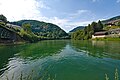 Enns in Reichraming 2022-08-05 01.jpg 8,384 × 5,612; 22.29 MB
-
 Enns in Reichraming 2022-08-05 02.jpg 8,384 × 5,612; 24.36 MB
-
 Enns in Reichraming 2022-08-05 03.jpg 8,384 × 5,612; 24.76 MB
-
 Enns in Reichraming 2022-08-05 04.jpg 8,384 × 5,612; 21.71 MB
-
 Enns in Reichraming 2022-08-05 05.jpg 8,384 × 5,612; 24.65 MB
-
 Former railway track, Reichraminger Hintergebirge.jpg 4,928 × 3,264; 12.87 MB
-
 Hst. Großraming Kraftwerk Unterstand.JPG 1,567 × 2,077; 2.57 MB
-
 Kirchberg ob der Donau - Ortsbildmesse 2016 7464.JPG 3,456 × 5,184; 4.97 MB
-
 Losenstein - Star Park Hohe Dirn - 1.jpg 5,688 × 3,792; 15.9 MB
-
 Reichraming Alte Forsteralm Forsteralmstraße 3 (01).JPG 2,560 × 1,920; 1.23 MB
-
 Reichraming Dirnbach Kapelle Dirnbachstraße (01).JPG 2,049 × 1,741; 1.94 MB
-
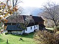
 Reichraming Ertlgut Rohrbachgraben 5 (01).JPG 2,482 × 1,752; 2.47 MB
-
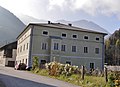
 Reichraming Forsthube Am Arzberg 1 (01).JPG 2,354 × 1,760; 2.31 MB
-
 Reichraming Forstmuseum Museumsweg 9 (01).JPG 2,156 × 1,726; 2.34 MB
-
 Reichraming Gütl bei der Schallermauer Hammerschmiedstraße 4 (01).JPG 2,490 × 1,794; 1.83 MB
-
 Reichraming Haus an der Schallen Hammerschmiedstraße 24 (01).JPG 2,349 × 1,666; 1.74 MB
-
 Reichraming im Bezirk SE.png 645 × 645; 24 KB
-
 Reichraming Neue Forsteralm Forsteralmstraße 2 (01).JPG 2,560 × 1,920; 3.11 MB
-
 Reichraming Oberhammerwerksverwalterhaus Hammerschmiedstraße 24 (01).JPG 1,968 × 1,429; 1.25 MB
-
 Reichraming Ortstafel Bahnhofstraße.JPG 2,141 × 1,440; 1.95 MB
-
 Reichraming Pfarrkirche Oberer Kirchenberg (01).JPG 1,942 × 1,497; 1.7 MB
-
 Reichraming Stöckl-Dirnbach Dirnbachstraße 61 (01).JPG 1,862 × 1,301; 1.46 MB
-
 Reichraming Türkenhaus Dirnbachstraße 11 (01).JPG 2,219 × 1,686; 2.21 MB
-
 Reichraming vom Schieferstein.JPG 2,304 × 3,456; 2.11 MB
-
 Star Park auf der Hohen Dirn 2018-09.jpg 5,367 × 3,354; 10.58 MB
-
 Walbahntrasse Reichraming2.jpg 1,024 × 1,536; 981 KB
-
 Waldbahntrasse Reichraming.jpg 1,024 × 1,536; 1.82 MB
-
 Wappen at reichraming.png 166 × 207; 2 KB


.JPG)
.JPG)
.JPG)
.JPG)
.JPG)
.JPG)
.JPG)

.JPG)
.JPG)

.JPG)
.JPG)


