Category:Rhein-Neckar-Kreis
Vai alla navigazione
Vai alla ricerca
Urban districts (cities): Baden-Baden · Freiburg · Heidelberg · Heilbronn · Karlsruhe · Mannheim · Pforzheim · Stuttgart · Ulm
circondario tedesco   .svg) | |||||
| Carica un file multimediale | |||||
| Istanza di | |||||
|---|---|---|---|---|---|
| Luogo | Distretto governativo di Karlsruhe, Baden-Württemberg, Germania | ||||
| Capitale | |||||
| Capo del governo |
| ||||
| Popolazione |
| ||||
| Altezza sul mare |
| ||||
| sito web ufficiale | |||||
 | |||||
Sottocategorie
Questa categoria contiene le 28 sottocategorie indicate di seguito, su un totale di 28.
Pagine nella categoria "Rhein-Neckar-Kreis"
Questa categoria contiene un'unica pagina, indicata di seguito.
File nella categoria "Rhein-Neckar-Kreis"
Questa categoria contiene 38 file, indicati di seguito, su un totale di 38.
-
 Alte Bruchsaler Straße.jpg 4 032 × 3 024; 5,15 MB
-
 Binnendüne Friedenshöhe Oftersheim.jpg 3 683 × 2 129; 2,37 MB
-
 Blick auf Ochsenbach (Leimen).jpg 2 045 × 1 137; 667 KB
-
 Brückensperrung Rhein-Neckar-Kreis 2011.JPG 3 648 × 2 736; 1,44 MB
-
 Brühlwegdüne.jpg 4 032 × 3 024; 5,3 MB
-
 Düne 3.jpg 750 × 498; 91 KB
-
 Friedhofsparkplatz - panoramio.jpg 1 936 × 2 592; 2,06 MB
-
 Gargoyle - panoramio.jpg 2 703 × 2 592; 1,08 MB
-
 Historische Steinbrücke über den Leimbach.jpg 2 041 × 1 221; 945 KB
-
 Kraichbach bei Reilingen.jpg 4 000 × 3 000; 2,82 MB
-
 Kriegerdenkmal - panoramio (40).jpg 1 916 × 2 158; 598 KB
-
 Landstrasse 532.JPG 3 008 × 2 000; 2,84 MB
-
 Leimbach in Nussloch.jpg 5 080 × 3 378; 9,36 MB
-
 Leimerklinge Amerikanerweg.jpg 4 943 × 3 282; 7,33 MB
-
 Locator map HD in Baden-Württemberg.svg 1 058 × 1 161; 278 KB
-
 Locator map HD in Germany.svg 1 075 × 1 273; 578 KB
-
 Maisbach Ortsstraße.jpg 3 667 × 3 485; 5,49 MB
-
 Maisbach, Ortsmitte mit Dorfbrunnen.jpg 4 000 × 3 000; 3,25 MB
-
 Maulbeerbuckel Düne.jpg 5 472 × 3 648; 11,72 MB
-
 Naturschutzgebiet Kallenberg und Kaiserberg.jpg 2 272 × 1 704; 1,56 MB
-

-
-

-

-
 Neubau1979.jpg 274 × 168; 14 KB
-
 NSG Nußlocher Wiesen, Wiesenniederung.jpg 4 000 × 3 000; 4,1 MB
-
 NSG Zugmantel-Bandholz 2023.jpg 4 032 × 3 024; 5,2 MB
-
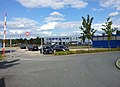
 Robert Unkel GmbH am Neckar - panoramio.jpg 4 560 × 3 392; 9,9 MB
-
 Schule - panoramio (50).jpg 2 494 × 2 592; 829 KB
-
 Schwarzbach bei Meckesheim.jpg 4 000 × 3 000; 4,16 MB
-
 Schwarzbachwehr Eschelbronn.jpg 5 472 × 3 648; 7,48 MB
-
 SOS Notrufsäule Björn-Steiger-Stiftung.JPG 2 736 × 3 648; 4,23 MB
-
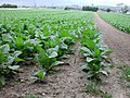 Tabakfeld Sandhausen.jpg 2 048 × 1 536; 1,08 MB
-
 Walldorf, Gewerbegebiet - geo.hlipp.de - 27735.jpg 640 × 464; 64 KB
-
 Weg im Herbst - panoramio.jpg 1 936 × 2 592; 2,77 MB
-
 Welde Verkehrskreisel Plankstadt.JPG 3 648 × 2 736; 4,31 MB
-
 Wiesloch AVR Erdaushub- und Bauschuttdeponie.JPG 3 648 × 2 736; 4,29 MB
-
 Zufahrt Erdaushub- und Bauschuttdeponie AVR in Wiesloch.JPG 3 648 × 2 736; 3,95 MB


.jpg)


.jpg)


.jpg)
.jpg)
.jpg)
.jpg)


.jpg)


