Category:Karlsruhe
Jump to navigation
Jump to search
Urban districts (cities): Baden-Baden · Freiburg · Heidelberg · Heilbronn · Karlsruhe · Mannheim · Pforzheim · Stuttgart · Ulm
large city in Baden-Württemberg, Germany    .svg)  | |||||
| Upload media | |||||
| Instance of |
| ||||
|---|---|---|---|---|---|
| Part of |
| ||||
| Named after | |||||
| Location | |||||
| Located in or next to body of water | |||||
| Visitor center | |||||
| Head of government |
| ||||
| Inception |
| ||||
| Population |
| ||||
| Area |
| ||||
| Elevation above sea level |
| ||||
| Budget |
| ||||
| Different from | |||||
| official website | |||||
 | |||||
Subcategories
This category has the following 31 subcategories, out of 31 total.
Media in category "Karlsruhe"
The following 200 files are in this category, out of 206 total.
(previous page) (next page)-

-
 20180309n Großer Heldbock, Großer Eichenbock, Larvengänge.jpg 1,599 × 1,200; 637 KB
-
 20230228 LN S-Bahn RN 867x385 OF.png 2,457 × 1,091; 805 KB
-
 Abzweigung im Raffineriegebiet - geo.hlipp.de - 18731.jpg 640 × 480; 72 KB
-
 Am Stadtgarten - geo.hlipp.de - 2448.jpg 480 × 640; 198 KB
-
 Ausblick von der A8 Richtung Karlsruhe - panoramio.jpg 3,072 × 1,536; 2.17 MB
-
 Autobahnausfahrt Karlsruhe-Nord - geo.hlipp.de - 18188.jpg 725 × 320; 43 KB
-
 Bankhof - geo.hlipp.de - 17943.jpg 480 × 640; 38 KB
-
 Bauarbeiten am Autobahndreieck Karlsruhe - geo.hlipp.de - 24489.jpg 657 × 320; 61 KB
-
 Baupavillon - geo.hlipp.de - 2124.jpg 640 × 480; 233 KB
-
 Bild von Menschen in der Offenen Werkstatt Karlsruhe..jpg 1,600 × 1,200; 1.06 MB
-
 Bildlogo Profilregion Mobilitätssysteme Karlsruhe.png 799 × 799; 95 KB
-
 BOStrab EBO Übergangsgebiet.jpg 5,568 × 3,712; 3.84 MB
-
 Brunnen des Wasserwerks Hardtwald - geo.hlipp.de - 17738.jpg 640 × 480; 106 KB
-
 Bus-Logo-Karlsruhe.svg 512 × 512; 1 KB
-
 Cabel Boats - geo.hlipp.de - 3011.jpg 480 × 640; 176 KB
-
 Cafeteria Schuler - geo.hlipp.de - 3009.jpg 638 × 456; 143 KB
-
 Calm Afternoon In Karlsruhe (169441705).jpeg 2,048 × 1,536; 1.53 MB
-
De-Karlsruhe.ogg 1.2 s; 19 KB
-
 Demoka026.JPG 2,592 × 1,944; 1.69 MB
-
 Demoka6.JPG 2,592 × 1,944; 1.12 MB
-
-
 DGStory.png 709 × 493; 214 KB
-
 Dr. Hussein Abdelfatah with Prof. Dr. Ulrich Kortenkamp & Prof. Dr. Mutfried Hartmann.jpg 1,683 × 1,165; 1.72 MB
-
 Durlacher Weg - geo.hlipp.de - 18159.jpg 640 × 480; 123 KB
-
 Duschen - geo.hlipp.de - 3530.jpg 640 × 480; 214 KB
-
 Edelmajolika Vasen Gerda Conitz Majolika Manufaktur Karlsruhe.png 3,024 × 2,281; 8.82 MB
-
 Einwohnerentwicklung von Karlsruhe - ab 1871.svg 800 × 400; 81 KB
-
 Einwohnerentwicklung von Karlsruhe -1900.svg 800 × 400; 22 KB
-
 Einwohnerentwicklung von Karlsruhe 1900-1945.svg 800 × 400; 25 KB
-
 Einwohnerentwicklung von Karlsruhe 1945-1971.svg 800 × 400; 24 KB
-
 Einwohnerentwicklung von Karlsruhe 1971-.svg 800 × 400; 30 KB
-
 Einwohnerentwicklung von Karlsruhe mit Prognosen.svg 800 × 400; 47 KB
-
 Einwohnerentwicklung von Karlsruhe.svg 800 × 400; 88 KB
-
 Electrical fuse box 2.jpg 2,592 × 1,936; 1.87 MB
-
 Electrical fuse box 3.jpg 2,592 × 1,936; 1.85 MB
-
 Elfenweg - geo.hlipp.de - 17911.jpg 640 × 480; 82 KB
-
 Erster Nachtfrost im Ostauepark - geo.hlipp.de - 22320.jpg 640 × 362; 77 KB
-
 EVA-Shuttlebus in Karlsruhe.jpg 4,032 × 3,024; 4.48 MB
-
 Felder im Fritschlach bei Daxlanden - geo.hlipp.de - 2619.jpg 640 × 480; 83 KB
-
 Flaggen an der Südtangente Karlsruhe.jpg 1,936 × 2,592; 1.19 MB
-
 Friedhofsweg mit Schild - geo.hlipp.de - 17897.jpg 640 × 480; 95 KB
-
 Friedrichstaler Allee - geo.hlipp.de - 18134.jpg 640 × 480; 112 KB
-
 Garten Skulptur - panoramio (2).jpg 3,056 × 4,074; 8.1 MB
-
 Garten Skulptur - panoramio (3).jpg 2,780 × 3,707; 6.6 MB
-
 Große Lampe in Karlsruhe.jpg 1,936 × 2,592; 1.55 MB
-
 Haltestelle "Tivoli" - geo.hlipp.de - 3886.jpg 640 × 480; 79 KB
-
 Haltestelle KVV Karlsruhe 1.jpg 2,592 × 1,936; 1.28 MB
-
 Haltestelle KVV Karlsruhe 2.jpg 2,592 × 1,936; 1.82 MB
-
 Hinter dem Konzerthaus - geo.hlipp.de - 3163.jpg 640 × 480; 136 KB
-
 Hochsitz am Otto-Fikentscher-Weg - geo.hlipp.de - 25284.jpg 640 × 480; 105 KB
-
 Humboldtpinguin - geo.hlipp.de - 2123.jpg 640 × 480; 236 KB
-
 Humboldtpinguin - geo.hlipp.de - 6285.jpg 640 × 480; 249 KB
-

-
 ISS014-E-15064 - View of Germany.jpg 3,032 × 2,064; 1.13 MB
-
 Joachim-Kurzaj-Weg in Oberreut - geo.hlipp.de - 18261.jpg 640 × 480; 78 KB
-
 Karlsruhe - panoramio (19).jpg 1,280 × 875; 751 KB
-
 Karlsruhe - panoramio (20).jpg 1,280 × 875; 761 KB
-
 Karlsruhe 2015-08-15 01.JPG 1,359 × 963; 1.08 MB
-
 Karlsruhe 2015-08-15 02.JPG 2,416 × 1,196; 1.9 MB
-
 Karlsruhe A 8 - panoramio.jpg 4,608 × 3,456; 8.2 MB
-
 Karlsruhe erste E-Mail Deutschlands.JPG 1,660 × 1,154; 351 KB
-
 Karlsruhe Hardwald from above.jpg 2,592 × 1,936; 602 KB
-
 Karlsruhe Storm Logo.jpg 1,400 × 876; 362 KB
-
 Karlsruhe Tiergarten - geo.hlipp.de - 3010.jpg 633 × 459; 156 KB
-
 Karlsruhe wikicon 22.11.2013 11-48-04.JPG 2,637 × 3,961; 2.57 MB
-
 Karlsruhe Wikipedia-Konferenz.jpg 3,984 × 2,988; 4.07 MB
-
 Karlsruhe, B 10 - geo.hlipp.de - 29562.jpg 640 × 343; 42 KB
-

-
 Karlsruhe, Straße der Demokratie - panoramio.jpg 3,456 × 4,608; 8.29 MB
-
 Karlsruhe- Rintheim - geo.hlipp.de - 14266.jpg 640 × 427; 124 KB
-
 Karlsruhe- Rintheim - geo.hlipp.de - 14268.jpg 640 × 421; 120 KB
-
 Karlsruhe- Weinbrennerplatz - geo.hlipp.de - 14253.jpg 640 × 424; 97 KB
-
 Karlsruhe- Weinbrennerplatz - geo.hlipp.de - 14254.jpg 640 × 427; 100 KB
-
 Kinder- und Jugendhaus Oststadt - geo.hlipp.de - 17802.jpg 640 × 480; 70 KB
-
 Kinderspielplatz im Ostauepark - geo.hlipp.de - 3922.jpg 640 × 480; 90 KB
-
 Kirche "St. Josef" - geo.hlipp.de - 18249.jpg 640 × 480; 65 KB
-
 Klosterweg - geo.hlipp.de - 18155.jpg 640 × 480; 91 KB
-
 Kwahlenkarlsruhe.svg 654 × 378; 104 KB
-
 Lacrosse Storm Logo 04.jpg 1,280 × 579; 210 KB
-
 Landappbw 105466 1819 Kaserne Grenadierkaserne Karlsruhe.jpg 1,280 × 720; 117 KB
-
 Landappbw 112195 1824 Grossherzog Karl-Friedrich-Denkmal Karlsruhe.jpg 1,280 × 720; 96 KB
-
 Landappbw 182314 1824 Statue Vor dem Schloss Karlsruhe.jpg 960 × 1,280; 230 KB
-
-

-
 Landappbw 250557 1817 Waldstraße Karlsruhe.jpg 960 × 1,280; 156 KB
-

-

-

-
 Landappbw 332733 1817 Rondellplatz Karlsruhe, Rondellplatz beim Ettlinger Tor.jpg 3,000 × 4,000; 767 KB
-

-

-
 Landappbw 401613 1823 alte Brücken-Rest Karlsruhe, beim Umschlagbahnhof.jpg 4,272 × 2,855; 1.82 MB
-
 Landappbw 401614 1823 alte und neue Brücke Karlsruhe, beim Umschlagbahnhof.jpg 4,272 × 2,855; 1.25 MB
-
 Landappbw 439549 1824 Baum Bismarck-Eiche Karlsruhe.jpg 960 × 1,280; 687 KB
-
 Landappbw 544230 1817 Karlsruher Säulen Karlsruhe.jpg 1,440 × 1,920; 185 KB
-
 Landappbw 544234 1819 Galerie Architekturschaufenster Karlsruhe.jpg 1,920 × 1,440; 268 KB
-
 Landappbw 575169 1821 Altes Schild der Hausnummer Karlsruhe-Grötzingen, Im Oberviertel 48.jpg 1,637 × 1,920; 1,016 KB
-
 Landappbw 575273 1824 Gedichtpfad Karlsruhe.jpg 2,592 × 1,944; 1.33 MB
-
 Landappbw 591454 1819 Alten- und Pflegeheim Luisenheim Karlsruhe.jpg 1,079 × 1,919; 313 KB
-
 Landappbw 745451 1817 Tullastraße Karlsruhe.jpg 1,920 × 1,442; 446 KB
-
 Landappbw 77540 1819 ZKM Karlsruhe.jpg 1,280 × 720; 103 KB
-
 Landappbw 82369 1817 City Park Karlsruhe Karlsruhe.jpg 1,280 × 949; 285 KB
-
 Landappbw 82370 1817 Clara Immerwahr Haber Platz Karlsruhe.jpg 1,280 × 960; 366 KB
-
-
 Leerstehendes Haus - geo.hlipp.de - 3913.jpg 640 × 480; 136 KB
-
 Leerstehendes Haus - geo.hlipp.de - 3915.jpg 480 × 640; 147 KB
-
 Logo - KVVH.jpg 400 × 326; 13 KB
-
 Logo - Volkswohnung GmbH.jpg 1,200 × 900; 44 KB
-
 Logo Volkswohnung.svg 600 × 105; 3 KB
-
 MAUK Gartenwelt - panoramio (1).jpg 4,468 × 3,351; 9.47 MB
-
 MAUK Gartenwelt - panoramio.jpg 1,950 × 1,463; 1.89 MB
-
 Neues Taubenhaus beim Schloss - geo.hlipp.de - 19352.jpg 640 × 480; 122 KB
-
 Oskar von Kukiel der Waschanstalt an der Alb bei Karlsruhe.jpg 1,074 × 827; 64 KB
-
 Ostring - geo.hlipp.de - 18937.jpg 640 × 480; 77 KB
-
 Ostring - geo.hlipp.de - 18938.jpg 640 × 480; 79 KB
-
 Oststadtkreisel - geo.hlipp.de - 19311.jpg 640 × 480; 80 KB
-
 Pappelallee beim Batzenhof - geo.hlipp.de - 19694.jpg 480 × 640; 118 KB
-
 Pappelreihe am Hausschildpfad - geo.hlipp.de - 17797.jpg 480 × 640; 80 KB
-
 Profilregion Mobilitätssysteme Karlsruhe.jpg 1,459 × 425; 202 KB
-

-

-
 Reptilie - panoramio.jpg 1,640 × 1,094; 544 KB
-
 Rheinhafenbad - panoramio.jpg 4,608 × 3,456; 4.09 MB
-
 Rheinhafenbrücke - panoramio (1).jpg 3,572 × 2,679; 5.72 MB
-
 Ricarda Schaber.jpg 1,200 × 803; 972 KB
-
 Richtungsschild - geo.hlipp.de - 3008.jpg 462 × 640; 199 KB
-
 River Pfinz Karlsruhe Hardtwald.jpg 3,264 × 2,448; 2.32 MB
-
 Rodel Schlitten - panoramio.jpg 2,592 × 3,456; 5.34 MB
-
 Saal Humpenhaus.jpg 3,337 × 2,017; 1.32 MB
-
 Schulgelände sign Karlsruhe.jpg 2,592 × 1,936; 676 KB
-
 Shuttle Bahn beim Rheinhafenfest 2015 - panoramio.jpg 4,608 × 3,456; 8.29 MB
-
 Sitzverteilungkarlsruhe.svg 459 × 279; 27 KB
-

-
 Skulptur "Ettlinger Tor" am Ettlinger Tor - geo.hlipp.de - 2996.jpg 480 × 640; 34 KB
-
-
 Sky Bar auf dem Karstadt Parkdeck 10 in Karlsruhe - panoramio.jpg 4,608 × 3,456; 3.63 MB
-
 Sky Beach Club P 10 - panoramio.jpg 4,379 × 3,284; 8.44 MB
-
 Smart Gun at ZKM (15940262080).jpg 3,200 × 2,368; 1.97 MB
-
 Spezialitäten aus Italien - panoramio.jpg 3,456 × 4,608; 9.15 MB
-
 Spiegelung - panoramio (15).jpg 2,265 × 1,699; 2.49 MB
-
 Sportschuhe - panoramio.jpg 3,248 × 4,323; 8.07 MB
-
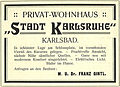 Stadt-Karlsruhe Karlsbad 1906.JPG 945 × 682; 183 KB
-
 Stadtbibliothek am Lameyplatz - panoramio.jpg 2,425 × 3,233; 4.02 MB
-
 Stadtfenster Karlsruhe am Marktplatz - panoramio.jpg 3,230 × 4,374; 6.86 MB
-
 Stadtgarten - panoramio (1).jpg 1,366 × 983; 986 KB
-
 Stadtgarten Eingang Festplatz - geo.hlipp.de - 2887.jpg 640 × 480; 62 KB
-
 Stadtranderholung - panoramio.jpg 4,608 × 3,456; 4.66 MB
-
 Straßenbahn Haltestelle Herrenstraße - panoramio.jpg 4,608 × 3,456; 8.87 MB
-
 Straßenbahn Karlsruhe - panoramio.jpg 700 × 467; 340 KB
-
 Stuttgarterstraße Karlsruhe Hauptbahnhof.jpg 2,592 × 1,936; 1.52 MB
-
 Suevia Karlsruhe.jpg 3,024 × 4,032; 1.48 MB
-
 Szene Kneipe - panoramio.jpg 3,267 × 4,608; 9.06 MB
-
 Südliche Uferstraße mit Brücke der Rheinhafenstraße.jpg 3,120 × 4,160; 5.69 MB
-
 Teichhuhn (Moorhen at Karlsruhe Stadtgarten) - geo.hlipp.de - 4657.jpg 640 × 412; 155 KB
-
 Terracotta Hase - panoramio.jpg 3,456 × 4,608; 4.11 MB
-
 Theodor-Heuss-Allee beim Durlacher Weg - geo.hlipp.de - 18131.jpg 640 × 480; 113 KB
-
 Train stop karlsruhe 1.jpg 2,592 × 1,936; 1.63 MB
-
 Train stop karlsruhe 3.jpg 2,592 × 1,936; 1.78 MB
-
 Treppenaufgang und Wasserspiele - geo.hlipp.de - 2986.jpg 640 × 480; 63 KB
-
 TS by René van der Voorden.jpg 2,048 × 2,048; 972 KB
-
 Unterführung am Albtalbahnhof - panoramio (1).jpg 3,581 × 2,686; 7.38 MB
-
 Unterführung am Albtalbahnhof - panoramio (2).jpg 2,976 × 2,232; 5.2 MB
-
 Unterführung am Albtalbahnhof - panoramio.jpg 4,608 × 2,384; 6.17 MB
-
 Vereinszentrum der Kleingärtner am Fasanengarten - panoramio.jpg 3,072 × 2,270; 4.02 MB
-

-

-
 Verschwundene Kunst am Ettlinger Tor - geo.hlipp.de - 3212.jpg 640 × 480; 108 KB
-
 Verschwundene Kunst am EttlingerTor - geo.hlipp.de - 3210.jpg 640 × 480; 125 KB
-

-
 Villa Bambini, Sophienstraße, Karlsruhe - panoramio (1).jpg 4,608 × 3,456; 5.03 MB
-
-
 Vogel (Fassadenmalerei) - panoramio (1).jpg 4,032 × 3,024; 8.16 MB
-
 Vogel (Fassadenmalerei) - panoramio (2).jpg 2,584 × 2,132; 4.43 MB
-
 Vogel (Fassadenmalerei) - panoramio.jpg 4,608 × 2,966; 6.91 MB
-
 VOR DME KRH 01.JPG 2,560 × 1,920; 1.62 MB
-

-
 Waldlehrpfad in Daxlanden - geo.hlipp.de - 2928.jpg 480 × 640; 127 KB
-

-
 Waldweg - geo.hlipp.de - 3050.jpg 480 × 640; 147 KB
-
 Waldweg beim Knielinger See - geo.hlipp.de - 2624.jpg 480 × 640; 160 KB
-
 Waldweg im Fritschlach - geo.hlipp.de - 2791.jpg 480 × 640; 138 KB
-
 Waldweg im Oberwald - geo.hlipp.de - 17906.jpg 640 × 480; 141 KB
-
 Waldweg im Oberwald - geo.hlipp.de - 17907.jpg 640 × 480; 132 KB
-
 Weg am Waldrand mit Rastgelegenheit - geo.hlipp.de - 19691.jpg 640 × 480; 90 KB
-
 Weg an der Bahnstrecke Durlach-Bruchsal - geo.hlipp.de - 19901.jpg 640 × 480; 83 KB
-

-

-
 Weg an der Westseite des Hirschgrabens - geo.hlipp.de - 18024.jpg 480 × 640; 123 KB
-
 Weg durch den Burgau - geo.hlipp.de - 18282.jpg 640 × 480; 63 KB
-

-
 Weg im Burgau - geo.hlipp.de - 18284.jpg 640 × 480; 65 KB
-
 Weg im Gleisfeld beim Ostring - geo.hlipp.de - 18939.jpg 480 × 640; 110 KB
-
 Weg im Hardtwald - geo.hlipp.de - 17989.jpg 480 × 640; 135 KB
-
 Weg im Rangierbahnhof - geo.hlipp.de - 18945.jpg 640 × 480; 120 KB
-
 Weg im Rangierbahnhof - geo.hlipp.de - 18950.jpg 640 × 480; 82 KB
-
 Weg Richtung Durlach an der Durlacher Allee - geo.hlipp.de - 19296.jpg 640 × 480; 102 KB
-

-
 Weg und Bahnstrecke entlang der Alb - geo.hlipp.de - 18295.jpg 640 × 480; 66 KB
-
 Weg und Bahnstrecke entlang der Alb - geo.hlipp.de - 18296.jpg 640 × 480; 76 KB


.jpeg)


.jpg)
.jpg)


.jpg)
.jpg)


_(Zeno_Ansichtskarten).jpg)


.jpg)


.jpg)


.jpg)

.jpg)


.jpg)


_-_geo.hlipp.de_-_4657.jpg)


.jpg)
.jpg)


.jpg)

_-_panoramio_(1).jpg)
_-_panoramio_(2).jpg)
_-_panoramio.jpg)


