Category:Rhu
Vai alla navigazione
Vai alla ricerca
insediamento in Scozia  | |||||
| Carica un file multimediale | |||||
| Istanza di | |||||
|---|---|---|---|---|---|
| Luogo |
| ||||
| Popolazione |
| ||||
 | |||||
Sottocategorie
Questa categoria contiene le 3 sottocategorie indicate di seguito, su un totale di 3.
A
- Ardencaple Hotel (6 F)
R
File nella categoria "Rhu"
Questa categoria contiene 47 file, indicati di seguito, su un totale di 47.
-
 A814 at Rhu, heading north - geograph.org.uk - 4197378.jpg 640 × 481; 104 KB
-
 Argyll and Bute - Rhu, Glenarn Road, Invergare - 20230909161426.jpg 4 896 × 3 672; 3,85 MB
-
 Beach, Rhu - geograph.org.uk - 5277021.jpg 1 024 × 768; 410 KB
-
 Beach, Rhu - geograph.org.uk - 5277028.jpg 1 024 × 768; 421 KB
-
 Beacon at Rhu Point - geograph.org.uk - 3140305.jpg 1 024 × 768; 192 KB
-
 Beside Gareloch Road - geograph.org.uk - 4951113.jpg 1 024 × 768; 185 KB
-
 Beside Gareloch Road - geograph.org.uk - 4951118.jpg 1 024 × 768; 196 KB
-
 Beside the shore at Rhu - geograph.org.uk - 5204307.jpg 1 600 × 1 200; 386 KB
-
 Beside the shore at Rhu - geograph.org.uk - 5204335.jpg 1 600 × 1 200; 701 KB
-
 Blairvadach Outdoor Education Centre - geograph.org.uk - 3412801.jpg 1 024 × 512; 353 KB
-
 Blairvadach Outdoor Education Centre - geograph.org.uk - 4197389.jpg 640 × 481; 72 KB
-
 Camilla 1 Rhu Marina June 2013.jpg 1 849 × 2 480; 892 KB
-
 Gare Loch from the foot of Aros Road - geograph.org.uk - 2811282.jpg 640 × 480; 97 KB
-
 Glenarn House - view from S.jpg 3 648 × 5 472; 13,86 MB
-
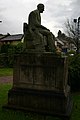 Grave of Henry Bell in Rhu churchyard - geograph.org.uk - 86712.jpg 427 × 640; 63 KB
-
 Helensburgh, Footpath - geograph.org.uk - 92011.jpg 640 × 480; 191 KB
-
 HMNB Clyde, Gare Loch - geograph.org.uk - 2922345.jpg 640 × 480; 70 KB
-
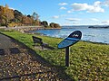 Interpretation panel by the shore at Rhu - geograph.org.uk - 5204291.jpg 1 600 × 1 200; 603 KB
-
 Looking Towards Rhu Marina - geograph.org.uk - 761123.jpg 640 × 480; 36 KB
-
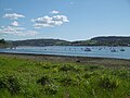
 Rhu and Rhu Bay from Port Glasgow - geograph.org.uk - 4825842.jpg 640 × 391; 84 KB
-
 Rhu and Rhu Bay from Port Glasgow - geograph.org.uk - 4825848.jpg 640 × 480; 119 KB
-

-
 Rhu Ellen Court - geograph.org.uk - 5204300.jpg 1 600 × 1 280; 410 KB
-
 Rhu from Port Glasgow - geograph.org.uk - 5440789.jpg 640 × 356; 75 KB
-
 Rhu from Port Glasgow - geograph.org.uk - 5703892.jpg 640 × 321; 98 KB
-
 Rhu Marina (3053043029).jpg 4 288 × 2 848; 3,52 MB
-
 Rhu marina and the Arrochar Alps - geograph.org.uk - 4647496.jpg 640 × 346; 60 KB
-
 Rhu Point - geograph.org.uk - 2037657.jpg 640 × 345; 81 KB
-
 Sailing Near Rhu (3003054099).jpg 4 288 × 2 848; 3,46 MB
-
 The beach at Rhu in Argyll and Bute - geograph.org.uk - 4173680.jpg 640 × 480; 61 KB
-
 The shore near Rhu Marina - geograph.org.uk - 3710295.jpg 1 024 × 512; 343 KB
-
 The West Highland Line at Torr - geograph.org.uk - 178847.jpg 640 × 480; 163 KB
-
 View towards Rhu Point - geograph.org.uk - 5277029.jpg 1 024 × 768; 438 KB
-
 Which Way Now. - geograph.org.uk - 761033.jpg 480 × 640; 48 KB
-
 Yachts moored on the Gare Loch north of Rhu - geograph.org.uk - 1919516.jpg 2 112 × 1 188; 539 KB
-
 Abundant heather - geograph.org.uk - 260946.jpg 640 × 480; 62 KB
-
 Forestry Road above Rhu - geograph.org.uk - 271574.jpg 640 × 480; 87 KB
-
 Fruin Water - geograph.org.uk - 434245.jpg 640 × 427; 105 KB
-
 Helensburgh, Footpath Signpost - geograph.org.uk - 92012.jpg 640 × 480; 135 KB
-
 Old Shipwreck at Camsail Bay - geograph.org.uk - 65003.jpg 640 × 480; 123 KB
-
 Rhu - Helensburgh, Hill House Track - geograph.org.uk - 179396.jpg 640 × 480; 123 KB
-

-

-

-
 Rhu Marina - geograph.org.uk - 65009.jpg 640 × 480; 113 KB
-
 Rhu village on the Gareloch - geograph.org.uk - 160389.jpg 640 × 480; 69 KB
-
 Torr Bridge - geograph.org.uk - 178851.jpg 640 × 480; 129 KB


.jpg)


.jpg)


