Category:Ringland, Norfolk
Jump to navigation
Jump to search
English: Ringland is a rural village (population 217 north-west of Norwich. Parts of the Wensum valley within Ringland parish constitute a Site of Special Scientific Interest.
village and civil parish in Norfolk, United Kingdom  | |||||
| Upload media | |||||
| Instance of | |||||
|---|---|---|---|---|---|
| Location | Broadland, Norfolk, East of England, England | ||||
| Area |
| ||||
| Said to be the same as | Ringland | ||||
 | |||||
Media in category "Ringland, Norfolk"
The following 179 files are in this category, out of 179 total.
-

-

-
 A most unusual face - geograph.org.uk - 2569266.jpg 640 × 575; 215 KB
-

-
 Animal sheds, Ringland Estate - geograph.org.uk - 5611092.jpg 1,600 × 1,200; 348 KB
-
 Back Lane, Ringland - geograph.org.uk - 3761004.jpg 640 × 480; 144 KB
-
 Back Lane, Ringland - geograph.org.uk - 4572287.jpg 2,304 × 3,072; 2.88 MB
-
 Back Lane, Ringland - geograph.org.uk - 4572308.jpg 2,181 × 2,900; 3.44 MB
-
 Barn at Glebe Farm, Ringland - geograph.org.uk - 3761020.jpg 640 × 480; 157 KB
-
 Bench mark on Ringland St Peter's church - geograph.org.uk - 2031319.jpg 640 × 480; 115 KB
-
 Bracken growing at Ringland Hills - geograph.org.uk - 2569219.jpg 640 × 480; 298 KB
-
 Bracken growing beside Sandy Lane - geograph.org.uk - 5539069.jpg 640 × 607; 557 KB
-
 Bridge on Ringland Road - geograph.org.uk - 3672153.jpg 3,072 × 2,304; 1.32 MB
-
 Bridge on Ringland Road - geograph.org.uk - 4572320.jpg 3,072 × 2,304; 1.74 MB
-
 Caravan site near the River Wensum - geograph.org.uk - 6029078.jpg 3,264 × 1,980; 2.63 MB
-
 Church Hill Plantation with hoar frost in the hedges - geograph.org.uk - 6029058.jpg 3,264 × 2,448; 1.68 MB
-
 Costessey Lane - geograph.org.uk - 3672140.jpg 3,072 × 2,304; 1.22 MB
-
 Costessey Lane, Ringland Hills - geograph.org.uk - 3672043.jpg 2,694 × 2,305; 1.56 MB
-
 Cottage on The Street, Ringland - geograph.org.uk - 5541945.jpg 640 × 480; 93 KB
-
 Crossroads, Ringland - geograph.org.uk - 5542588.jpg 2,848 × 2,136; 1.43 MB
-
 Cut Mark Ringland St Peters Church - geograph.org.uk - 5461267.jpg 2,231 × 2,231; 3.85 MB
-
 Dark clouds over Blackbreck plantation - geograph.org.uk - 5539060.jpg 640 × 480; 249 KB
-

-

-

-
 Elizabeth II postbox on The Street, Ringland - geograph.org.uk - 5542484.jpg 2,136 × 2,848; 1.36 MB
-
 Elizabeth II postbox, Ringland - geograph.org.uk - 5542584.jpg 2,136 × 2,848; 1.14 MB
-
 Entrance to Glebe Farm, Ringland - geograph.org.uk - 3761021.jpg 640 × 480; 190 KB
-
 Field Road - geograph.org.uk - 3672142.jpg 3,072 × 2,304; 1.37 MB
-
 Fields by Glebe Farm, Ringland - geograph.org.uk - 3761024.jpg 640 × 480; 235 KB
-
 Fields by Glebe Farm, Ringland - geograph.org.uk - 3761026.jpg 640 × 480; 194 KB
-
 Footpath along Back Lane, Ringland - geograph.org.uk - 3761002.jpg 640 × 480; 178 KB
-
 Footpath junction at Ringland - geograph.org.uk - 3761001.jpg 640 × 442; 213 KB
-
 Footpath through Ringland Hills - geograph.org.uk - 3760868.jpg 640 × 480; 274 KB
-
 Footpath to Low farm, Ringland - geograph.org.uk - 3761039.jpg 480 × 640; 285 KB
-
 Footpath to Ringland - geograph.org.uk - 3761010.jpg 640 × 480; 250 KB
-
 Free range pigs west of Ringland - geograph.org.uk - 5541938.jpg 640 × 480; 81 KB
-
 Free-range pig - geograph.org.uk - 5539038.jpg 640 × 561; 374 KB
-
 Free-range pigs - geograph.org.uk - 5539045.jpg 640 × 480; 266 KB
-
 Free-range pigs near Ringland village - geograph.org.uk - 5539035.jpg 640 × 605; 404 KB
-
 Free-range pigs near Ringland village - geograph.org.uk - 5539047.jpg 640 × 574; 385 KB
-
 Gated track to the River Wensum - geograph.org.uk - 3760880.jpg 640 × 480; 291 KB
-
 Harvested field by the headland - geograph.org.uk - 6029061.jpg 3,264 × 2,448; 1.7 MB
-
 Hill House Cottages, Ringland - geograph.org.uk - 5541939.jpg 640 × 480; 82 KB
-
 Honingham Lane - geograph.org.uk - 5610118.jpg 1,600 × 1,214; 321 KB
-
 House in Ringland - geograph.org.uk - 5611094.jpg 1,600 × 1,200; 387 KB
-
 House on The Street, Ringland - geograph.org.uk - 5541950.jpg 640 × 480; 64 KB
-
 Low Farm Ringland - geograph.org.uk - 5978460.jpg 4,000 × 2,248; 5.52 MB
-
 Many signs - geograph.org.uk - 667338.jpg 480 × 640; 166 KB
-
 Minor road into Ringland - geograph.org.uk - 5541940.jpg 640 × 480; 98 KB
-
 Minor road towards Ringland - geograph.org.uk - 5541937.jpg 640 × 480; 94 KB
-
 Nectar Tea sign at Glebe Farm - geograph.org.uk - 3761044.jpg 480 × 640; 214 KB
-
 Oak trees beside Back Lane, Ringland - geograph.org.uk - 3761007.jpg 480 × 640; 250 KB
-
 Once a chapel - geograph.org.uk - 667324.jpg 613 × 470; 195 KB
-
 Outdoor pigs near Ringland - geograph.org.uk - 5611090.jpg 1,600 × 1,200; 420 KB
-

-
 Pasture north of Honingham Lane - geograph.org.uk - 5539053.jpg 640 × 480; 247 KB
-
 Pastures beside Back Lane - geograph.org.uk - 3761033.jpg 640 × 480; 240 KB
-

-

-
 Poplars beside the River Wensum - geograph.org.uk - 3760876.jpg 640 × 480; 274 KB
-
 Primrose Grove from Ringland Lane - geograph.org.uk - 5611098.jpg 1,600 × 1,167; 477 KB
-
 Private track into Blackbreck plantation - geograph.org.uk - 5539024.jpg 640 × 480; 391 KB
-
 Private track to the River Wensum - geograph.org.uk - 6029075.jpg 3,264 × 2,448; 1.85 MB
-
 Public footpath to Honingham Park - geograph.org.uk - 5539050.jpg 640 × 475; 422 KB
-
 Ringland (Norfolk) WW1 Roll of Honour - geograph.org.uk - 4773715.jpg 2,592 × 3,456; 2.53 MB
-
 Ringland (Norfolk) WW2 Roll of Honour - geograph.org.uk - 4773721.jpg 2,592 × 3,456; 3.18 MB
-
 Ringland Estate gates and building - geograph.org.uk - 5611087.jpg 1,600 × 1,200; 461 KB
-
 Ringland Lane - geograph.org.uk - 5611100.jpg 1,600 × 1,200; 363 KB
-
 Ringland Road, Ringland Hills - geograph.org.uk - 3672037.jpg 3,072 × 2,304; 1.49 MB
-
 Ringland St Peter's church - geograph.org.uk - 2263512.jpg 640 × 480; 104 KB
-
 Ringland Village Notice Board - geograph.org.uk - 4571690.jpg 2,216 × 2,947; 3.28 MB
-
 Ringland Village sign - geograph.org.uk - 4572260.jpg 3,072 × 2,304; 1.89 MB
-
 Ringland Village sign - geograph.org.uk - 4572266.jpg 2,291 × 3,046; 2.73 MB
-
 Ringland Village sign - geograph.org.uk - 4572288.jpg 2,304 × 3,072; 3.43 MB
-
 Ringland Village sign - geograph.org.uk - 4572306.jpg 3,072 × 2,304; 1.98 MB
-
 River Wensum - geograph.org.uk - 4572323.jpg 3,072 × 2,304; 1.86 MB
-

-
-
 Road junction in Ringland - geograph.org.uk - 2308870.jpg 640 × 480; 79 KB
-
 Roadkill - geograph.org.uk - 6029063.jpg 3,264 × 2,448; 1.78 MB
-
 Roadsign on Ringland Road - geograph.org.uk - 4572316.jpg 2,240 × 2,978; 2.77 MB
-
 S Peter, Ringland, choir stalls - geograph.org.uk - 5364853.jpg 640 × 480; 68 KB
-
 S Peter, Ringland, churchyard (b) - geograph.org.uk - 5364839.jpg 640 × 480; 62 KB
-
 S Peter, Ringland, churchyard (c) - geograph.org.uk - 5364844.jpg 640 × 480; 96 KB
-
 S Peter, Ringland, hatchments - geograph.org.uk - 5364862.jpg 640 × 480; 47 KB
-
 S Peter, Ringland, nave - geograph.org.uk - 5364858.jpg 480 × 640; 61 KB
-
 S Peter, Ringland, pulpit - geograph.org.uk - 5364850.jpg 480 × 640; 56 KB
-
 Sandy Lane - geograph.org.uk - 5539062.jpg 640 × 480; 350 KB
-
 Sheds by Glebe Farm, Ringland - geograph.org.uk - 3761015.jpg 640 × 480; 173 KB
-
 Sheep pastures by the River Wensum - geograph.org.uk - 3761030.jpg 640 × 480; 216 KB
-
 Sheep pens beside Back Lane - geograph.org.uk - 3761035.jpg 640 × 480; 199 KB
-
 Slow - swans crossing - geograph.org.uk - 6029080.jpg 3,264 × 2,448; 1.77 MB
-
 St Peter, Ringland, chancel - geograph.org.uk - 5368812.jpg 480 × 640; 42 KB
-
 St Peter, Ringland, churchyard (a) - geograph.org.uk - 5364837.jpg 640 × 480; 65 KB
-
 St Peter, Ringland, ledger slab - geograph.org.uk - 5368815.jpg 640 × 480; 87 KB
-
 St Peter, Ringland, organ - geograph.org.uk - 5368813.jpg 480 × 640; 70 KB
-
 St Peter, Ringland, spring 2017 - geograph.org.uk - 5352056.jpg 640 × 480; 63 KB
-
 St Peters Church, Ringland - geograph.org.uk - 5541943.jpg 640 × 482; 56 KB
-
 Tank traps beside the river - geograph.org.uk - 3961707.jpg 640 × 480; 100 KB
-

-
 Telephone Box ^ Village Map - geograph.org.uk - 4571686.jpg 2,192 × 2,914; 3.11 MB
-
 The field off Field Road, Ringland - geograph.org.uk - 6029069.jpg 3,264 × 1,592; 1.76 MB
-
 The hanging sign of the White Swan at Ringland - geograph.org.uk - 5321622.jpg 2,592 × 3,456; 2.96 MB
-
 The Old Vicarage, Ringland - geograph.org.uk - 3761012.jpg 640 × 540; 234 KB
-
 The Old Vicarage, Ringland - geograph.org.uk - 3761028.jpg 640 × 528; 232 KB
-
 The River Wensum at the top of its banks - geograph.org.uk - 2240735.jpg 640 × 480; 208 KB
-
 The River Wensum, Ringland - geograph.org.uk - 5541960.jpg 640 × 480; 71 KB
-
 The Street - geograph.org.uk - 667300.jpg 640 × 480; 159 KB
-
 The Street - geograph.org.uk - 667345.jpg 480 × 640; 148 KB
-
 The Street Postbox - geograph.org.uk - 4571677.jpg 3,072 × 2,304; 1.96 MB
-
 The Street Postbox - geograph.org.uk - 4571681.jpg 3,072 × 2,304; 1.86 MB
-
 The Street Postbox - geograph.org.uk - 4571683.jpg 2,304 × 3,072; 2.24 MB
-
 The Street ^ The Street Postbox - geograph.org.uk - 4571672.jpg 3,072 × 2,304; 1.88 MB
-
 The Street, Ringland - geograph.org.uk - 4571626.jpg 3,072 × 2,304; 2 MB
-
 The Street, Ringland - geograph.org.uk - 4571630.jpg 3,072 × 2,304; 1.81 MB
-
 The Street, Ringland - geograph.org.uk - 4572282.jpg 3,072 × 2,304; 1.79 MB
-
 The Street, Ringland - geograph.org.uk - 4572290.jpg 3,072 × 2,304; 1.82 MB
-
 The Street, Ringland - geograph.org.uk - 4572299.jpg 3,033 × 2,272; 1.92 MB
-
 The Street, Ringland - geograph.org.uk - 5541948.jpg 640 × 480; 96 KB
-
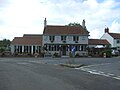
 The Swan - geograph.org.uk - 667298.jpg 640 × 480; 166 KB
-
 The Swan Inn Public House - geograph.org.uk - 2365256.jpg 3,072 × 2,304; 1.28 MB
-
 The Swan Inn Public House - geograph.org.uk - 2365259.jpg 3,072 × 2,304; 1.34 MB
-
 The Swan Inn Public House sign - geograph.org.uk - 2365260.jpg 2,304 × 3,072; 1.31 MB
-
 The Swan Inn, Ringland - geograph.org.uk - 5541955.jpg 640 × 480; 56 KB
-
 The Swan Public House, Ringland - geograph.org.uk - 4572305.jpg 3,072 × 2,304; 1.94 MB
-
 This way to Ringland on Costessey Lane - geograph.org.uk - 3760883.jpg 640 × 480; 267 KB
-
 To Costessey on Costessey Lane - geograph.org.uk - 3760886.jpg 640 × 480; 265 KB
-
 To Ringland Hills on Sandy Lane - geograph.org.uk - 5539064.jpg 640 × 632; 499 KB
-
 To Ringland on Back Lane - geograph.org.uk - 3761018.jpg 640 × 480; 169 KB
-
 Track into Blackbreck plantation - geograph.org.uk - 5539020.jpg 640 × 604; 571 KB
-

-
 Track skirting Poetsbreck plantation - geograph.org.uk - 5539065.jpg 640 × 480; 383 KB
-

-

-
 Traffic jam in Ringland - geograph.org.uk - 5352062.jpg 640 × 480; 66 KB
-
 View across field to Cobb's Hill - geograph.org.uk - 3760871.jpg 640 × 480; 228 KB
-
 View towards Aves' Gap, Ringland - geograph.org.uk - 2569223.jpg 640 × 480; 209 KB
-
 View towards Church Hill in Ringland - geograph.org.uk - 5539054.jpg 640 × 569; 339 KB
-
 View towards Slade Hills - geograph.org.uk - 5539034.jpg 640 × 480; 271 KB
-
 Welcome to St Peter, Ringland^ - geograph.org.uk - 5364841.jpg 640 × 480; 83 KB
-
-

-
 WW2 Home Guard shelter, Ringland - geograph.org.uk - 3929663.jpg 640 × 480; 268 KB
-
 Attractive house - geograph.org.uk - 667328.jpg 640 × 480; 166 KB
-
 Autumn colours in Long Plantation - geograph.org.uk - 586438.jpg 480 × 640; 113 KB
-
 Back Lane - geograph.org.uk - 667334.jpg 480 × 640; 127 KB
-
 Bridge at Ringland over the River Wensum - geograph.org.uk - 43455.jpg 640 × 480; 101 KB
-
 Deighton Hills from A1067 - geograph.org.uk - 347328.jpg 640 × 480; 83 KB
-

-
 Flooded fields - geograph.org.uk - 667295.jpg 640 × 480; 142 KB
-
 Flooded road - geograph.org.uk - 586456.jpg 480 × 640; 124 KB
-
 Flooded road to Weston Longville - geograph.org.uk - 586447.jpg 480 × 640; 78 KB
-
 Footbridge on path - geograph.org.uk - 667269.jpg 480 × 640; 173 KB
-
 Full to bursting - geograph.org.uk - 667293.jpg 640 × 480; 173 KB
-
 Gate and Riverside Meadow - geograph.org.uk - 412808.jpg 640 × 480; 126 KB
-
 Green track to Field Farm - geograph.org.uk - 586449.jpg 480 × 640; 117 KB
-
 Looking NE on Honingham Lane - geograph.org.uk - 586481.jpg 640 × 480; 84 KB
-
 Looking SE past Pump Farm - geograph.org.uk - 586451.jpg 640 × 480; 82 KB
-
 New housing near Low Common - geograph.org.uk - 667304.jpg 640 × 480; 172 KB
-
 Northwest along The Street - geograph.org.uk - 667317.jpg 640 × 480; 174 KB
-
 Old Hall Farm - geograph.org.uk - 586425.jpg 640 × 480; 87 KB
-
 One of a number of attractive houses - geograph.org.uk - 667307.jpg 640 × 480; 156 KB
-
 Poetbreck Plantation - geograph.org.uk - 586484.jpg 480 × 640; 94 KB
-
 Poplars on the River Bank - geograph.org.uk - 412779.jpg 640 × 480; 112 KB
-
 Pump Farm - geograph.org.uk - 586443.jpg 640 × 480; 68 KB
-
 Ringland Hills - geograph.org.uk - 39257.jpg 640 × 426; 152 KB
-
 Ringland Lane - geograph.org.uk - 586437.jpg 480 × 640; 98 KB
-
 Ringland Road - geograph.org.uk - 412760.jpg 640 × 480; 83 KB
-
 Slade-Ringland Hills - geograph.org.uk - 518151.jpg 640 × 480; 72 KB
-
 Soggy track - geograph.org.uk - 586458.jpg 480 × 640; 63 KB
-
 Swans on the River Wensum - geograph.org.uk - 667287.jpg 640 × 480; 154 KB
-
 The River Wensum - geograph.org.uk - 667291.jpg 640 × 480; 142 KB
-
 The road to Weston Green - geograph.org.uk - 586445.jpg 480 × 640; 53 KB
-
 The Village Green - geograph.org.uk - 667303.jpg 640 × 480; 157 KB
-

-
 Track past Poetbreck Plantation - geograph.org.uk - 586483.jpg 480 × 640; 86 KB
-
 Track to Morton Hall - geograph.org.uk - 586436.jpg 480 × 640; 99 KB
-


_larva_-_geograph.org.uk_-_2569257.jpg)


_WW1_Roll_of_Honour_-_geograph.org.uk_-_4773715.jpg)
_WW2_Roll_of_Honour_-_geograph.org.uk_-_4773721.jpg)


_-_geograph.org.uk_-_5364839.jpg)
_-_geograph.org.uk_-_5364844.jpg)


_-_geograph.org.uk_-_5364837.jpg)


